

Aena's Indoor Mapping & Routing App Expands to Barcelona


Last year thanks to a collaboration between Aena Telefonica CARTO and Situm a new Indoor Mapping solution called 'AenaMaps' was launched to assist passengers during their navigation through airport environments.
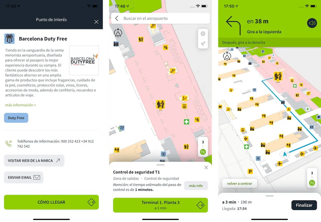
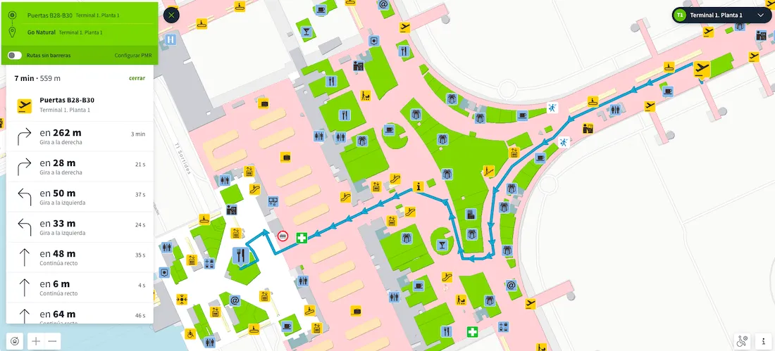
As we reported when the solution was launched AenaMaps allows passengers to be able to visualize their entire journey and locate key points of interest such as restaurants shops toilets or security controls as well as the time required to reach the boarding gate. Given the often complex nature of these indoor environments the solution is helping hundreds of millions of passengers to avoid getting lost and discover all of the amenities on offer within the terminal buildings.
Expansion to Barcelona 'El Prat' Airport
At launch maps and navigation were made available for the Adolfo Suárez Madrid-Barajas Airport. In line with Aena's expansion plans the app has been recently updated to also include support for Josep Tarradellas Barcelona–El Prat Airport Terminal 1. El Prat Airport is an international airport located 12 km southwest of the center of Barcelona. It is the second largest and second busiest airport in Spain and the sixth busiest in Europe.
The Barcelona–Madrid air shuttle service known as "Pont Aeri" (in Catalan) or "Puente Aéreo" (in Spanish) literally "Air Bridge" is one of the world's busiest passenger air routes. Therefore having AenaMaps now available in both Barcelona and Madrid airports will enable millions of passengers to more effectively navigate these indoor environments.
Available via the Aena app on Android and iOS routes can be followed both visually and by voice. The maps and routes can also be viewed on Aena's website.
During the solution's development CARTO has participated in the cartographic enrichment of Aena's airport maps and plans route development and architecting this advanced analytics solution. Situm has provided key technological components and geopositioning services within the airports.
This project is a key part of the digital transformation project that Aena and Telefónica are jointly undertaking to offer innovative solutions to passengers with the overall goal of providing a superior customer experience. As part of this goal AenaMaps will continue to expand to include maps and navigation for more airports across Spain.
Want to learn more about Indoor Mapping solutions?


