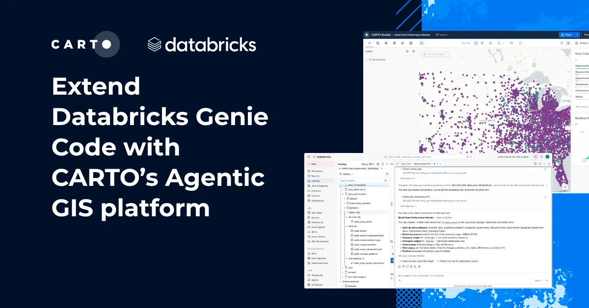
Agentic GIS in Microsoft Copilot with CARTO



For most organizations, the hard part of spatial analysis was never the question. It was everything between the question and the answer: finding the right dataset, getting hold of the right tool, waiting behind the requests that arrived first to a resource-limited team of GIS experts. The people who understood the business problem best were rarely the people who could run a tool to get the answer.
AI agents change that order of operations. You describe the outcome you want, and the agent does the assembly. That is what we built CARTO for Agents for, and with the CARTO MCP Server the whole platform is now available to any agent that speaks MCP. Maps, workflows, apps, geocodes, routes, and access to third-party data are all tools an agent can call. Analysts and GIS practitioners get their time back for the problems that actually need expert judgment, and everyone else stops waiting.
For many enterprises, the agent people already have open all day is Microsoft Copilot. This post walks through connecting the CARTO MCP Server to Microsoft Copilot Studio, so geospatial work gets faster and reaches far more people across your organization, in the tool they already use.
Turning Microsoft Copilot into a geospatial agent with the CARTO MCP Server
Once the MCP Server is registered as a tool, your Copilot agent starts working as a geospatial expert: building maps, updating and recreating them, iterating on analytical procedures, managing your account, and more. Every action is attributed to your authenticated CARTO user, recorded and traceable, and every query runs natively in your connected data warehouse with the same permissions and data access controls that user already has.
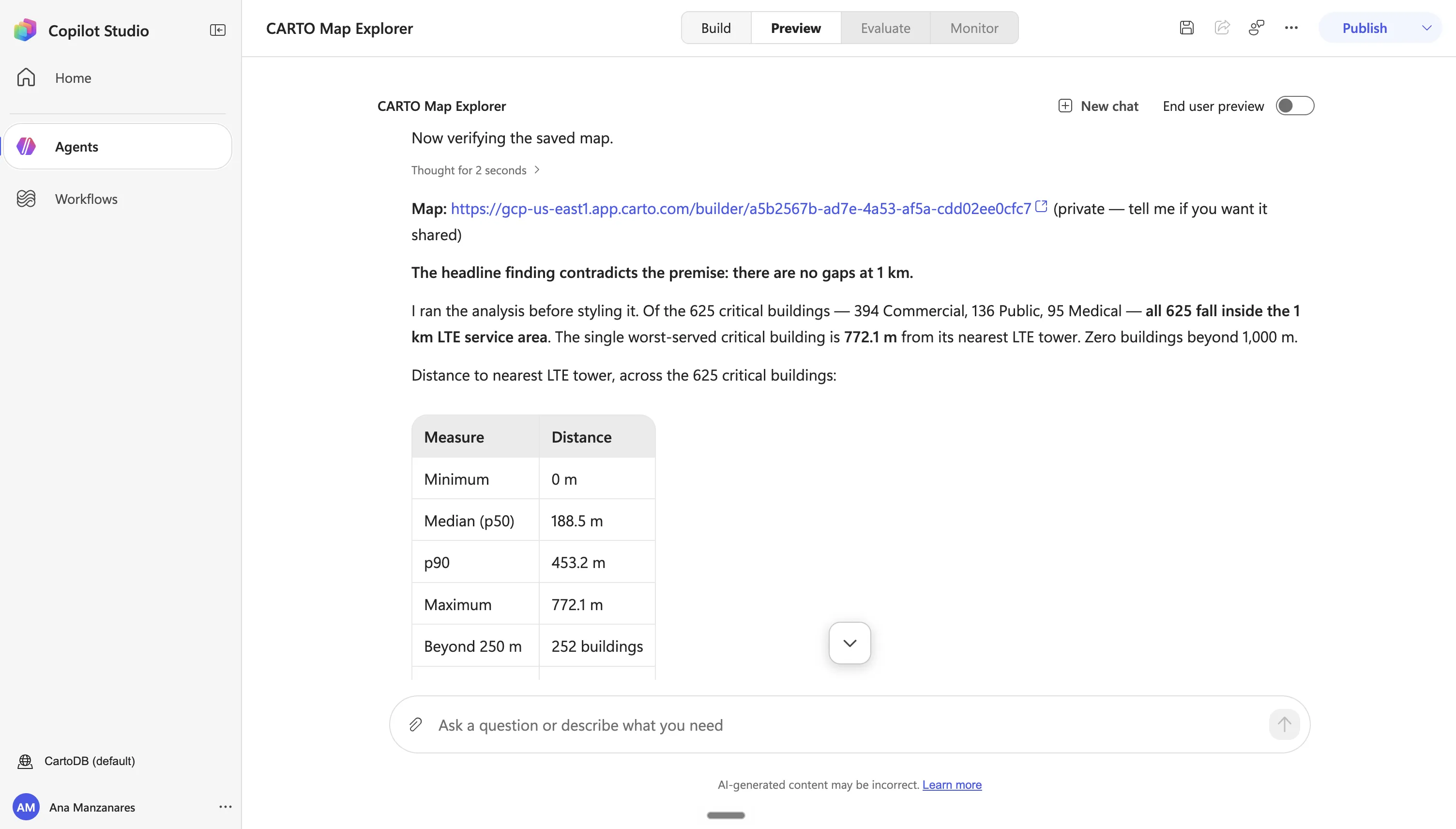
Build maps and CARTO Workflows, turn by turn. Ask for a map in plain language and refine it in conversation: change the color scale, add a layer, fix the legend, widen the popup. No coding, no switching tools. The same applies to analysis. Talk through how a pipeline should work, then have the agent build it as a CARTO Workflow. That is a bigger deal than it sounds: instead of an agent writing a fresh query every time somebody asks the same question, you get an authored workflow you can open, inspect, audit, fork, and schedule. It runs the same way every time.
Automate the work nobody wants to do twice. 50 regional versions of the same map. 40 quarterly maps that need refreshing. One parameterized analysis run across every market. This work was always possible, just tedious enough that it rarely happened. Agents do not get bored on item 12, and the fiftieth map gets the same attention as the first.
Put maps and analysis in front of the whole organization. Because the agent lives in Microsoft 365, distribution stops being a separate project. A regional manager can ask for the store performance map and get it. A risk analyst can trigger the flood exposure workflow, then ask the agent to explain what came back. They sign in once with their CARTO account, and from then on there is no GIS training to sit through and no queue to wait in.
Run the platform from the same chat window. Administrators get the same treatment. Reviewing connections, managing users and credentials, auditing what has been created, checking activity data: all of it is available as tools, so routine platform management happens where you already are.
Governed and secure by design. None of this moves your data. CARTO is cloud-native, so every query runs inside your connected data warehouse. The MCP tools call the same CARTO APIs the Builder interface uses, with the signed-in user’s token, so they inherit the roles, permissions, and row-level security you already have. Every action lands in Activity Data with attribution to the platform that made the call, and CARTO stays model-agnostic: your Copilot agent, your Microsoft tenant, your models, your governance.
Connect the CARTO MCP Server to Microsoft Copilot Studio
Setup takes a few minutes in Copilot Studio and one credential in CARTO. In short:
- In CARTO, go to Developers > Credentials > SPA OAuth Clients and create a client. Keep the Client ID and Secret on hand.
- In Copilot Studio, open your agent and choose Tools > Add a tool > Add new MCP. Enter the CARTO MCP Server URL and select OAuth 2.0 with manual configuration, using CARTO’s authorize and token endpoints and the scopes listed in the docs.
- Copy the redirect URL that Copilot Studio generates back into the allowed callback URLs of your CARTO OAuth client, then create the connection and sign in.
- Publish the agent to Microsoft 365 Copilot or Teams for the people who need it.
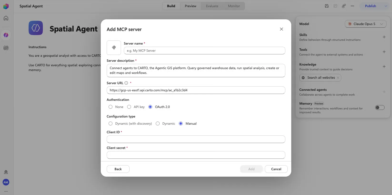
Two things worth knowing before you start: the agent needs generative orchestration turned on, and you should leave Copilot Studio’s dynamic discovery option off. If all you need is browsing and querying data, you can connect with a CARTO API access token instead, which gives read and discovery tools without authoring.
It is also worth loading the CARTO Agent Skills into your Copilot agent as knowledge or instructions. They are public playbooks that teach an agent how to do geospatial work well, so it picks sensible methods, classifications, and cartography without being told each time.
Full instructions, including the exact endpoints, scopes, and screenshots, are in the Microsoft Copilot Studio documentation.
See it in action
Using Microsoft Copilot to build an interactive map analyzing Chicago’s “L” line
We loaded Chicago’s CTA network data into our data warehouse (e.g. “L” lines and stations, bus routes, 800m station walksheds, and Chicago’s community areas), and asked Copilot to turn it into a transit access map with CARTO Builder.
Through the MCP Server and the carto-create-builder-maps skill, the agent made real cartographic decisions: tunneled track dashed and elevated solid in true CTA route colors, line weights above every polygon border so the network reads first, and hatching reserved for one class only (the areas the “L” barely reaches). It finished with widgets for access level, average distance to the nearest station, and step-free access.
Using Microsoft Copilot to build an analysis pipeline in CARTO Workflows
CARTO’s MCP Server is much more than just a way to create visualizations; it gives you access to all the analytical capabilities available in the CARTO Platform and running natively in your connected data warehouse.
In this basic example, we pointed Copilot at a couple of tables in our warehouse and asked it to build the analysis as a pipeline in CARTO Workflows.
The agent laid out the pipeline for review before running anything, capped the first pass at a data sample to protect the Location Data Services (LDS) quota, and saved the workflow so it can be rerun over the full set. That is the difference between an answer and an asset — the same workflow can be audited, extended with new rules, or replicated for another city by anyone who opens it.
Sharing access to geospatial insights in Microsoft Copilot
It’s not just about building assets. You can also use Microsoft Copilot to provide access to your analyses across your organization. Copilot is able to search within your CARTO account, find maps and workflows relevant to the user prompt, and return the links to assets and some insights. Analysts publish their work once in CARTO, and Copilot makes it findable by the specific business questions other areas of your organization are actually asking, so existing analysis gets reused rather than rebuilt.
Start today!
If you are a CARTO customer, you are just a couple of minutes away. Add the CARTO MCP Server to your Copilot Studio agent, sign in with your CARTO account, and the agent has the platform. Pair it with the Agent Skills so it brings geospatial judgment as well as access.
Not sure where to start, or not a customer yet? Request a demo and we will show you what your own data looks like from inside Copilot.
Frequently Asked Questions
What do I need to connect the CARTO MCP Server to Microsoft Copilot Studio?
A CARTO account and a few minutes. In CARTO, go to Developers > Credentials > SPA OAuth Clients and create a client. In Copilot Studio, open your agent, choose Tools > Add a tool > Add new MCP, enter the CARTO MCP Server URL, and select OAuth 2.0 with manual configuration using CARTO’s authorize and token endpoints. Copy the redirect URL Copilot Studio generates into your CARTO OAuth client’s allowed callback URLs, create the connection, sign in, and publish the agent to Microsoft 365 Copilot or Teams.
Does connecting CARTO to Microsoft Copilot loosen any of our data controls?
No. The agent acts as your authenticated CARTO user for every call, and each call executes natively in your connected data warehouse under the permissions and row-level security you already have. Every action is logged in Activity Data with attribution to the platform that made the call, and the choice of AI model stays yours.
Can Microsoft Copilot build more than just maps with CARTO?
Yes. Beyond building and editing maps in CARTO Builder, Copilot can design and run CARTO Workflows — auditable, schedulable pipelines — handle platform administration tasks like reviewing connections and managing users, and search across your CARTO account to surface existing maps and workflows relevant to a question.
Can I connect the CARTO MCP Server to Copilot without OAuth?
Yes, if all you need is browsing and querying data. You can connect using a CARTO API access token instead of OAuth 2.0, which gives read and discovery tools without the ability to author maps or workflows.