All of CARTO, in every agent


Five years ago, asking a GIS professional to build a map meant a software drama: which tool to use, which file format (still using shapefiles?), and how to keep performance from collapsing on real data. And all that drama? That meant delays on using the map to actually drive a decision.
That's finally changing. With AI agents, your energy and time can be focused on the actual map, the research, and the story you want to tell.
The leap — from operating software to describing an outcome — is happening across every industry, and it's happening faster in geospatial than most people have noticed. We think it's the biggest change to spatial work in decades, and we've spent the past year building CARTO for it.
Today we're announcing an important milestone for how agents can do GIS with CARTO for Agents: every CARTO capability is now available as an MCP tool.
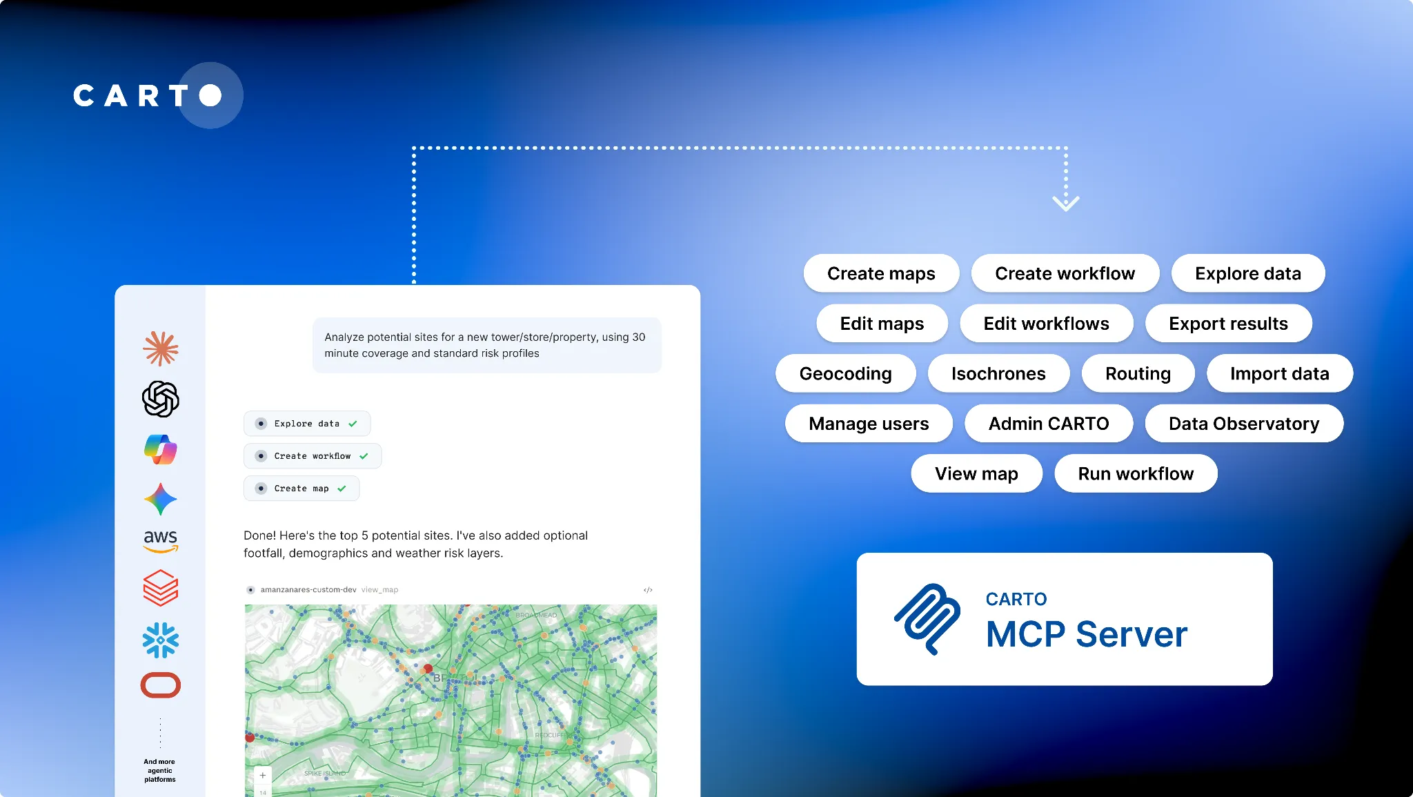
From creating and editing maps, composing and running Workflows, and managing connections, to exploring and querying your warehouse, importing data, or issuing credentials, the CARTO MCP Server now allows your agents to explore, create, edit, manage and use all your CARTO content in the agentic platform your team is already using. That means Claude, Microsoft Copilot, Gemini Enterprise, Snowflake Cowork, Databricks Genie, Oracle Agent Factory, ChatGPT, Perplexity, or anything else that speaks MCP.
No terminal. No coding. With your guidance and the CARTO MCP Server, your agents can complete geospatial tasks faster than ever before.
Moving from a few experts to… everyone
When we released CARTO for Agents, the best fit were technical teams already using coding platforms and coding agents like Cursor or Claude Code. These advanced users were already using AI to generate code: why not also use it to generate maps and workflows with CARTO?
Their experience sharpened the toolkit — better Agent Skills (our open-source playbooks that teach agents CARTO's geospatial expertise) and a more capable CLI.
What surprised us: people weren't just going faster, they were doing work that never got done before like the analysis everyone discussed for years but no one had time for, the per-market time series dashboard variants, or the 3D storymap that once seemed impossible.
Our customers and internal teams reported map creation and time-to-insight dropping by around 80%, with the reclaimed capacity going straight into more analysis. CARTO for Agents was making them more ambitious. And critically, none of it came at the cost of governance: the data stayed in the warehouse, the maps stayed governed CARTO assets, and every action stayed auditable.
So we immediately thought… Shouldn't every GIS team benefit from this too?
The natural progression was to take CARTO for Agents further: from the technical teams living in coding agents to all GIS professionals, in all agentic platforms.
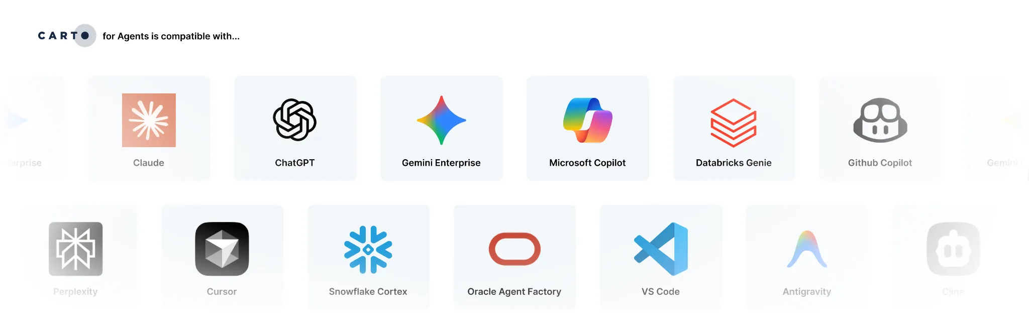
The same experience, everywhere
Most companies we talk to are already deploying some sort of agentic platform to their teams that uses MCP. If you're new to this term, MCP — the Model Context Protocol — is the open standard that lets any agent talk to any tool.
What feels magical about MCP is how easy, consistent, and powerful the setup is:
- Claude: teams add the CARTO MCP Server as a connector and register the Agent Skills as a plugin — available across Claude Desktop, Code, and the web.
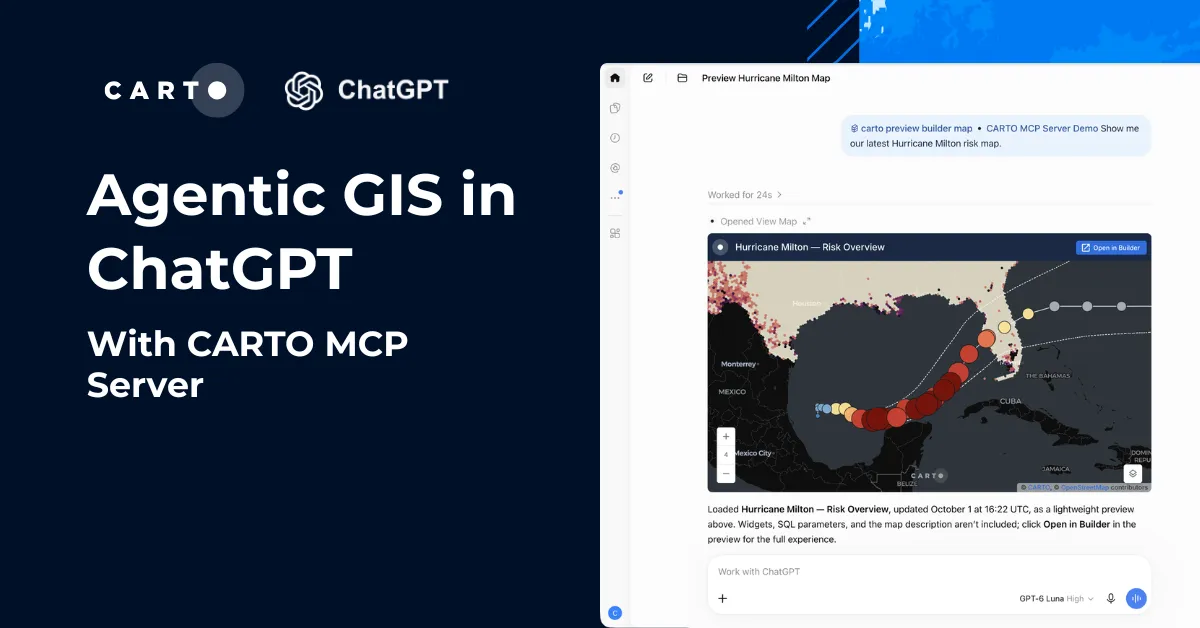
- ChatGPT: add CARTO as a connector in Developer Mode (or publish it to your workspace) and your GPTs can call every CARTO tool.
- Microsoft Copilot: register CARTO as an agent/tool in Copilot Studio and roll it out to your org through Microsoft 365 Copilot.
- Gemini Enterprise: wire CARTO in as an MCP tool for your Agentspace agents, governed by your existing Google Cloud IAM.
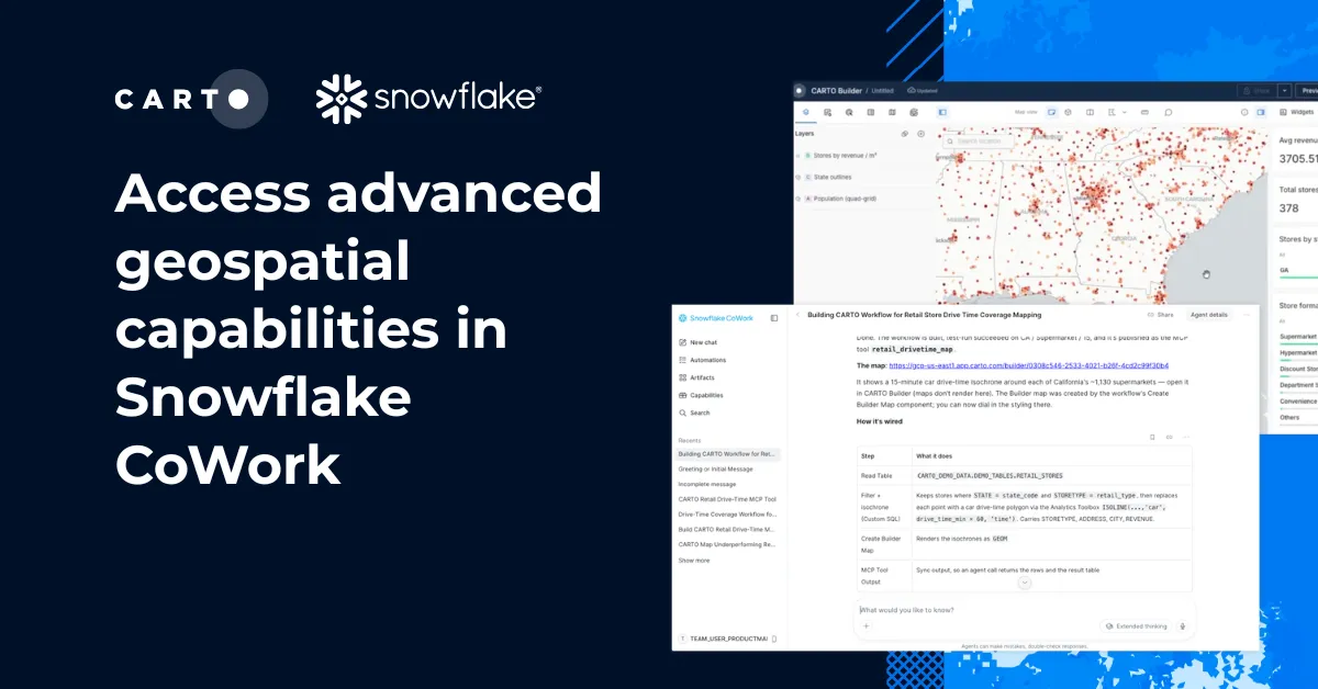
- Snowflake Cortex/Cowork: connect the CARTO MCP Server so Cortex Agents operate your maps and Workflows right next to your Snowflake data.
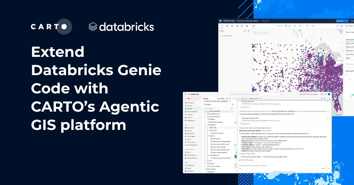
- Databricks Genie: expose CARTO as an MCP tool so agents run governed spatial analysis over data already in Unity Catalog.
- Oracle Agent Factory: register CARTO as an MCP tool and compose it into your agent pipelines.
And these are just some examples. Most agents and agentic platforms can be enriched with custom MCP servers in just a few clicks.
MCP itself is growing. One example is MCP Apps, where users can get interactive HTML experiences inside their agents instead of plain text. CARTO uses MCP Apps to allow agents to visualize a complete CARTO Builder or a custom CARTO + deck.gl map to preview your spatial data, all inside the agent chat.
What agents turn out to be unreasonably good at
When we started deploying CARTO for Agents for real use cases we found a few surprising things that were not, again, only about speed.
They have infinite patience for the details humans skip
We assumed agents would produce competent, slightly bland maps that maybe a cartographer would fix. The opposite happened.
Given a good skill to follow, it crafts the details people skip:
- It builds rich, detailed popups and tooltips, even with custom HTML.
- It writes a genuinely complete map description.
- It checks the actual data to see whether the palette suits the distribution.
- It notices that the legend labels are unreadable at that font size.
The agent doesn't do this because it has taste, it does because it never gets bored, never leaves at 5pm, and never decides this one is good enough.
The agent's first draft is more complete than a human's, so the person's time moves from assembly to judgment — a better use of a cartographer.
Creating and editing an interactive map in CARTO Builder from Microsoft Copilot.
They don’t get tired after three maps
Ask someone (human) to update 40 regional-performance maps for a new quarter and find the insights. They'll naturally drag their feet for days through the tedious updates and quality decreases.
Now imagine this prompt:
"Take every map in the Q3 retail folder, update them to the Q4 2026 data including widgets, and re-publish. Don't touch the styling. Show me a summary of what changed."
Map 40 gets the same care as map one. This is also true for generating — loop over a list of regions or customers and produce one map each, all consistent, all governed, all real CARTO assets. Batch work was always technically possible, just long and tedious. Now anyone who can describe the job can run it.
Workflows make agents become a spatial data scientist that’s part of your team
Most GIS tasks end in a map — but someone has to prepare, enrich, and analyze the data first. That usually means a data scientist, a separate team, and a black box.
We found that agents do this work well with CARTO Workflows, that ranges 200+ spatial components you can compose into a pipeline without writing SQL.
Why? Because an agent with the right skills has both the spatial data science expertise and deep Workflows knowledge. You describe the analysis you want and it selects the right components to build it: the joins, the buffers, the enrichment, the H3 aggregation, the scoring. This frees up the valuable time of your data scientist for the spatial analytics that really need their expertise.
What comes back is not a one-time answer in a black box. The agent created a step-by-step Workflow in your organization that a colleague can open, read, audit, question, fork, schedule, and re-run next month.
Using ChatGPT to create an analysis workflow in CARTO to score POIs based on their proximity to target demographics.
They plan first, then build something deterministic
This is perhaps the least intuitive and also the most important.
Sure, you could point an agent at your warehouse and let it write SQL. It demos great.
But then it fails as a practice; you get different answers every run, millions of tokens burned in retry loops, no audit trail, and nobody able to say whether the number is right.
What a well-instructed agent does instead looks like what a careful analyst does. It explores first: what tables exist, what's actually in the columns, how the geometries are encoded, where the nulls are. It proposes a plan and shows it to you. Then it builds the analysis as a CARTO Workflow — explicit, versioned, inspectable — and runs that.
That plan is AI-generated, but the workflow it produces isn't reinvented every time you run it. Once you approve it, it runs the same way today and six months from now: a fixed pipeline, not a new SQL query written from scratch on every request.
With a prompt like this one:
"We're evaluating 15 candidate sites for a new distribution center in the Midwest. Find the relevant demographic and road network data, work out a scoring approach that accounts for population within a 30-minute drive, competitor proximity and warehouse suitability, show me your plan before you build anything, then turn it into a Workflow I can re-run for other regions."
The agent comes back with a plan, a defensible scoring method, and a pipeline your team can audit line by line. Next quarter you re-run it. In six months someone asks why site 7 scored the way it did and there's an actual answer, not a chat log.
Determinism beats improvisation for the analyses that matter. The agent's creativity belongs in figuring out what to build. The thing it builds should run the same way every time.
Governed and secure by design
The way we work is changing dramatically but not the work itself. The data is still confidential and security is still of the utmost importance.
CARTO is cloud-native in the strict sense: every query executes inside BigQuery, Snowflake, Databricks, Redshift, Oracle or PostgreSQL. Your data does not move. Row-level security and other RBAC controls your data team already configured stay in force, because the agent's query is subject to exactly the same policies as any other query.
Every MCP tool passes the user's own token to the same platform APIs that Builder uses, and the same permissions apply. If a user can't edit that map, neither can their agent.
All actions are logged and attributable in your Activity Data, down to which platform it came from — so an admin can see that a Workflow ran from Copilot on Tuesday, who triggered it, and what it touched. And the model layer stays yours: CARTO is model-agnostic, so whatever LLM your organization has already vetted is the one driving.
Reimagining GIS for the agentic era
All geospatial tools will soon include some AI components that will simplify the process from location data to insight. CARTO does too. And those in-app AI assistants will grow in capabilities and power. But we think what's actually happening is bigger and less comfortable for vendors than that.
AI capabilities buried in a geospatial platform that only works when a specialist opens it will forever keep GIS gated, siloed, no matter how good the AI is. The future of GIS is not more AI features in the same systems.
The future of GIS is spatial analysis that any person or agent in an organization can reach, producing work their colleagues can trust.
This is why CARTO is reimagining GIS for agents. CARTO is the first completely headless GIS platform, where you can securely perform all geospatial operations from the agentic platforms your organization is already deploying to every team.
Get started in two minutes
Nothing to download. Just connect the CARTO MCP Server to your favorite agentic platform: Copilot, Gemini Enterprise, Claude, ChatGPT, Snowflake Cowork, Databricks, Oracle or any MCP-compatible host, authenticate with your CARTO account, and your agent has the platform.
Get started with the CARTO MCP Server
Pair the CARTO MCP Server with our Agent Skills to bring the geospatial judgment along with the capabilities:
Get started with the CARTO Agent Skills
Or even better, let your agent take care of it:
"I'd like to set up CARTO for Agents. Documentation is here: https://docs.carto.com/carto-for-agents/carto-for-agents. Help me connect the CARTO MCP server and use the CARTO Agent Skills. Then let's create our first workflow and map."
What are you going to build with CARTO for Agents?
PS: If you're not sure where to start or you're not a customer, request a demo and we'll run it against your own data.
Frequently Asked Questions
Which agentic platforms can connect to CARTO?
CARTO connects to any platform that speaks the Model Context Protocol. That includes Claude, ChatGPT, Microsoft Copilot, Gemini Enterprise, Snowflake Cortex and Cowork, Databricks Genie, and Oracle Agent Factory, each with a per-platform setup guide in the CARTO documentation. Most agentic platforms can be extended with custom MCP servers in a few clicks.
Does my data leave the warehouse when an agent runs a spatial analysis?
No. Every query executes inside your own data warehouse — BigQuery, Snowflake, Databricks, Redshift, Oracle or PostgreSQL — and the data never moves. The row-level security and RBAC controls your data team already configured stay in force, because the agent’s query is subject to exactly the same policies as any other query.
Can an agent do something the user is not permitted to do?
No. Every MCP tool passes the user’s own token to the same platform APIs that CARTO Builder uses, so identical permissions apply. If a user cannot edit a map, neither can their agent, and every action is logged and attributable in Activity Data, down to which platform it came from.
What is the difference between the CARTO MCP Server and CARTO Agent Skills?
The CARTO MCP Server exposes every CARTO capability as a tool an agent can call, from creating and editing maps to composing Workflows and querying your warehouse. Agent Skills are open-source playbooks that teach agents CARTO’s geospatial expertise, so they know how to use those tools well. Pair the two to bring geospatial judgment alongside the capabilities.