Announcing CARTO's Spatial Analytics in Snowflake


Editor’s note: This post dates from November 2021 and marks an early milestone in CARTO and Snowflake’s collaboration: the general availability of spatial analytics running natively in Snowflake. We’ve kept it here as a historical read you can enjoy for a look at where it all began. The platform has grown enormously in the years since, so for the latest on CARTO and Snowflake, visit CARTO for Snowflake or CARTO’s documentation.
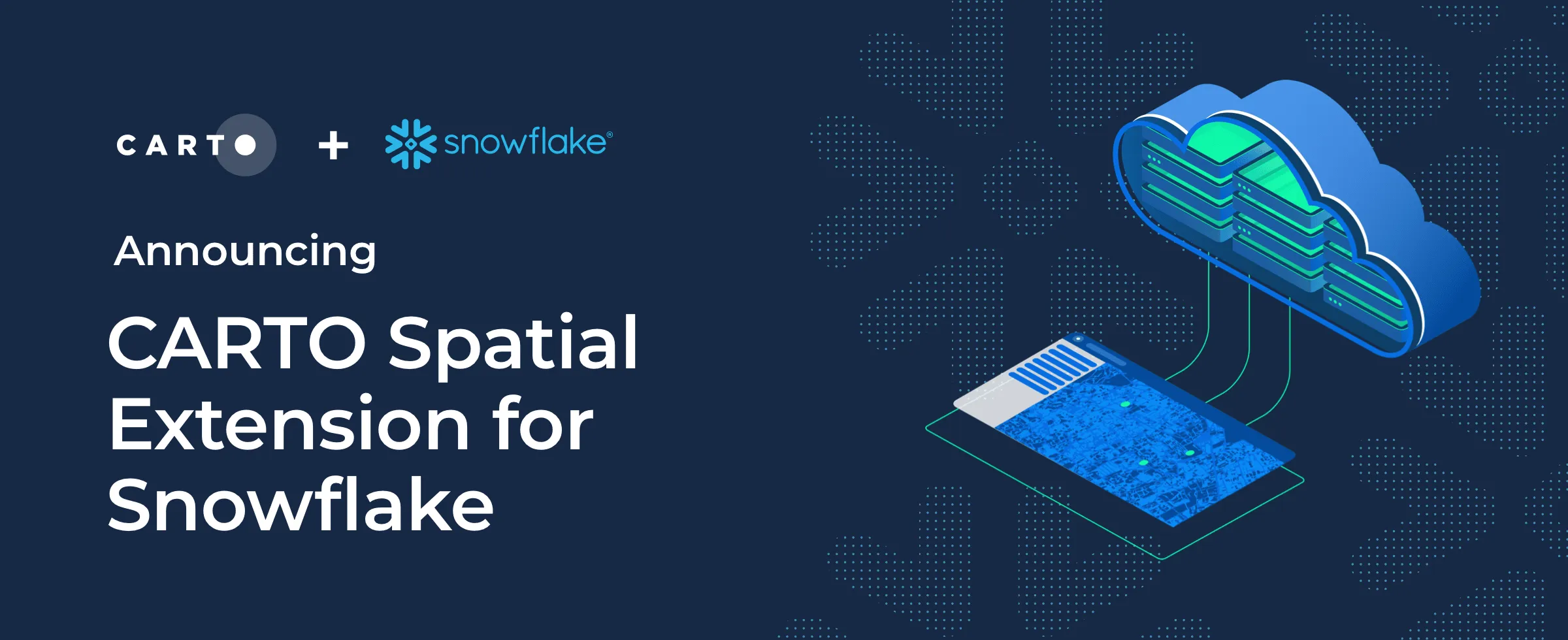
At CARTO our mission is to help customers unlock spatial analytics in the cloud and today we are excited to announce the general availability of the CARTO's Spatial Analytics in Snowflake.
Snowflake is one of the fastest growing Cloud Data Warehouses with strong support for data sharing and multicloud. Users can enable any number of critical workloads with near-unlimited scale concurrency and performance to make better quicker business decisions.
We have been working with Snowflake for a long time now and customers such as Indigo AG have been using CARTO and Snowflake together very successfully. Today's announcement is coupled with the great new additions by the Snowflake team such as the recent support for "GEOGRAPHY" data type.
Building on this release the team at CARTO have continued to develop an extensive array of features to extend the available geospatial capabilities making cloud native spatial workloads as seamless as possible for users of the Snowflake platform.
CARTO's Spatial Analytics in Snowflake
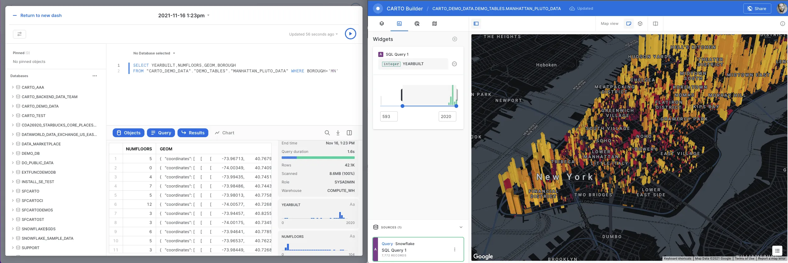
Today’s CARTO's Spatial Analytics in Snowflake announcement coincides with the release of a complete redevelopment of our platform. Our all-new cloud native platform gives Snowflake users unprecedented flexibility to:
- Connect to interact with spatial data hosted in Snowflake.
- Generate and share interactive map visualizations or run advanced spatial analysis using SQL.
- Deploy a complete framework of analytical capabilities to perform location-based analysis, within the Snowflake Data Cloud.
- Ingest thousands of public and premium location datasets right inside Snowflake without running complex ETLs or manual updates.
- Develop rapid insightful spatial applications using a comprehensive toolkit of developer resources.
All of these features are delivered through a new interface bringing a unified experience to Snowflake users so they can create organization accounts connect to Snowflake hosted data tables and begin their exploratory analysis in just a few clicks using our new Data Explorer. This tool simplifies the navigation of Snowflake hosted data and lets users create map previews and location-based insights rapidly.
Spatial data analytics is growing significantly above the market average and CARTO complements Snowflake's unlimited scalability by offering a complete solution for Spatial Analytics. With technology that pushes down queries to the data platform and its location data in Snowflake's Data Marketplace, CARTO offers a state-of-the-art cloud-native GIS system in the Snowflake ecosystem.Sergei Sokolenko, Principal Product Manager at Snowflake.
A modern mapping UI to make maps from SQL
We have completely reworked our Builder tool. For this new version of Builder we have shifted entirely to vector rendering using the latest open source frameworks from Kepler.gl and deck.gl.
The tool provides a unique interface to run SQL work with cartography layers iterate visualization approaches (including 3D), apply filters, widgets and much more. Builder gives users the flexibility to mix SQL, tables, or tilesets in the same map and we have integrated several basemap options.
Introducing the Analytics Toolbox for Snowflake
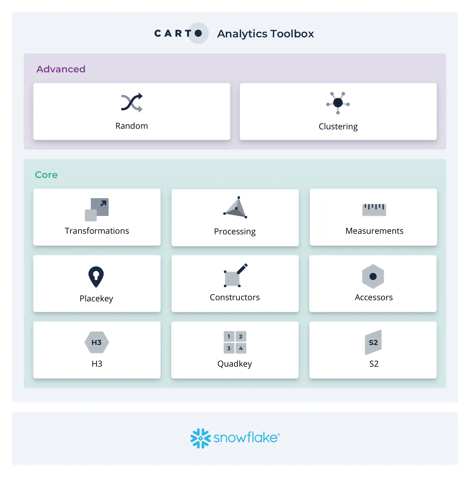
For both Developers and Data Scientists, our Analytics Toolbox brings more than 60 advanced spatial functions that can be deployed inside Snowflake. These User Defined Functions cover a broad range of spatial use cases and include data transformations, indexing for Quadkey, S2 and H3, and advanced functions to carry out geocoding clustering and more.
Functions can be called directly from within the platform giving Data Scientists the ability to explore visualise and analyze their Snowflake spatial data without switching contexts or the need for time-consuming ETL processing.
Check out the video below for an example of the Analytics Toolbox in action.
Thousands of spatial datasets to enrich your analysis
At the heart of the platform is our Data Observatory, making access to spatial datasets as frictionless as possible. Through CARTO's Spatial Analytics in Snowflake users can browse, visualize, and ingest thousands of curated spatial datasets, including Demographics, Points of Interest, Mobility, Environmental, Financial, Behavioural data and more.
Key ready-to-query datasets from the CARTO Data Observatory are also available to Snowflake users through the Snowflake Data Marketplace, further simplifying the enrichment of business transaction and account data using relevant location datastreams.
This data is made available directly in Snowflake so you can easily run spatial JOINS without the need for complex transformation routines.
Accelerate spatial app development with our APIs, SDKs, and templates
And that's not all! We have also released a full suite of resources for developers who are working with data hosted in Snowflake. Our APIs, SDKs and ready-to-go app templates significantly reduce the time required to develop custom map-based applications.
What’s more, we’ve removed the need to build your own geospatial backend. Developers can design map visualizations in Builder and then use them in code - learn more here.
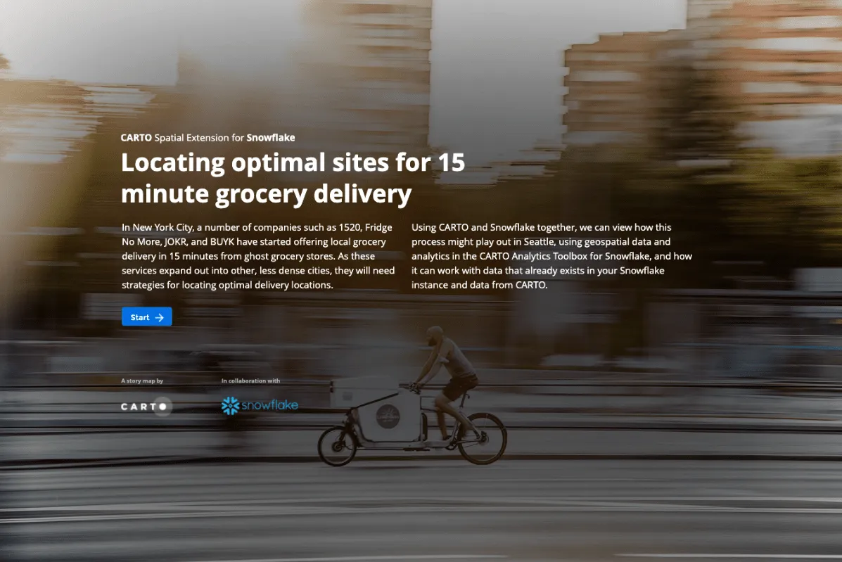
To showcase how these tools can be used for map-based storytelling we have created a Snowflake driven demo centered on the new breed of ultrafast grocery delivery players.
Spatial Analysis in Snowflake
Our announcement is a major step forwards to enable more advanced Location Intelligence in the Snowflake Data Cloud.
As of today, Snowflake users working on location-based data and workloads, have access to a fully integrated platform to bring advanced analytics to their hosted data and develop even more engaging web experiences using map based insights.
CARTO's Spatial Analytics in Snowflake can be accessed as a free 30 day trial. Click here to sign up and get access to all of these great new features.
 | This project has received funding from the European Union's Horizon 2020 research and innovation programme under grant agreement No 960401. |
Frequently Asked Questions
What did CARTO announce for Snowflake in November 2021?
The general availability of CARTO’s spatial analytics platform for Snowflake, on 16 November 2021, alongside a complete redevelopment of the CARTO platform. It gave Snowflake users five things: a connection to spatial data held in Snowflake, interactive map visualizations and SQL-based spatial analysis, a framework of analytical functions running inside the Snowflake Data Cloud, thousands of public and premium location datasets available in Snowflake without ETL, and a developer toolkit for building spatial applications. The announcement followed Snowflake’s own addition of a GEOGRAPHY data type.
What was in the Analytics Toolbox for Snowflake at launch?
More than 60 advanced spatial functions, deployed inside Snowflake as user-defined functions, covering data transformations, spatial indexing for Quadkey, S2 and H3, geocoding and clustering. Because the functions ran in Snowflake and could be called from the CARTO interface, data scientists could explore, visualize and analyze spatial data without switching tools or running ETL first. The function count has grown since November 2021; CARTO’s Analytics Toolbox for Snowflake documentation carries the current list.
How did CARTO get spatial datasets into Snowflake?
Through the Data Observatory, CARTO’s catalog of curated third-party spatial data covering demographics, points of interest, mobility, environmental, financial and behavioral sources. Users could browse, visualize and ingest datasets so they landed directly in Snowflake and could be spatially joined to their own tables without transformation routines. As of the 2021 announcement, a subset of ready-to-query Data Observatory datasets was also published on the Snowflake Data Marketplace.
Who was using CARTO with Snowflake when it launched?
The announcement names Indigo AG as a customer already running CARTO and Snowflake together before general availability. Sergei Sokolenko, then a Principal Product Manager at Snowflake, is quoted in the post saying that CARTO’s query pushdown to the data platform and its location data in the Snowflake Data Marketplace made it a cloud-native GIS option within the Snowflake ecosystem.
Does this 2021 announcement describe CARTO for Snowflake today?
No. The post carries an editor’s note explaining that it dates from November 2021, marks an early milestone in the CARTO and Snowflake collaboration, and is kept online as a historical record because the platform has changed considerably since. For current capability the note points to the CARTO for Snowflake product page and to CARTO’s Analytics Toolbox for Snowflake documentation.