CARTO AI Lab: working at the frontier of geospatial AI


We are living through the biggest technological breakthrough of our era. AI has changed how we work for good, and GIS has been no exception.
Agentic GIS is changing who does spatial analysis and how. AI Agents can now reason through a spatial question, choose the right data and methods, run the analysis, and check their own results, putting work that used to sit with a handful of experts in the hands of every team.
The same wave of AI is also reshaping how we model the world. Applying transformer architectures, the kind that power large language models, to vast amounts of spatial data has given birth to a new breed of geospatial foundation models. These models learn deep spatial relationships across millions of features in complex datasets, building general-purpose representations of places that can be reused across many real-world problems. With them, we can make more accurate predictions, detect clusters, and analyze patterns of change at a scale and speed that weren’t possible before.
The hard questions organizations ask of their spatial data won’t change. How fast they get answers, how many people can ask them, and how deep those answers go will. CARTO has led the way in Agentic GIS, and we believe the next step is bringing AI Agents and geospatial foundation models together.
Introducing the CARTO AI Lab
AI is opening up new ways to understand our world and act on that understanding. Geospatial foundation models are learning what makes places distinctive, while AI Agents are changing how we explore and analyze spatial data. We created the CARTO AI Lab to turn those advances into tools for real-world decisions, bringing research and product development together to tackle business, environmental, and societal challenges.
The AI Lab connects multiple areas of research: geospatial foundation models, the analytical methods that turn their embeddings into answers, and Agentic GIS. We explore and train models, develop new ways to analyze their outputs, and give AI Agents the spatial expertise to put those methods to work through CARTO for Agents. That means helping people answer questions such as where to expand, which locations share similar characteristics, and how places are changing.
As part of CARTO, the Lab helps shape both what the platform can do today and what comes next, from the models and embeddings available across our tools to the analyses agents can carry out. It also looks beyond the platform, testing new ideas, publishing research, and working with partners on problems the industry has yet to solve.
The Lab currently focuses on four main areas of activity:
1. Geospatial foundation models
Geospatial foundation models are a young field, with open questions at every stage: which data sources to learn from, how to combine different signals, and which model architectures and training objectives produce embeddings that work across locations and tasks. The Lab investigates these questions by designing and training our own models, exploring and comparing models from across the field, and evaluating their embeddings on real tasks such as site selection, demand estimation, and risk modeling. We publish what we learn about what works, where models fall short, and why. PlacePulse, whose embeddings capture the profile of every populated place in the US, is the first model to come out of this work.
Map showing the visualization of the embeddings using the Visualization component available in CARTO's Analytics on Embeddings Extension Package for CARTO Workflows.
2. Spatial analytics on embeddings
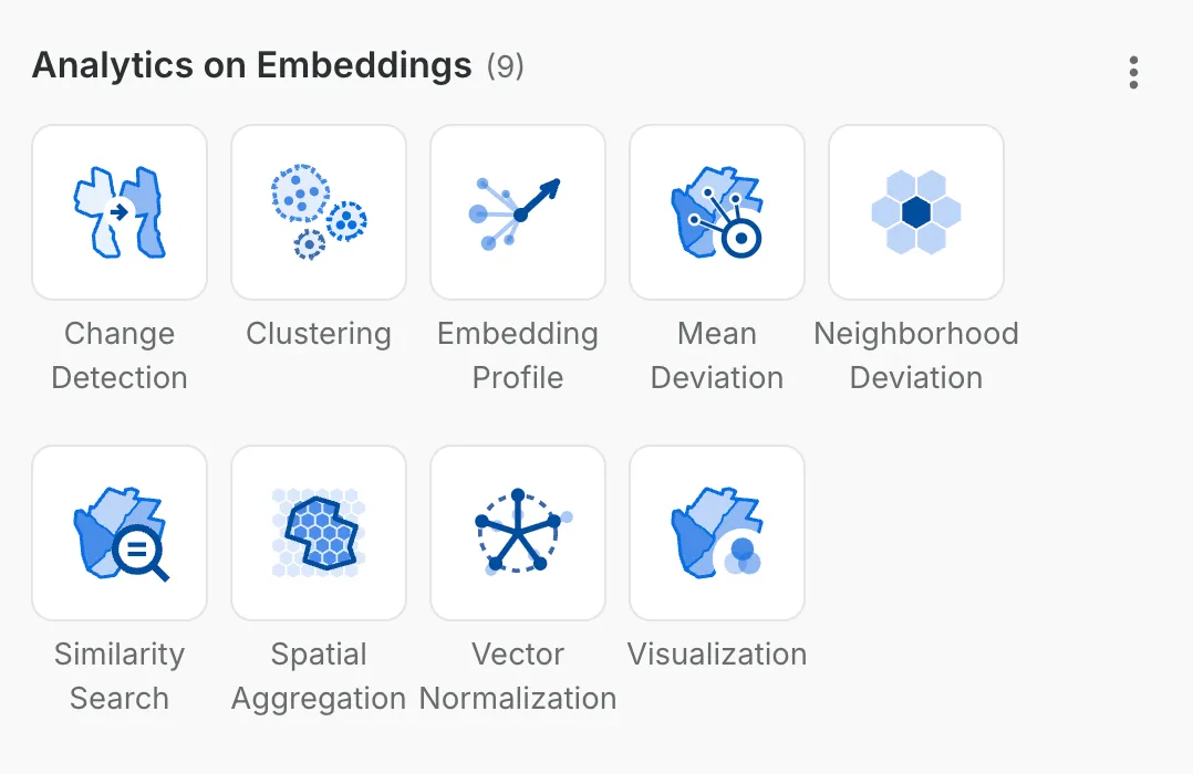
Embeddings only matter if people can use them. The Lab researches, designs, and implements new capabilities for spatial analytics on top of embedding models, and makes them available through the CARTO platform. The first of these is the Analytics on Embeddings extension package for CARTO Workflows, which brings visualization, clustering, change detection, similarity search, and machine learning on embeddings to any analyst, no ML background required. After all, the value of a foundation model isn’t in its vectors, but in the insights those vectors help uncover.
3. Agentic GIS
The Lab helps AI Agents perform advanced spatial data science at scale, contributing directly to the capabilities of CARTO for Agents. The team is behind the Agent Skills that teach agents advanced spatial analysis, such as geographically weighted regression to model how relationships between variables change across space, spatial autocorrelation with Moran’s I and LISA to find statistically significant clusters and outliers, and composite scoring to build supervised and unsupervised indexes. With them, users can create and run advanced spatial models from the agentic harness of their choice.
4. Collaborations
The hardest problems in geospatial AI won’t be solved by any one team. The Lab works with other AI labs, research institutions, and companies to evaluate and co-create models and to take on the toughest challenges together, with partners such as the Barcelona Supercomputing Center, LGND, Northeastern University, and Cotality, among others.
PlacePulse Embeddings: the Lab’s first geospatial foundation model
The first model developed by the CARTO AI Lab is PlacePulse, built in collaboration with Applied Geographic Solutions (AGS).
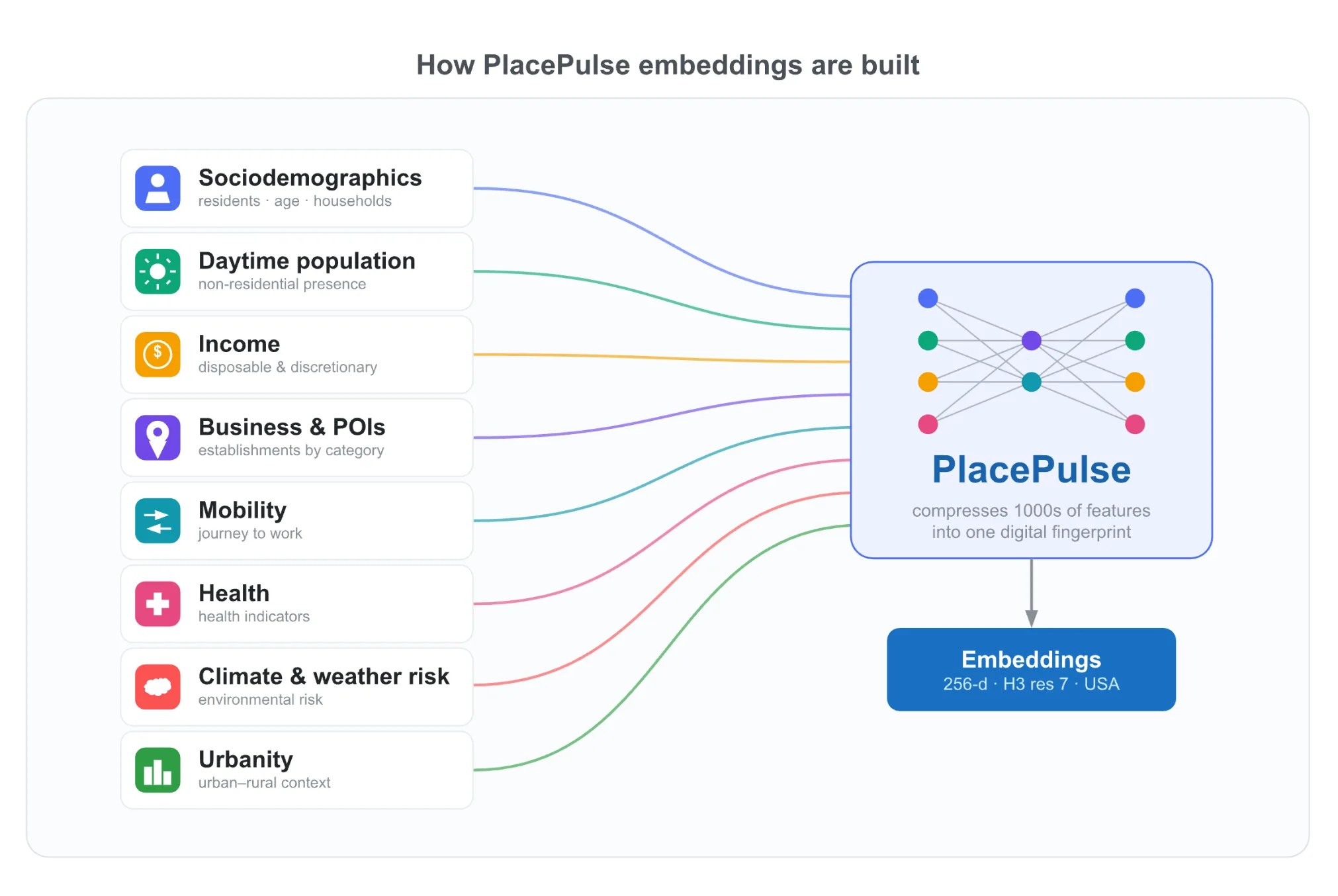
PlacePulse produces a single 256-dimensional vector for every populated location in the US, about 1.06 million H3 cells at resolution 7. Each vector compresses hundreds of structural variables curated by AGS (572 attributes, expanded to 2,288 features with neighborhood context), from demographics and business activity to commuting patterns, income, and climate risk, into one profile of the place. Trained with self-supervised learning, it isn’t tuned to any single task, which is what makes it reusable across many: from finding new markets that match a retailer’s best-performing stores to spotting where EV charging infrastructure lags behind demand.
The science behind PlacePulse is described in our paper, “PlacePulse: Learning Transferable Place Representations from Structural Geographic Data”. It covers the data, the model architecture, and how we evaluated the embeddings across downstream tasks.
Let’s work together
The CARTO AI Lab is open for collaboration. If you’re an AI lab, a research institution, a data provider, or an organization with a hard spatial problem that today’s tools can’t answer, we’d like to hear from you. We’re especially interested in evaluating and co-creating geospatial foundation models, testing new analytics on embeddings with real use cases, and pushing what AI Agents can do with spatial data.
Get in touch with the CARTO AI Lab and tell us what you’re working on.