

CARTO Driving Sustainability Impact Worldwide on Google Cloud


When CARTO was founded in 2012 the main areas of focus were conservation and biodiversity projects. Fast forward exactly 10 years and CARTO is proud to be one of the leading sustainability-driven geospatial companies with exciting projects influencing the public and private sectors worldwide. With thousands of out-of-the-box data sets available and advanced spatial analytics functions CARTO’s cloud-native Location Intelligence platform is a helpful tool for a wide range of spatial use cases.
We are even more proud to partner with leading cloud providers such as Google Cloud and are excited to announce that we have achieved the Google Cloud Ready - Sustainability designation in the Google Cloud Partner Advantage Program. By earning the Sustainability designation CARTO has proven our success in building and producing solutions and tools on Google Cloud to help customers achieve their sustainability and Environmental Social Governance (ESG) goals.
Since joining forces on the sustainability front last year CARTO and Google Cloud have collaborated on a range of successful projects spanning different continents and industries. Let’s dive into some of these inspiring stories below!
Micro-Mobility Paves the Way for Smarter and Greener Cities
A big part of making sure our cities are environmentally friendly is urban mobility solutions. Sustainable mobility planning has demonstrated positive results concerning improved air quality road safety and citizens’ health. That’s why CARTO was excited to be able to support the expansion of Tembici a Latin American leader in the micro-mobility space. Tembici’s bicycles are an excellent example of moving large urban centers in Latin America in a sustainable direction with easily accessible infrastructure for citizens. To make their Site Selection processes smoother Tembici collaborated with CARTO and leveraged Google Cloud’sBigQuery to be able to tap into vast amounts of data such as premium sociodemographic datasets and make data-driven decisions when expanding their fleet.
A deciding factor for Tembici was that CARTO was not new to the micro-mobility and smart city projects space. CARTO had previously been selected to continue to Phase 1 (Solution Design) of the AI4Cities project within the field of mobility. AI4Cities is an EU-funded project that brings together leading European cities seeking Artificial Intelligence (AI) solutions to accelerate carbon neutrality. CARTO’s “FutureUrbanMobility” solution was selected to join this initiative to help incorporate micro-mobility into urban mobility planning. The solution which also leverages Google Cloud’s BigQuery uses Location Intelligence and Machine Learning to pinpoint the best locations for micro-mobility services by applying predictive models for emissions and air quality.
Learn more about how CARTO can be leveraged to realize the sustainability potential of Smart Cities here.
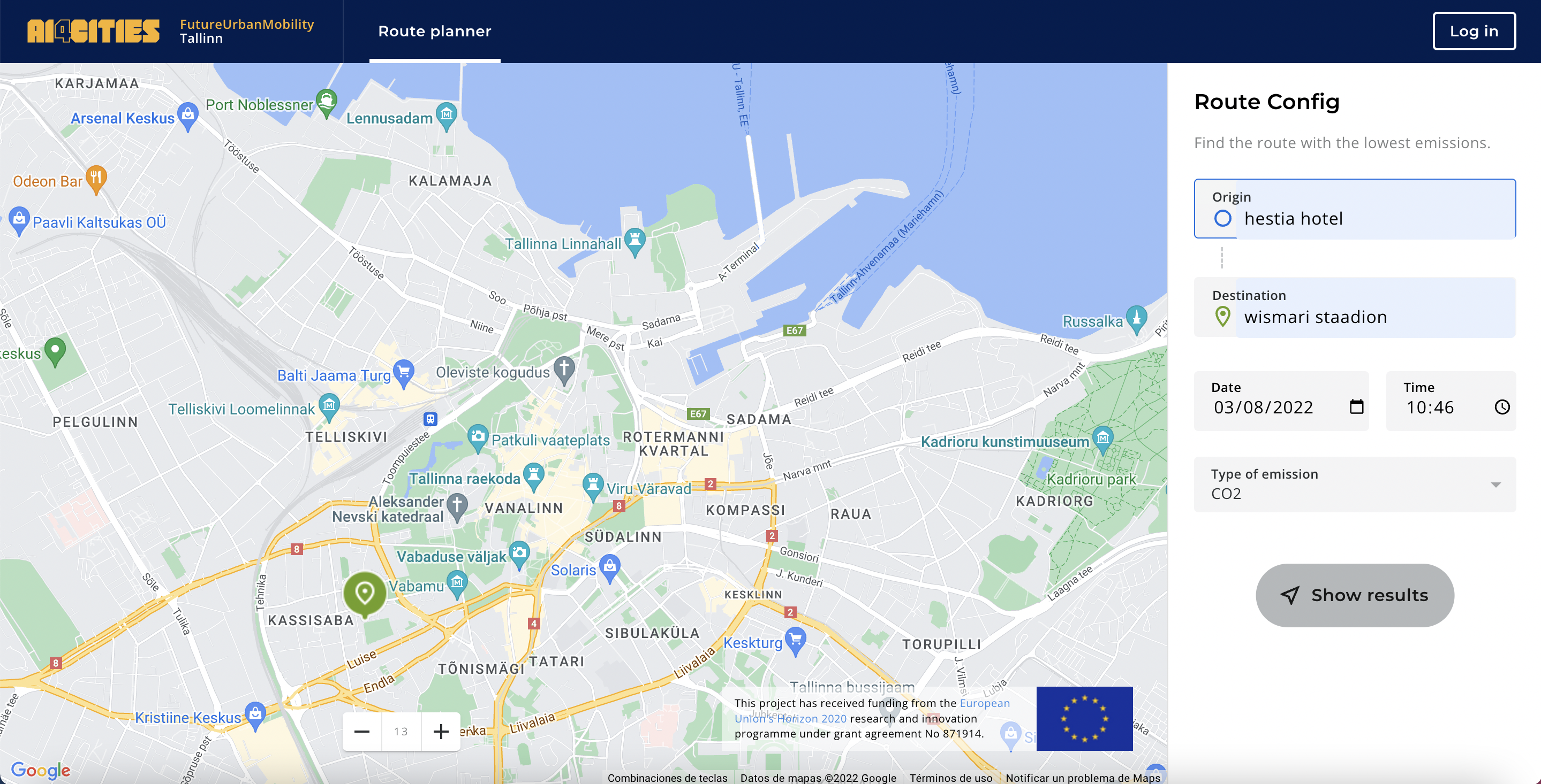
AI4Cities Future Urban Mobility Project by EU (Tallinn - Estonia). Route planner to find the route with the lowest emissions.
Governments Use Location Intelligence to Combat Climate Change
Another interesting sustainability story from CARTO and Google Cloud is the work done with the Hawaii Department of Transportation (HDOT). HDOT leverages the Climate Insights for Infrastructure offering built by CARTO on Google Cloud to identify elements of the state’s transport infrastructure most at risk from climate-related impacts. The tool incorporates self-service spatial data Location Intelligence and visualizations helping guide future investment and empowering non-technical users to generate insights on the state’s climate resilience.

Map demonstrating population density in Hawaii
Hawaii DOT’s story is only one of the example use cases enabled by the CARTO for Climate Insights offering launched earlier this year. The offering built on Google Cloud combines the power of BigQuery Google Earth Engine Google Maps and CARTO to help give governments a deeper understanding of the climate risks impacting the infrastructure they manage. CARTO for Climate Insights can enhance understanding with thousands of spatial datasets from the CARTO Data Observatory while the Analytics Toolbox can allow decision-makers to run advanced climate-related analytics at scale.
Preserving Natural Resources with Spatial Data Analytics
CARTO and Google Cloud’s partnership in sustainability also goes back to CARTO’s roots in the conservation sector with various initiatives such as the World Resources Institute’s Global Forest Watch (GFW) program. In short GWF’s mission is forest preservation. Thanks to work with Google Earth Engine and CARTO the platform allows users to calculate forest change statistics within a user-defined area and subscribe to tree cover loss alerts as well as view and even download data for a specific country. Used by journalists scientists policy-makers campaigners or community organizers worldwide the platform enables intuitive exploration of large volumes of data to make better more informed decisions.
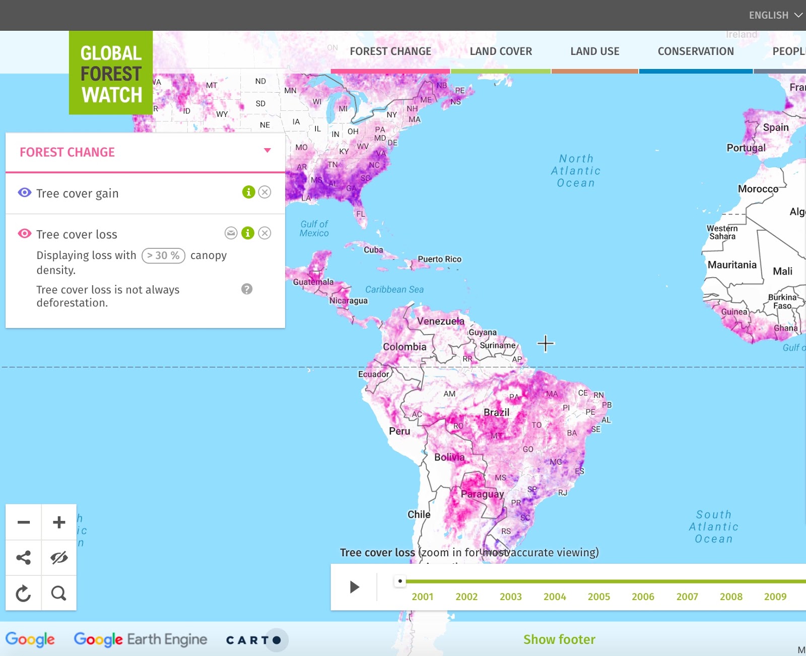
GFW map showing tree cover gain and loss
Worth noting is that CARTO offers grants to non-profit organizations that use data for good. Whether it is for preserving natural resources combating climate change or educating the public we are proud to play an active role in the development of solutions that directly contribute to benefitting future generations. Check out some of the amazing work our grant beneficiaries are doing here!
Google Cloud Ready for Sustainability
We’re entering a new era of sustainability driven business transformation, which cloud is key to enabling and accelerating that transformation. The Google Cloud partner ecosystem will play a key role in providing solutions that help our joint customers deliver on their sustainability goals,”
Said Justin Keeble managing director of global sustainability at Google Cloud.
These new solutions will be accessible through our Google Cloud Ready - Sustainability validation program for customers to accelerate climate action. We are partnering with purpose to help drive towards a net zero future.”
Luis Sanz our CEO also shared:
Geography is fundamental to the study of sustainability, but the industry’s current knowledge of it is very limited. Organizations, both public and private, will need better data and analysis to help them adapt their processes quickly. Our spatial analytics platform brings together Google’s geo partner ecosystem and the power of BigQuery, to provide the data, computing scalability and interoperability required to tackle some of the world’s most challenging sustainability problems.”
Join Us in Making a Difference
Is your organization working to adapt to climate change or simply moving in a more sustainable direction with its operations? There’s a lot to be done and the challenges our generations are facing require an all-hands-on-deck approach. Working together with CARTO the leading Location Intelligence platform and Google Cloud the cleanest cloud in the industry can be a great next step in your sustainability journey. Get in touch with us to see how we can help with your projects!


