CARTO BigQuery Tiler is Now Available for Google Cloud Platform


As announced at Google Cloud Next '20 we are very pleased to provide more details about our BigQuery Tiler which is now available as a beta.
If you are analyzing very large datasets with millions or billions of points or GB of geographies then the BigQuery Tiler provides the only solution to visualize large location datasets without having to move data outside BigQuery.
We are very excited about the new CARTO BigQuery Tiler and the possibilities that it will bring to those needing to visualize very large datasets. Those working with geospatial Big Data of billions of points can now create incredibly detailed responsive and insightful maps in a matter of minutes with simple SQL queries. We can’t wait to see what you create!
Javier de la Torre - Founder and Chief Strategy Officer CARTO
Stunning maps in minutes
With the ability to work solely in SQL and without ETL you can create stunning maps in minutes. In the video below we showcase some of these along with a demonstration of how they are made possible.
Produce vector tilesets directly from SQL
Working out of the box you have all the power of vector tiles at your fingertips without the need to install on your BigQuery. To visualize a dataset you simply need to create a tileset (a representation of the data optimized for map visualizations). You can use a stored procedure and with different options or our CLI tool.
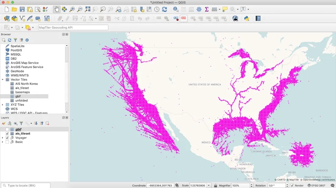
250m building footprints in the US from Microsoft
Store tilesets in BigQuery directly
Using our spatial partition for effective storage and consumption the tilesets generated are stored under tables which are partitioned and optimized for visualization.
1.4B species locations from the Global Biodiversity Information Facility
Visualize privately or publicly in CARTO or other tools
We create standard vector tiles that can be used in many different tools. Under the hood you see vector tiles which can be used in many different clients such as CARTO deck.gl Mapbox GL QGIS and many more. The maps can be private or made public with our publishing service upon request.
Want to get started?