Earth Observation for a better world - See you at ESA Space Industry Days


We believe earth observation is one of the fundamental tools we are going to use to protect our planet. You can’t protect what you can’t see. There is a large scale revolution happening in the earth observation domain. Everything from new satellites like Sentinel, to new forms of satellite, to non-satellite deployable drone systems, are making imagery cheaper and faster than we have ever experienced.
Our ability to gain knowledge from imagery and other data products is at times mind blowing. We can observe the ongoing impact of floods and human migration, we can observe the real-time changes to our biosphere, and there has been nearly a decade of archaeological discoveries thanks to accessible imagery.
While the potential impact of earth observation data is clear, it has not always been so easy to access and use. A mix of challenges related to the size format and complexity of observation data has left many people unable to leverage it to address their own challenges. Today though, through the work of DigitalGlobe, Google, Mapbox and many others, the availability of high quality data products is growing fast.
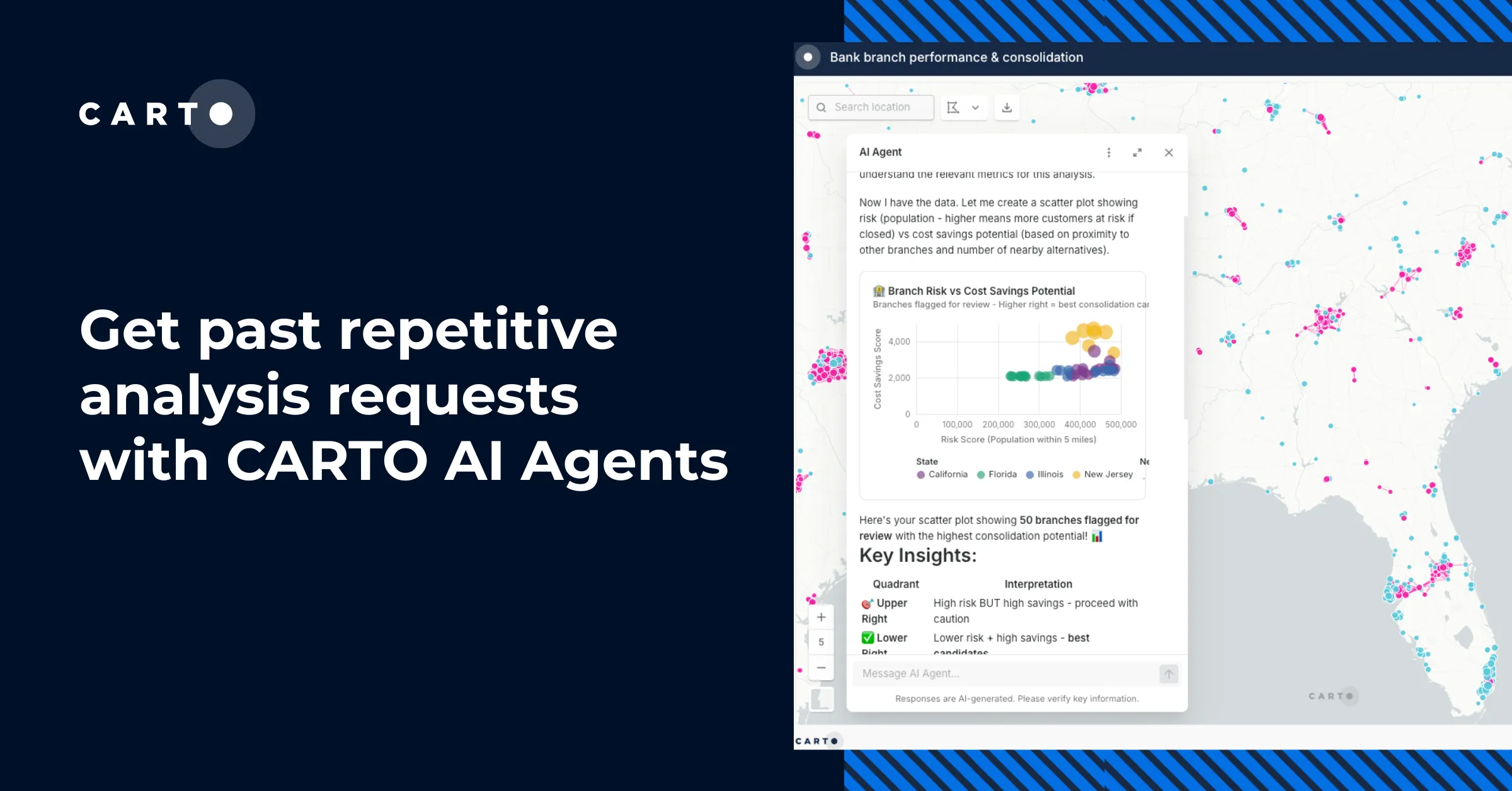
Now the challenges has become, how do we build Earth observation data into decision making, disaster response, and even story telling. And in this space is in which CartoDB facilitates some key tasks related to visualization, analysis, and sharing of the data, enabling organizations to accelerate the pace of innovation using data from earth observation.
How CartoDB is helping in Earth Observation projects
CartoDB is already a key element in some important projects related to earth observation, being the perfect example Global Forest Watch, a project that lets you find out what is happening in forests, right now. Global Forest Watch (GFW) “is a dynamic online forest monitoring and alert system that empowers people everywhere to better manage forests. For the first time, Global Forest Watch unites satellite technology, open data, and crowdsourcing to guarantee access to timely and reliable information about forests. GFW is free and follows an open data approach in putting decision-relevant information in the hands of governments, companies, NGOs, and the public”.
CartoDB is the backend used for storing real-time data and for showing the maps and different visualizations. CartoDB provides in a project like this data storage of geospatial information in a cloud and autoscaling environment, easy to use APIs to build custom visualizations, the possibility of mixing different types of data over choosen basemaps… with all the needed flexibility and fast deploy times.
We also recently launched the Climate Grants, and have already granted resources to organizations like WWF.
CartoDB at ESA - Industry Space Days
This week we are travelling to Netherlands to attend the ESA Space Industry Days. We have a booth where we will be demoing CartoDB so if you happen to be around please ping us.
Pictured above: Another map from the European Satellite Sentinel1. We hope you enjoy it and we look forward to collaborate with you out there in the space.