Google Fusion Tables Turndown: An Alternative to Keep Mapping


You've probably heard that Google Fusion Tables and the Fusion Tables API will be turned down on December 3 2019. This means embedded Fusion Tables visualizations (maps charts tables and cards) will also stop working that day.
If you're trying to find a Google Fusion Tables alternative we have good news for you: CARTO can help. Transitioning to our platform is easy and you'll get a ton of additional geospatial features on top of map visualizations.
Ready to enjoy the advantages of a full stack Location Intelligence platform?

What's in the Package?
CARTO is a robust cloud hosted solution for managing and analyzing spatial data and provides very powerful map authoring and publishing workflows as well as Spatial Data Science capabilities for taking your analysis to the next level.
Easy Drag-and-drop Mapping
You can easily create a web map from your browser with our drag and drop tool and conduct advanced spatial calculations and analyses at scale running common location analyses such as clustering and radius-of-influence. You can also add context using a range of built-in measures (including demographic commercial or environmental data).
Dynamic Data in the Cloud
Unlike other geospatial platforms with CARTO you can truly enjoy the peace of mind of a fully managed geospatial database and save time by creating views and new tables directly in our platform.
Capture the Power of Spatial Data Science
You can save time gathering and cleaning data by using our spatial data repository Data Observatory and speed up your analysis with CARTOframes—our Python package that allows you to interact with CARTO using your own libraries functions and workflows visualizing straight out of Jupyter Notebooks.
Have questions? Want to see it in action?
Request a demo from our experts
Transition to CARTO
You can download your data from a table directly and export it to a CSV or KML file or if you have many tables you can use the new dedicated Fusion Tables option in Google Takeout to download all your data in one step exporting this data in the following formats: JSON CSV and KML.
Once you have a CSV or KML file ready you can quickly sync it into CARTO to create a map style it and publish it in 30 minutes.
Need Some Inspiration?
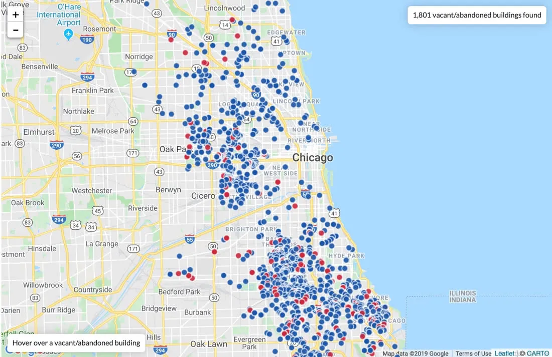
View the full map at https://chicagobuildings.org/
See how Derek Eder from Datamade created a new version of his Searchable Map Template formerly on Google Fusion Tables now powered by CARTO.
Are You a Non-profit?
If you're a small non profit or working on a project with social impact you may be eligible for a CARTO grant. Click here for more info.
Want to give CARTO a try for free? Get started today!