

Solving Global Litter with Machine Learning & Spatial Data


Surfrider UNEP Oceans Conservancy Keep America Beautiful Keep Britain Tidy Zero Waste Canada: many of us will be familiar with the campaigns that NGOs and our governments are running across the world to ensure we don't accept litter as a normal part of our environment. However with 1 in 4 people admitting to littering it's no mean feat trying to make our world a litter-free place - and understanding precisely where to tackle the problem is key.
Back in 2014 after having the idea two years earlier the Litterati founding team decided they were going to take on this immense challenge by putting the best location-based technology into the hands of local communities - empowering others to take action and crowdsource insights.
More than 3.9 Million Pieces of Litter Stored
The Litterati app built and maintained by a team of four between North Carolina and Madrid allows citizens in more than 115 countries to take pictures of trash during clean ups uploading to a database which now has more than 3.9 million pieces of litter stored. So what happens next?
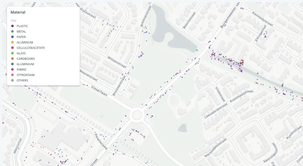
Litterati aggregates all of these images and registers them by using a taxonomy C.O.M.B category (e.g. drink food personal hygiene) object (e.g. cup bottle can) material (e.g. plastic metal paper) and brand (e.g. McDonalds Starbucks Coca-Cola) before applying machine learning algorithms to generate insights on litter patterns which are inherently spatial. Using Location Intelligence their team can ask questions such as: How does the weather affect the types of litter thrown? How do specific types of POIs (such as night clubs or schools) affect the litter drop frequency?
Tackling Regulation and Changing Societal Behaviour
Founder Jeff Krischner said "Having data-driven insights through the Litterati community allows our partners to tackle regulation and change societal behaviour - and by using location-based litter-related data we have even stronger arguments."
With support from several partners including the Rockefeller foundation Jeff and his team are now working with some of the world's largest NGOs CPG brands and several water companies to use their technology and spatial analytics to help them with their litter related goals.
"We introduced CARTO's platform recently to our technical team and its ease of use and the ability to explore new use cases so fast immediately became valuable to us in our mission."
Want to know more about using LI in your city or government?


