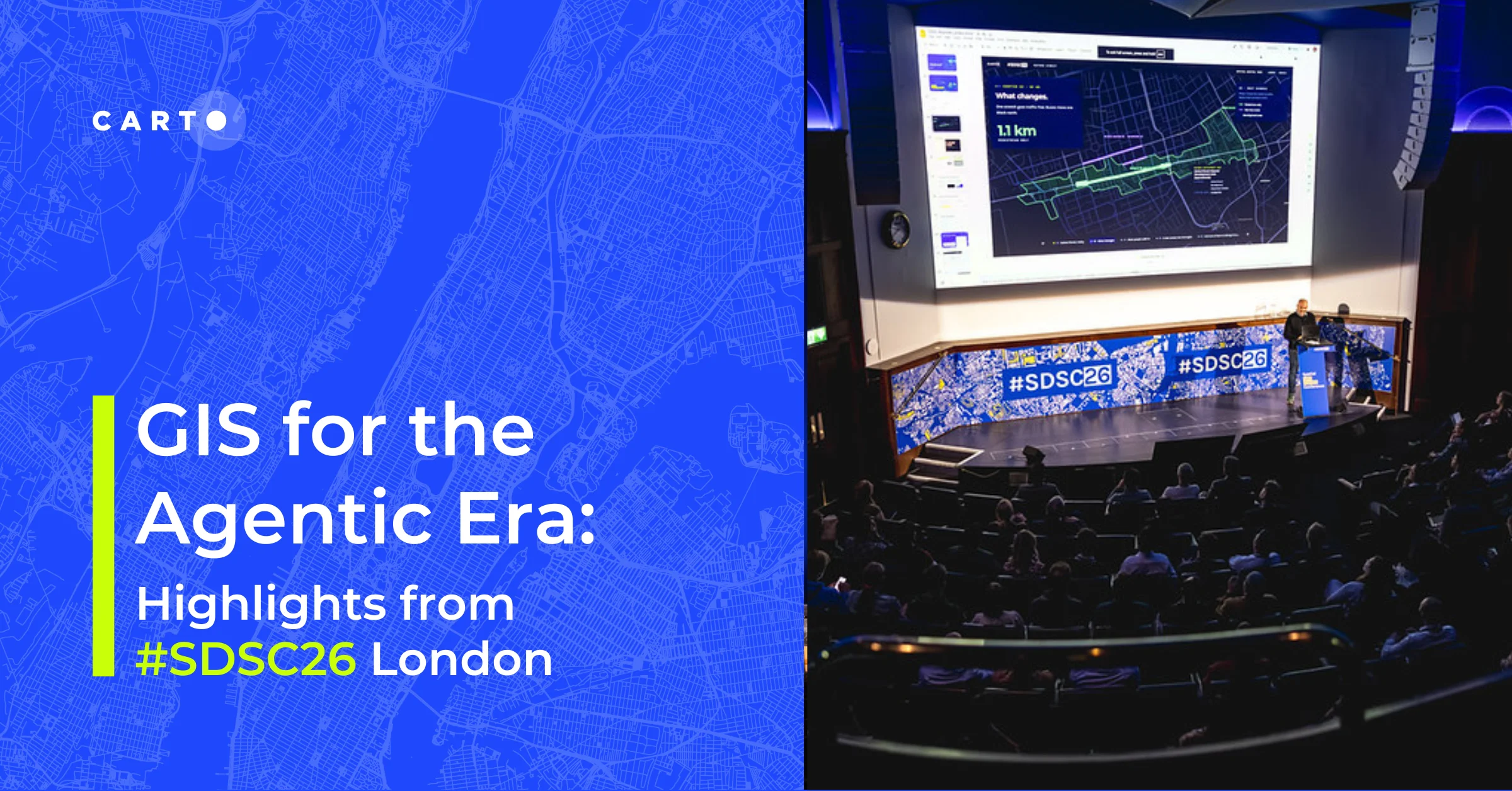
Moves bought by Facebook, visualized by CartoDB


As you may've heard Facebook has bought yet another company our favorite Moves. Moves track your daily activity including your location. And when it comes to location what better app helps you to visualize and analyze than CartoDB? Learn how much location info Moves has about you with this simple guide: just upload your Moves data to CartoDB and -no step 2- visualize it!
Export your Moves data. Login into your Moves account and click on the export tab. It's awesome how easy is to export it on different formats:
##_NOT_FOUND_IMAGE_## https://i.imgur.com/GoES7SG.png ##_NOT_FOUND_IMAGE_##
Extract the file and choose the activities.geojson file (you can choose any other file and format to upload to CartoDB):
##_NOT_FOUND_IMAGE_## https://i.imgur.com/Z9DnarV.gif ##_NOT_FOUND_IMAGE_##
Upload that file to your CartoDB (just drag and drop) and you'll get your data imported. Clicking in Map view and boom! Your are visualizing all your moves.
##_NOT_FOUND_IMAGE_## https://i.imgur.com/c0AksCl.gif ##_NOT_FOUND_IMAGE_##
If you zoom in you'll see the level of detail" which could get scary! From there you can style filter your data analyze"
Use CartoDB to visualize this data and many more. Sign up today. Go ahead and mix this data with your Foursquare checkins Instagram photos your bike activity" and you'll get a pretty accurate self-visualization ;)