One Europe, one framework for geospatial data


AI-ready, sovereign, scalable and interoperable. CARTO joins a European Commission study to explore how that vision can work across Europe.
Europe has made an extraordinary investment in understanding our planet. Copernicus and other Earth observation programmes monitor a changing environment. National mapping agencies describe our territory in detail. Regional and local authorities maintain the data behind planning, infrastructure and public services. New satellites, sensors, connected infrastructure and commercial providers add more perspectives every year.
Together, these sources could answer some of Europe’s most important questions: where to invest in climate resilience, how land use is changing, which communities and infrastructure are exposed to emerging risks. Answering them means connecting observations from space with information on the ground, across organisations and national borders. AI is changing who can make those connections, how quickly they can make them, and who can use the results.
Data in context
More sources, greater possibilities
Combining complementary datasets builds a richer picture of a place and what is happening there. A satellite can show changes in vegetation. Ground sensors add local measurements. National mapping establishes terrain, boundaries and infrastructure. Together, they support questions that no single source can answer. This is the opportunity of data fusion.
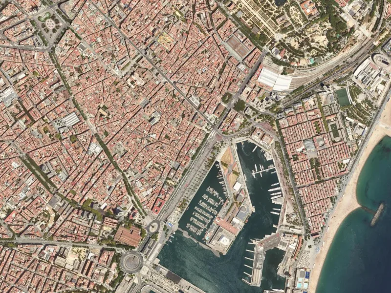
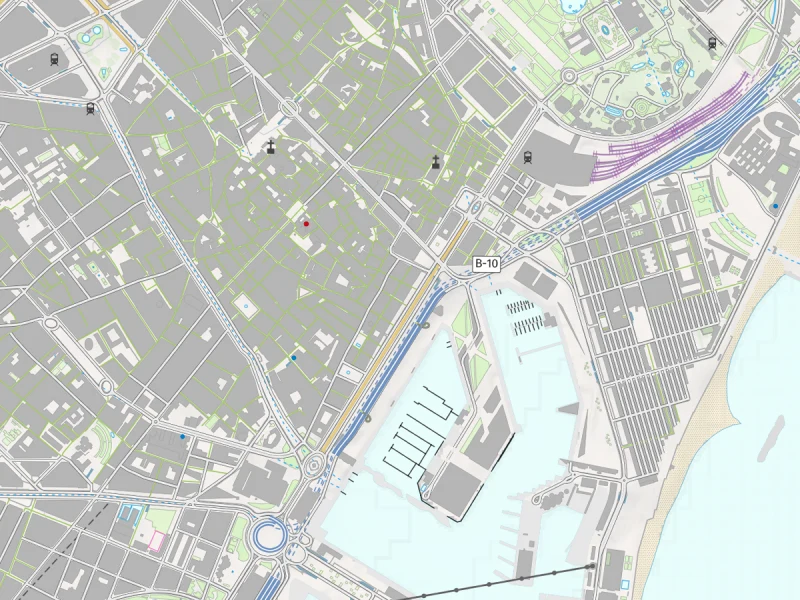
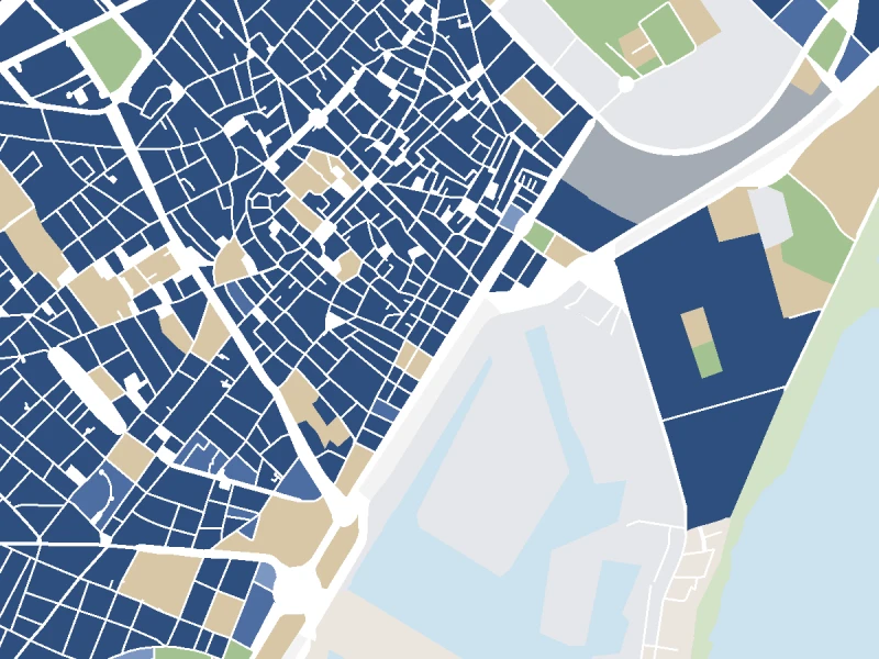
The same stretch of Barcelona’s waterfront through three complementary sources, from a regional agency and an EU programme. Orthophoto and topographic map © Institut Cartogràfic i Geològic de Catalunya (ICGC), CC BY 4.0. Land use: Copernicus Land Monitoring Service, Urban Atlas 2018, © European Union.
Each new source becomes more valuable when it can work with the others.
As the number of sources and stakeholders grows, building a separate integration for every combination becomes hard to sustain. Differences in formats, definitions, resolution, update cycles and access conditions all affect whether data can be used together, and whether the result is meaningful.
AI offers a way through that complexity. An agent can find relevant datasets, interpret their documentation, reconcile differences between sources and coordinate the tools needed to analyse them. People can begin with a question in their own language, and the ability to ask sophisticated questions extends beyond the teams that can assemble every step by hand.
Realising that potential requires foundations designed for this more connected world.
A common framework
Four principles for Europe’s geospatial data
Discoverable, understandable and usable by the systems that increasingly act on our behalf. Agents need clear metadata, documentation, access conditions and analytical guidance, and every answer should stay connected to the evidence: which data was used, how it was processed and what uncertainty remains.
Publishers decide where their data lives, who can access it and under which conditions. A federated approach keeps data with its custodians while common standards allow it to be discovered and used across borders. Wider use and national stewardship reinforce each other.
Ready for growing volumes of data and far more questions. Open, cloud-native formats let tools read only the parts of a dataset they need, with computation running in the environment the user chooses. That reduces the serving burden on publishers and keeps large datasets affordable to maintain.
Working across borders and across the wider data economy, in the analytical tools, applications and AI environments organisations already use. Open standards, shared definitions, compatible formats and clear rights make connections reliable and reduce the ambiguity AI has to resolve.
Geospatial expertise remains essential to defining reliable methods and judging whether an answer is fit for a decision. AI can make that expertise available to many more people.
The study
A policy framework for core geospatial data in the EU
Putting those foundations in place across Europe is the focus of a new study for the European Commission’s Directorate-General for Defence Industry and Space, DG DEFIS. A consortium led by Evenflow, with ConsultingWhere, CARTO and BHO Legal, has kicked off its work on the study “Comprehensive policy framework for core geospatial data in the EU”, supported throughout by the Open Geospatial Consortium (OGC), EuroGeographics and Pathway2. The kick-off meeting with DG DEFIS took place in Brussels on 29 September 2026.
Over the next 18 months, the study will take stock of how core geospatial data is governed, produced, licensed and shared across the EU-27, and assess the potential impact of a unified core geospatial data policy. A central focus is connecting Europe’s space capabilities, including Earth observation and positioning and timing, with authoritative geospatial information and sectoral data. For space data, the work will also feed the development of European Space Data Spaces and Labs, as envisaged in the Commission’s Vision for the European Space Economy.
The consortium will consult data providers and users and put forward technology, governance and legal options for a common EU approach, with a demonstrator showing what integrated core geospatial data and space data makes possible in practice. CARTO leads the technology-based option and the development of the open-source demonstrator.
One Europe, one framework for geospatial data is the ambition: make Europe’s data work together while the organisations that produce it stay in control.
From vision to impact
Bringing the vision into practice
These principles connect directly with our work on Portolan and CARTO SDI, which explores how open publication and publisher-controlled data can support modern analytics and AI.
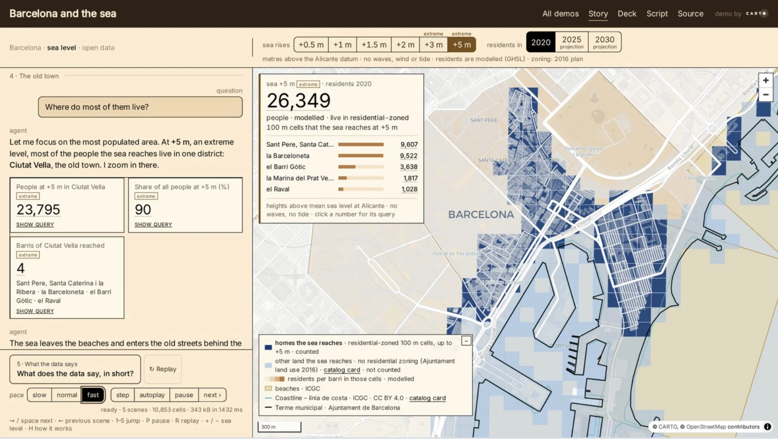
We will bring that experience to the study through an open-source, platform-independent demonstrator. Our role is to connect the policy discussion with practical evidence: how national geospatial data and EU space data can work together, what that makes possible, and which barriers still need to be addressed. Technology is one part of the work. A sustainable framework also needs governance and legal arrangements that clarify responsibilities and make data usable under conditions its producers can trust.
For Europe, the opportunity is substantial. Its investment in Copernicus and space technologies becomes more useful when connected with the knowledge held by national agencies, local authorities, businesses and a growing community of data producers. AI gives us a new way to make that shared knowledge accessible. A common framework can set the conditions for using it reliably across Europe.
Get involved
Help shape a common framework for Europe’s geospatial data
A project website and the first stakeholder consultations will follow in the coming weeks. If you produce, manage or use geospatial data, we want to hear what you need this framework to make possible.
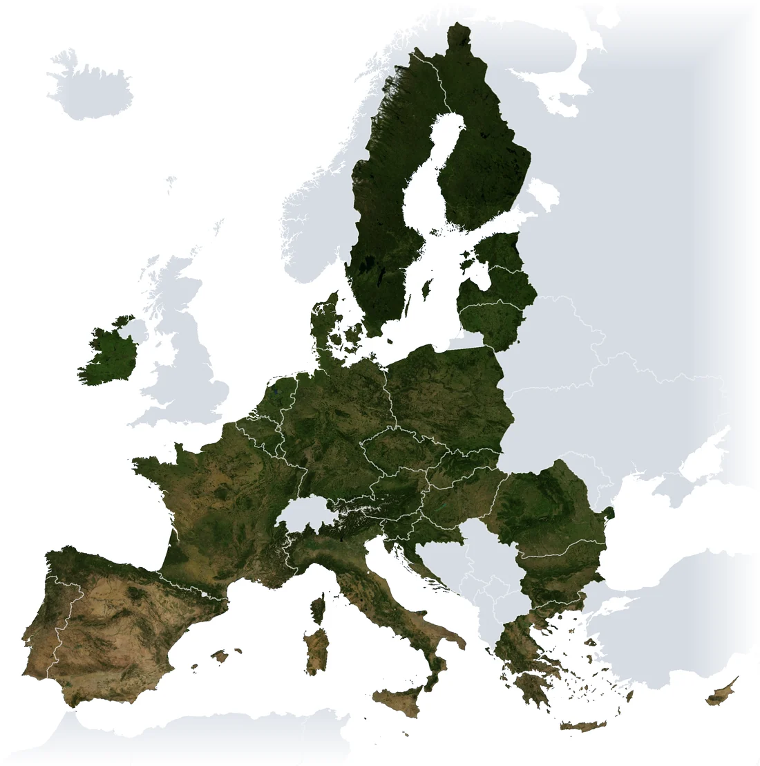
Get in touch →Map of the EU-27: imagery NASA Blue Marble Next Generation, boundaries Natural Earth.
Frequently Asked Questions
What is the DG DEFIS study on core geospatial data in the EU?
It is a European Commission study, titled ‘Comprehensive policy framework for core geospatial data in the EU’ (EC-DEFIS/2025/OP/0034), carried out for the Directorate-General for Defence Industry and Space. It is carried out by a consortium led by Evenflow, with ConsultingWhere, CARTO and BHO Legal, supported by the Open Geospatial Consortium (OGC), EuroGeographics and Pathway2. Over 18 months from September 2026 it will take stock of how core geospatial data is governed, produced, licensed and shared across the EU-27, assess the potential impact of a unified policy, and put forward technology, governance and legal options for a common EU approach.
What is CARTO's role in the DG DEFIS geospatial data study?
CARTO leads the technology-based option and the development of an open-source, platform-independent demonstrator. The demonstrator is meant to show how national geospatial data and EU space data can work together, what that makes possible, and which barriers still need to be addressed.
Would a common European geospatial framework centralise data in one place?
No. The approach CARTO proposes is federated: data remains with its custodians, while common standards allow it to be discovered and used across borders. Publishers decide where their data lives, who can access it and under which conditions, and organisations choose where analysis runs and which AI models may participate.
What does AI-ready geospatial data mean?
It means data that AI agents can discover, understand and use, backed by clear metadata, documentation, access conditions and analytical guidance. An agent needs to know what a dataset represents, when it was produced, how it relates to other sources and where its limitations lie. Answers built from it should stay connected to the evidence: which data was used, how it was processed and what uncertainty remains.