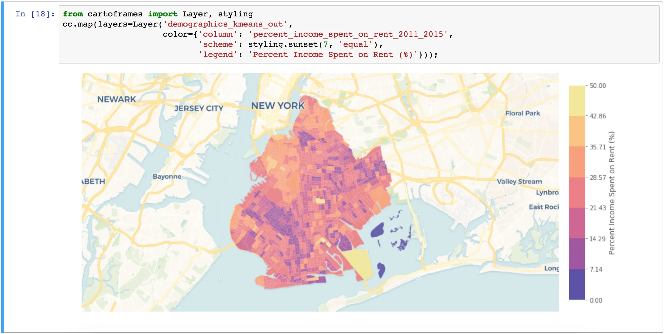
Embracing Location Intelligence can help insurers to reduce their exposure to risk, while preparing and offering policyholders better service and more varied plans that meet their needs.
Cities, local governments, and entrepreneurs are working together, through hackathons and app challenges, to create successful businesses. We highlight 3 from Colorado's Go Code challenge.
Using credit card data, one of the largest banks in Spain created an Urban Discovery tool that describes city dynamics and compares areas from different cities.
Last week, over 200 geospatial experts convened at the United Nations to discuss how big data can help the organization achieve its 17 Sustainability Development Goals (SDGs).
Six months after the beta, CARTO officially launches CARTO VL a JavaScript library for vector-based visualization and analytics in Location Intelligence applications