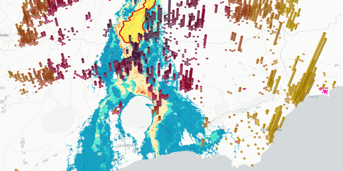
We are very pleased to announce the appointment of Javier de la Torre, Founder & CPO of CARTO, to The Open Geospatial Consortium's (OGC) Board of Directors
The pandemic has significantly affected waste management in our cities - read how Location Intelligence can be used to optimize collection & reduce costs.
We are excited to introduce the CARTO Spatial Analytics in BigQuery, a suite of functions & procedures to perform spatial analysis natively within the Google BigQuery environment using SQL
How can Location Intelligence be used for Sustainability? Discover some examples including sustainability for agriculture, environment, mobility, cities, & more
Recently we published a map to track the COVID-19 vaccination rollout in the US–learn how this Cloud Native Spatial App was developed using CARTO & Google Cloud
How is vaccination progressing in the US at an individual level? Find out using our interactive COVID vaccination tracker app visualizing every person in the US
AenaMaps, a solution developed by CARTO, Telefónica, & Situm, leveraging indoor mapping to provide navigation within Aena's airports expands to Barcelona
Download our new report on site selection strategies & how location data & advanced spatial analysis can help retailers adapt & thrive in a post pandemic world
Read how WXY, an architecture, urban design, & planning firm, built an interactive school district dashboard for Montgomery county using the CARTO platform