US Broadband Map: Closing the Digital Divide in America
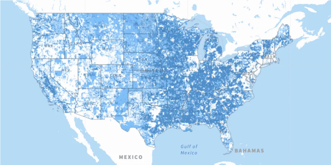
The Connect America Fund aims to close the digital divide between rural & urban America. Learn more about it's impact with a newly updated map from the USAC.
Use casesThe Connect America Fund aims to close the digital divide between rural & urban America. Learn more about it's impact with a newly updated map from the USAC.
Use cases