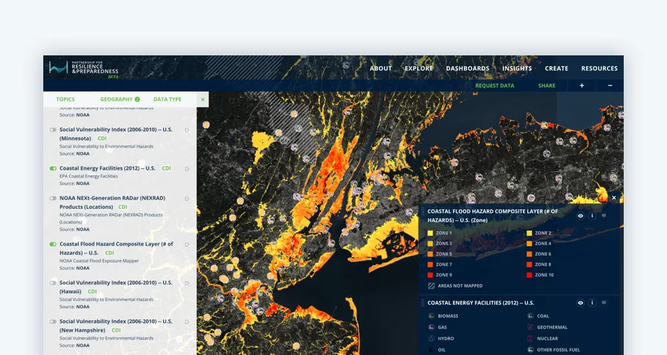
The Revolution will be Visualized: CARTO joins PREP
Discover CARTO's role in the Partnership for Resilience and Preparedness (PREP), empowering global climate resilience planning.
Spatial DataDiscover CARTO's role in the Partnership for Resilience and Preparedness (PREP), empowering global climate resilience planning.
Spatial Data