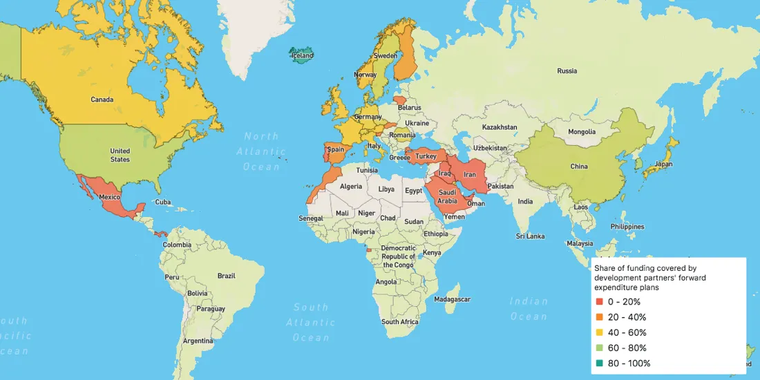
Map of the Month: World Refugee Day
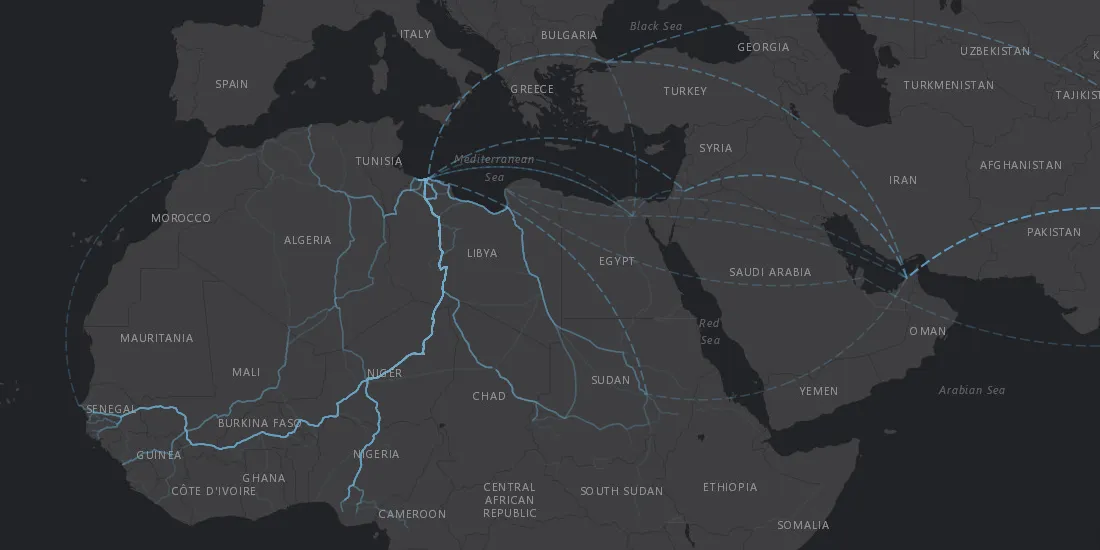
Solutions to the challenges faced by refugees, displaced persons, and the world as a whole as it tries to assist them are rooted in location data
Use casesSolutions to the challenges faced by refugees, displaced persons, and the world as a whole as it tries to assist them are rooted in location data
Use cases