

Super Charged Site Selection for Electric Vehicles


Electric vehicles are becoming one of the true success stories in sustainable transport both environmentally and commercially. Their popularity has grown exponentially with over 10 million electric vehicles (EVs) on the road in 2020 an increase of 43% on the year before. This is set against the trend of new car registrations declining by around a third globally.
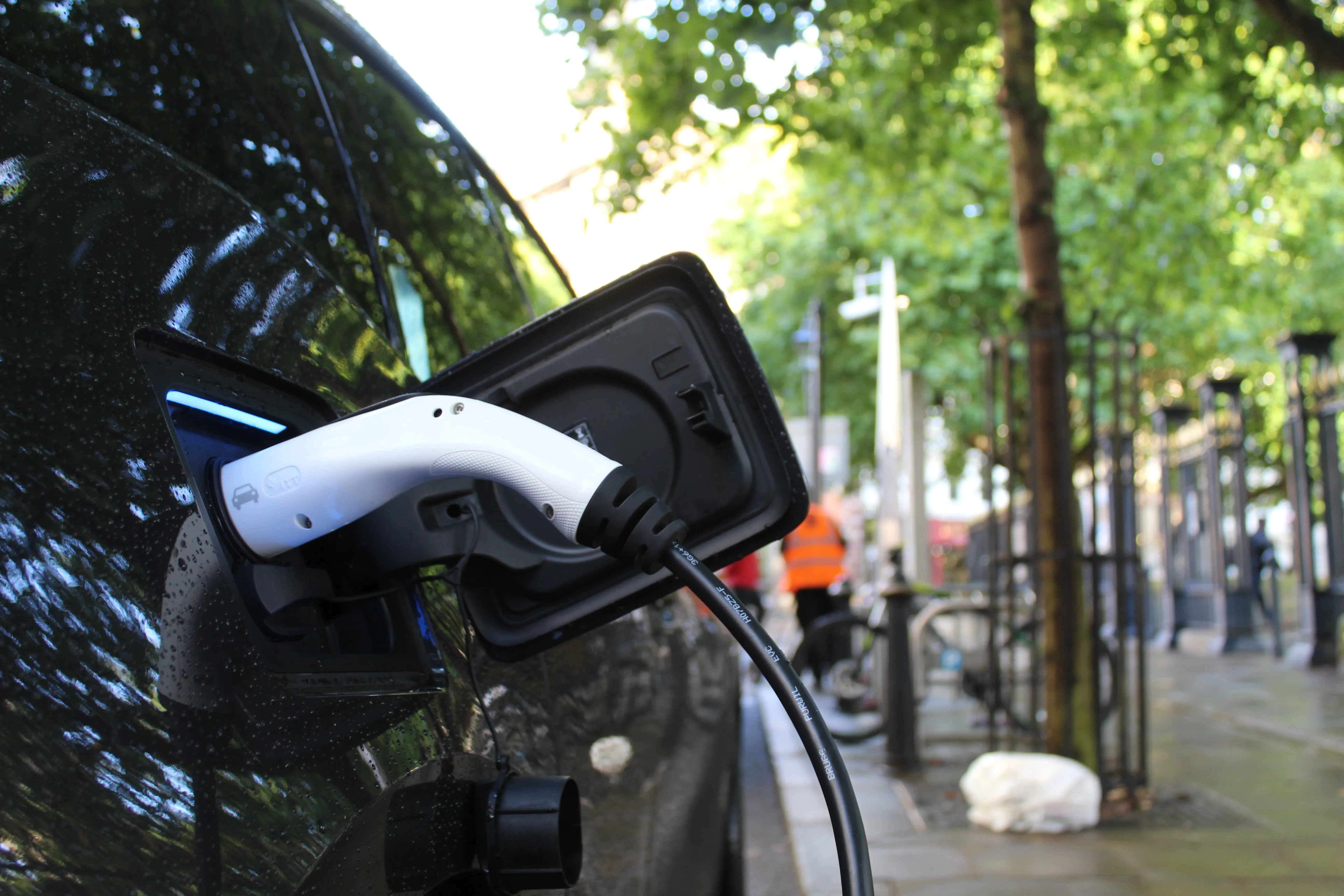
With low emissions and running costs as well as varying tax and levy benefits such as Spain’s Moves III grant scheme electric vehicles are no longer just the sustainable choice but often the economic choice too. So why isn’t everyone going electric? If you look at any electric vehicle pro-con list there’s one factor that always appears: charging points. Potential owners can be apprehensive about the availability of charging points particularly when visiting unfamiliar areas. In order to enable widespread uptake of electric vehicles a comprehensive network of charging points is required. CTID Engineering & Technologies are an organization hoping to drive growth in this network through intelligent site selection. They seek potential charging station locations which have a strong local market and can therefore be expected to generate a strong revenue.
About CTID and Their EV Charging Needs
CITD is a leading company in the provision of comprehensive engineering design services for systems and structural components in the aeronautical and defense sectors. They have ambitions to expand their offering to include electric vehicles charging stations as part of their commitment to sustainability.
Dashboards for Electric Vehicle Site Selection
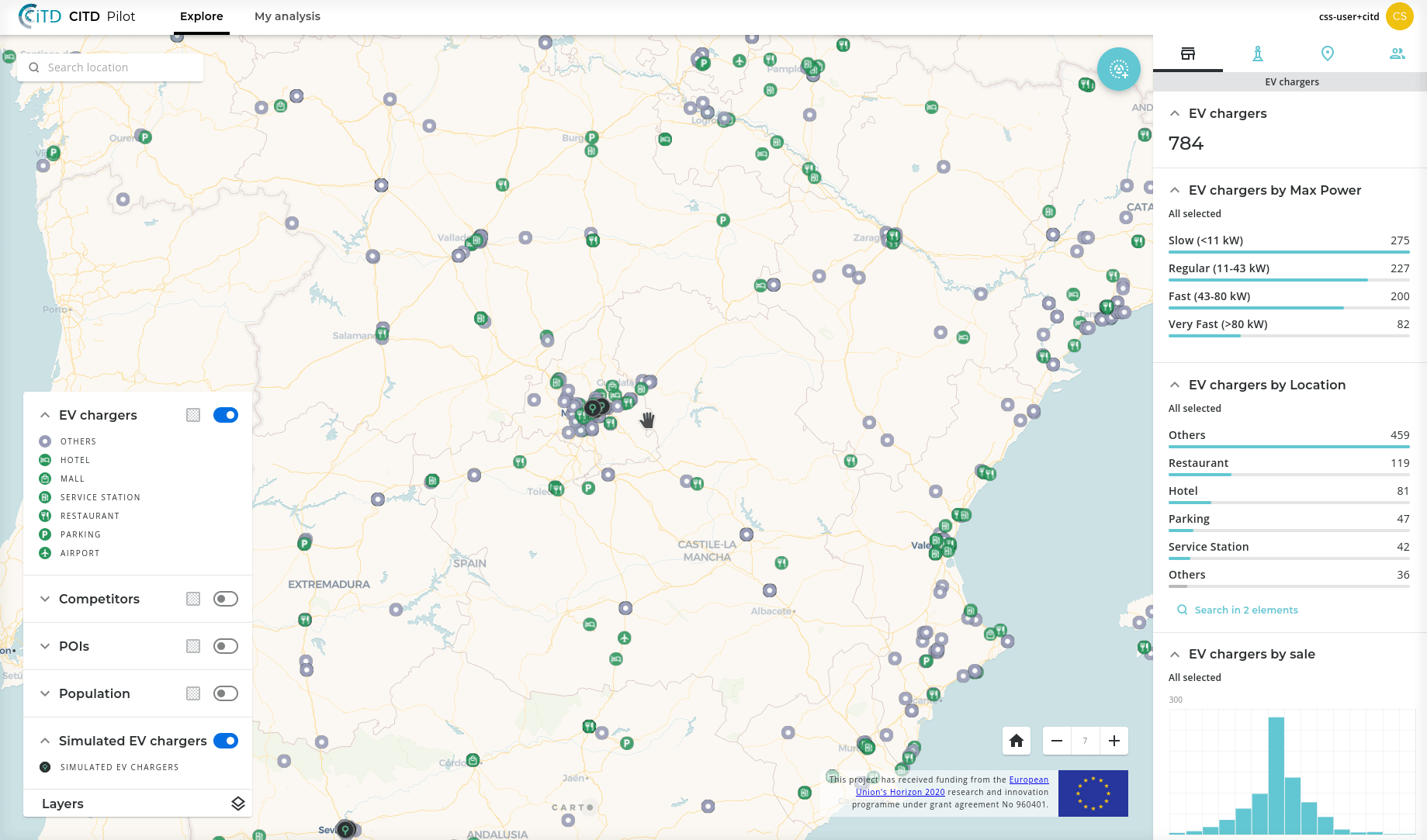
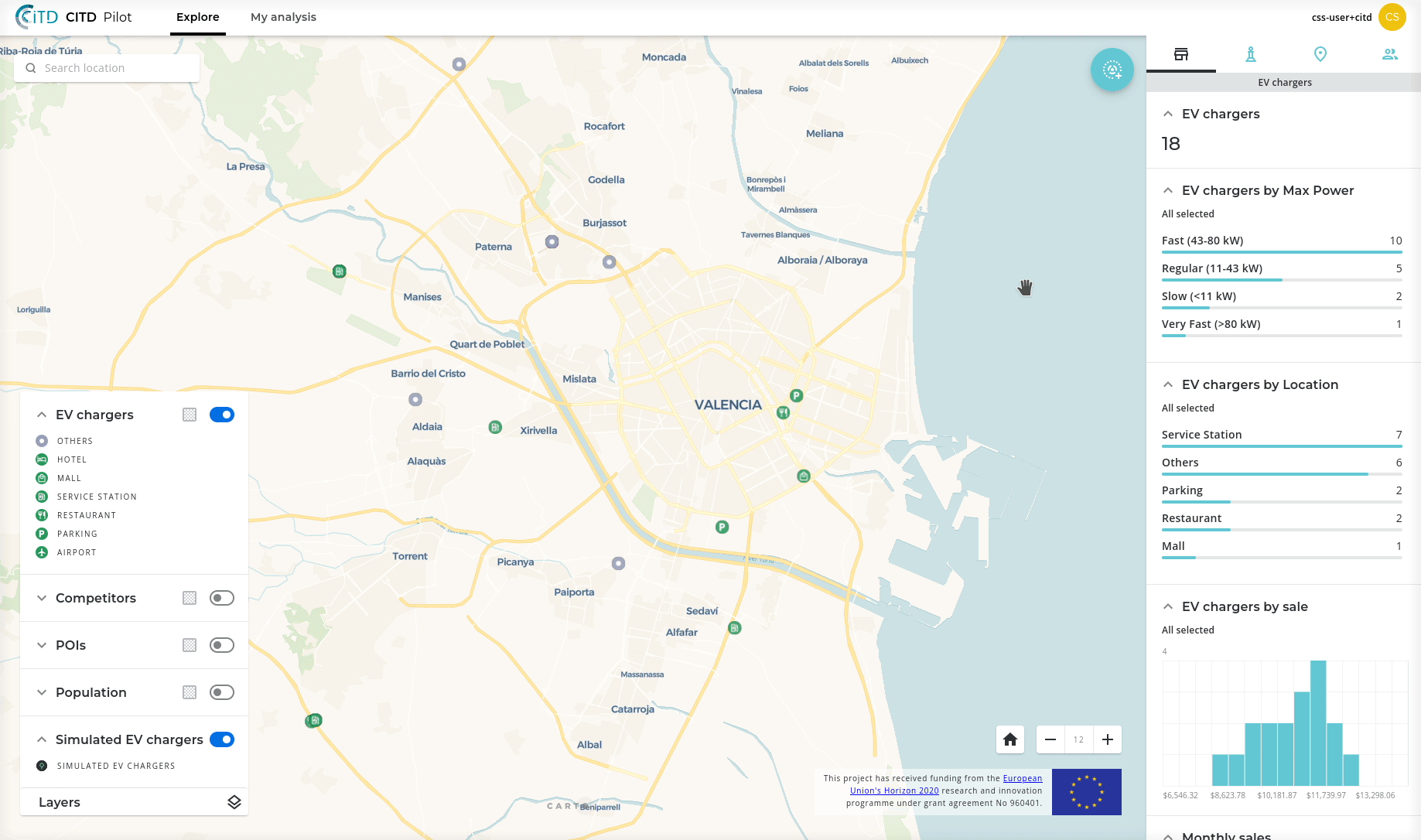
CARTO has developed a location-based dashboard to help CTID to plan and monitor the most optimal locations for electric vehicle charging stations. The Site Planning and Monitoring solution empowers CITD staff to:
- Monitor site performance across their network
- Compare site performance and identify new potential high performing sites
- Analyze competitor site locations
- Predict the success of future sites
The solution includes insights on EV charging point locations sales competitors points of interest and demographics. Keep scrolling to see the solution in action!
Using Location Intelligence for Business Outcomes
CARTO’s Site Selection solution is aimed at empowering CITD staff without GIS or data science skills to tackle common business problems making their workflows more efficient than if they had to rely on technical staff every time they needed a question answered. So what kind of problems does the solution help to solve?
Insight 1: How Well is This Region or Specific Charging Station Performing?
The data visualizations in this solution are dynamic - meaning they change depending on where in the world the map user is viewing. Users can easily pan and zoom around the map to check and compare performance in specific regions. They can also select individual charging locations to understand specific performance at that point for example the total value of sales and how many people live within a 1-kilometer drive.
Insight 2: How Can I Predict the Performance of a Potential New Charging Location?
Site Selection is one of the most powerful applications of Location Intelligence allowing businesses to out-position competitors and maximize revenue. This application provides crucial site selection intelligence to users without them needing GIS or data science skills.
Users can drop a pin anywhere on the map and be presented with predictions on the performance of a potential charging point in that location. This includes insights on the potential market competitors and revenue utilizing CARTO’s Revenue Prediction tools from our Analytics Toolbox. This is a powerful way of understanding and comparing how successful potential locations are likely to be.

Insight 3: How Can I Identify General Areas for Successful Future Expansion?
Let’s say you weren’t quite sure where a future charging point should be located and rather than testing specific locations you wanted to know general regions that would be successful and then pinpoint exact locations from there. Our solution has the perfect tool for that - Whitespace Analysis. Whitespace Analysis takes a set of user-generated parameters - required boundary minimum revenue threshold analysis of competitors etc - and predicts a number of likely high-performing areas. Users can then delve deeper into these areas to pinpoint the optimum location for a charging point.

Insight 4: How Can I Replicate a Current High-Performing Location?
In Valencia the highest performing electric vehicle charging station is Exoil Pista de Silla - Wenea 1 in the south of the city. This station has achieved the highest revenue of all locations; if you were planning on opening a new charging station nearby wouldn’t you be keen to replicate Exoil Pista de Silla - Wenea 1? Well that’s exactly what this solution allows with its “Find Twin Areas'' tool. Users can leverage the tool to scan input demographic and point of interest data to establish areas with similar characteristics which are likely to generate a similar revenue.
The map above shows the top 15 most similar locations for a charging station. The most similar location - “TA4” in the north-west of the city - has a similarity rating of 95.14%.
Behind the Scenes: Creating the Dashboard
This dashboard was created by CARTO’s solutions team who develop custom spatial apps for clients. The following datasets were used as inputs:
Client data
- Asset locations
- Asset revenue
- Competitor list
Data from CARTO’s Data Observatory
- Spanish provinces for territory assignment
- Demographic data to understand social characteristics for each charging point such as total population gender split and education level. In this case we used CARTO’s Spatial Features dataset which includes core demographic data from WorldPop as well as environmental data and POI aggregations from sources such as OpenStreetMap NASA and Worldclim. This dataset is available in a Quadgrid geography - a type of global hierarchical grid designed for spatial modeling at scale. You can find out more about the benefits of hierarchical grids for Location Intelligence here.
- Points of interest data data to establish relevant local amenities for charging points. In this instance we used OpenStreetMap a freely available global dataset.
Conclusions
This work has been made possible through the European Union’s Horizon 2020 program. Head to our blog to read other stories about how CARTO has been working with this program to democratize access to Spatial Data Science with the next generation of our Location Intelligence platform such as through sharing data on home energy efficiency.
Interested in learning more about Location Intelligence and Electric Vehicles? Read more about how CARTO is being used in this area as well as our role as a Strategic Partner in Future: Fast Forward a program which aims to turn Spain into a hub for electric vehicles in Europe right here. You can also get in touch with us for a free demo with one of our specialists.


