Snowflake Summit 2025 - highlights for geospatial


The Snowflake Summit has to be one of our favorite events of the year! Held in San Francisco, this year’s event showcased the next generation of AI, apps, and data platforms - and CARTO was proud to be at the heart of it all. From major announcements around agentic AI and interoperability to a landmark shift for geospatial data in the cloud-native ecosystem, the momentum around Location Intelligence has never been stronger.
In this post, we’ll share the top highlights from Summit - and what they mean for the future of geospatial analytics.
.webp)
What we’re most excited about: spatial taking center stage
At Snowflake Summit 2025, the announcements confirmed what many in the spatial community have long anticipated: geospatial data is finally stepping into the cloud-native mainstream. Two themes stood out most - interoperability and AI - and both are transforming how spatial data is used, shared, and understood.
Interoperability: open formats are changing the game.
Spatial data has historically been siloed - stuck in proprietary formats or isolated systems. Snowflake Summit cemented why that’s no longer the case.
- Native geospatial support in Apache Iceberg. Snowflake’s announcement of GEOGRAPHY and GEOMETRY types on Iceberg is a major leap forward. Developed with input from CARTO, this brings native spatial support to one of the fastest-growing open table formats - enabling true multi-engine geospatial analytics. You can learn more about this development here.
- GeoParquet becomes the standard. With strong community backing, GeoParquet is now the default for storing and exchanging spatial data in a columnar, compressed format. It unlocks better performance, lower storage costs, and full compatibility across various engines.
- Access once, use anywhere. Together, Iceberg and GeoParquet allow users to write spatial data once and read it from anywhere - without conversions, rewrites, or vendor lock-in. This marks a foundational shift in how organizations manage and scale location data.
CARTO has played a key role in both initiatives, from defining specifications to helping cloud platforms like Snowflake support spatial interoperability by design.
AI: smarter spatial insights with Snowflake Cortex
The second big theme? AI-native workflows - and spatial is front and center here, too.
- Cortex AISQL & Document AI. Anyone who works with spatial data knows the pain of being told “please find the data attached”... only to open a PDF. Snowflake is taking that pain away with their new AI SQL capabilities which let you query unstructured data (like PDFs or scanned maps) using SQL and natural language! This is huge for geospatial teams dealing with things like permits or planning documents.
- Cortex Agents for Data Exploration. With agentic workflows, users can now ask natural-language questions about their spatial datasets and get contextual answers, visualizations, or next steps - instantly.
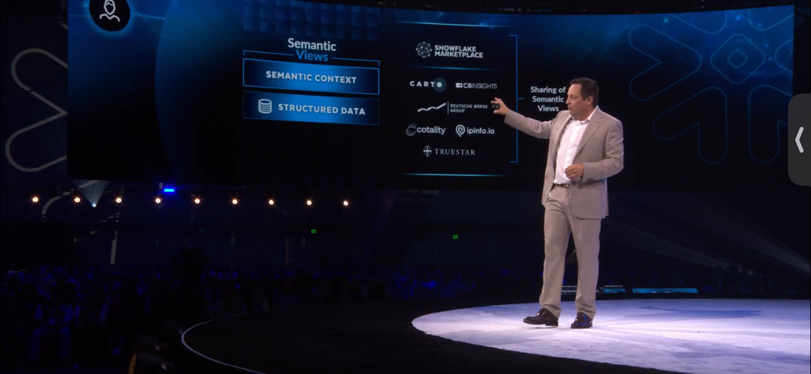
- Semantic Models + Spatial Metrics. Snowflake’s private preview of Semantic Views and the sharing of Semantic Models allows teams to define and reuse spatial dimensions and KPIs - such as footfall density or drive-time coverage - across different teams and apps.
So… how can you start taking advantage of these developments?
CARTO + Snowflake: Seamless Location Intelligence
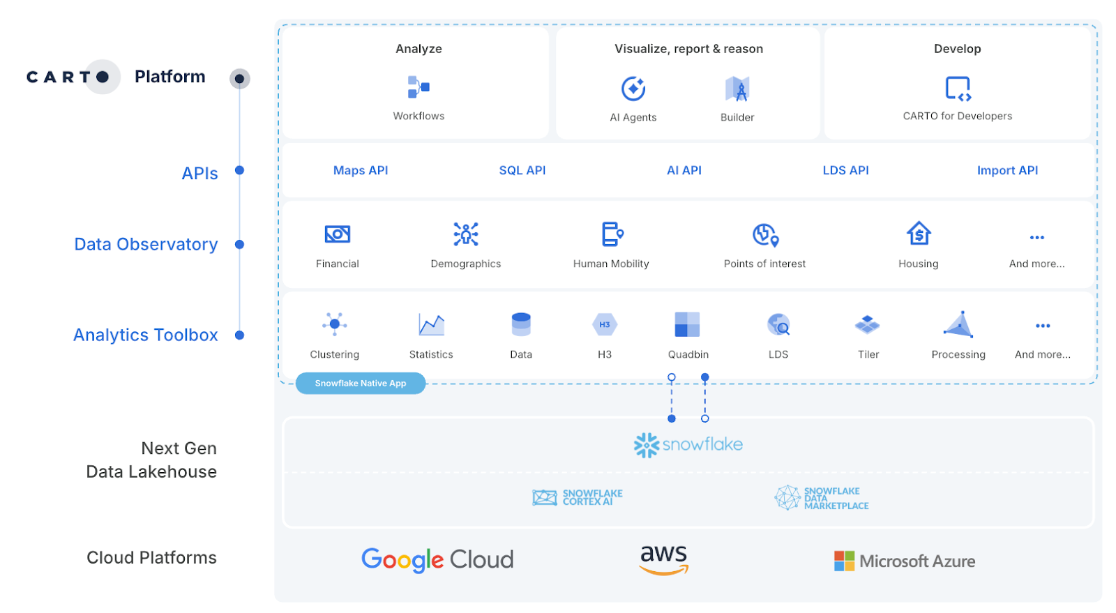
CARTO is deeply integrated with Snowflake at every layer - from storage to analysis to app development. The entire platform is run natively inside Snowflake - meaning spatial analysis without time-consuming ETL or painful data governance. It’s spatial analytics that scales with your cloud - fast, governed, and cloud-native by default. With openness at its core, CARTO extends easily to BI tools like Power BI and QGIS, letting teams connect spatial insights across their wider analytics ecosystem.
To make things even more seamless, CARTO is available as a Snowflake Native App and can be easily deployed via the Snowflake Marketplace.
Conclusion: the future of spatial is cloud-native
The announcements at Snowflake Summit 2025 mark a turning point: geospatial data is no longer confined to niche systems or workflows. With developments across interoperability and AI, spatial analytics is finally becoming open, scalable, and accessible.
Want to see how you can take advantage of these updates? Request a demo to connect with our experts and explore the possibilities.