The Top 5 Location Intelligence and Spatial Webinars


With soaring scorching temperatures impacting people across the globe this Summer is relegating many of us to the indoors. To give you something to do while cooling off inside we've compiled a list of our most-viewed webinars from this year (and also some great webinars from some of our friends).
Every month CARTO presents expert webinars covering the biggest topics and trends from around the Location Intelligence industry. Our webinars range from collaborations with industry thought leaders to technical sessions keeping viewers up-to-date on the latest advances in Spatial Data Science.
Even if you missed the live sessions you can view any of CARTO's webinars on demand. So crank the AC pour yourself a cold beverage and beat the heat with CARTO's Top 5 Webinars of the year so far:
- The Sum of our Parts: the Complete CARTO Journey
- Location Intelligence for All: Enabling Individuals to Use Spatial Analysis
- Best practices for Spatial Data Science using CARTO and Python
- Think Spatial don't ignore location in your models!
- How to use Spatial Data Science in your Site Planning Process
1. The Sum of our Parts: the Complete CARTO Journey
At CARTO we understand Location Intelligence as a repeatable framework that powers the data-to-insight pipeline through a five-step process:
- Data Ingestion & Management
- Data Enrichment
- Analysis
- Solutions & Visualization
- Integration
Want to know how these steps can be incorporated throughout your organization? Watch this webinar to learn how Location Intelligence can help you to power a data-to-decision workflow.
2. Location Intelligence for All: Enabling Individuals to Use Spatial Analysis
One of the strengths of the CARTO platform is that it makes Location Intelligence available for everyone:
- Are you a Data Scientist? Integrate spatial data and analysis into Python scripts.
- Are you a Developer? Build interactive customer maps to use on your own websites and apps.
- Are you a Business User? Uncover insights from location data by creating maps from scratch on your browser with our intuitive user interface.
This webinar is full of examples of how we've helped individuals in all these roles with our tech stack!
3. Best Practices for Spatial Data Science using CARTO and Python
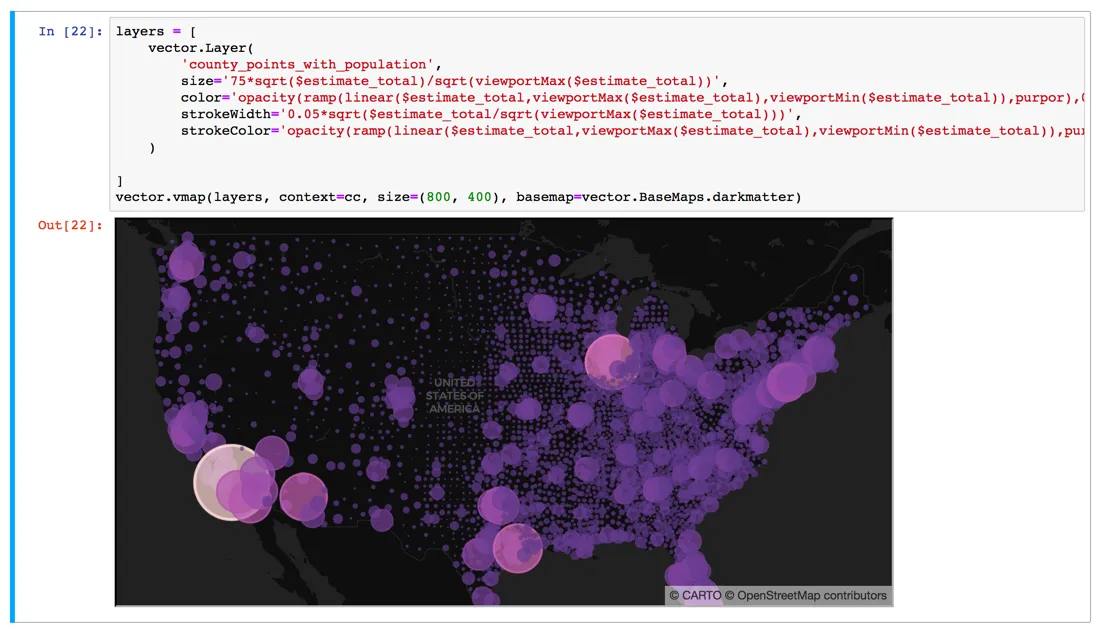
One of the most popular webinars we've ever done this technical webinar teaches listeners how they can combine CARTO and Python for spatial data analysis workflows from the comfort of their own Jupyter notebooks using CARTOframes.
CARTOframes is a Python package for interacting with CARTO that's built specifically with data scientists in mind and speaks the language of some of the de facto standards of the data science community: Jupyter notebooks pandas matplotlib and SQL/PostGIS. If you are not using CARTOframes already you might be surprised by what you are missing.
{% include icons/icon-bookmark.svg %} Looking to learn more about Spatial Data Science? Register for the Spatial Data Science Conference today!
4. Think Spatial Don't Ignore Location in your Models!
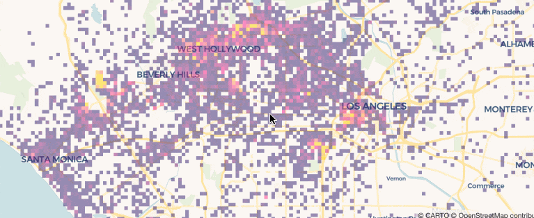
Thinking spatially can help you to build powerful models that outperform the typical data science tools. In this webinar our data science experts walk you through some essential tools to build statistical models estimate their parameters and perform predictions.
Learn how to take advantage of CARTO's tech stack with this webinar that features practical demos!
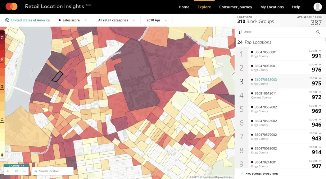
5. How to use Spatial Data Science in your Site Planning Process
Site Planning is one of the most common applications of modern Location Intelligence technology. For retailers and other businesses it is imperative to analyze multivariate geolocated data (both from inside your company and from external data sources) and derive data-driven insights when opening relocating or consolidating location sites.
This webinar explores how to access the CARTO Data Observatory for data enrichment and how to develop a similarity score bringing together modern data streams (e.g. mobile financial demographic and point of interest data) to find locations that show similar characteristics with respect to an existing site.
More Location Intelligence Webinars from Around the Web
Still looking for more content on Location Intelligence and Spatial Data Science? Well look no further. Here are a couple of our favorite webinars and presentations from leading experts in geospatial:
- Advancing Geographic Equity Using Spatial Analysis: This webinar from All In: Data for Community Health features leaders from the Center for Urban Affairs at the University of Minnesota The Center for Spatial Data Science at the University of Chicago and The Public Health National Center for Innovations discussing geographic insights about health-related public investments that remain hidden without the application of spatial analysis.
- Bringing new forms of data to the study of cities: An oldie but a goodie this webinar from Senior Lecturer in Geographic Data Science and member of the Geographic Data Science Lab at the University of Liverpool Dani Arribas-Bel provides a primer for those interested in urban studies using more contemporary data streams.
Stay up to date on CARTO's upcoming webinars events and blog posts? Subscribe to the CARTO 5!