Introducing User Comments: boost collaboration in your maps


We’re excited to unveil the latest feature in CARTO Builder: User Comments!
Imagine your team is analyzing coverage gaps for a new 5G rollout. You’ve mapped areas with weak signal coverage, layered with population density and infrastructure availability. But aligning on rollout priorities means involving planners, engineers, and regional leads - each bringing different context to the table.
One team flags a high-priority zone due to population needs. Another highlights upcoming fiber upgrades that could support deployment. A regional lead notes zoning challenges that might delay the buildout.
With User Comments in CARTO Builder, this cross-functional input happens directly on the map - structured, visible, and in context - so decisions move forward faster and with everyone on the same page. No more disconnected conversations or lost context - just seamless collaboration and faster decision-making, all within the map itself.
Built for enterprise-scale collaboration
Enterprise mapping projects rarely happen in isolation. They involve contributions from data teams, planners, engineers, business stakeholders, and external partners - often spread across departments, regions, or even time zones.
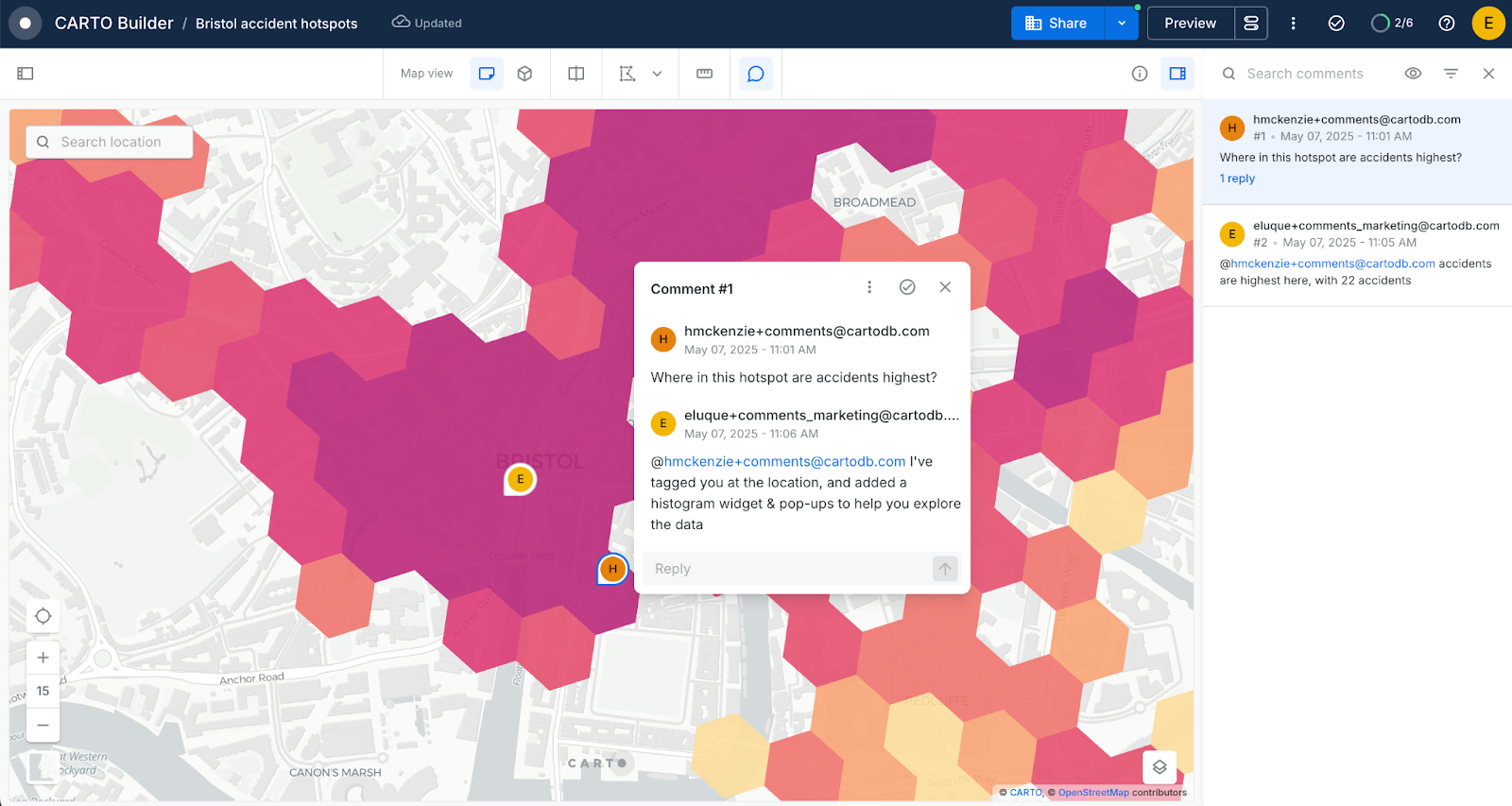
With User Comments in Builder, all of these voices can come together in one shared space. Comments are tied to a specific geographic location, creating a clear, structured thread of communication. Whether it's validating assumptions, flagging deployment risks, or aligning on next steps, teams can collaborate directly where decisions are being made - on the map.
What’s more, this collaboration is happening natively in a cloud environment, which means your entire team can collaborate in real-time, from anywhere in the world, without worrying about compatibility or version control issues. This cloud-native functionality ensures your enterprise-level projects stay smooth and efficient, no matter how large or complex the task at hand.
Turn your maps into collaborative workspaces
User Comments in Builder aren’t just about leaving notes — they’re about enabling smarter, faster collaboration across every stage of a spatial workflow. Here’s how teams are putting them to work:
- Collaborative spatial analysis: work together to validate or refine map outputs by referencing specific features or patterns on the map.
- Review, validation & quality assurance: highlight inconsistencies: like incorrect geocoding, outdated layers, or visual mismatches - helping ensure accuracy before decisions are made.
- Scenario & “what-if” planning: stakeholders can propose spatial alternatives by anchoring ideas directly to map locations.
- Stakeholder engagement & collaboration: executives, clients, or external partners and teams can provide input tied to specific regions, keeping conversations strategic and focused.
- Field-to-office collaboration: on-site teams can comment in real time, reporting conditions or updates directly from the field.
Start commenting - today!
Getting started with comments in Builder is easy! Just follow the steps below, and if you don’t have a CARTO account remember you can sign up to a free 14-day trial to give this a go yourself.
Here’s how to start using comments:
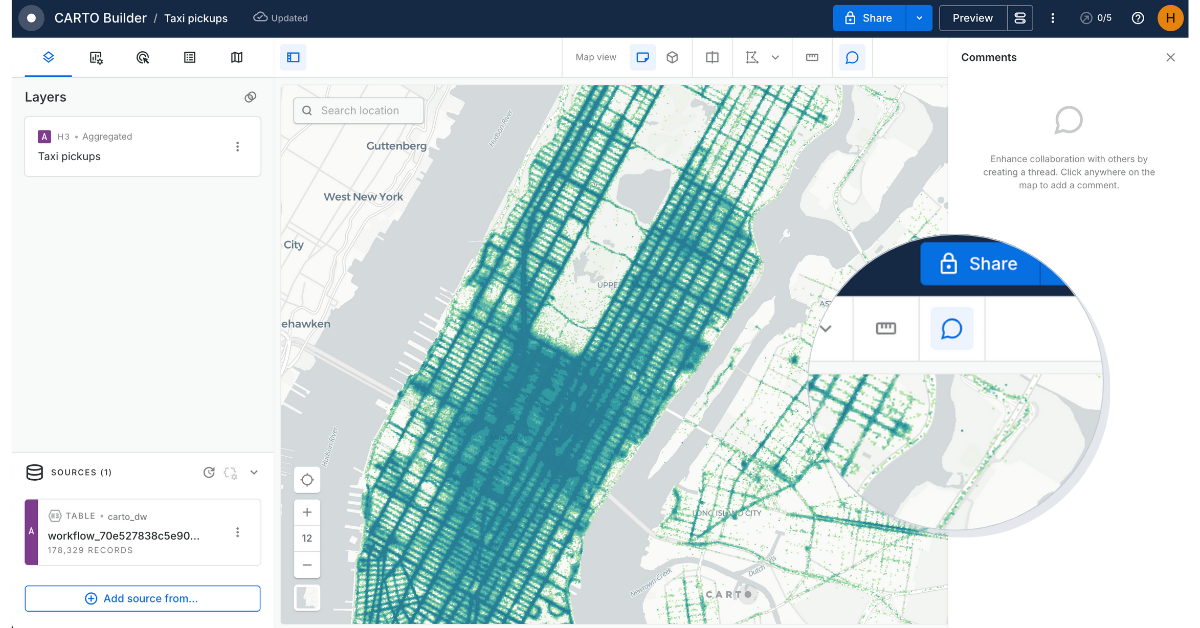
- Open any CARTO Builder map
- At the toolbar at the top of the screen, you’ll find a new Comments icon on the right-hand side.
- When you click the icon, you will now be able to add a comment anywhere on the map! This will also open the Comments panel on the right-side of the screen.
- In order to enable your Viewer users to comment on your map, head to Map settings for viewers (to the right of Preview) and enable comments. Note that only logged-in Viewer users with access to the map will be able to view and add comments.
With this feature, you can:
- Add context-aware comments on map features or layers
- Tag teammates who will receive email notifications for quick input
- Track conversations directly within the project
- Resolve threads as tasks are completed
Learn more about how you can use this feature in our Documentation.
A step forward for enterprise mapping collaboration
This release is part of our ongoing commitment to enabling smarter, faster, and more collaborative spatial decision-making. By bringing user commenting directly into Builder, we’re eliminating friction and helping your team do more, together.
Want to see how your organization can benefit from our collaboration features? Request a demo with one of our experts today!