CUSTOMER STORIES
Using Spatial Analysis to Measure UK Gentrification
The Client
The Centre for Advanced Spatial Analysis (CASA) is an interdisciplinary research institute focusing on the science of cities within The Bartlett Faculty of the Built Environment at UCL.
The Challenge
CASA use geospatial analysis for a number of challenges. One such challenge was to identify, characterise, and locate neighborhoods in London which have undergone recent gentrification, specifically disaggregating the different types of change revealed by the data. They also wanted to explore which neighborhoods are likely to be next in line and be able to present and make available data, code, and novel interactive visualisations as a comprehensive tool for supporting policy and decision making in the city.
Results
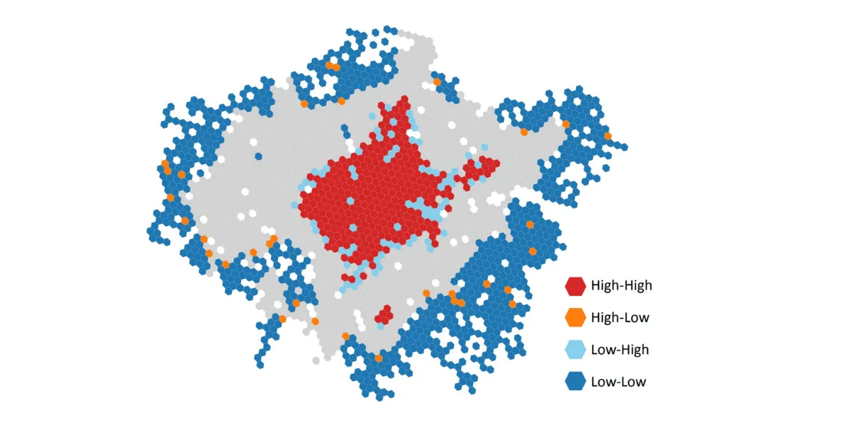
The analysis has shown that two broad processes of neighborhood change – neighborhood ascent and decline – collectively accounted for 1,351 LSOAs or almost 30% of all LSOAs in the city. No borough, except for the City of London, was spared from these processes, thereby underscoring the extensiveness of socio-spatial transformations happening in London.
Why CARTO?
CARTO was used due to its ability to leverage novel Machine Learning, spatial analytical techniques, and new sources of multi-dimensional data to easily create novel interactive visualisations.
For more details on this customer story, read the full blog post.