CUSTOMER STORIES
Charging Electric Vehicles EV on the Public Network

With CARTO, we analyze charging station usage to identify peaks, pinch points, and power demand fluctuations. This helps our clients manage queues and better understand utilization changes.
Jade Edwards
Head of Insights at ZapMap
With CARTO, we analyze charging station usage to identify peaks, pinch points, and power demand fluctuations. This helps our clients manage queues and better understand utilization changes.
Jade Edwards
,
Head of Insights at ZapMap
The Client
ZapMap
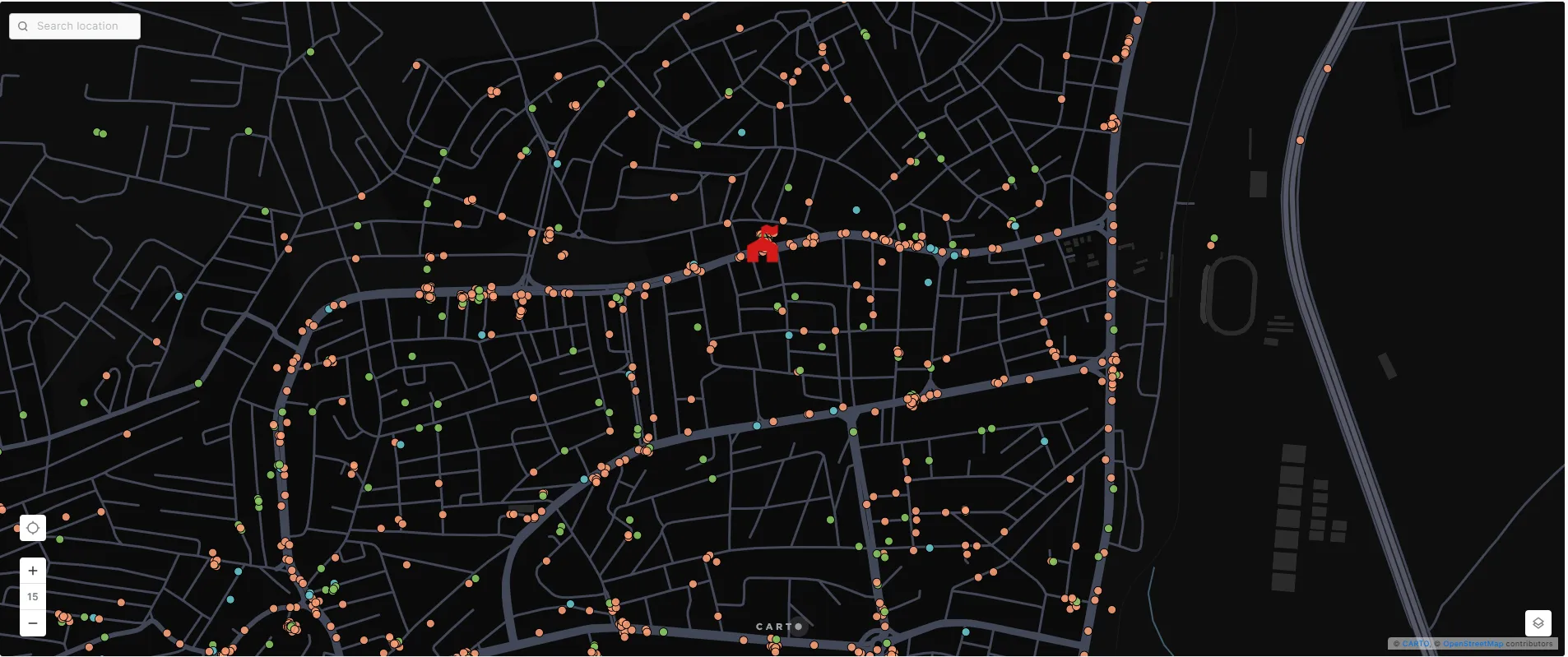
ZapMap is a leading platform for electric vehicle (EV) drivers in the UK, offering essential tools to locate, plan routes, and pay for public EV charging. With over 1.5 million app downloads and 800,000 registered users, ZapMap simplifies EV charging by aggregating geospatial data from over 61,000 charging devices and 100+ charge point operators into one unified app.
The Challenge
Helping EV drivers find chargers and giving the industry better insights
With over 100 charge point operators and a fast-growing number of charging locations, EV drivers struggle to find chargers easily. Industry partners, like charge point operators and utility companies, also need accurate data on charger usage, availability, and demand to improve infrastructure. ZapMap needed a solution to clean, combine, and analyze large amounts of EV charging data in real-time.
Results
Clear data for EV drivers and better tools for the industry
ZapMap chose CARTO for its ability to handle massive, dynamic datasets and deliver actionable geospatial insights. As a result, Zapmap is able to track and analyze over 1 million charging sessions monthly to see peak usage and regional trends. This enables industry stakeholders to pinpoint infrastructure gaps, predict future demand, and optimize energy management.
95% of UK charging locations mapped
With the help of CARTO, ZapMap provides live updates every 1–5 minutes for over 32,000 sites, helping EV drivers find available chargers and avoid out-of-service locations.
+
.webp)
A cloud-native approach
CARTO is the Location Intelligence platform built to run natively within your Google Cloud’s BigQuery lakehouse. This seamless integration breaks down GIS data silos, empowering you to transform spatial analysis into business-critical decisions directly inside your cloud environment.
CARTO’s platform eliminates slow and ungovernable ETL processes, and ensures enterprise-grade speed, scalability and security. Your geospatial teams gain native access to the full power of Google Cloud’s open, serverless architecture - including Apache Iceberg with BigLake, BigQuery ML, Gemini Enterprise Agent Platform (formerly Vertex AI), and Google Maps APIs. In addition, CARTO offers rich geospatial visualizations, an advanced Analytics Toolbox, a low-code design and automation environment, and app development toolkits - all available through Google Cloud Marketplace.