
Looking for an ESRI ArcGIS Enterprise alternative?
CARTO is the leading Location Intelligence & GIS platform for enterprise cloud natives. See why modern analytics professionals are making the switch.
Why choose CARTO over ESRI?

CARTO vs ESRI at a glance
The cloud-native Location Intelligence platform for teams of all sizes
Proprietary enterprise GIS with a broad range of products and services
CARTO
Direct cloud connections with no limitations on multiple data warehouses and databases. All queries are run natively on the data warehouse and no data is stored in CARTO.
ESRI
Connectors for BigQuery, Redshift and Snowflake for ArcGIS Pro. Data is queried then transferred and stored in ArcGIS Pro.
CARTO
CARTO leverages the same performance as in your data warehouse for queries and analysis, served via a simple API layer (no ODBC or JDBC connection). Our Analytics Toolbox runs and scales in the data warehouse. Flexible visualization options from simple to complex, including aggregations for large features.
ESRI
Esri supports connectivity with BigQuery, Redshift and Snowflake, using legacy technologies like ODBC. Cloud support is limited, handling datasets with a few thousand features.
CARTO
CARTO Data Observatory provides over 12,000 public and premium datasets from a variety of vetted data providers.
ESRI
Demographic data for 130+ countries through Esri Demographics, and other datasets available for purchase such as Traffic Counts.
CARTO
Analysis is run natively using Spatial SQL directly in the cloud data warehouse environment.
ESRI
Proprietary analysis runs through toolbox services in ArcGIS Pro.
CARTO
Fully cloud-native with serverless connections and deployment.
ESRI
Not cloud native. Esri Enterprise includes duplication services and containerized deployments.
CARTO
CARTO sets out clear pricing with no hidden fees. Our flexible license model allows for unlimited users and map viewers, without requiring named user accounts.
ESRI
Esri has a complex consumption based pricing model that is difficult to predict and budget for. In addition, much of the advanced capabilities of the Esri system come at a significant additional cost to end users.
CARTO
SaaS cloud hosted or a self-hosted option deployed with Docker Compose or Kubernetes.
ESRI
Esri Enterprise requires management by internal IT resources and some cloud managed services.
CARTO
CARTO provides a simplified, intuitive UX that is easy to learn and adopt for the non-GIS user. Users can derive location insights faster and easier.
ESRI
Esri creates products and solutions aimed at serving their core audience, the traditional GIS user. Specialized training is required.
CARTO
Flexible enterprise pricing plans, with all inclusive pricing.
ESRI
Limited migration capabilities. Complex product portfolio and a credit-based pricing system.
CARTO
Data is not stored in CARTO. A single API layer used across all platform elements.
ESRI
Various APIs depending on the product.
CARTO
CARTO uses and contributes to open source libraries such as Deck GL, React, Geoparquet…
ESRI
Closed-source product, but can integrate with some open source tools.
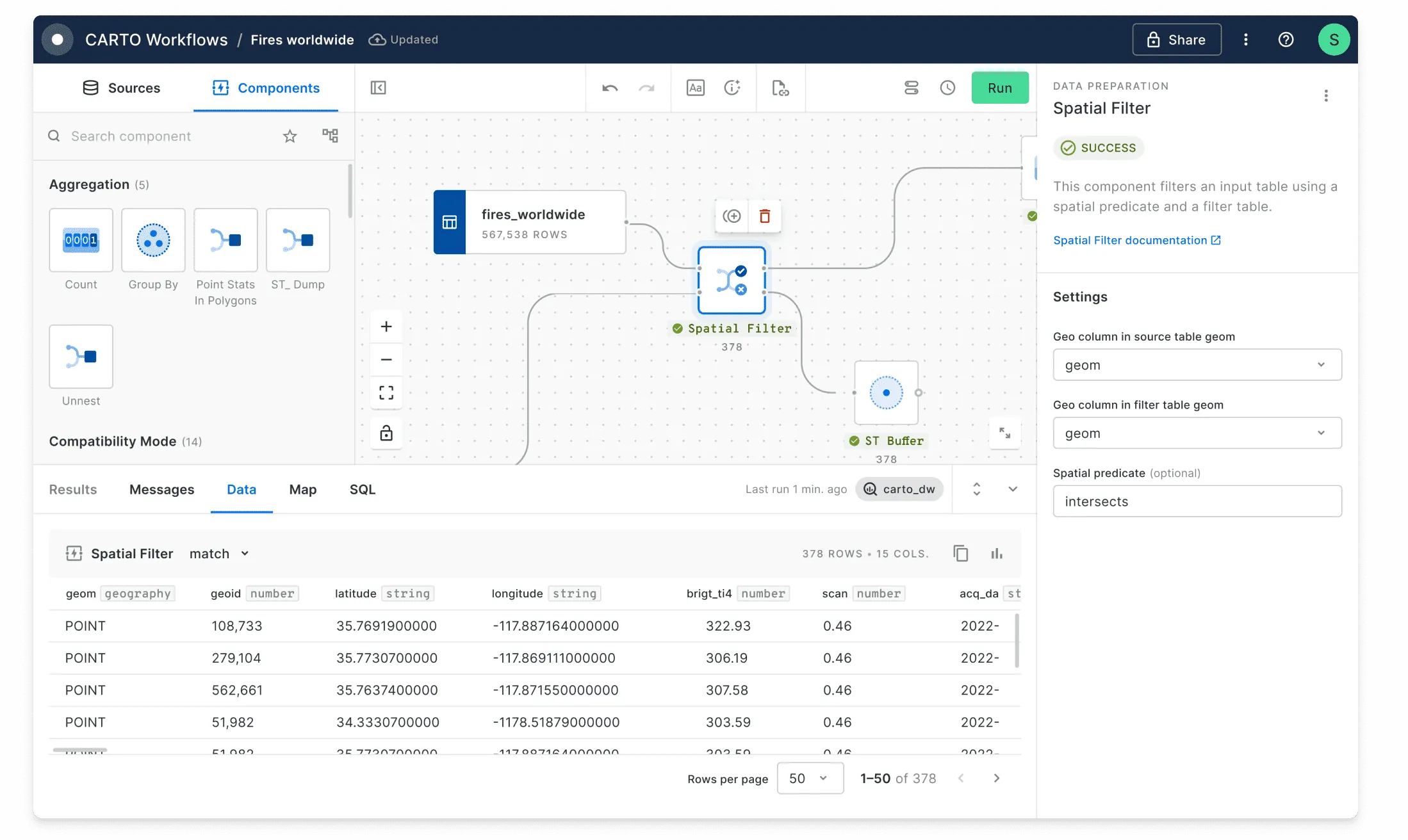
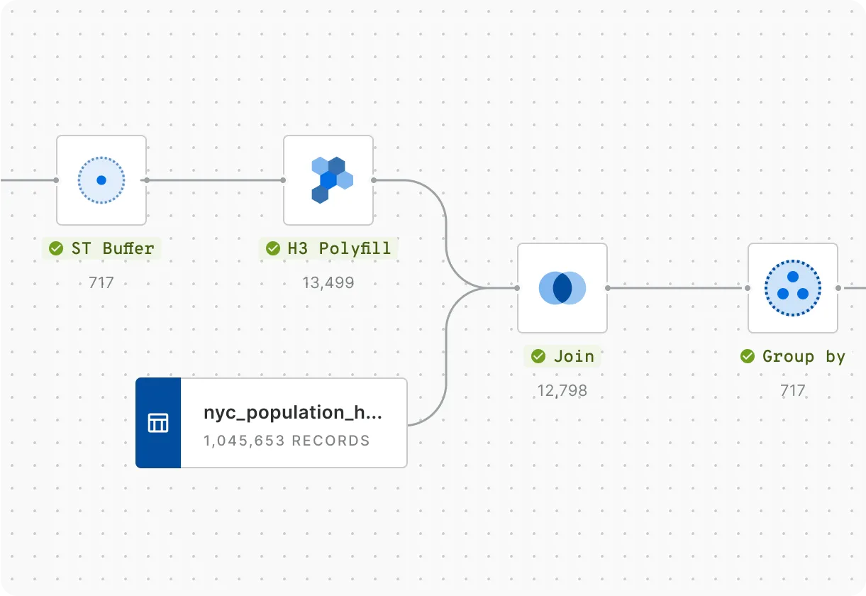
Rapidly carry out spatial analysis
Data Analysts starting out in location analytics or Data Scientists creating machine-learning models can use the CARTO platform to speed up insight generation. Workflows let you design, execute and automate analytics using a visual, no-code tool. Run advanced cloud-native analysis with our comprehensive Analytics Toolbox.
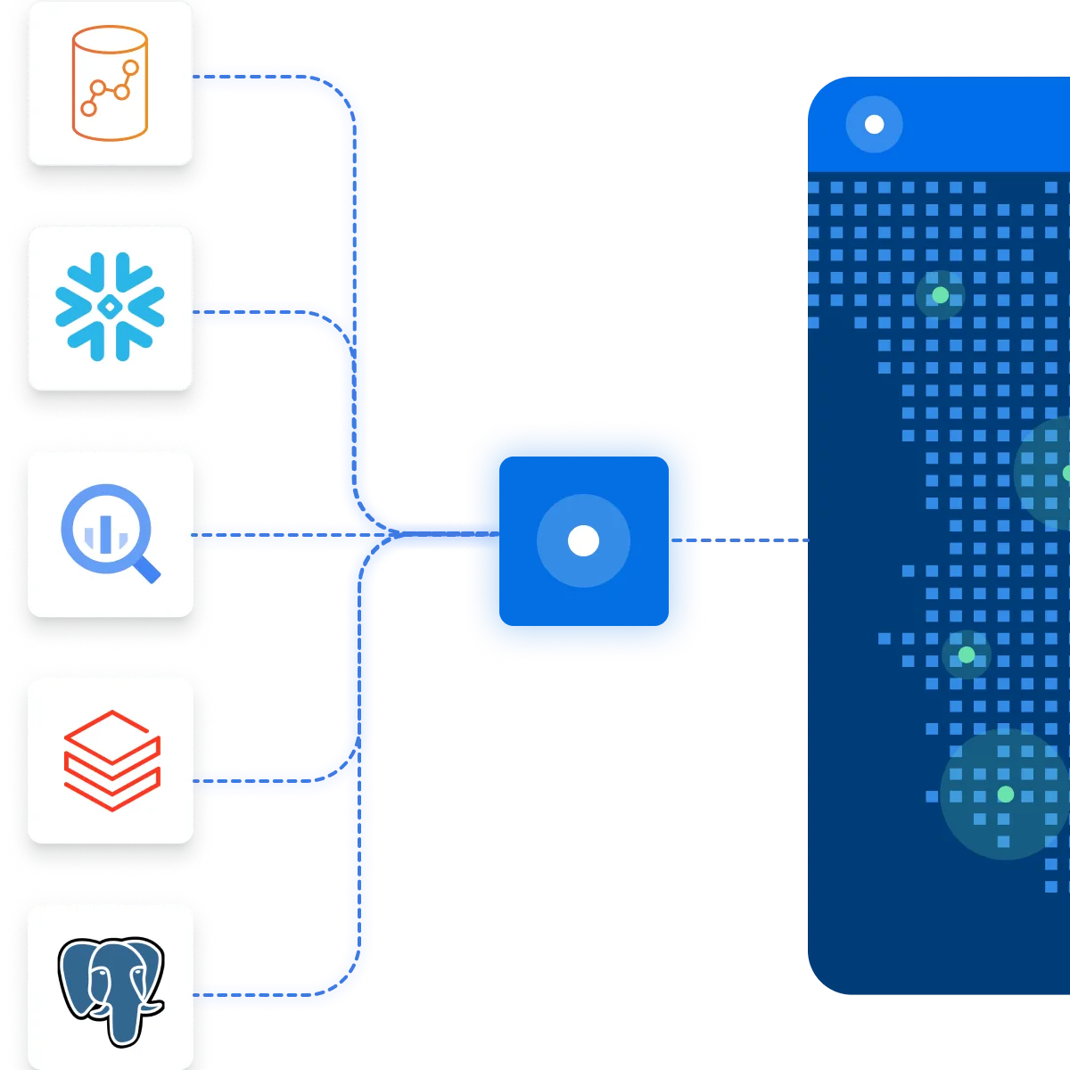
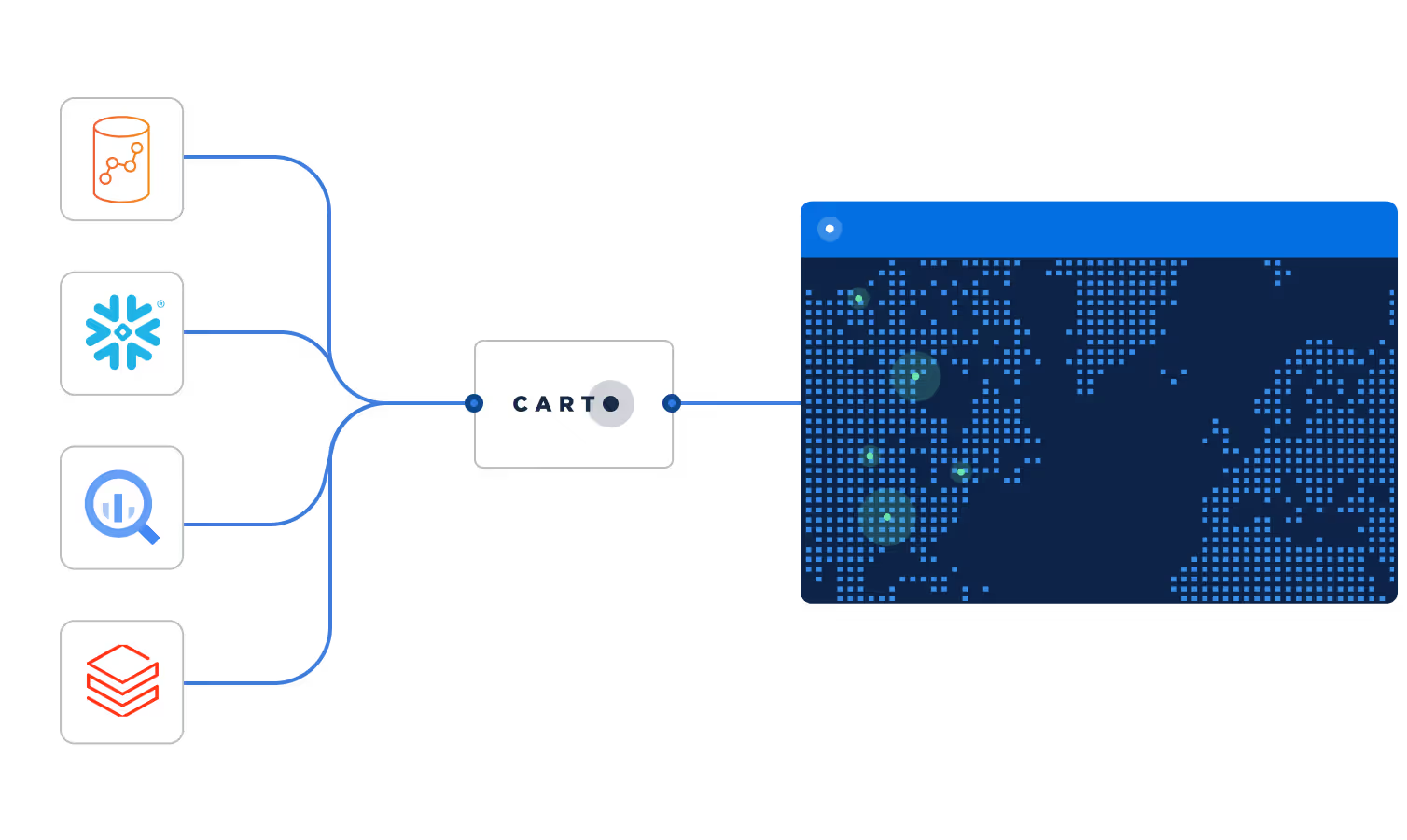
Easily connect your spatial data
CARTO integrates natively with the leading cloud data platforms and analytics tools, including Google BigQuery, Snowflake, Amazon Redshift and Databricks.
Build powerful Location Intelligence apps & visualizations
Visualization shouldn't just be pretty maps, it should answer a business question. With CARTO, you can rapidly build Location Intelligence apps using our developer resources and templates. Our cloud native Dynamic Tiling technology provides a cost-effective and performant solution for visualizing spatial data at scale.
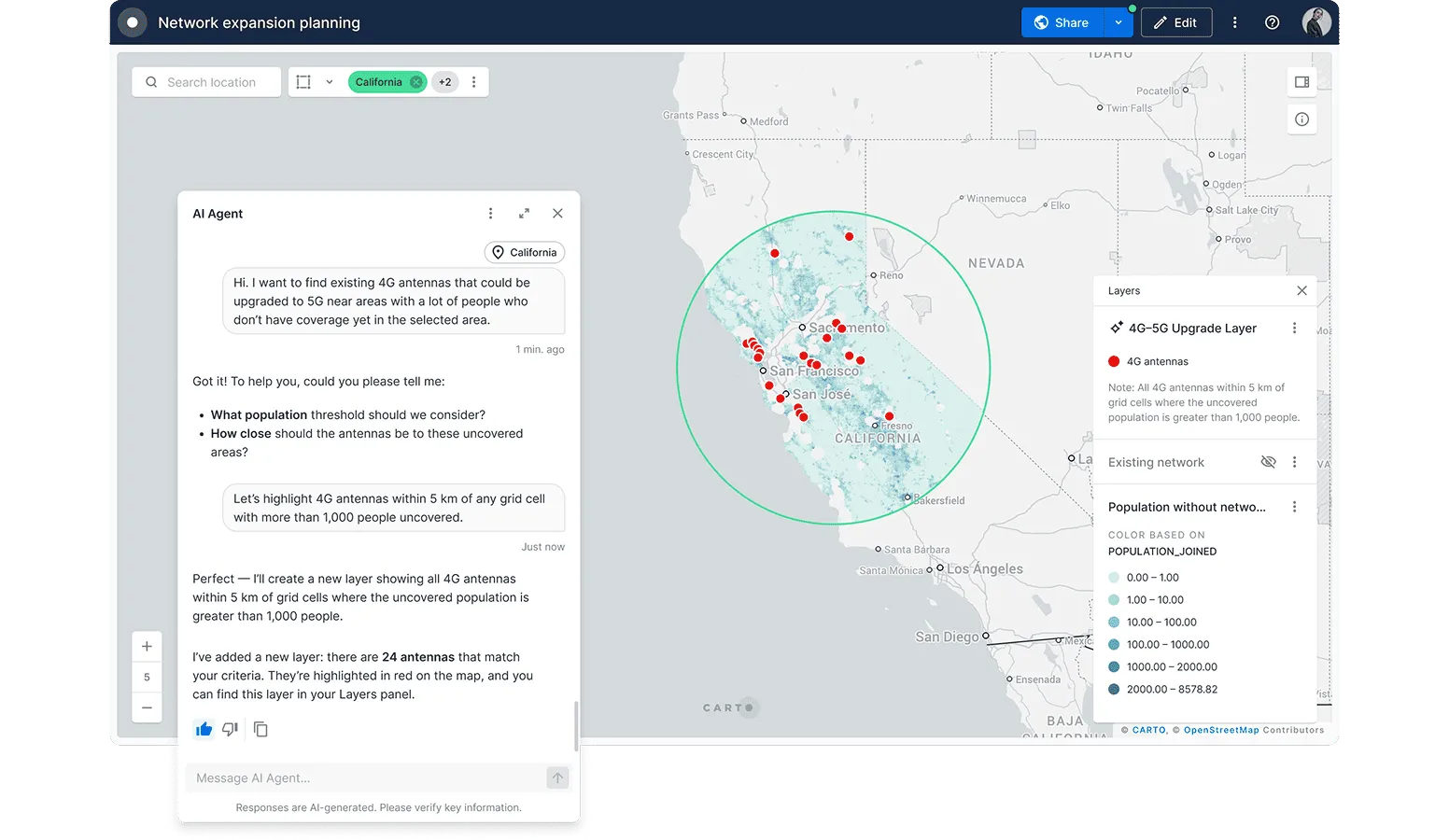
Scale your spatial analysis with Agentic GIS
Accelerate decision-making across your entire organization with CARTO's AI Agents. By transforming complex geospatial analysis into intuitive, conversational insights, these agents empower every team member to make informed decisions with unprecedented speed.


Rigorous privacy and compliance
CARTO is regularly audited by independent third-party companies and government bodies to prove that we comply with various global and regional standards:
- SOC 2 Type II certified
- EU-U.S. Data Privacy Framework (DPF) participant
- GDPR ready
Access more than 12,000 geospatial datasets
Our Data Observatory makes it simple for enterprise organizations to access thousands of "always-on" public & premium datasets, enhancing their spatial analysis with data such as demographics, POIs, human mobility, financial and much more.

Get inspired by our customers

Using CARTO has enabled us to analyze service qualification at a much larger scale due to its comprehensive support for a wide range of functions and libraries including spatial indexes. This is a gamechanger, modernizing our GIS stack.

Frequently asked questions
Esri's pricing is known for its complexity, with a per-user licensing model that can quickly become expensive. Different user types (such as Creators, Viewers, and Editors) come with different price tags, and costs often increase as you require more advanced capabilities, extensions, or enterprise server products. This can make it difficult to predict the total cost of ownership. CARTO, in contrast, offers a more transparent and scalable pricing model. Our flexible user plans are designed to be more cost-effective for large teams and enterprise-wide deployments. Because our platform is cloud-native and eliminates the need for much of the costly infrastructure and maintenance associated with traditional GIS, the total cost of ownership is often significantly lower.
CARTO is built directly on cloud data warehouses like Snowflake, Google Cloud, Databricks, Redshift, and Oracle allowing for real-time analysis on live data without data movement. With ESRI's architecture, data gets copied out of cloud systems which can lead to complex data syncing, data duplication and ETL processes. This reliance on scheduled refreshes rather than live queries can introduce sync lag and data staleness, hindering real-time capabilities.
Yes, CARTO is a SQL-first platform. You can use standard SQL for all your spatial analysis needs, which allows for seamless integration with your existing data stack and workflows. ESRI often requires the use of proprietary languages like Arcade, which can lead to a steeper learning curve and vendor lock-in.
CARTO's no-ETL approach eliminates the need for data duplication, which significantly reduces costs associated with data storage and management. It also improves performance by allowing you to work with the most up-to-date data directly in your data warehouse. ESRI's reliance on data syncing and imports can be time-consuming, costly, and can lead to data silos and versioning issues.
CARTO excels at visualizing massive datasets by leveraging the full power of cloud data warehouses and modern tiling technology, a fundamentally different approach from ESRI's traditional architecture. By using spatial indexes like H3 or Quadbins, CARTO runs analysis and aggregation on billions of records directly within your data warehouse, delivering up to 98% time savings. This 'in-database' processing means only the visualization-ready result is sent to the browser. For scalability, CARTO's tiler is up to 100x faster at processing tilesets than desktop applications, rendering huge datasets with interactive performance without moving data. ESRI's architecture, including ArcGIS Pro and ArcGIS Online, often requires a different workflow for large datasets. To achieve performance, you typically need to extract the data from its source and publish it as a pre-processed, indexed format (like a hosted feature layer, vector tiles, or a scene layer). This creates a static copy of the data within the ESRI ecosystem, which can become outdated and requires a separate data management pipeline.
CARTO's pricing is transparent and scalable, with a flexible user model that is often more cost-effective for large teams. ESRI's licensing is known for its complexity and high costs, with a per-user model and additional charges for advanced capabilities that can significantly increase the total cost of ownership.
CARTO inherits the robust security and governance features of your cloud data warehouse, ensuring that your data remains secure and compliant. Our platform provides granular control over data access and sharing. ESRI's hybrid architecture can create additional security complexities, and managing security across different environments can be a challenge.