Trade area analysis is the practice of defining the geographic zone from which a business location draws most of its customers or sales. Understanding a trade area helps retailers, restaurants, banks, and other consumer-facing businesses plan store networks, target marketing campaigns, forecast revenue, and evaluate competitive overlap.
“Trade area analysis” and “catchment analysis” are used interchangeably and refer to the same practice. The term varies by industry and region: “catchment” is more common in the UK and Europe and in sectors such as healthcare and education, while “trade area” is more common in North American retail.
What is a Trade Area?
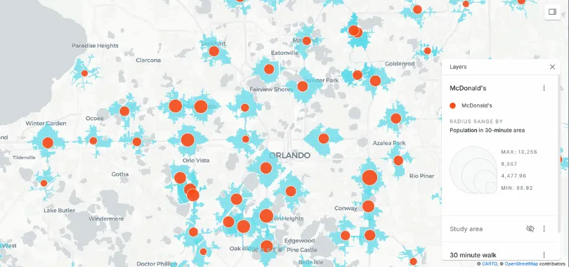
A trade area is the catchment of a physical location, the geographic boundary inside which most of the customers, transactions, or visits originate. The size and shape of a trade area depend on the type of business, the local population density, the road and transit network, and the surrounding competition.
There is no single correct way to draw a trade area. Common methods include:
- Radial trade areas: circles of fixed radius around the location. Quick to compute but ignore road networks and natural barriers.
- Drive-time or walk-time isolines: polygons drawn using actual travel time or travel distance on the road network. Isolines cover both, whereas isochrones are strictly time-based. More realistic than radial buffers and widely used for retail, healthcare, and quick-service restaurants. CARTO supports isolines through the Analytics Toolbox.
- Customer-derived trade areas: polygons drawn around the actual home or visit locations of known customers (for example, the convex hull or a probability surface of customer origins). The most accurate method but requires customer-level data.
- Gravity models: probabilistic methods such as the Huff model that estimate the share of a household’s spend each location captures, given distance and store attractiveness.
Why Trade Area Analysis Matters
Trade area analysis turns the question “where are my customers?” into something quantifiable. Once a business can describe its trade areas precisely, it can:
- Forecast revenue for a candidate new location based on the demographics and spend within the projected trade area
- Target marketing to the postal codes or census blocks inside a trade area instead of the entire city
- Identify cannibalization risk when a new store would overlap an existing trade area
- Evaluate market coverage by mapping the union of all trade areas against the addressable market
Trade Area Analysis in Cloud Data Warehouses
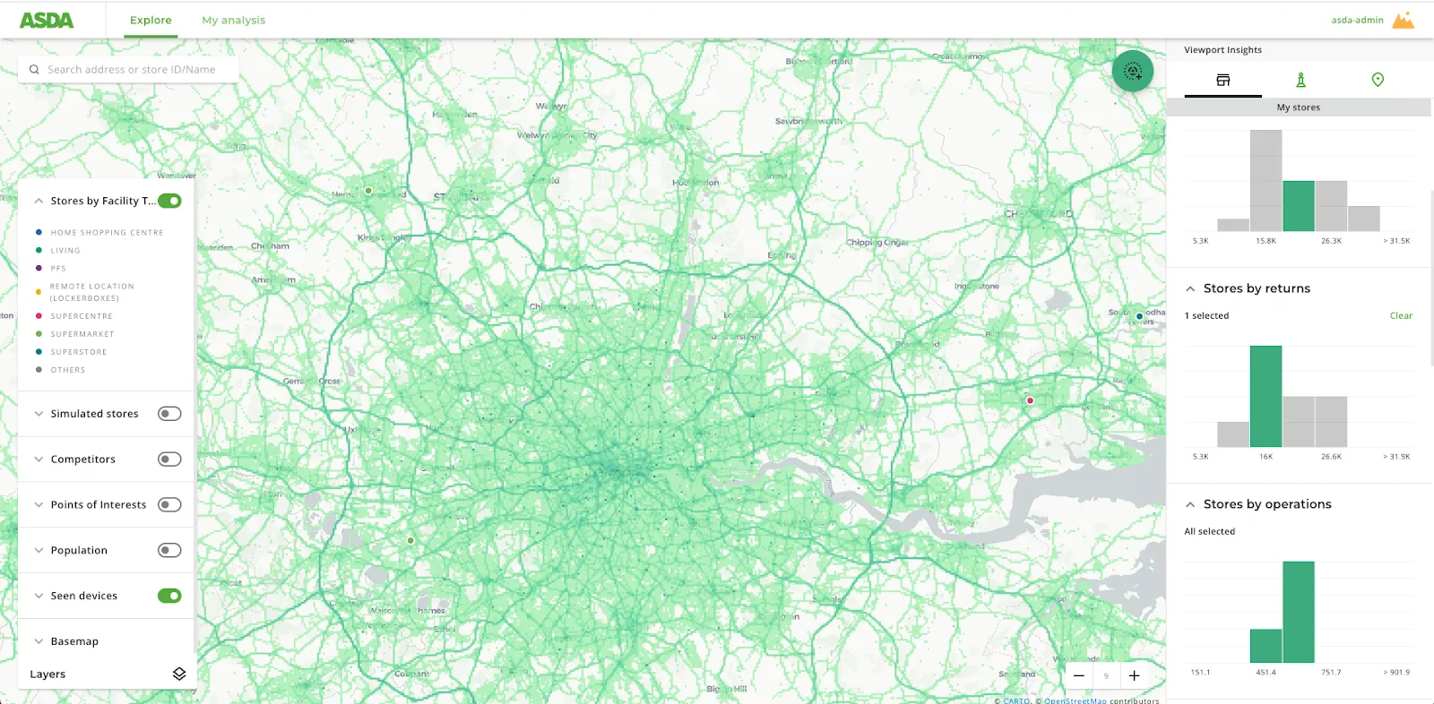
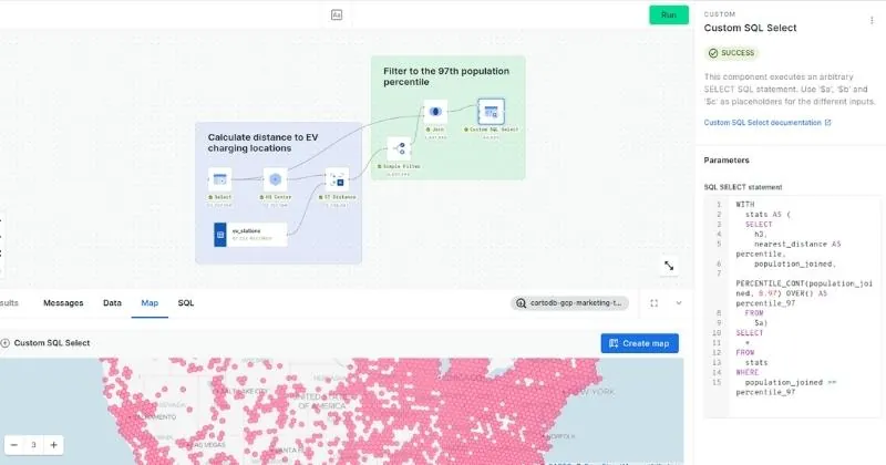
Modern trade area analysis runs natively in cloud data warehouses where customer transactions, demographics, and points of interest already live. Using Spatial SQL and the CARTO Analytics Toolbox, analysts can:
- Generate isoline polygons for thousands of locations in parallel
- Enrich each trade area with mobility, demographic, and spend data from the CARTO Data Observatory
- Score and compare candidate sites without exporting data outside the warehouse
- Compare trade area results across markets, regions, or entire store networks in a single map view. A common limitation of traditional GIS tools is that analysts can typically only view one market (city, county, DMA) at a time. CARTO plus the cloud lets you run and visualize the full network at once, which changes how teams approach network planning and cross-market benchmarking.
Use Cases
- Retail site selection: choosing where to open a new store based on the projected trade area’s population, demographics, and existing competition
- Store performance analysis: explaining why some stores outperform others by comparing the demographics of their trade areas
- Out-of-home advertising: defining the catchment of a billboard or digital screen for audience targeting
- Banking and insurance: modeling branch networks and risk exposure by geographic catchment
Trade area analysis is closely related to site suitability analysis: trade area analysis defines the surrounding catchment area, and site suitability analysis ranks candidate locations based on the qualities of those catchments.