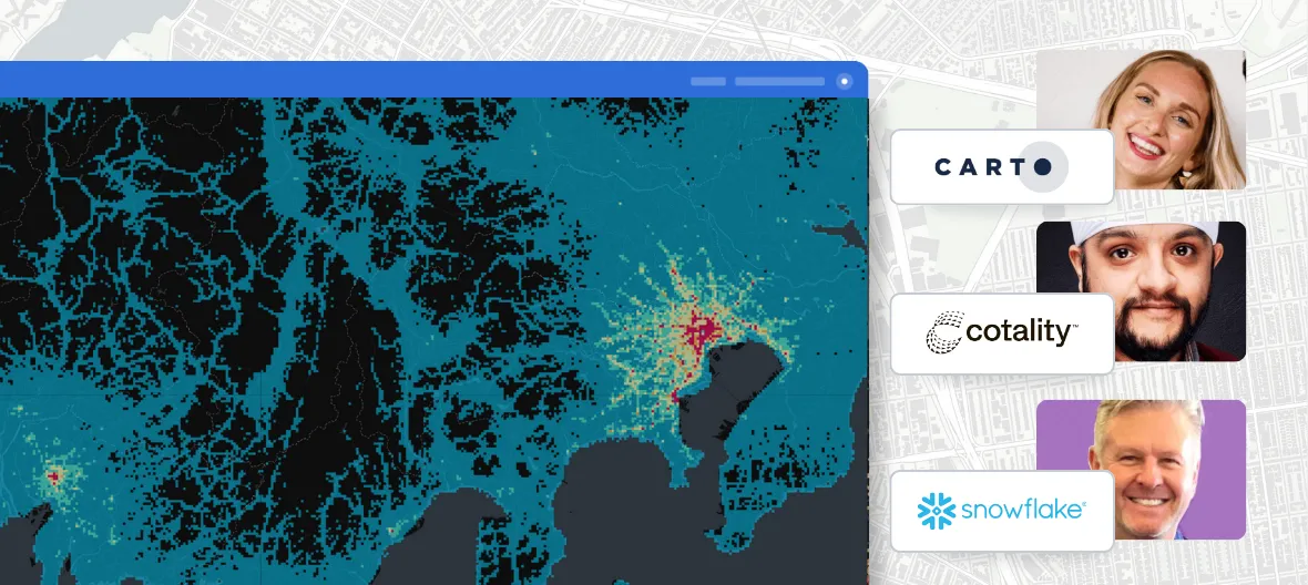
SEE IT IN ACTION
Agentic GIS for Financial Services
Watch how Financial Services teams move from a single question to a prioritized plan in minutes. Fraud, branch network, portfolio, and customer answers run inside your cloud data warehouse.


_logo%201.webp)


From a single question to $800K in annual savings, in one session

Why Financial Services teams are moving to Agentic GIS
1,500 hours saved per analyst, every year
Analysts lose 19% of their time on data evaluation and 34% on prep work. CARTO runs spatial analysis where the data already lives, so the team works on the question instead of the pipeline. Source: IDC and salary.com.
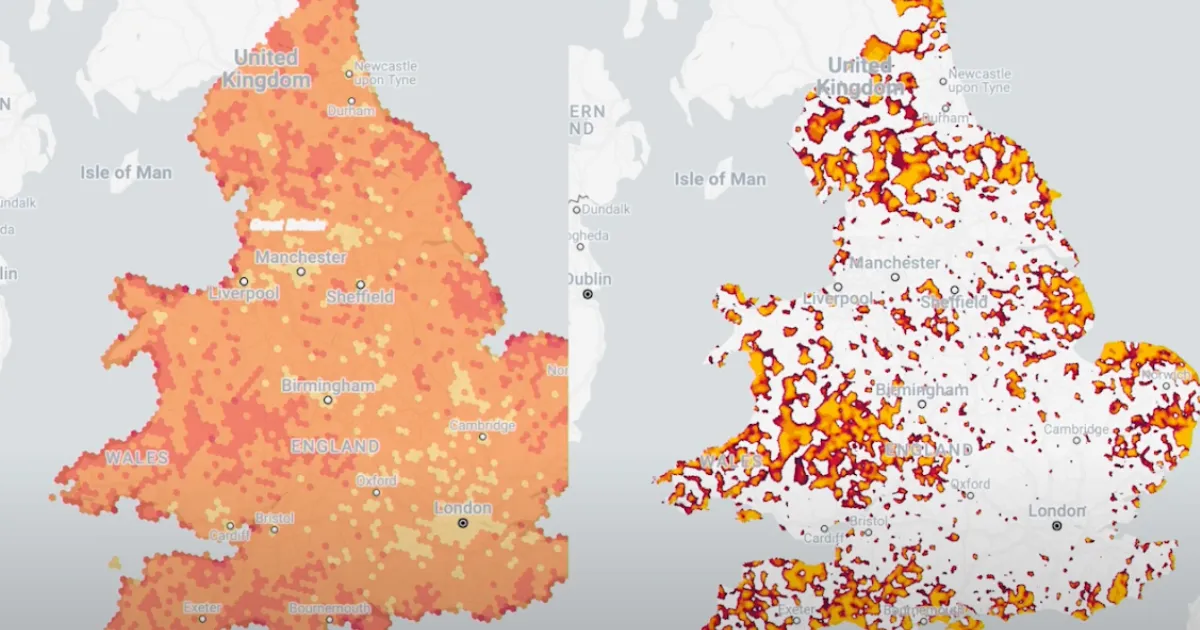
30% less fraud exposure with geospatial data
Firms without geospatial data see 30% more fraud in transactions and account applications. CARTO adds location context to fraud and AML workflows so anomalies surface in the warehouse, not after the fact. Source: BCG.
98% of investment professionals use alternative data
Alternative data plays a major role in generating alpha for asset managers and private equity. CARTO's geospatial AI makes mobility, demographic, and economic datasets queryable next to your portfolio data. Source: Deloitte.
How Agentic GIS works
Run spatial analysis where your data lives
CARTO AI Agents push the geospatial analytics work down to Snowflake, BigQuery, Redshift, Azure, Databricks, or Oracle. Data never moves, governance stays intact, and the answer comes back in minutes.
Pick yours to learn more

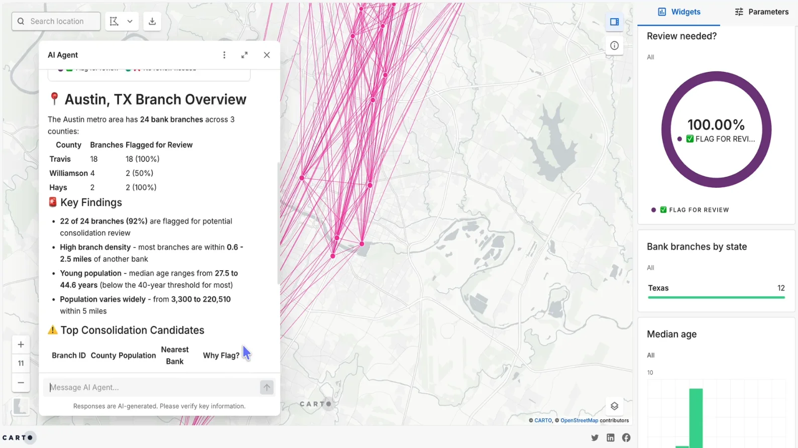
Ask in plain language
Your team types a question in natural language. "What is the consolidation opportunity in Austin?" or "Which branches absorb the most customers if we close two?" No SQL, no specialist GIS skills required.
Share a plan, not a map
The Agent surfaces ranked candidates, savings estimates, service-disruption risks, and a recommended timeline. Hand it to the operations or investment team ready to act.
Frequently asked questions
CARTO AI Agents act like GIS specialists for the rest of the team. They take a question in plain language, run spatial analysis directly inside Snowflake, BigQuery, Redshift, Databricks, or Oracle, and return a ranked plan with the cost, risk, and timeline behind it. Use cases include branch network analysis, fraud, portfolio risk, and customer segmentation.
Yes. A CARTO AI Agent can identify consolidation candidates in a city, model the customer impact if a branch closes, recommend mitigation steps such as temporary staffing, and propose a 90-day transition plan. The work runs against the bank's own data, so the result reflects the institution's actual customer base.
Yes. CARTO runs spatial analysis inside your cloud data warehouse. Data never moves, your governance setup stays in place, and you can use your own vetted LLMs and endpoints. The platform inherits the security controls already approved by your security and compliance teams.
Traditional GIS tools require specialist skills, separate environments, and often manual data movement between the warehouse and the GIS platform. Agentic GIS removes those steps. AI Agents pull spatial data, run the analysis, and return the answer next to the financial data your teams already work with. A risk officer or business analyst can ask the question and get the answer in plain language.
The five most common spatial analytics use cases are fraud detection and AML compliance, real estate and asset valuation, climate and catastrophe risk modeling, transaction and customer behavior analytics, and credit and loan portfolio risk. CARTO's geospatial AI covers all five inside the same warehouse environment, with the same set of AI Agents.