.webp)
Mobility
Optimizing transport infrastructure spatially is key to the future of mobility. The most efficient cities are moving away from traditional methods to analyze new data for a greener future.


.svg)


Get inspired by our customers


CARTO has allowed us to tackle complex challenges relating to road accident analysis in London and much more. Working with their cloud-native platform has been a transformative experience, making it faster for us to visualize large-scale geospatial data and quickly deliver insights to different areas of our business, partners, and clients.


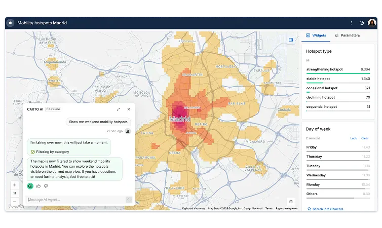
Mobility Planning
Optimizing public transport infrastructure, such as bikes, buses, trains, & metro services, is paramount in order to reduce traffic & improve road safety. Analyzing commuter patterns through origin-destination matrices & spatial models allows cities to provide the right services to the people who need it most.
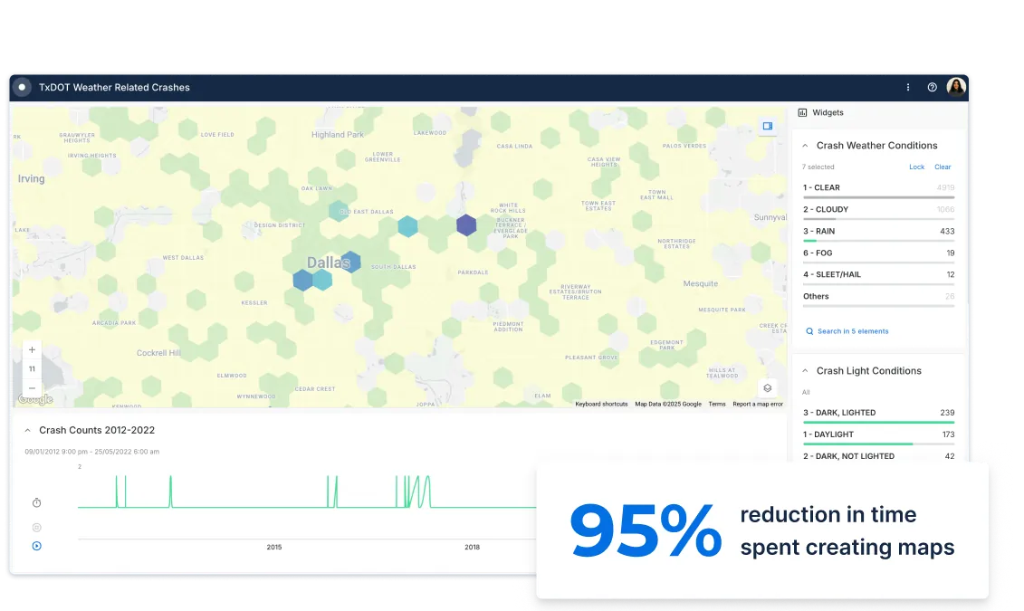
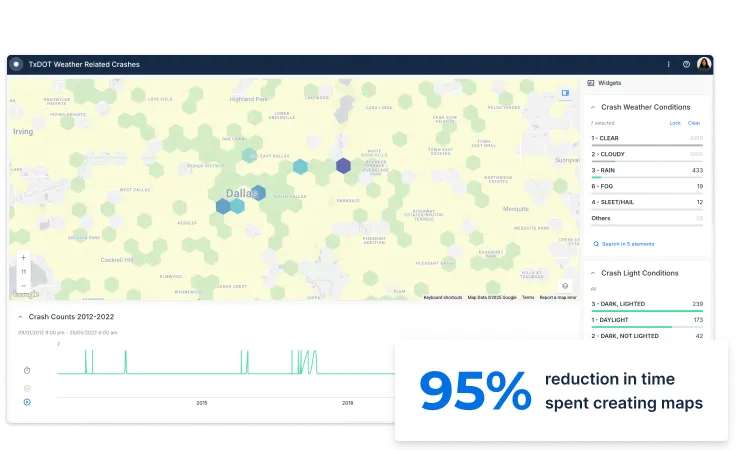
Road Safety Analysis
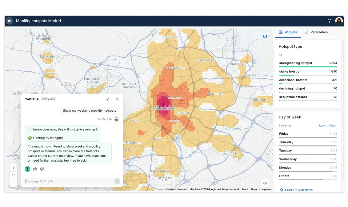
With a wide range of data streams now available from a rapidly growing number of sensors & GPS devices, we can now understand the health of our road networks at a deeper granularity than ever before.
To make our cities safer & more efficient, local governments need to apply Spatial Data Science methodologies, going beyond the analysis of historical data, to predicting the probability of incidents by location.
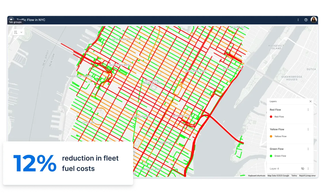
Traffic Management
Traffic jams cost the US a staggering $87 billion in lost productivity per year. Citizens in every city now use data from smartphones & embedded satellite navigation to work around traffic. Yet only a handful of local governments are fully capturing the value of new location data streams & spatial analysis to optimize their city traffic management operations & reduce CO2 emissions.
Citizen Services
Providing real-time & crowdsourced insights on transport networks to citizens via intuitive solutions has become a key pillar of urban mobility strategies. Gathering & visualizing spatial data through simple Open Data web applications enables citizens to share information on road safety, congestion, & much more - allowing them to make more informed mobility decisions.