

Security, Governance and Compliance
True cloud-native, Enterprise GIS
Deployment options, connections, and data access policies designed for ultimate security and control.
.webp)


Data always remains where it belongs - in your lakehouse
CARTO runs entirely inside your lakehouse. Data is never synced, copied or transferred. Extend the geospatial capabilities of your data lakehouse, without compromising on security and governance.
Deploy CARTO in your own cloud
With our Self-hosted deployment you can host and operate CARTO your way, with ultimate control
Options for both Single VM and Orchestrated containers.
Streamlined installation, with fully self-service or assisted options.
Support for deploying inside your VPC or behind your VPN, and with proxy configurations.
Standardized releases. Regular updates to ensure stability across all environments.
Rigorous privacy and compliance
CARTO is regularly audited by independent third-party companies and government bodies to prove that we comply with various global and regional standards:
- SOC 2 Type II certified
- EU-U.S. Data Privacy Framework (DPF) participant
- GDPR ready


Pick yours to learn more

Available from the leading cloud marketplaces
Start getting the most out of your spatial data by trialing, purchasing and accessing CARTO directly from your cloud vendor's marketplace.
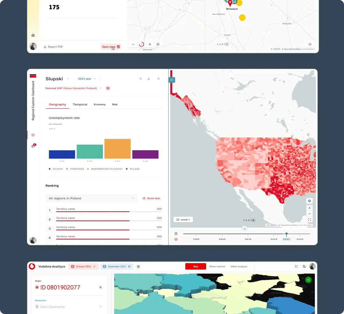
One Agentic GIS platform for all users
Streamline your tech stack with an end-to-end geospatial platform built for the enterprise. From data analysts to developers, CARTO has tools for everyone in your team.
.webp)
Accelerate decision making
Getting intelligence from complex data often requires coding or specialized skills. With CARTO, build & deploy AI Agents to perform complex geospatial tasks using natural language, for instant, actionable insights.
.webp)

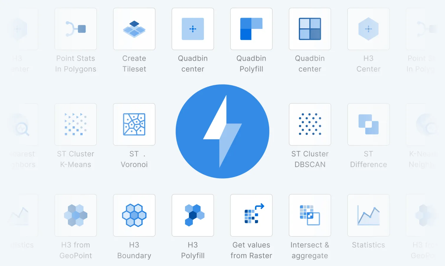
Spatial analysis for everyone
Spatial analysis can demand deep expertise, creating bottlenecks and slowing insights. CARTO Workflows empowers everyone with 100s of low-code, drag-and-drop tools to simplify, automate & accelerate analytics.
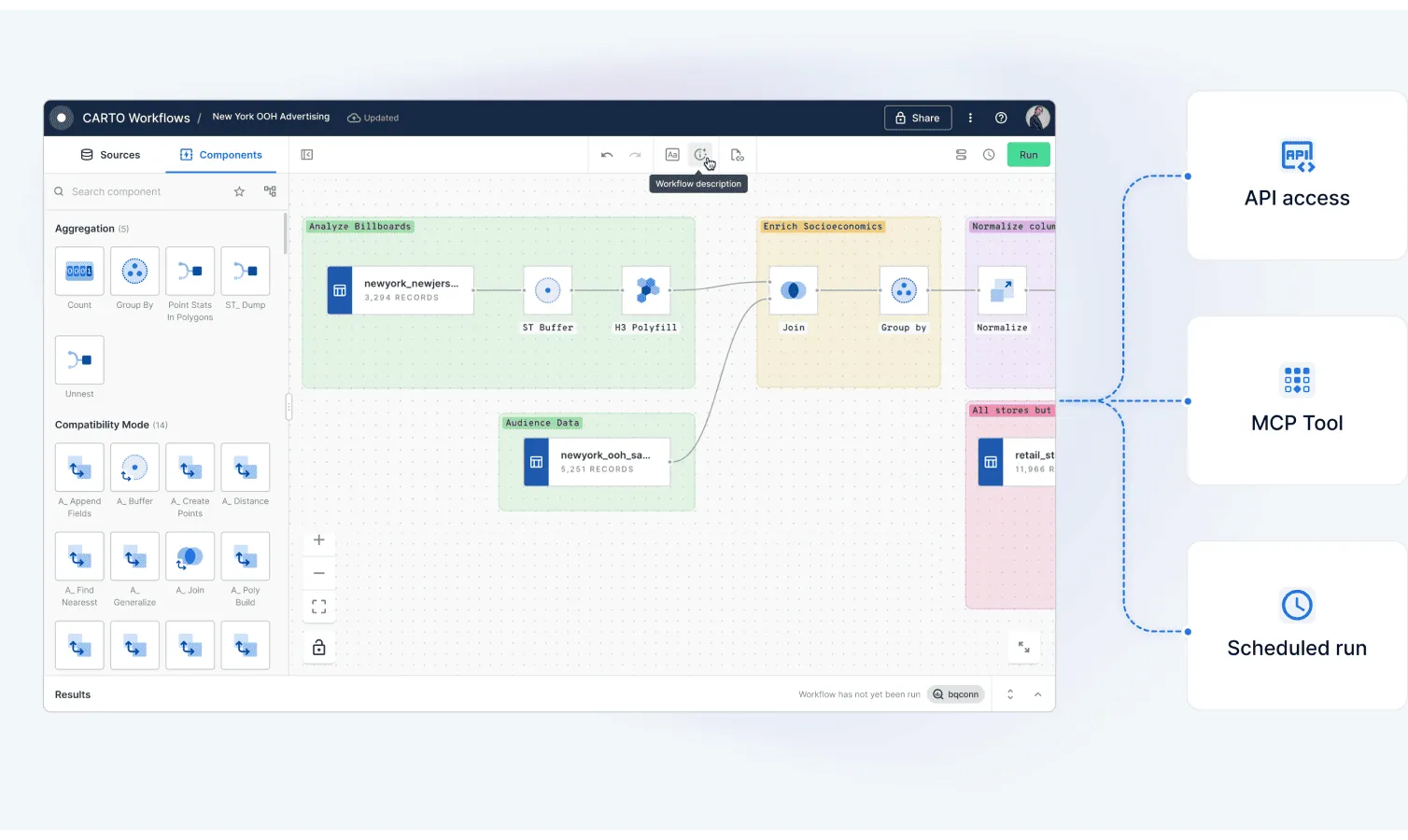
Eliminate analysis silos
Spatial workflows are often siloed and manual. With Workflows, you can automate & schedule your analysis, trigger them via APIs or even build them into your AI pipelines as MCP tools.
.webp)


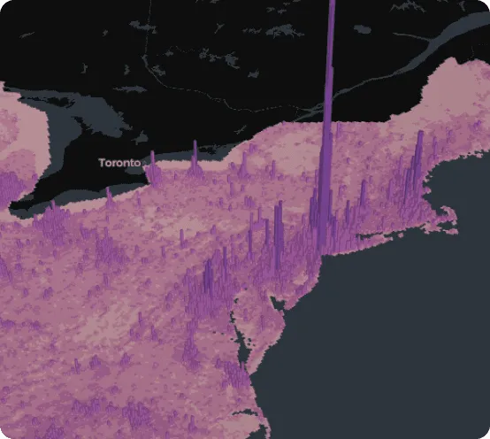
Unmatched data visualization capabilities
.webp)
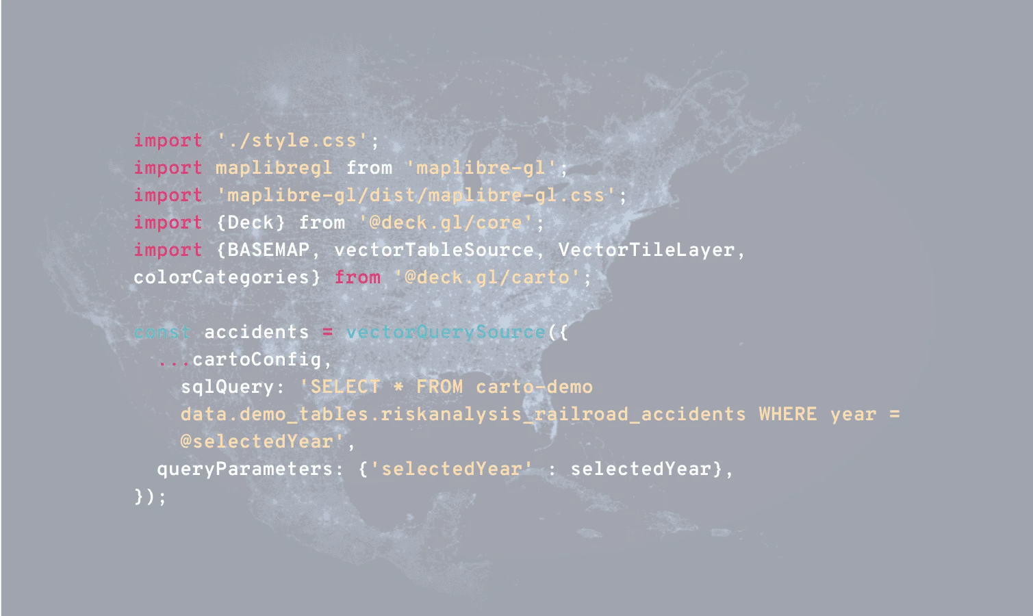
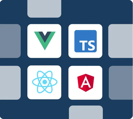
Develop with flexibility, deploy at scale
Reduce development complexity. With CARTO, benefit from enterprise-grade, framework-agnostic development. Use our powerful APIs and native deck.gl support - no ETLs, backend APIs or data replication needed.
More than 12,000 datasets to enhance your analysis
Sourcing and managing high-quality spatial data wastes 60% of a typical analyst's time. With CARTO's Data Observatory, access thousands of ready-to-use, curated datasets directly in your data warehouse.
.webp)
.webp)
Get inspired by our customers
With CARTO's AI Agents, predictive growth insights move beyond data analysts and into the hands of every decision-maker. Now, anyone can ask our data questions like 'Which neighborhoods will grow fastest?' and get instant answers - speeding up site planning and providing a real competitive edge.

CARTO is very cloud-driven which is ideal for us as we are able to easily leverage our data in Snowflake. The connection allows us to streamline our ways of working with geospatial data in an unprecedented fashion, bringing us more productivity, capability and scalability.

At EQT, we constantly seek ways to enhance the strategic value of our investments and improve the decision-making process. CARTO has been a game-changer for EQT, their cloud-native platform, seamless data integration, Builder for visualization and Analytics Toolbox make it much easier for us to assess investment opportunities and provide strategic advice to our portfolio companies.

CARTO has allowed us to tackle complex challenges relating to road accident analysis in London and much more. Working with their cloud-native platform has been a transformative experience, making it faster for us to visualize large-scale geospatial data and quickly deliver insights to different areas of our business, partners, and clients.

Working with the CARTO platform has helped take our Location Intelligence strategy to the next level. The platform's rich set of data analytics features and cloud-native approach helps us deliver outstanding insights that fuel our strategy, execution, and performance measurement.

CARTO's cloud-native approach and the ability to use H3 at scale was a big game changer for us. We can now compute data in real time without the need for heavy coding. Working with the CARTO platform has been extremely impactful as we can now easily visualize & analyse massive amounts of satellite data.

By partnering with a world-class Location Intelligence platform provider we've been able to unlock unique spatial insights from our mobile data, opening new lines of business and turning billions of events in to unique insights for Retailers, Real Estate companies and Public Sector organizations.

TALK TO US
Request a demo
Schedule a 20-minute meeting with our experts to understand how you can use spatial analysis in your organization.