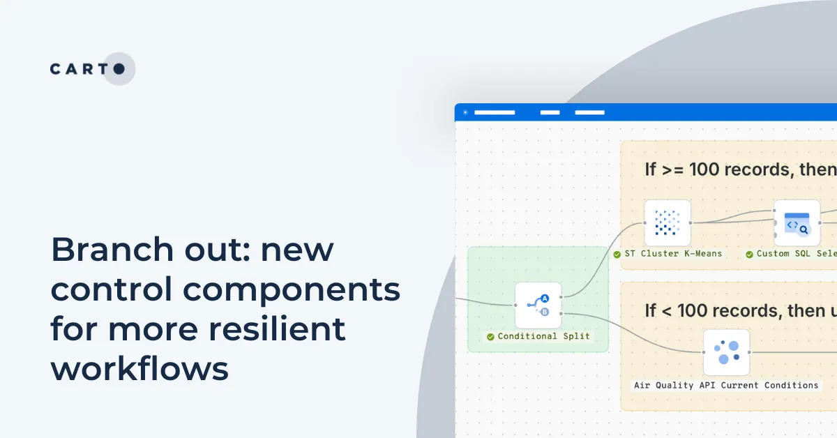
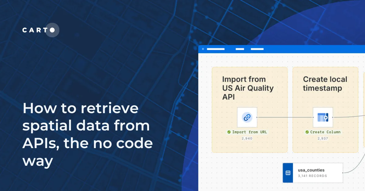
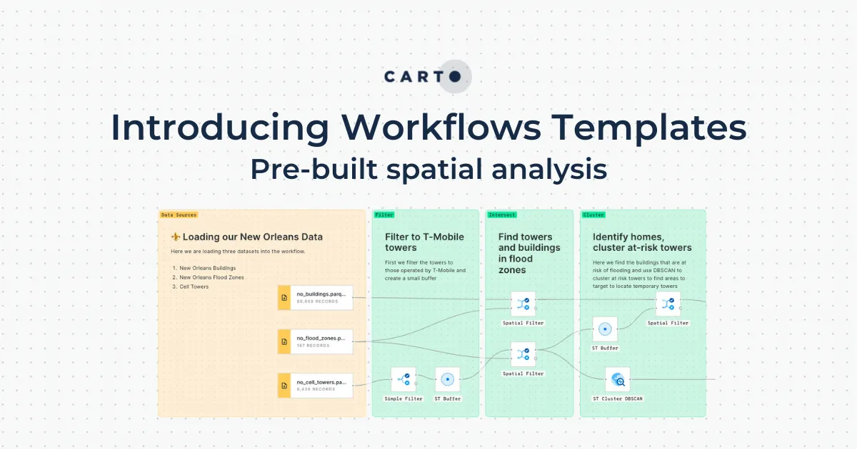
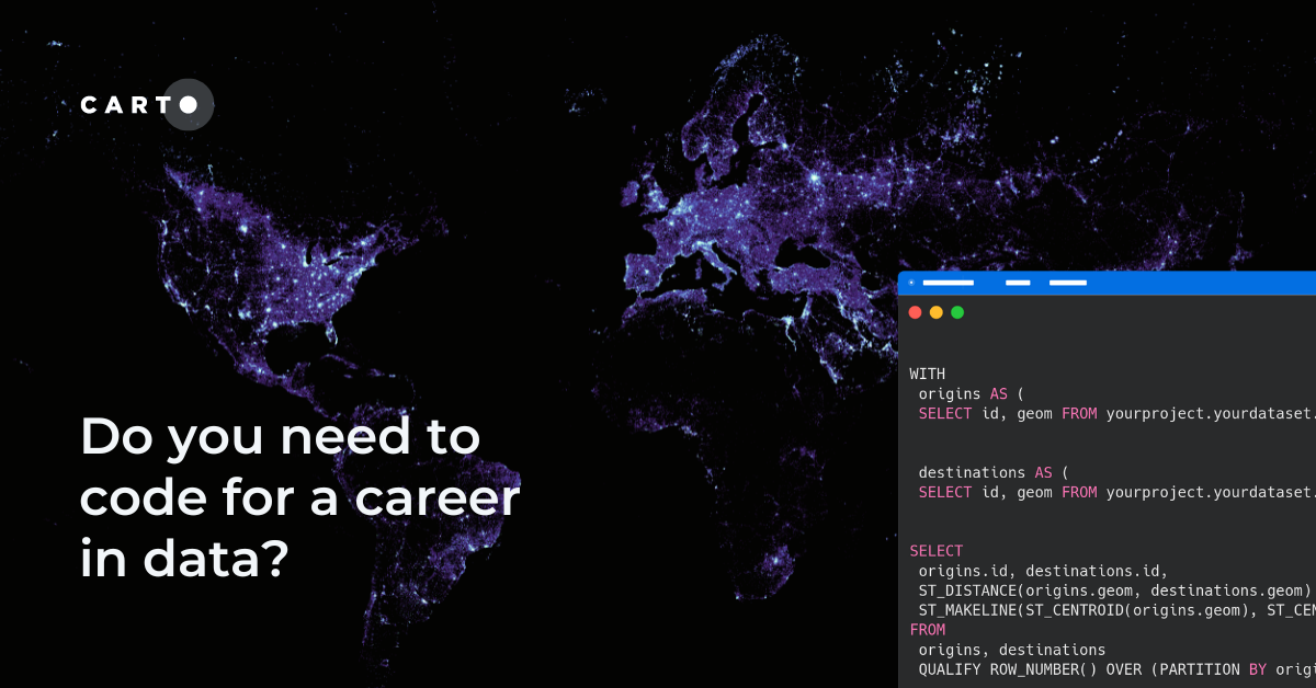
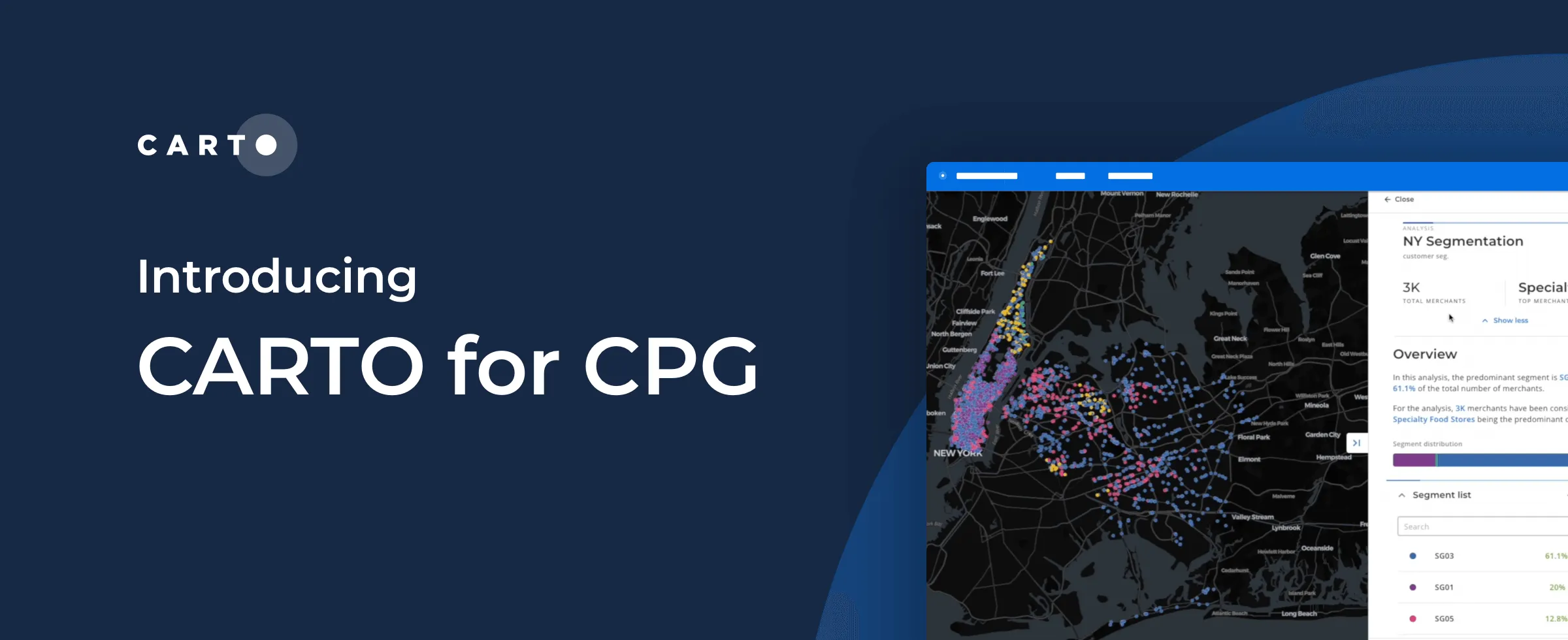
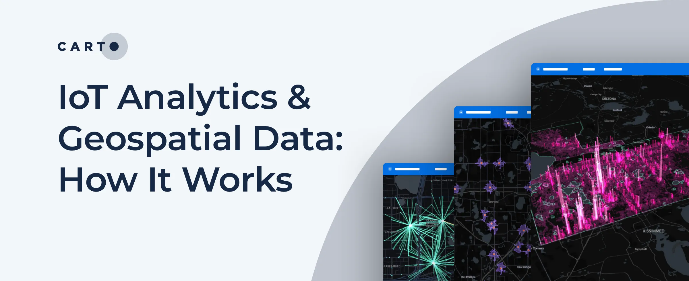
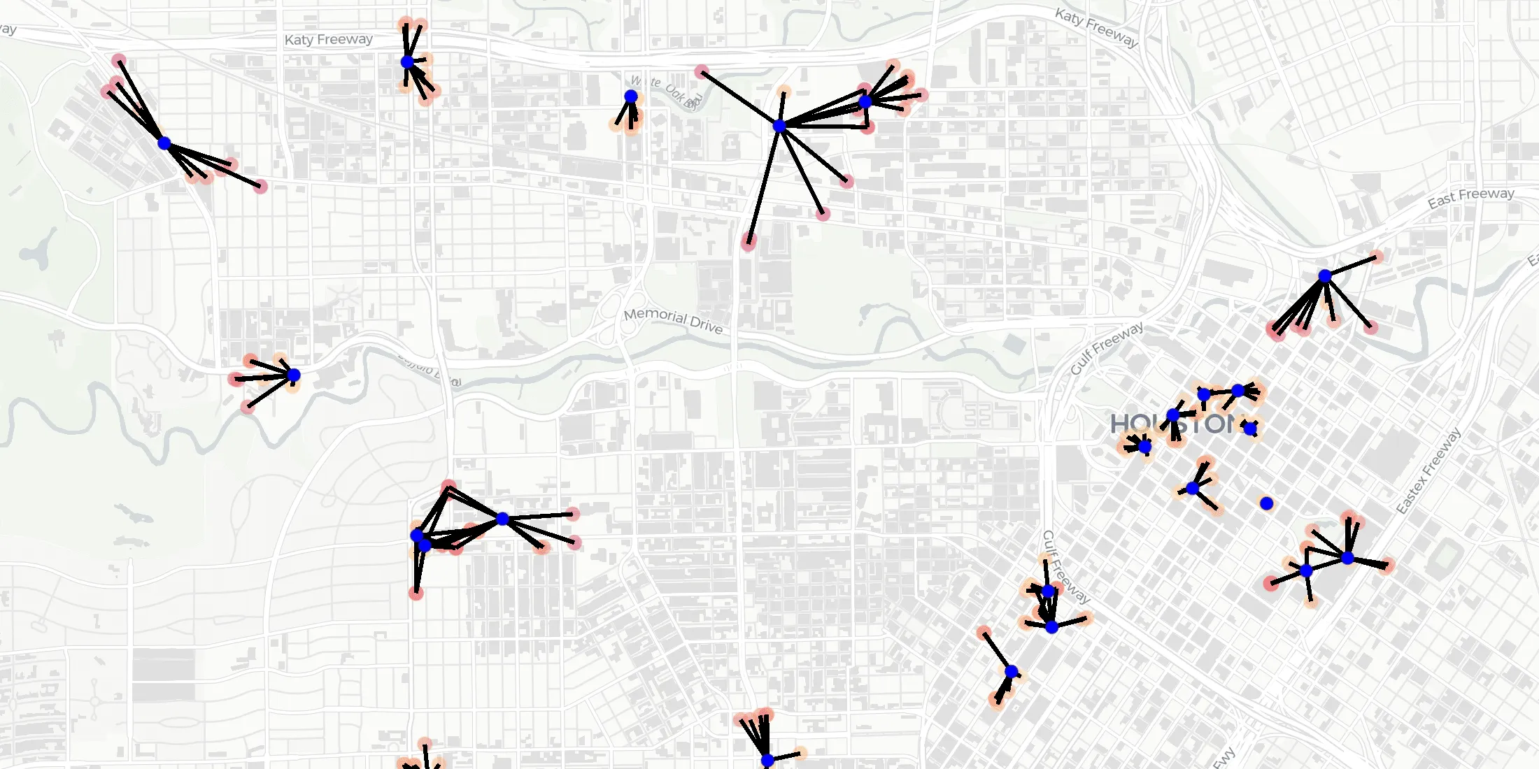
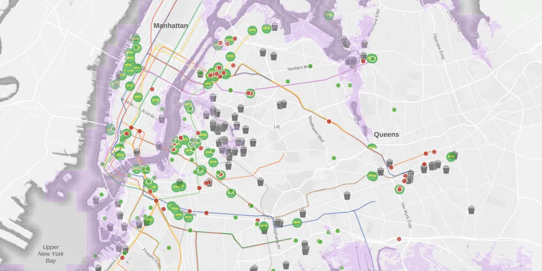
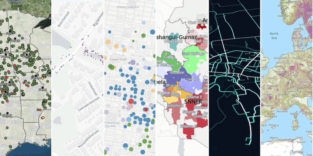
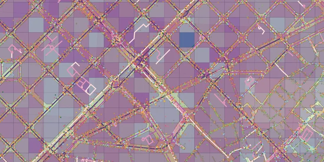
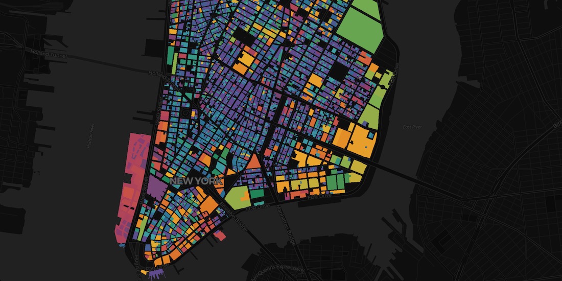
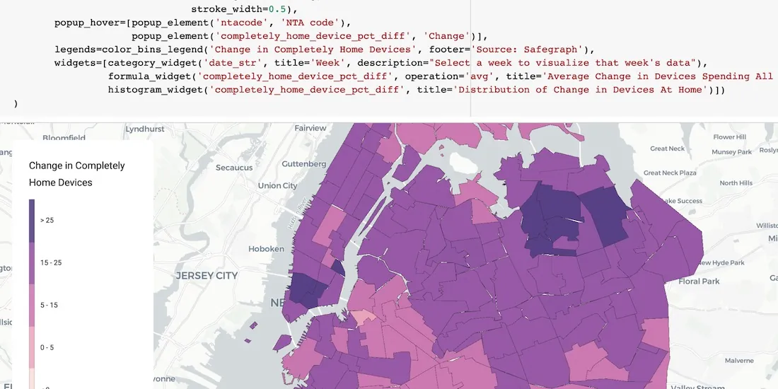
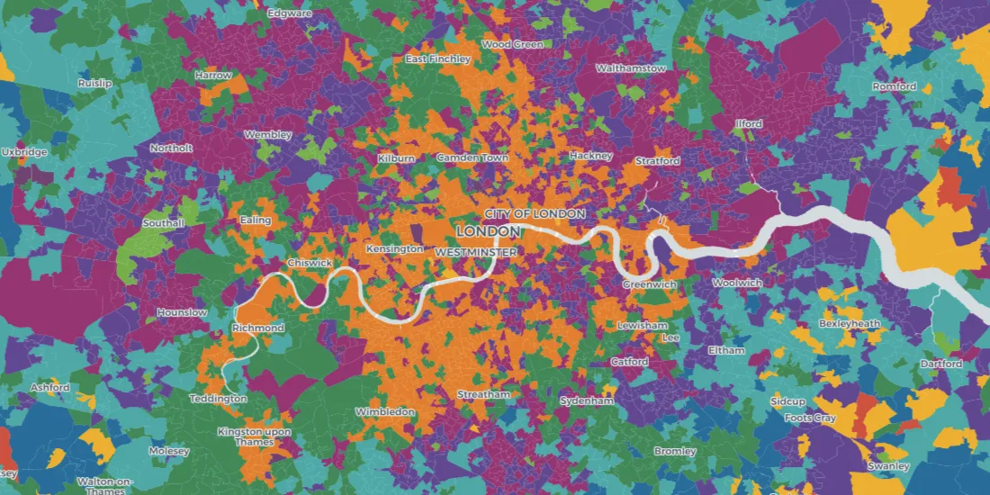
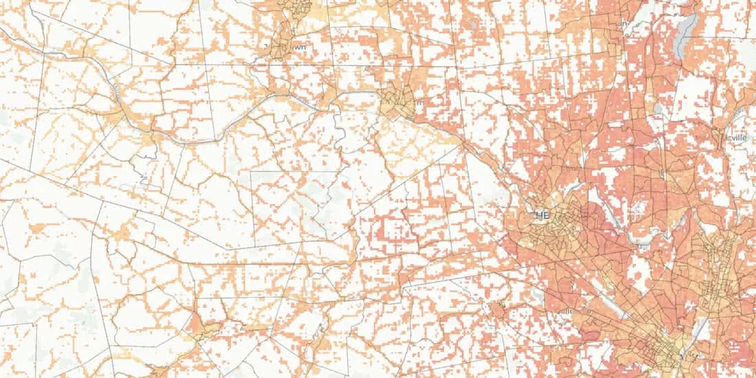
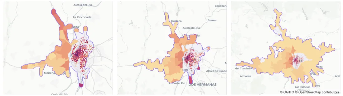
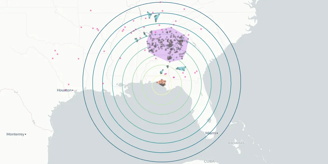
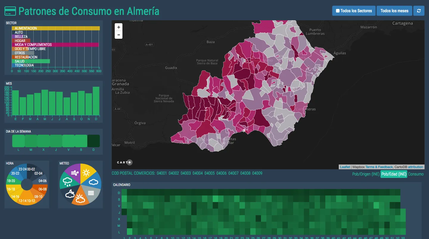
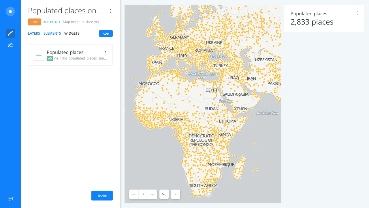
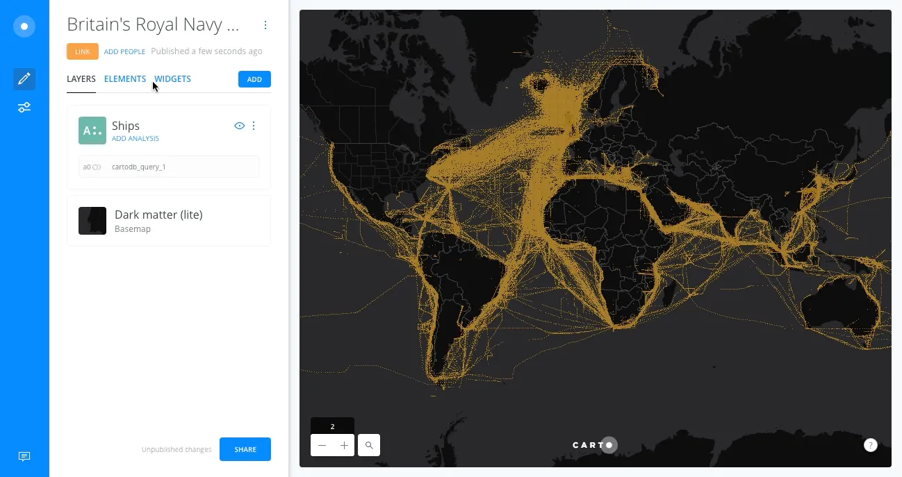
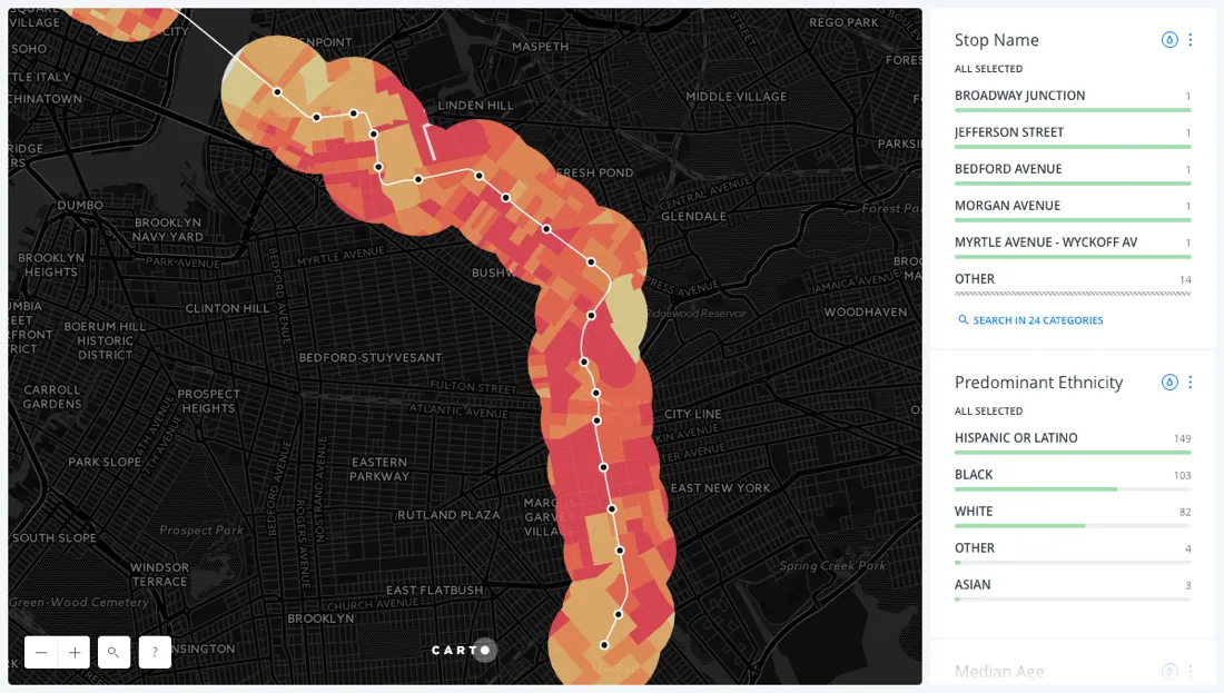
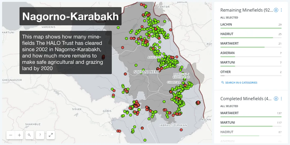
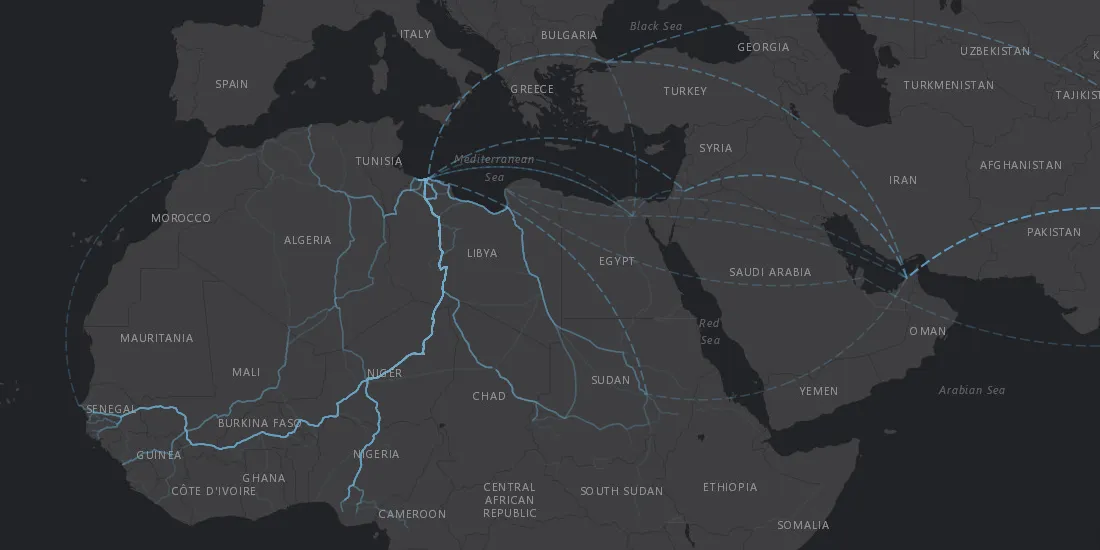
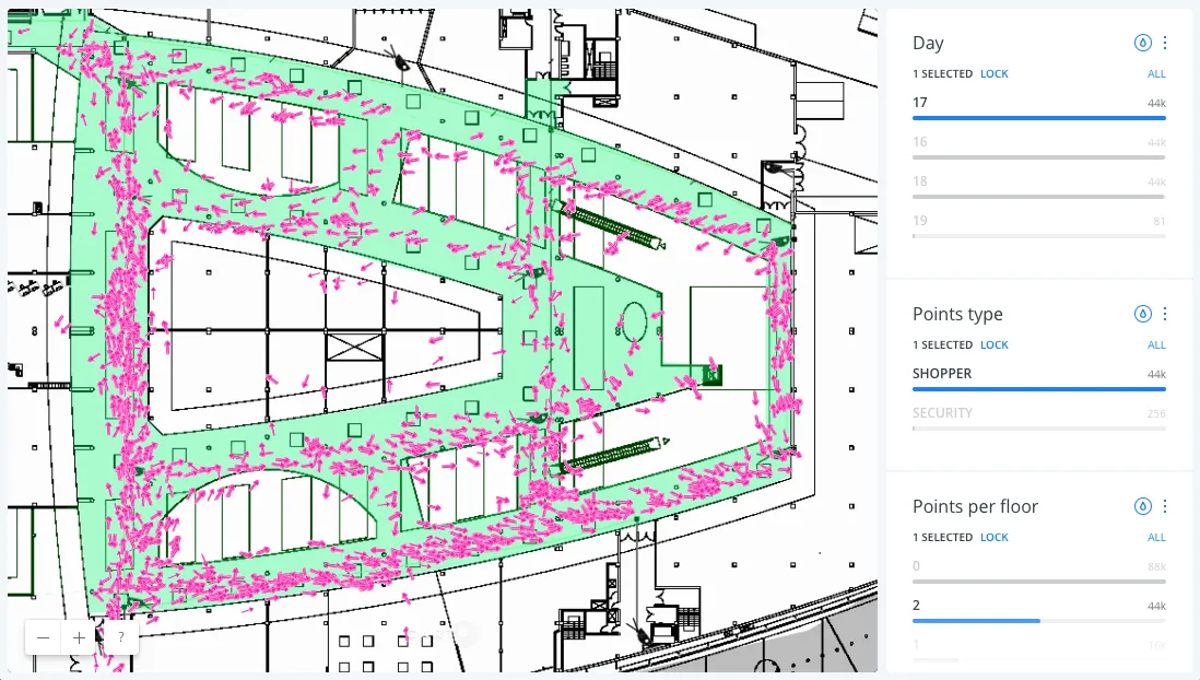
World Cup 2026 spatial analysis: drive-time catchments and sponsor activation hotspots across all 16 stadiums, built with the CARTO CLI and CARTO agent skills.
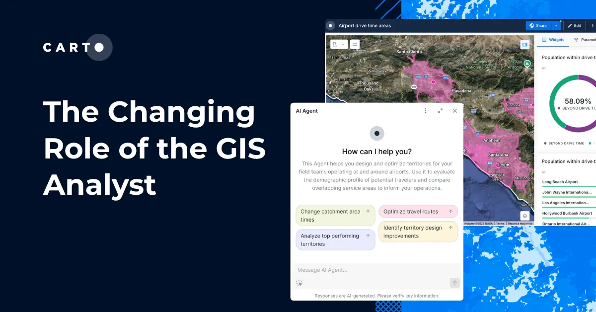
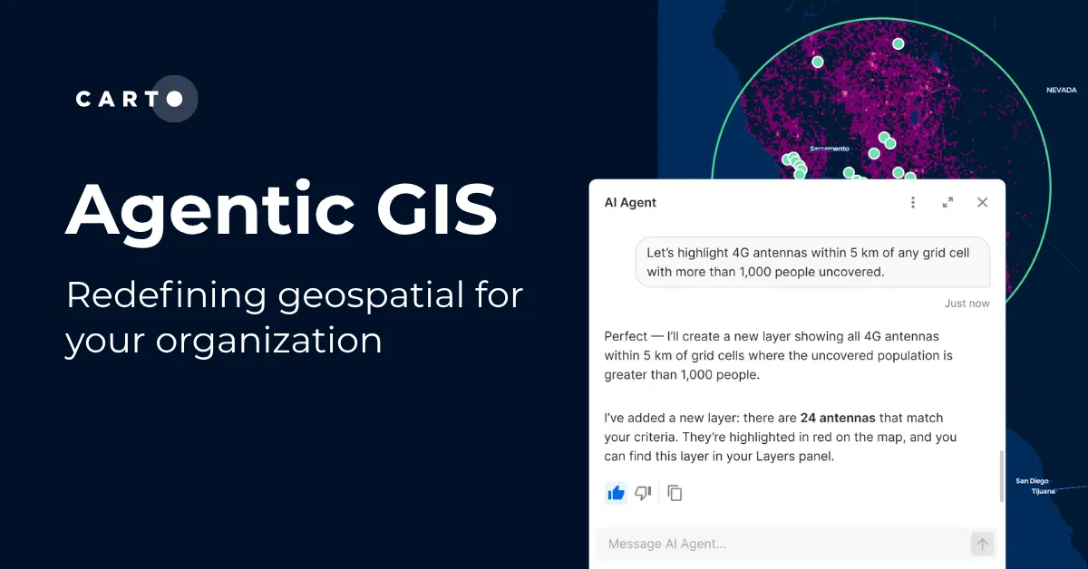
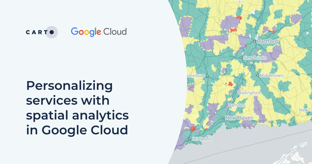
State and local agencies need spatial insight at the speed of today's decisions. But legacy GIS platforms and siloed tools create real barriers. Geospatial AI is changing that.
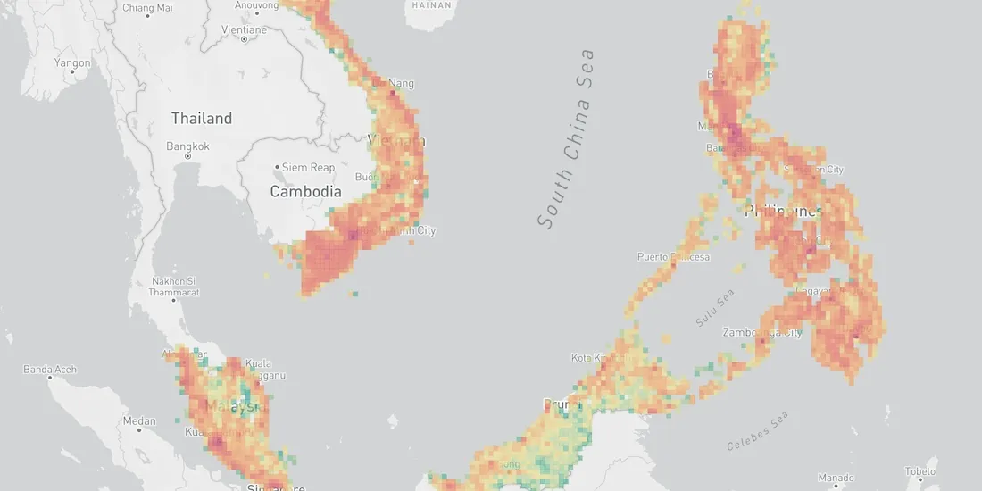
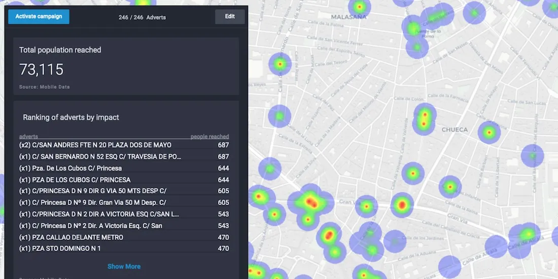
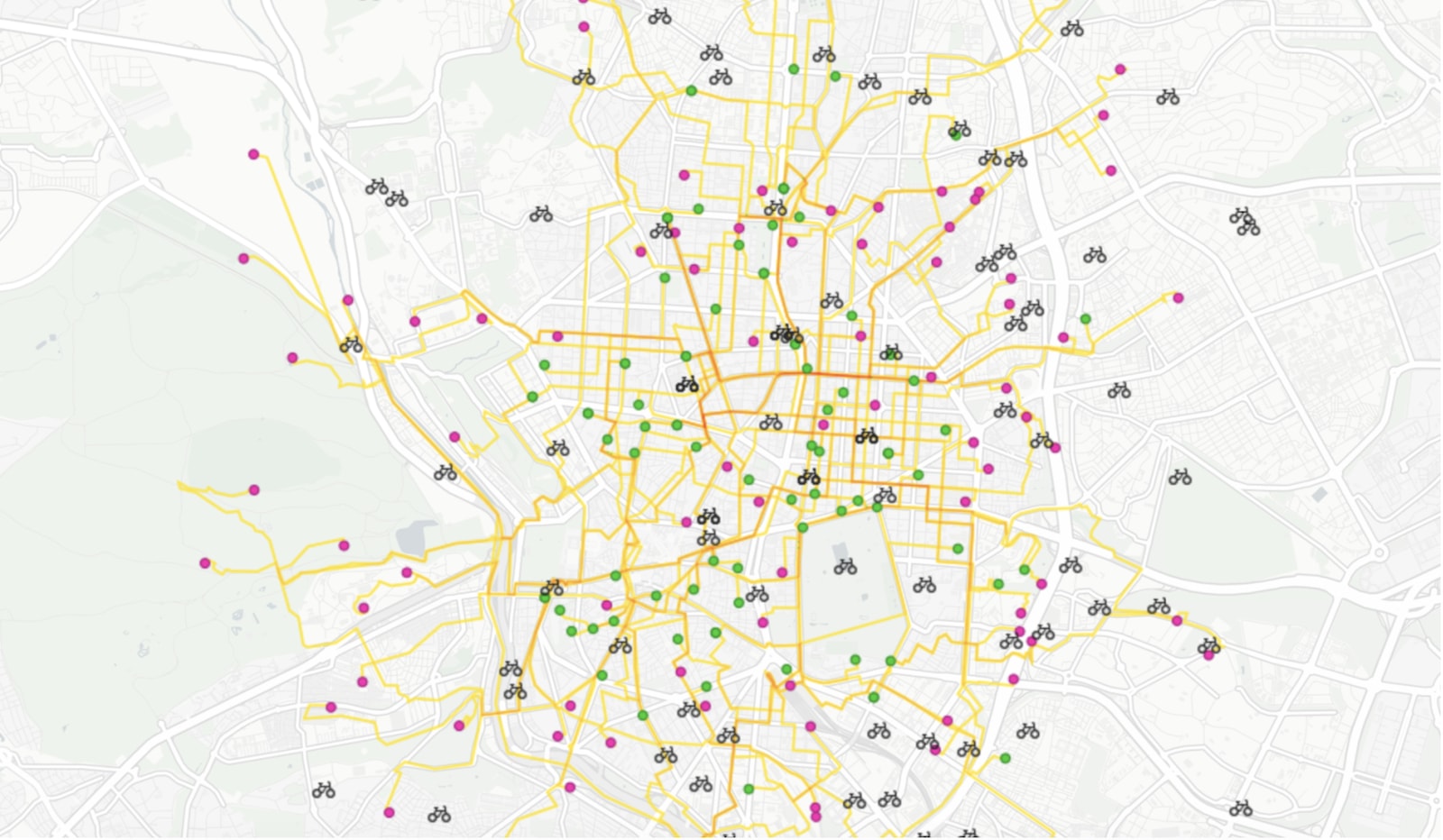
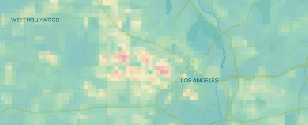
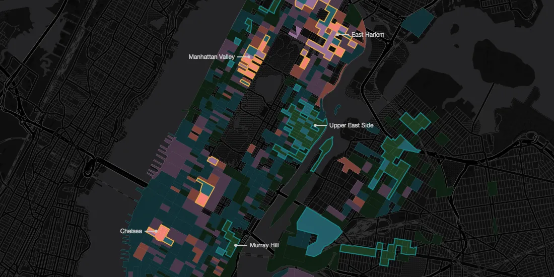
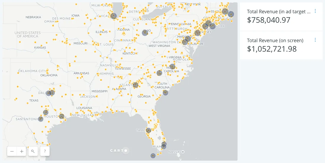
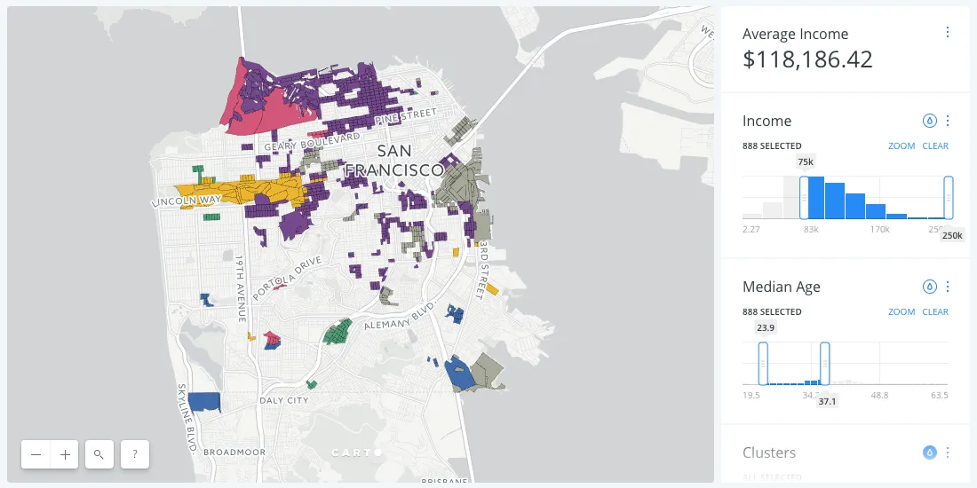
Out-of-home advertising is getting more data-informed. Learn how spatial analytics helps OOH professionals target audiences, plan campaigns, and prove ROI.
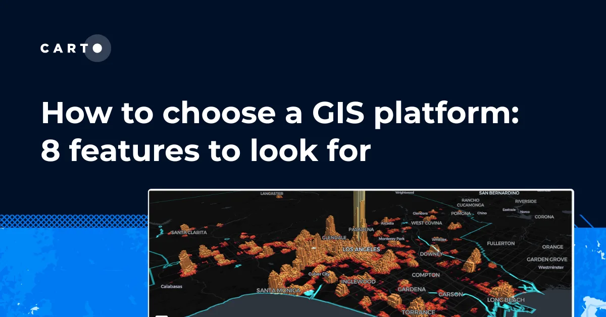
A practical checklist of the features to look for when choosing a GIS platform, from deployment model and data integration to scale, AI, security, and cost.
Big data is more than volume. Learn what big data really means, why 80% of it has a spatial component, and how cloud-native spatial analysis turns it into decisions.
Compare cloud, desktop, and open source GIS platforms. Find the best spatial analytics software for your team, from CARTO to Esri, QGIS, Felt, and more.
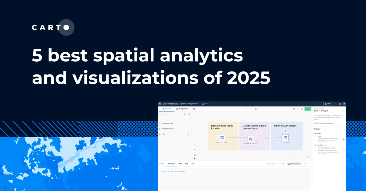
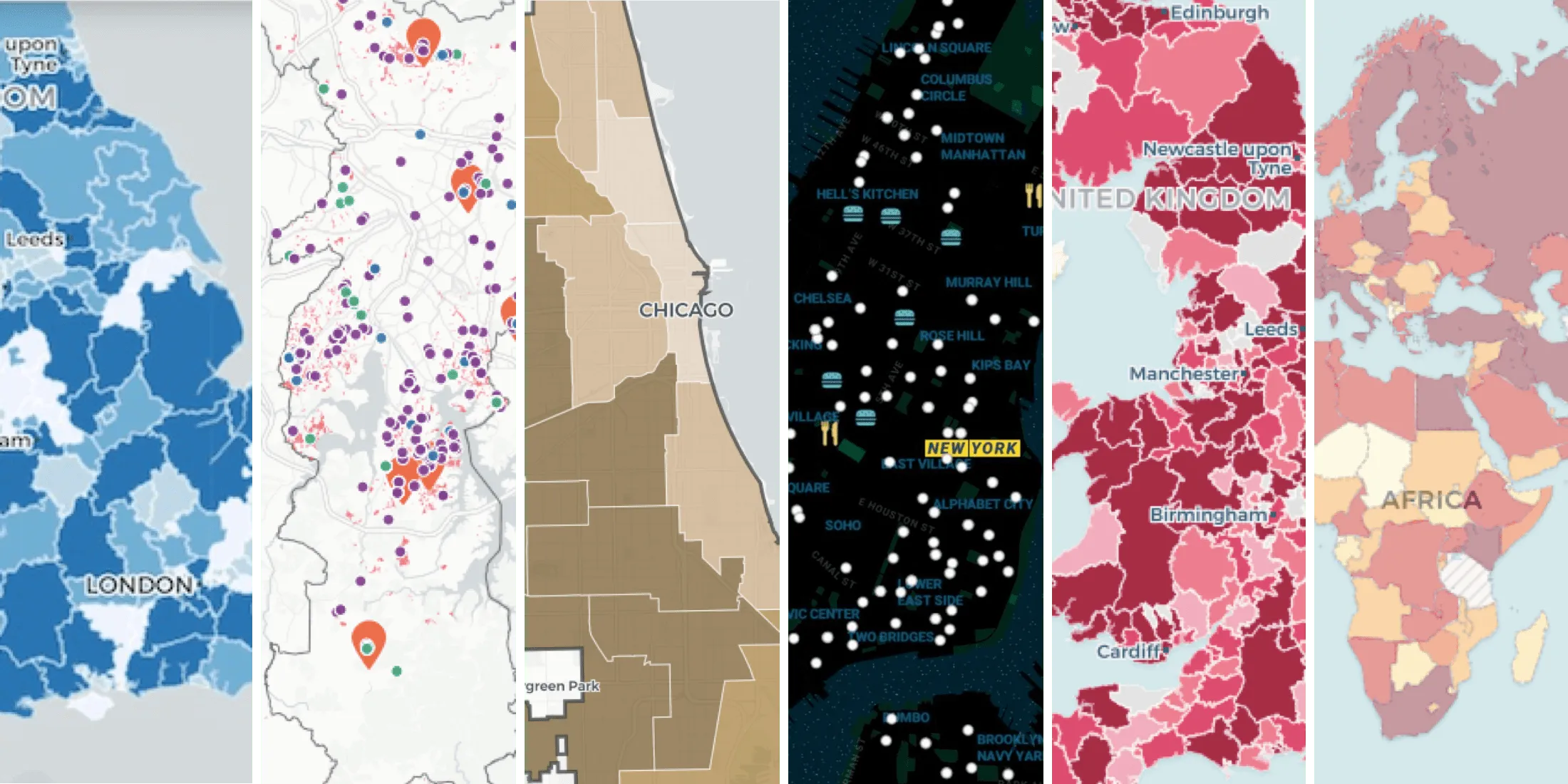
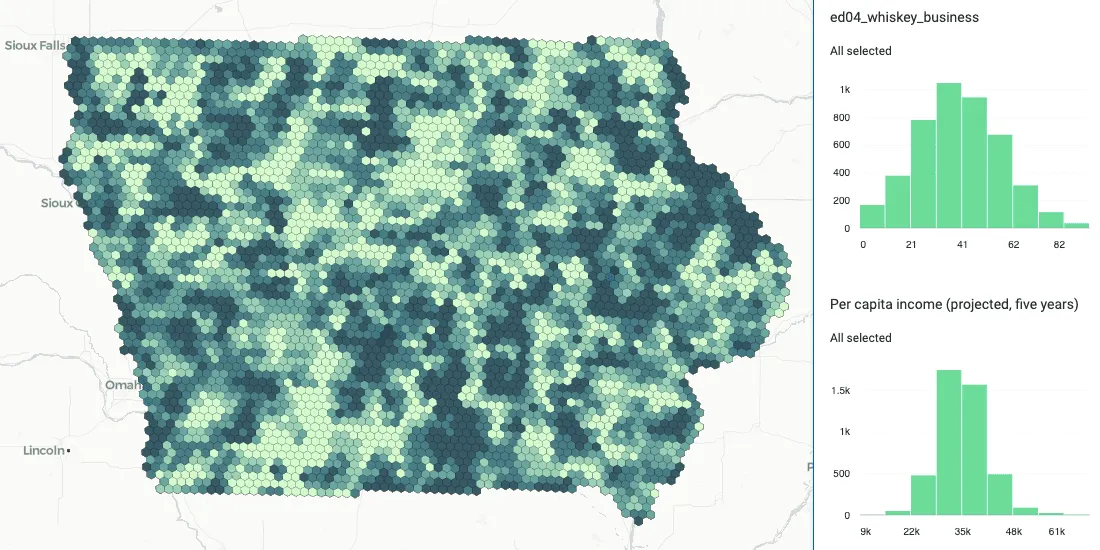
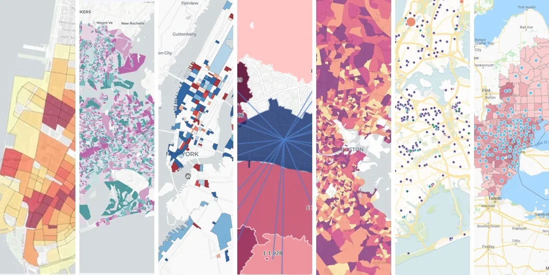
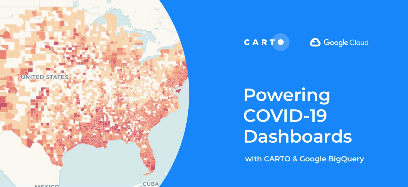
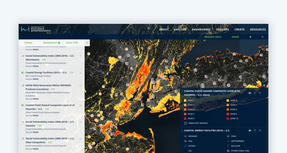
Discover the best spatial analytics of 2025. Learn how industry leaders use CARTO to analyze historical risk, manage real-time operations, and plan for growth.
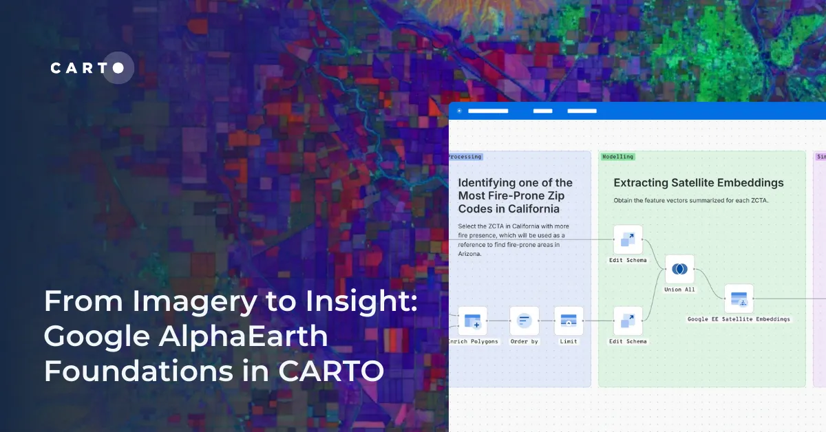
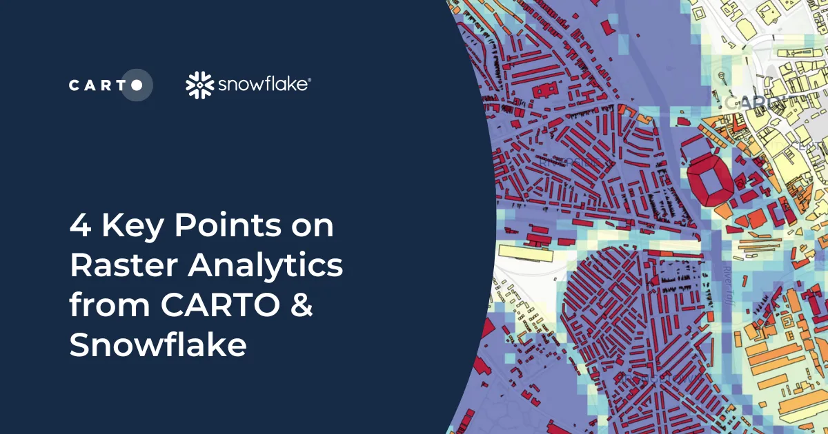
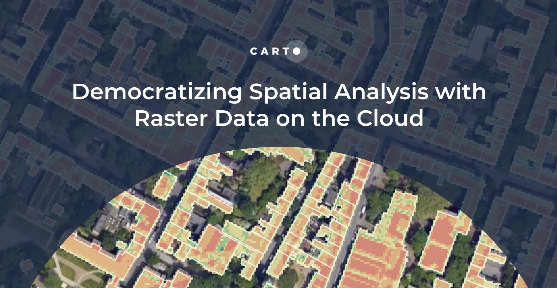
CARTO now lets you run analytics directly on geospatial foundation model embeddings. Visualize, cluster, and detect changes to turn spatial data into decisions.
Only 1 in 4 AI projects deliver ROI. Discover a proven 5-step roadmap for scaling geospatial AI - govern data, automate workflows & unlock Agentic GIS value.
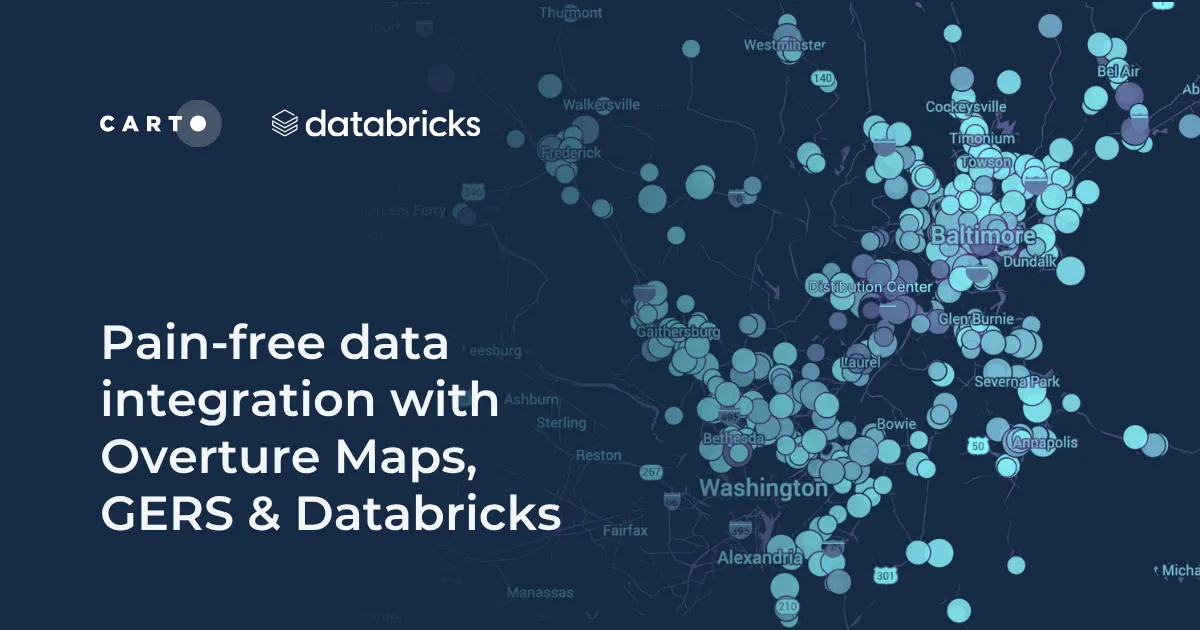
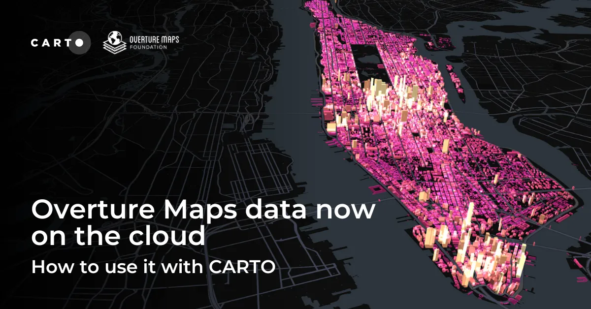
Discover how the GERSification of Overture Maps Foundation data can help you connect open and premium data to speed up analysis and smarter spatial decisions.
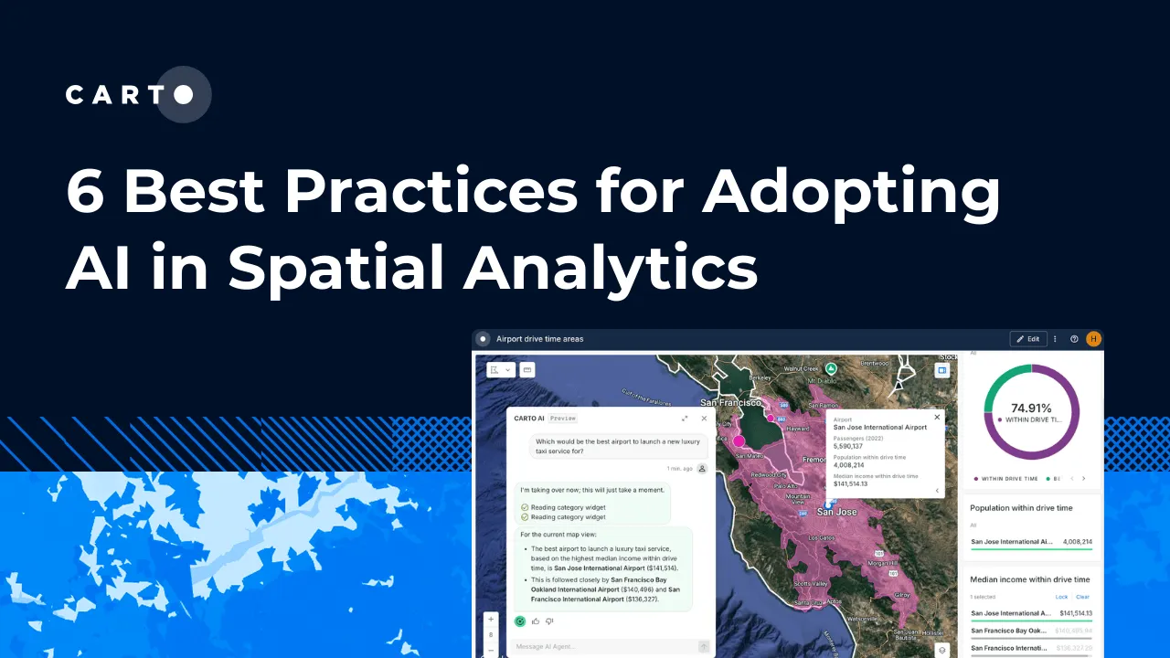
Learn 6 best practices for integrating AI into spatial analytics. Establish a secure, scalable AI strategy to automate tasks and make confident decisions.
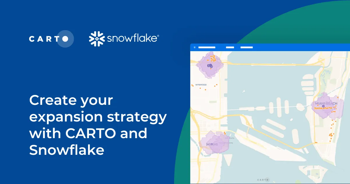
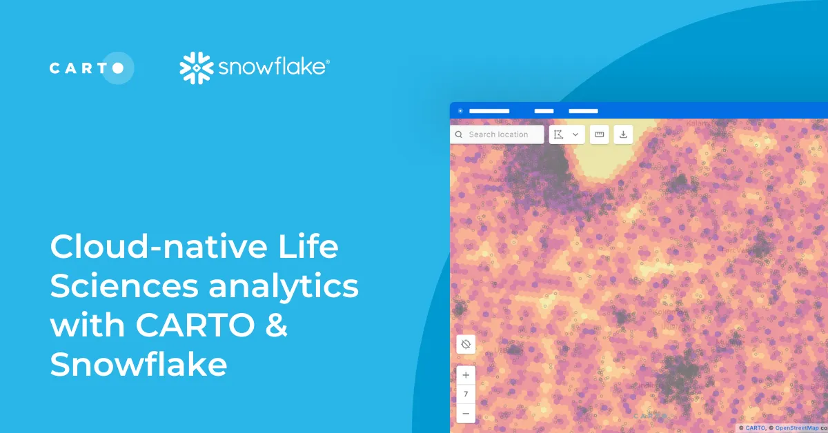
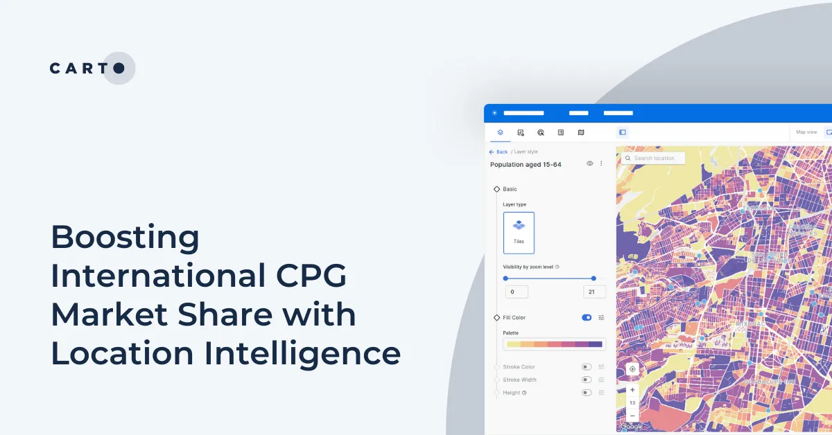
Learn how CARTO and Snowflake help you build a winning expansion strategy. Pinpoint ideal locations, leverage spatial analytics & AI for confident growth.
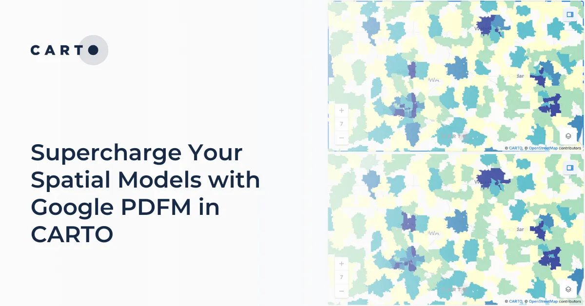
Integrate Google's PDFM embeddings into CARTO Workflows for enhanced spatial models. This blog shows two use cases on how these embeddings improve predictions.
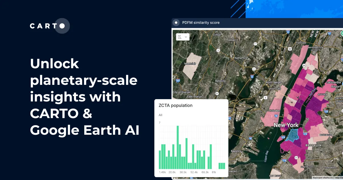
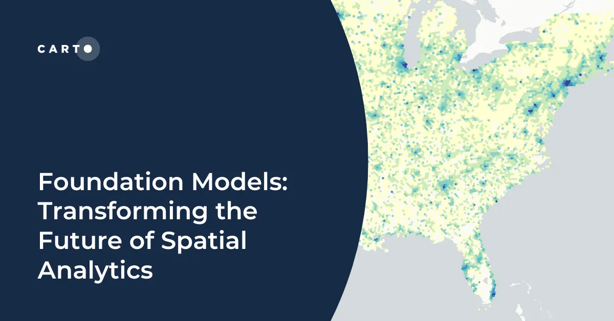
Explore how geospatial foundation models like Google’s PDFM are revolutionizing spatial analytics, from disaster response to urban planning with CARTO.
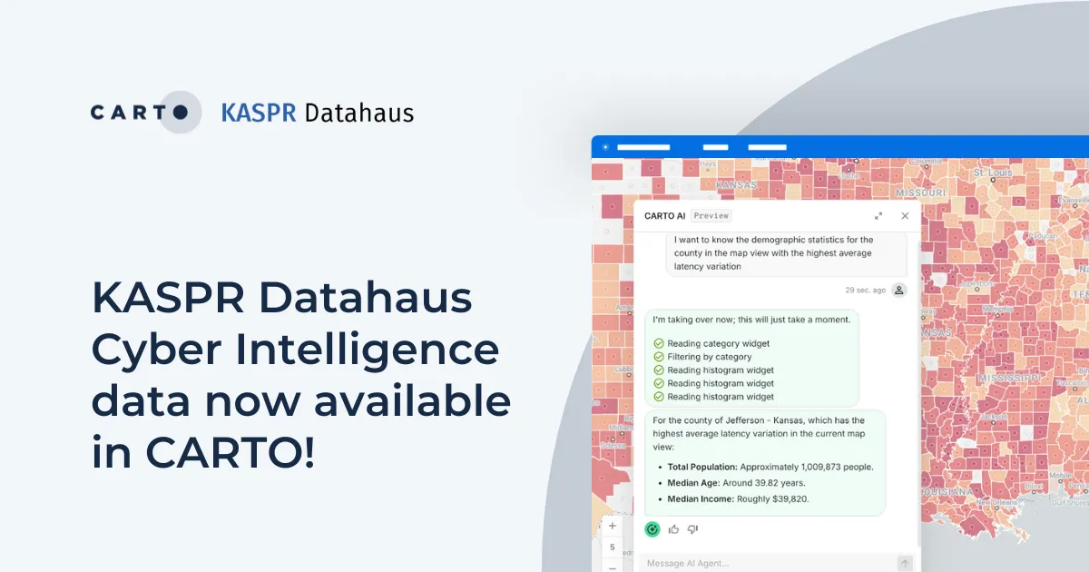
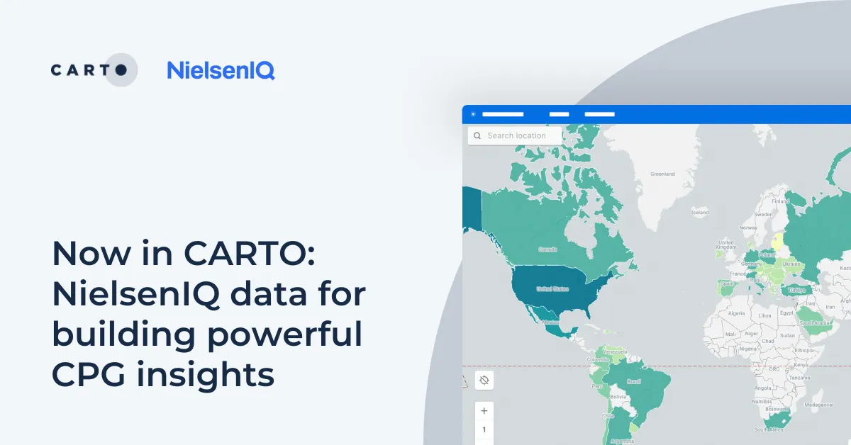
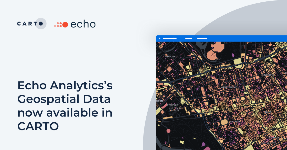
Announcing KASPR's global cyber intelligence data - now in CARTO! Monitor internet performance, optimize networks & drive smarter geospatial decisions.
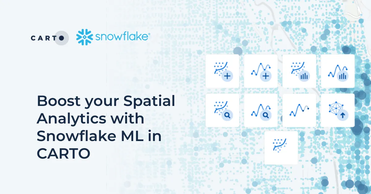
Discover how Snowflake ML in CARTO simplifies machine learning for spatial analytics. Easily build, train, and deploy forecasting models in your workflows.
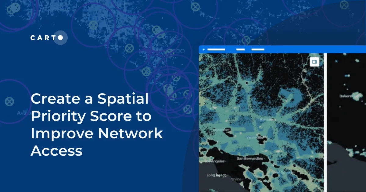
Discover how CARTO enhances data accessibility, empowering decision-makers with actionable insights to improve network access for senior citizens and communities.
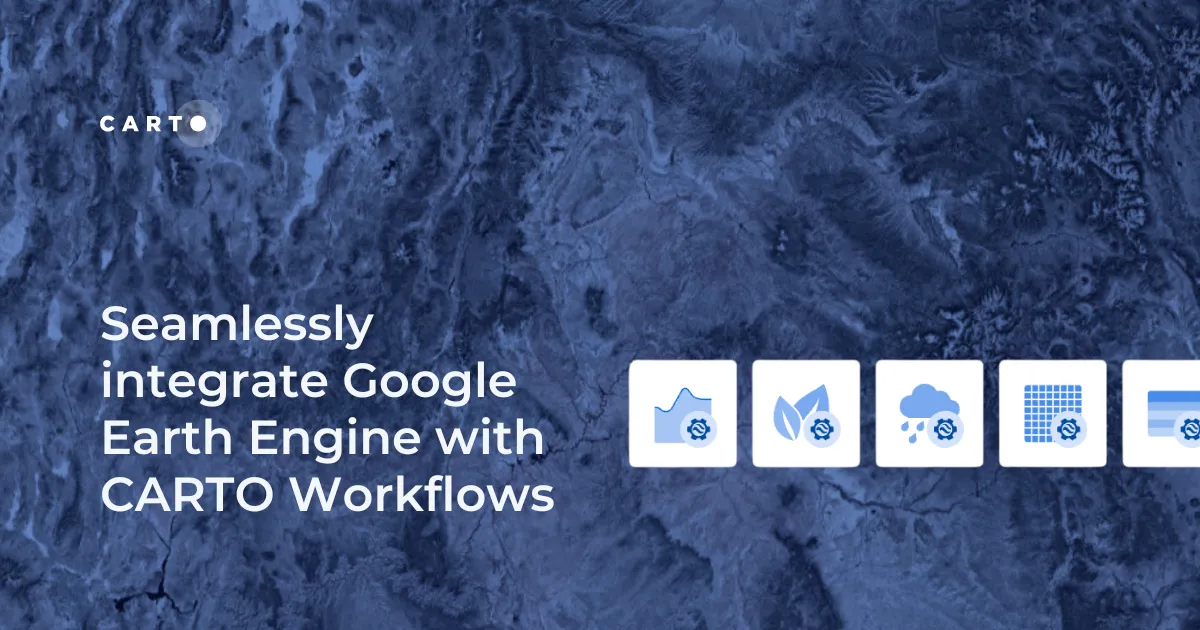
Seamlessly integrate Google Earth Engine with CARTO Workflows to analyze spatial data at scale - no coding required. Unlock powerful geospatial insights today!
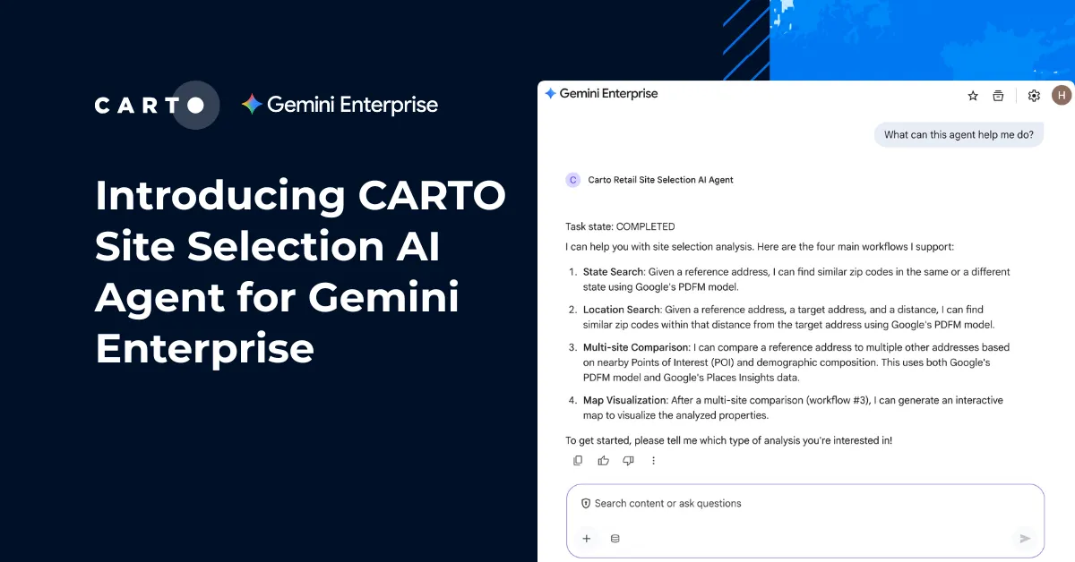
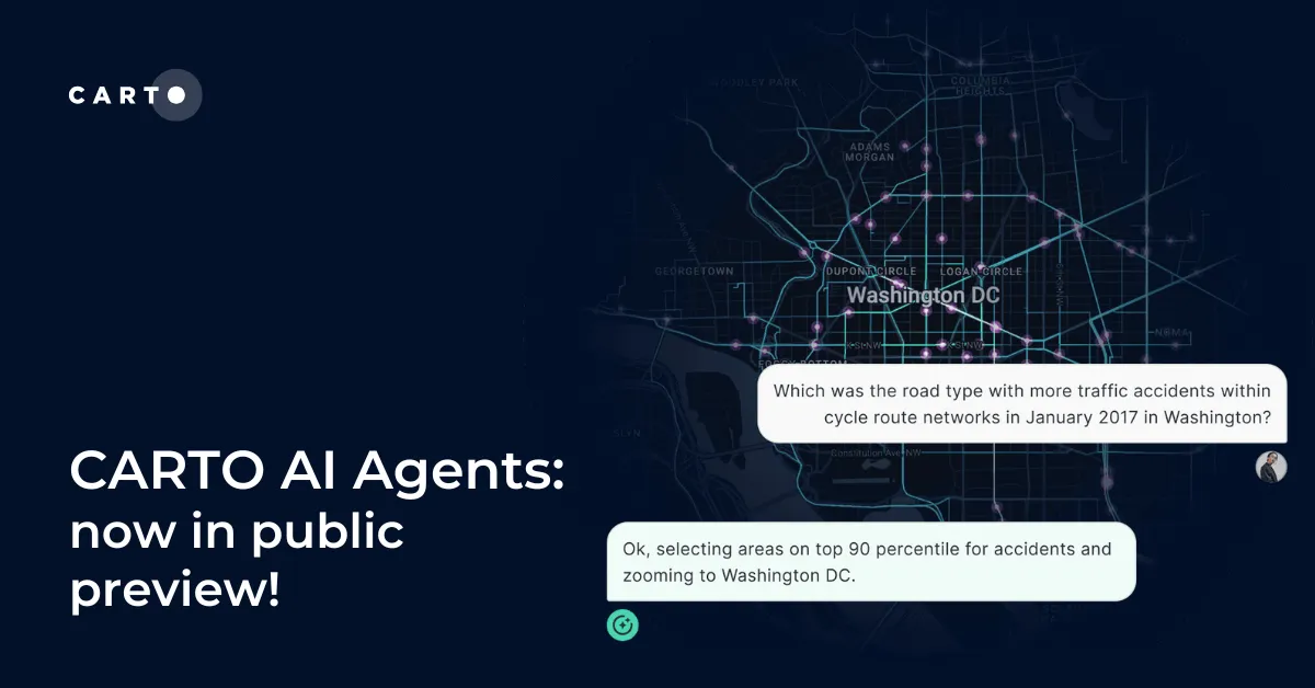
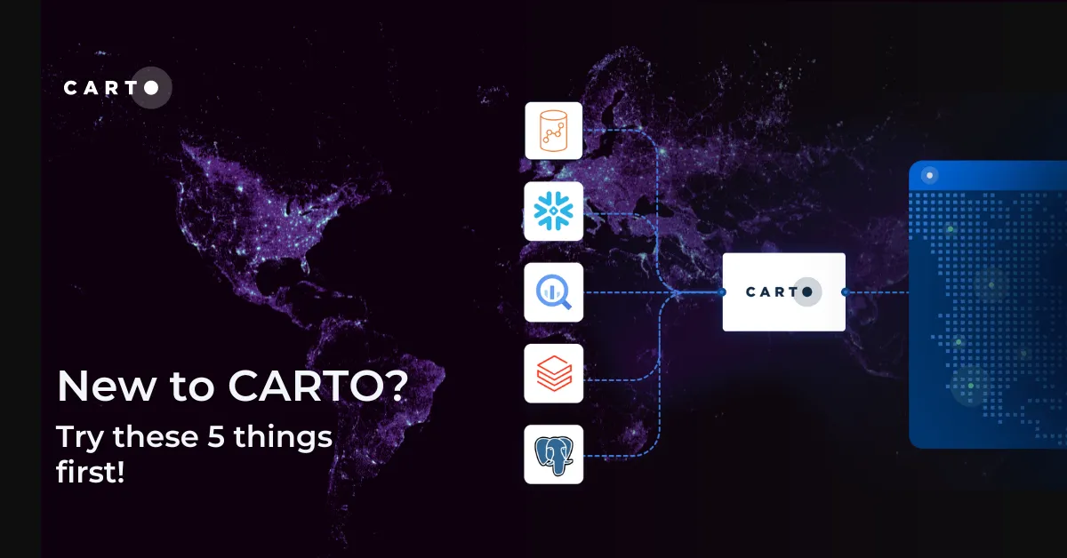
Discover how CARTO AI Agents are democratizing spatial analysis, making it accessible to all users. Learn about real-life applications revolutionizing geospatial industries.
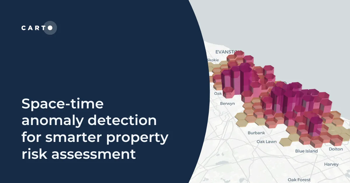
Learn how to detect crime anomalies & assess property risk in near real-time using CARTO Workflows—low-code spatial analytics for scalable spatial data science
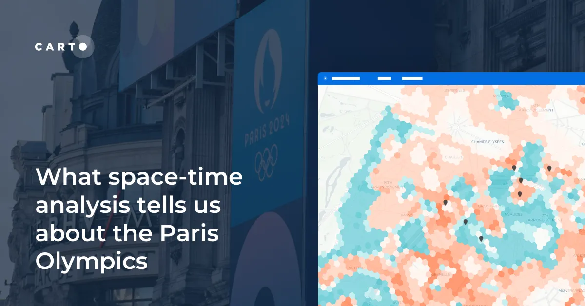
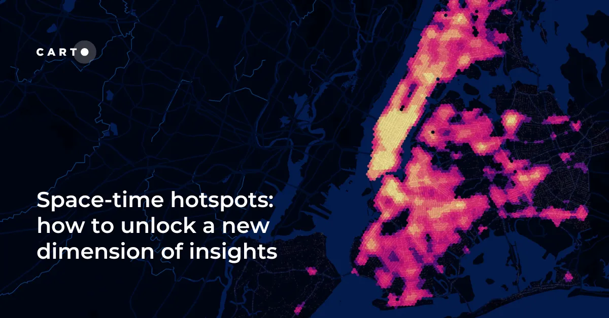
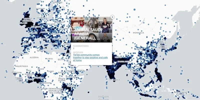
Explore space-time analytics through the 2024 Paris Olympics! Discover insights from human mobility data & learn how to leverage spatial analysis tools.
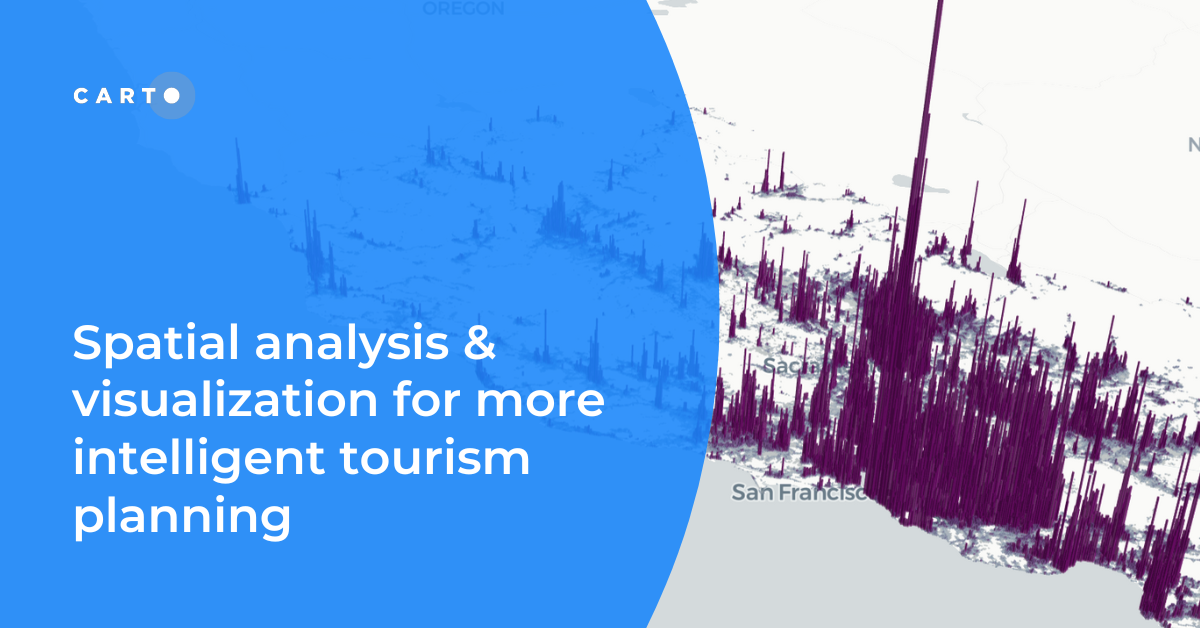
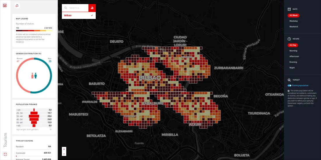
Discover how spatial data analysis and visualization empowers tourism organizations to personalize experiences, optimize resources & make strategic decisions.
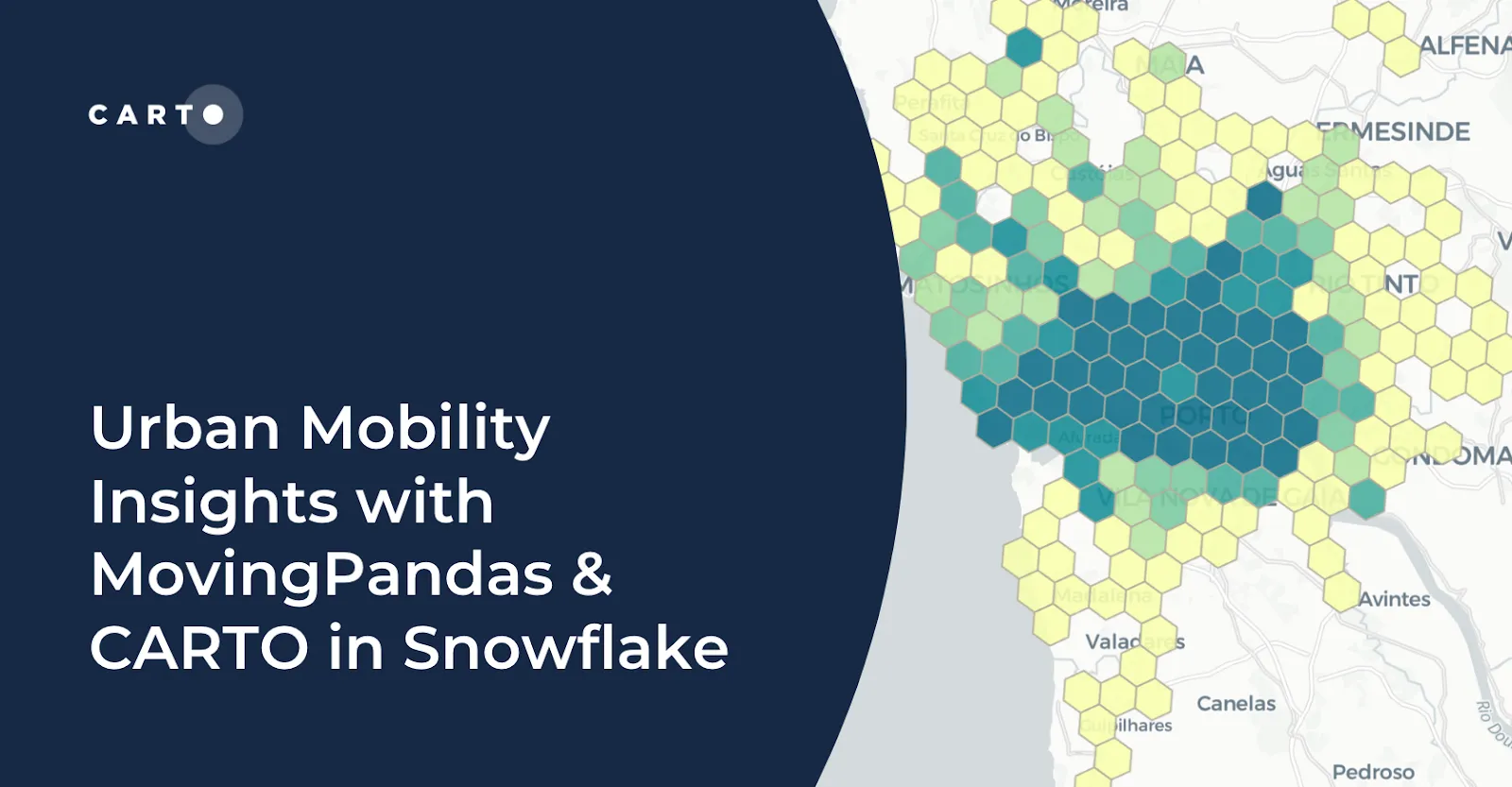
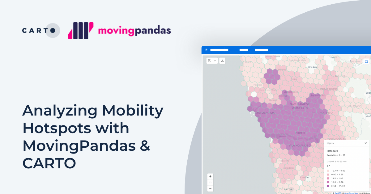
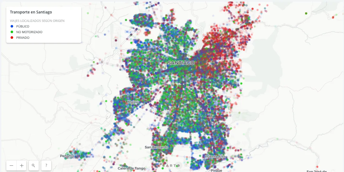
Learn how integrating MovingPandas with CARTO in Snowflake boosts urban mobility analysis by uncovering traffic hotspots and optimizing city transportation.
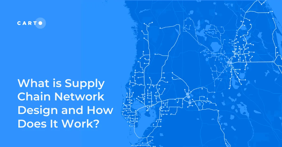
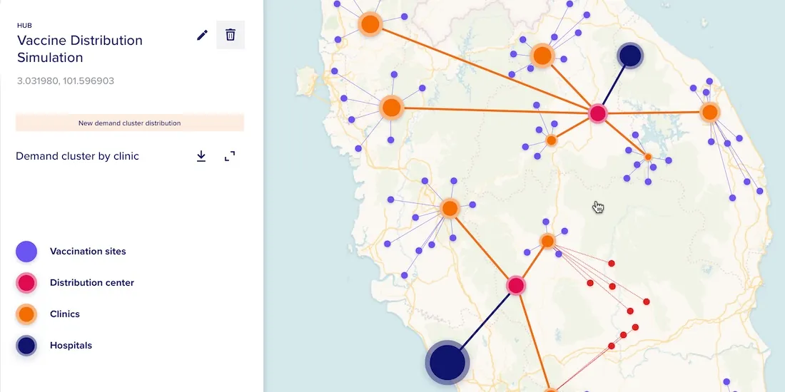
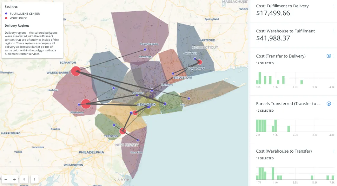
Improve your supply chain network design! Use spatial analysis to optimize your supply chain design for cost savings, efficiency, resilience & sustainability.
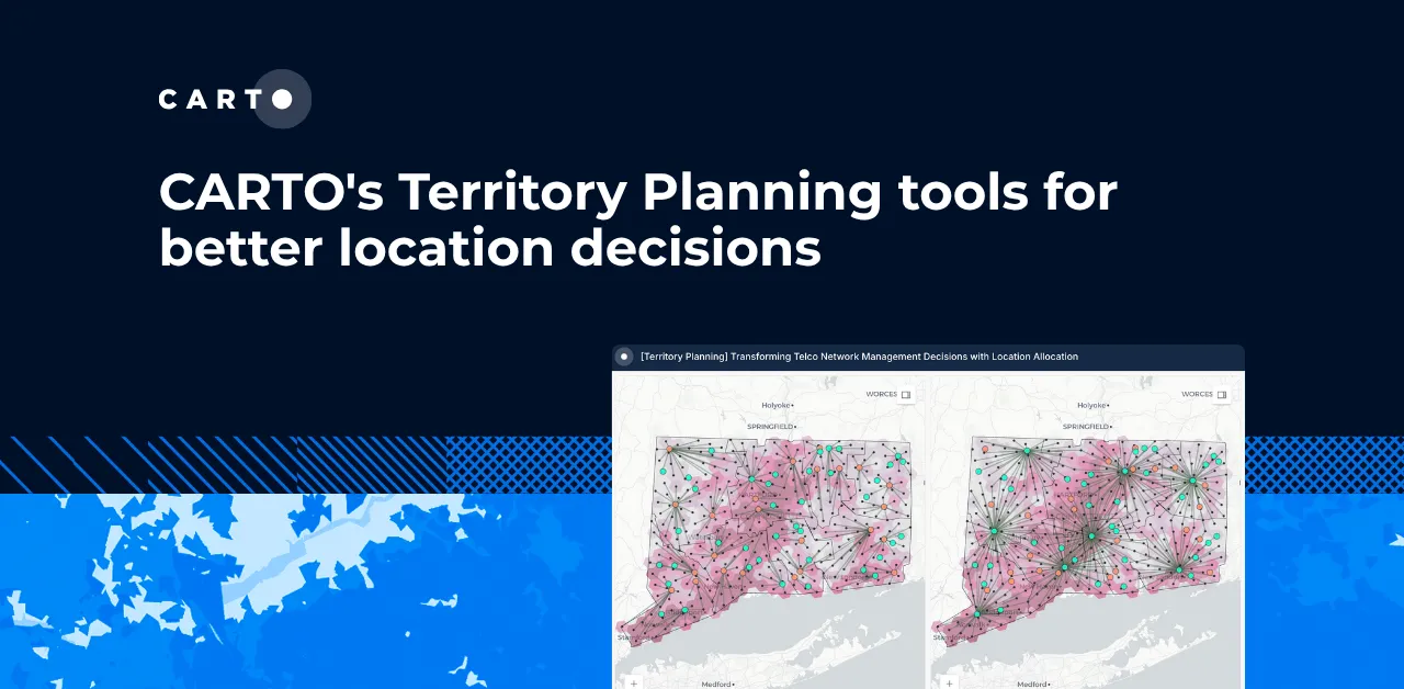
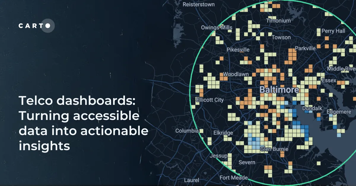
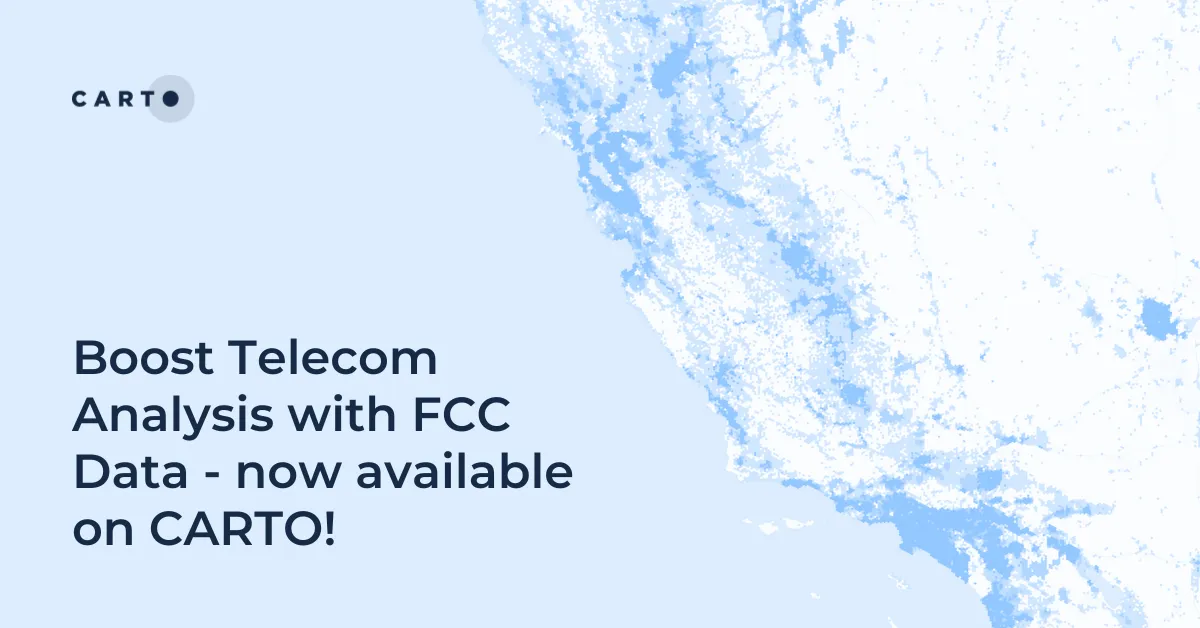
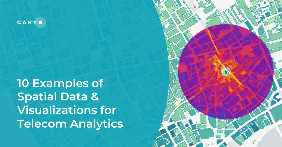
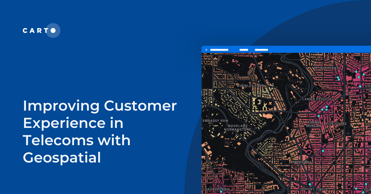
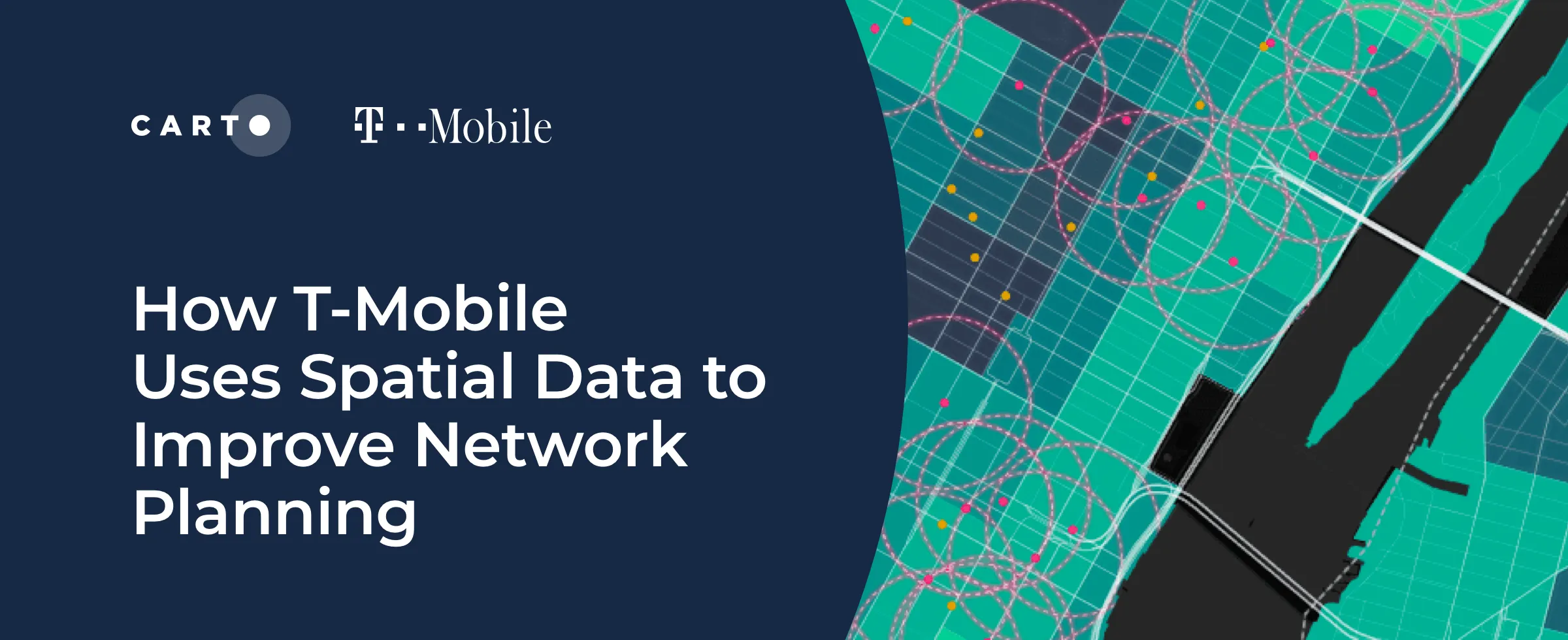
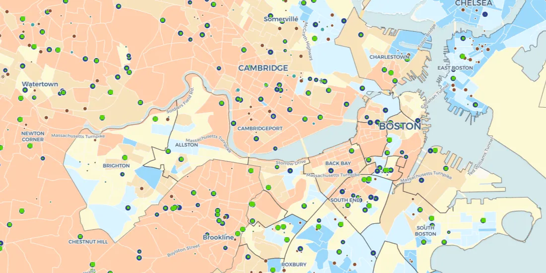
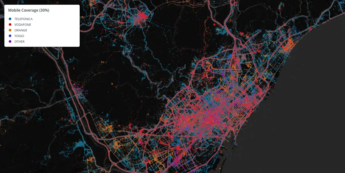
Explore 10 maps using CARTO's cloud-native platform and spatial data for telecom analytics to enhance network optimization, coverage, and customer satisfaction.
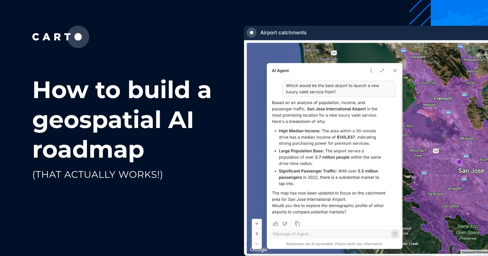
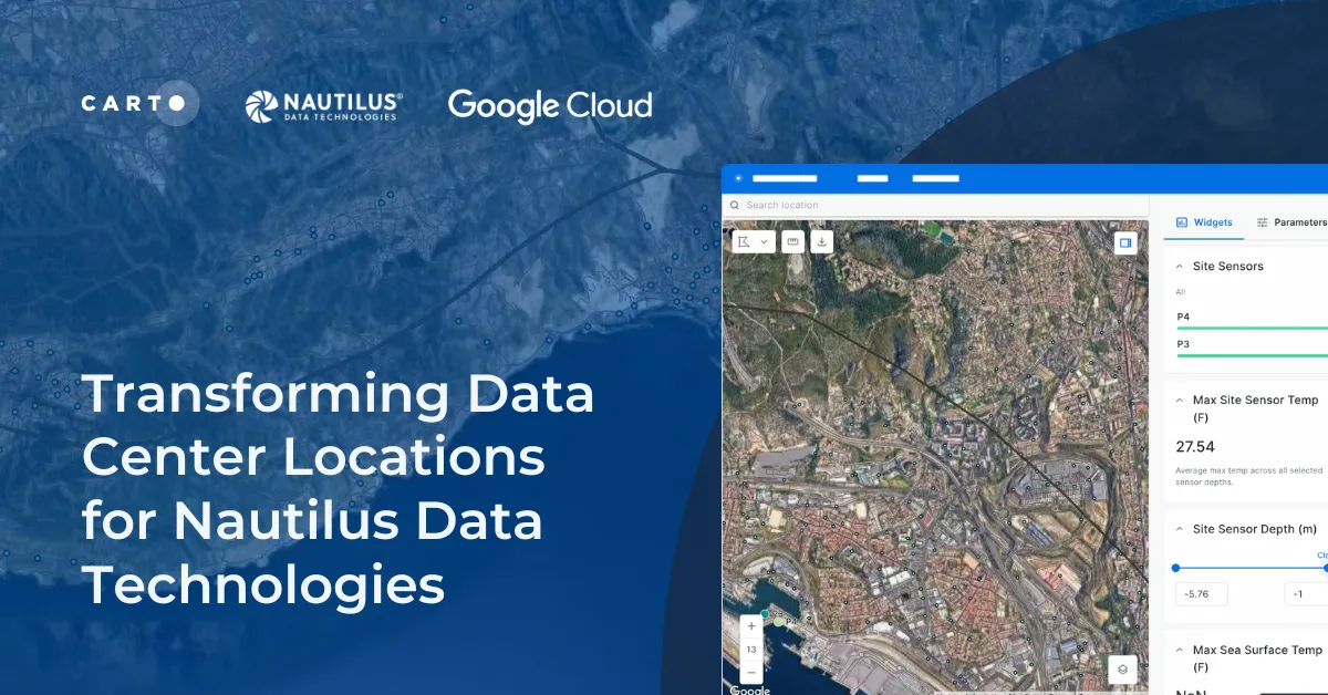
Learn how we are collaborating with Google Cloud to provide Nautilus Data Technologies with an innovative solution for data center site selection and monitoring.
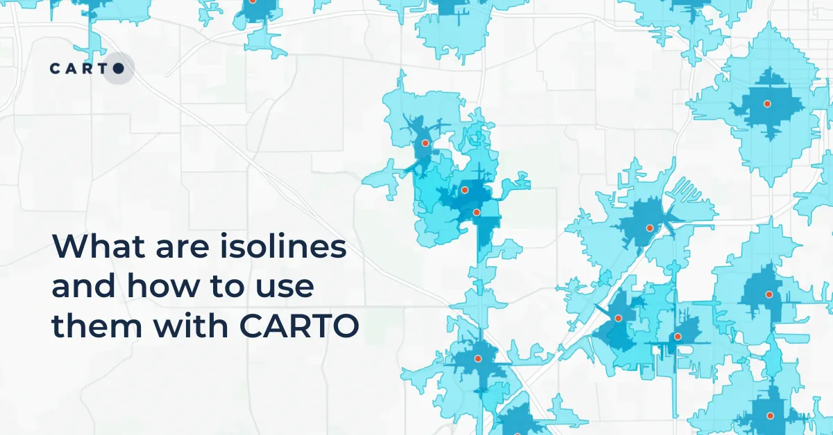
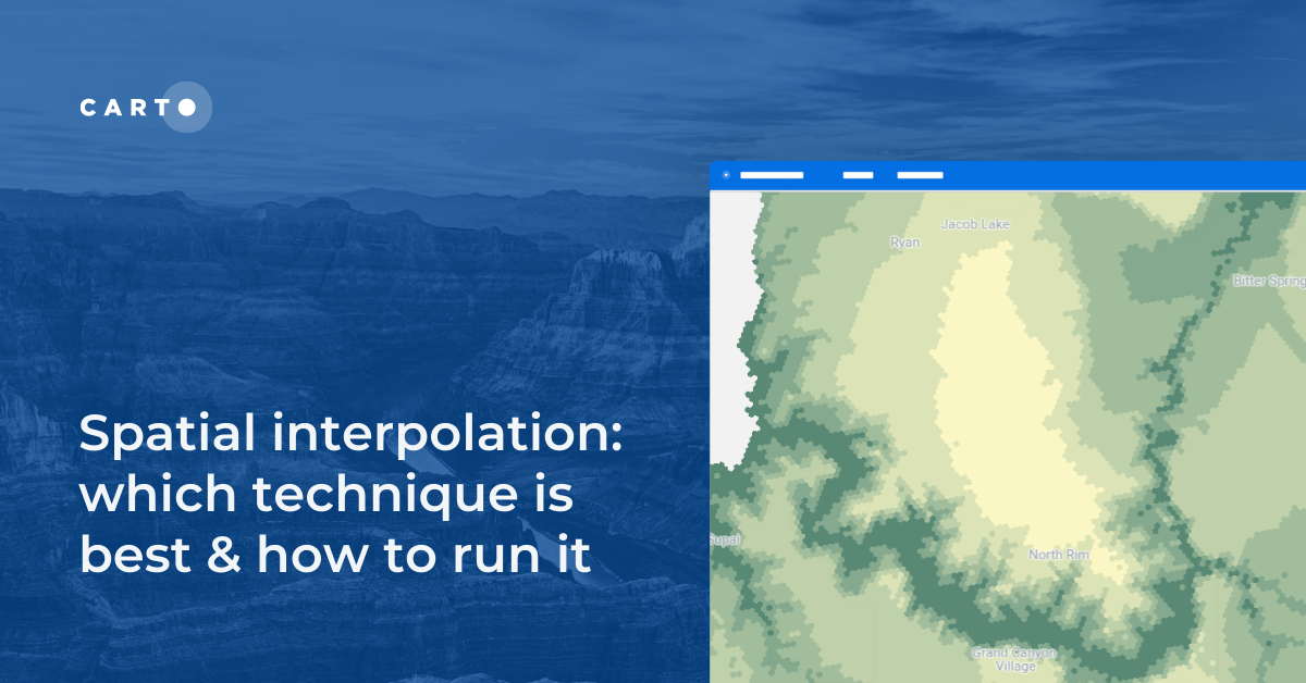
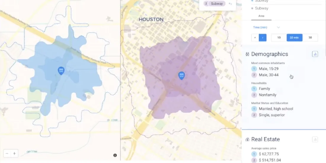
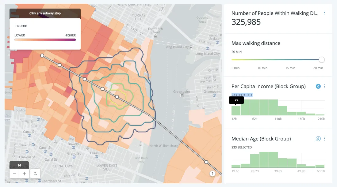
Learn what isolines are and how to use them at CARTO. Follow this quick guide for creating isolines & trade areas. Use them to derive actionable insights.
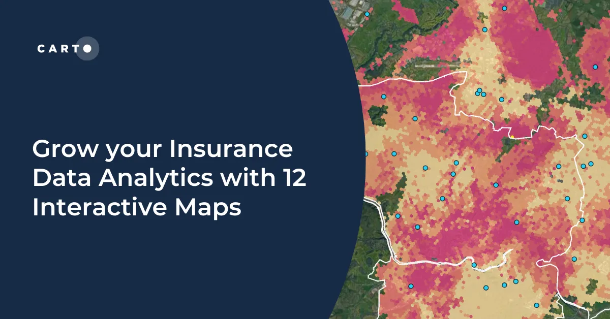
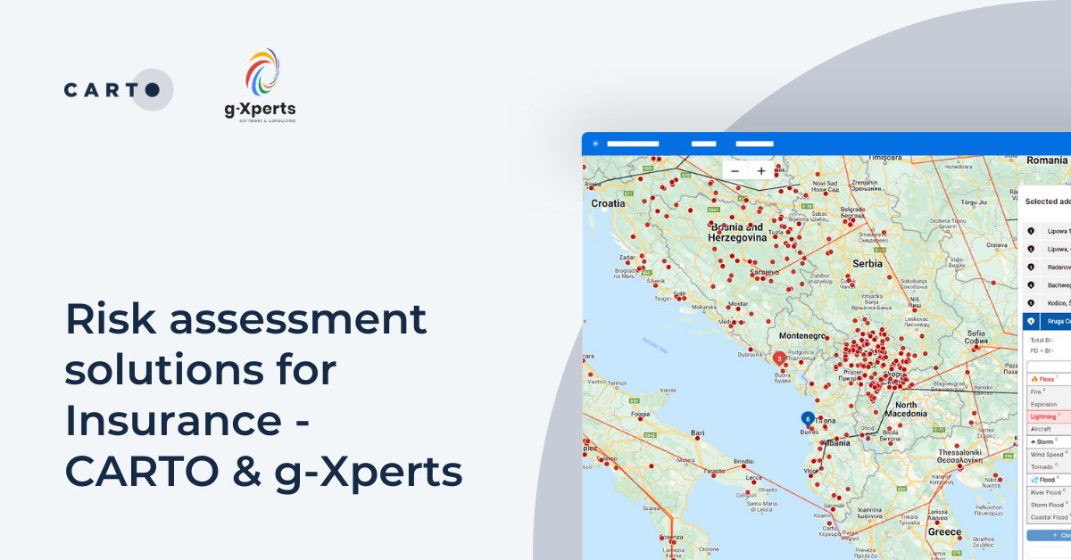
Grow your insurance data analytics with these 12 maps and visualizations. Request a demo now to optimize your risk assessment and decision-making processes.
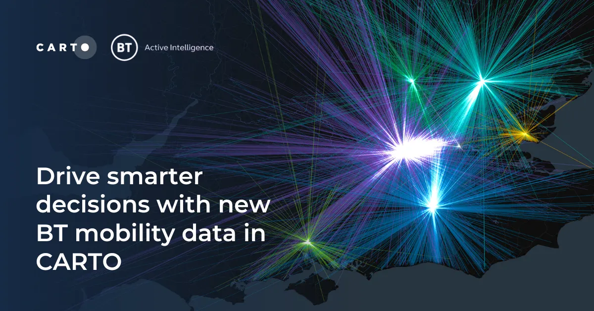
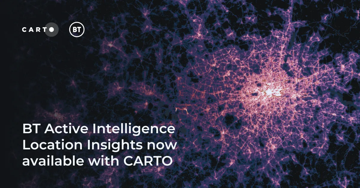
Access hyper-local footfall insights with BT Active Intelligence Location Insights, now available with CARTO! Explore granular mobility data in the cloud.
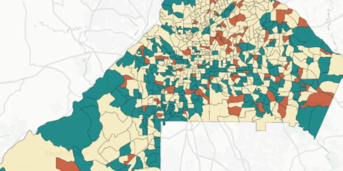
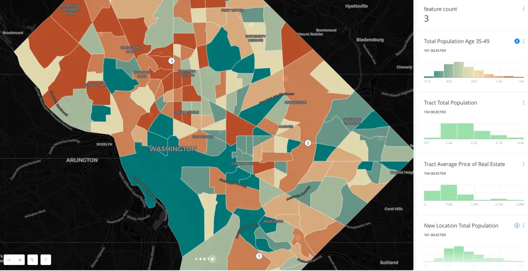
Learn how to create a spatial priority score to improve network access for senior citizens. Explore data integration, regression models, and AI insights.
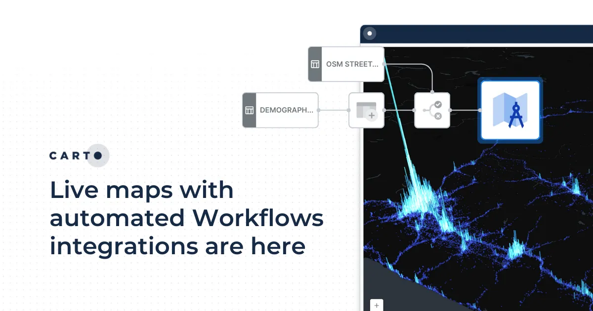
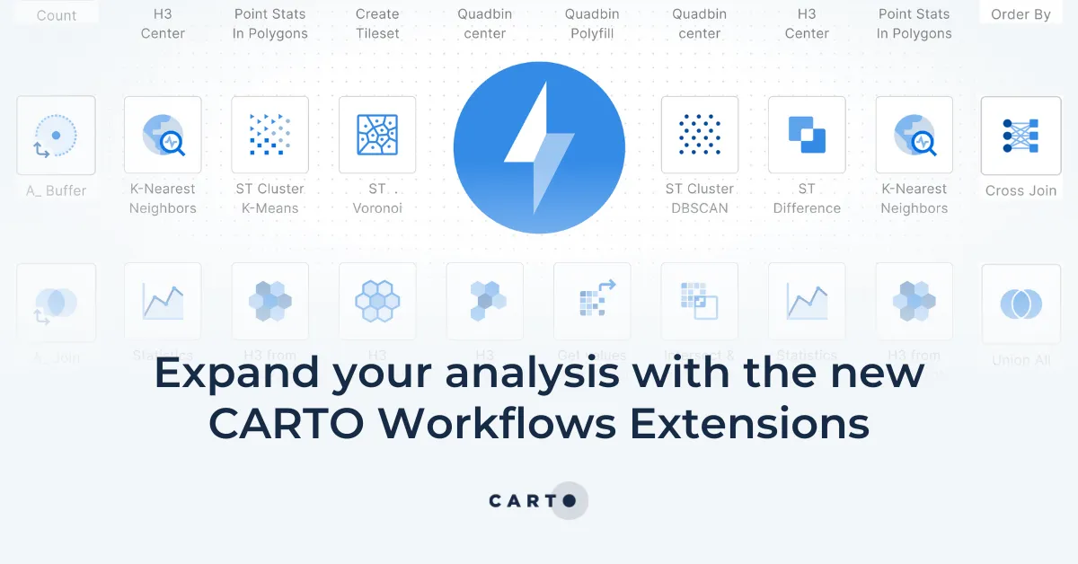
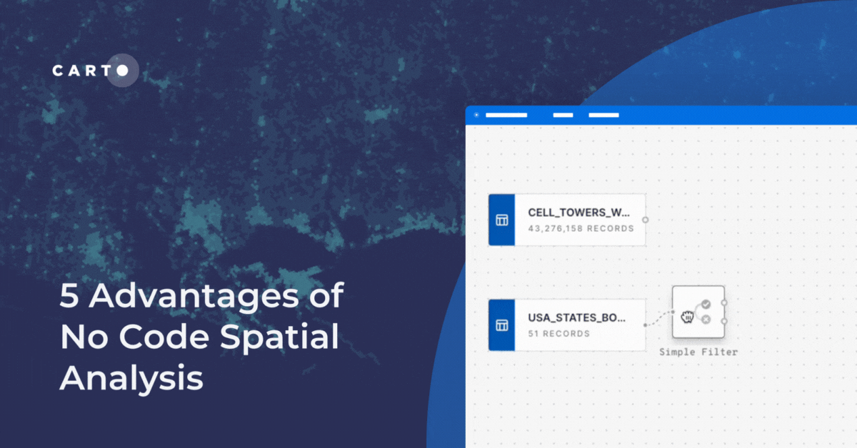
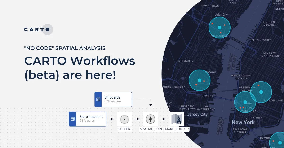
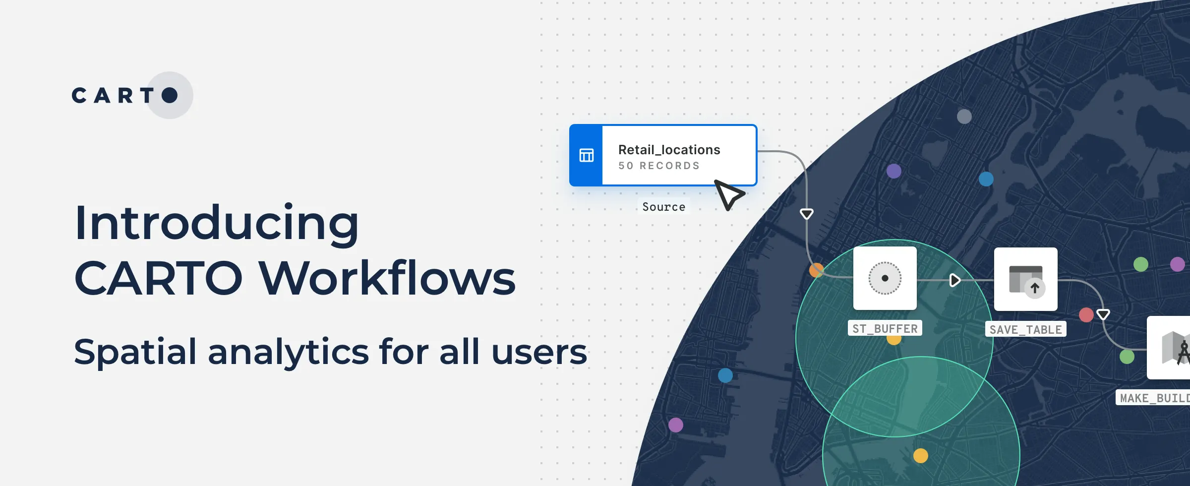
Is no code for spatial analysis possible? Discover 5 advantages to go no code & see CARTO Workflows in action! Reduce bottlenecks, save time & de-risk.
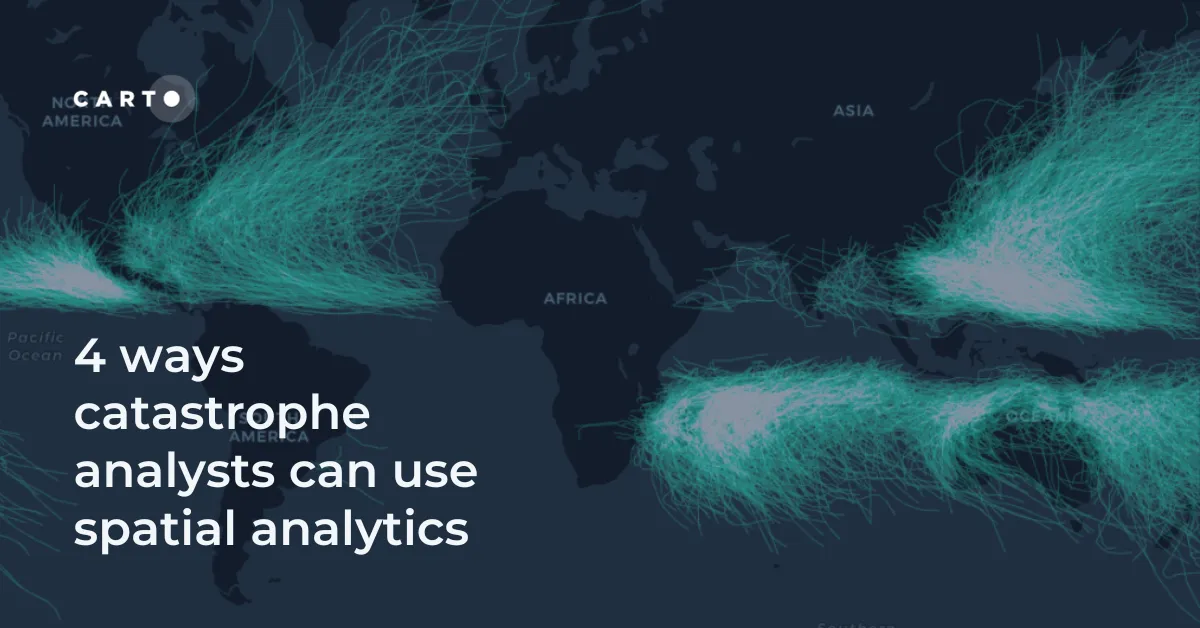
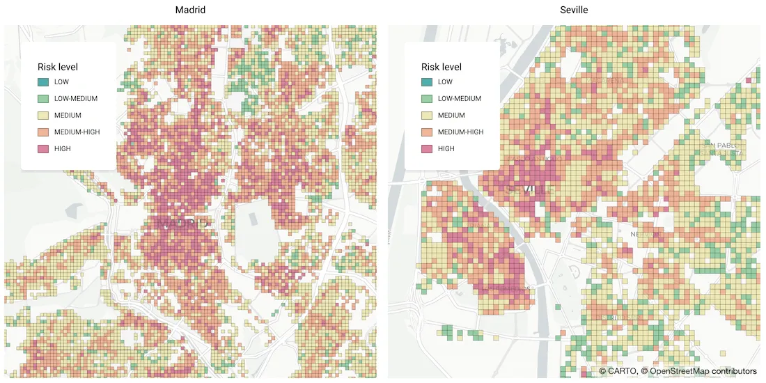
Discover 4 different spatial analytics techniques Catastrophe Analysts can use to understand key climate-related risks for better insurance decision-making.
Explore mobility hotspots with MovingPandas and CARTO. Tutorial on transforming trajectory data into space-time hotspots for intelligent decision-making.
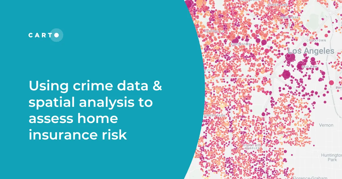
Discover how spatial analysis of crime data can be used for smarter home insurance decisions, including personalized underwriting & targeted marketing.
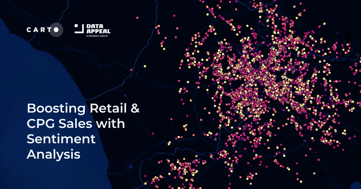
Leverage sentiment analysis for retail growth. Explore Data Appeal's insights, using sentiment data for strategic business expansion. Free 14-day trial.
Discover spatial trends in vacation rentals & relationships with land use, ft. tutorials on how to conduct this analysis and use it to drive decision-making.
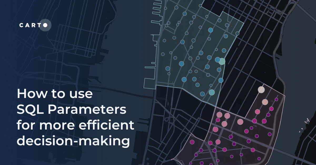
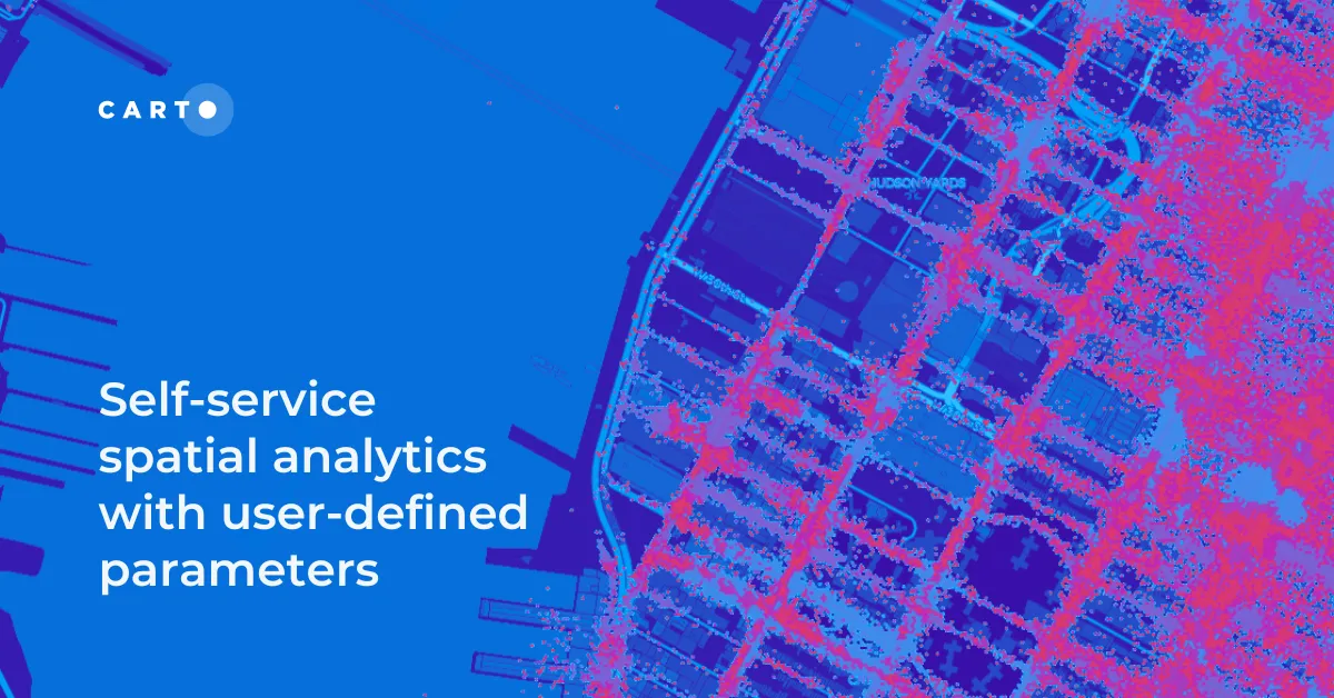
Unlock Spatial Insights for non-expert users with User-Defined Parameters. Learn how to democratize geospatial data analysis for faster decision-making.
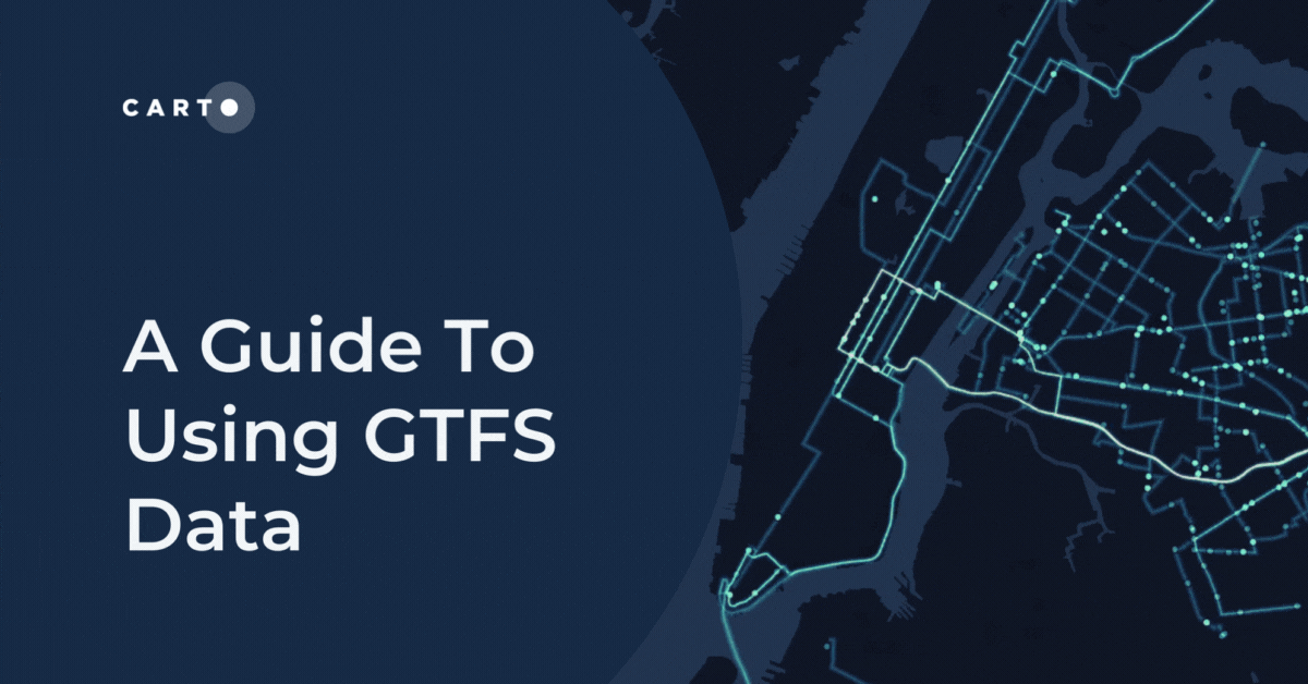
The General Transit Feed Specification - or GTFS - is a specification for transit data. Use GTFS data for transit analysis & map visualization. Free tutorial.
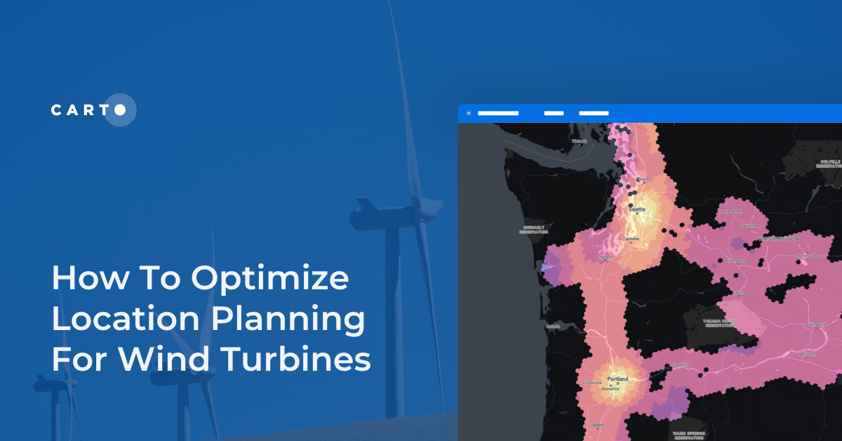
Optimize wind farm locations with our guide on location planning for wind turbines. Explore criteria, spatial analysis, and use CARTO for a free trial.
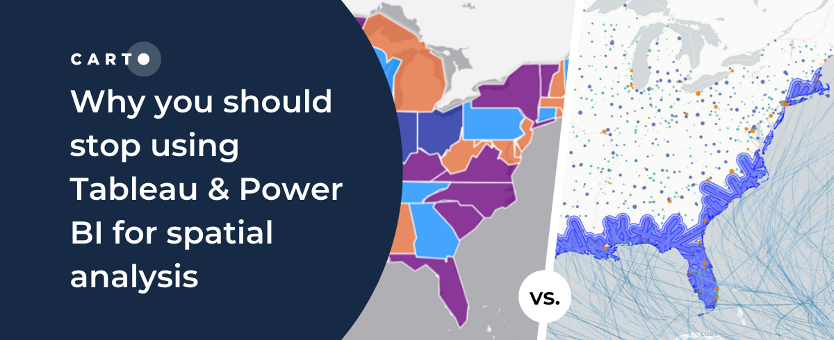
Tableau vs Power BI: why these tools aren’t optimal for spatial analysis. Explore limitations & find solutions for handling complex geospatial data effectively.
CARTO and Google Cloud have collaborated on sustainability projects for micro-mobility, government infrastructure, and preserving natural resources use cases.
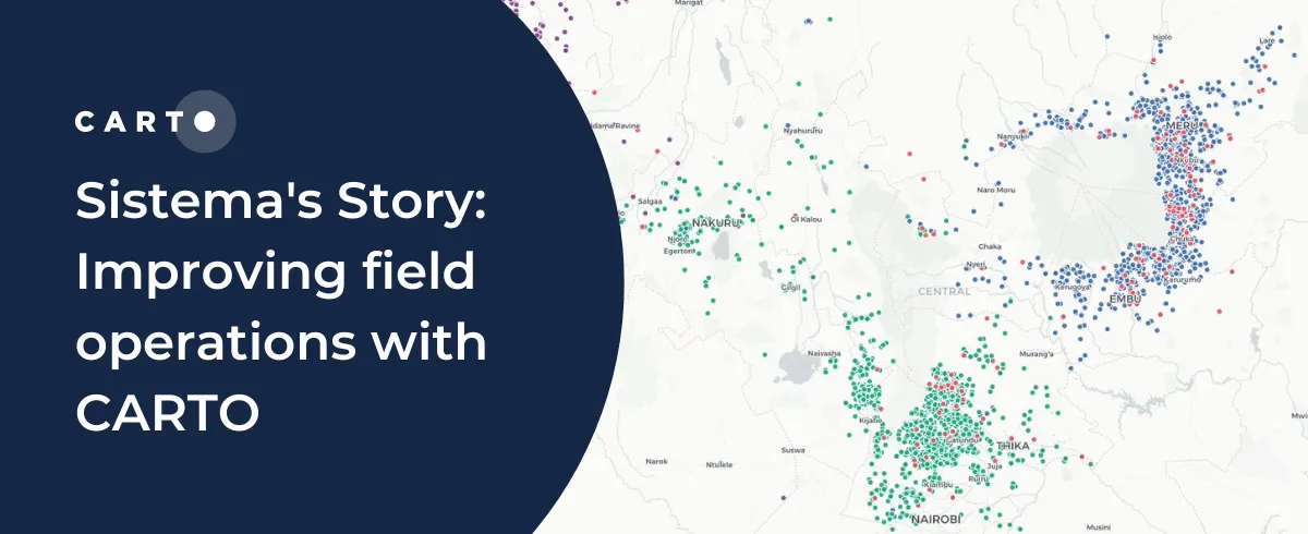
Understand how Sistema.bio is using CARTO to manage and plan their field operations to bring their sustainable biodigester to the world’s smallholders.
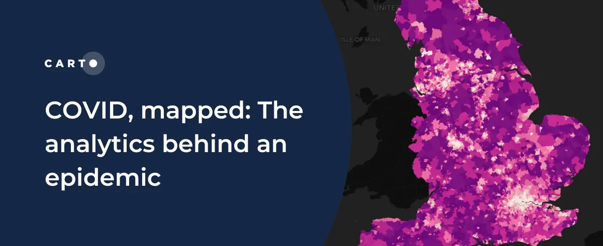
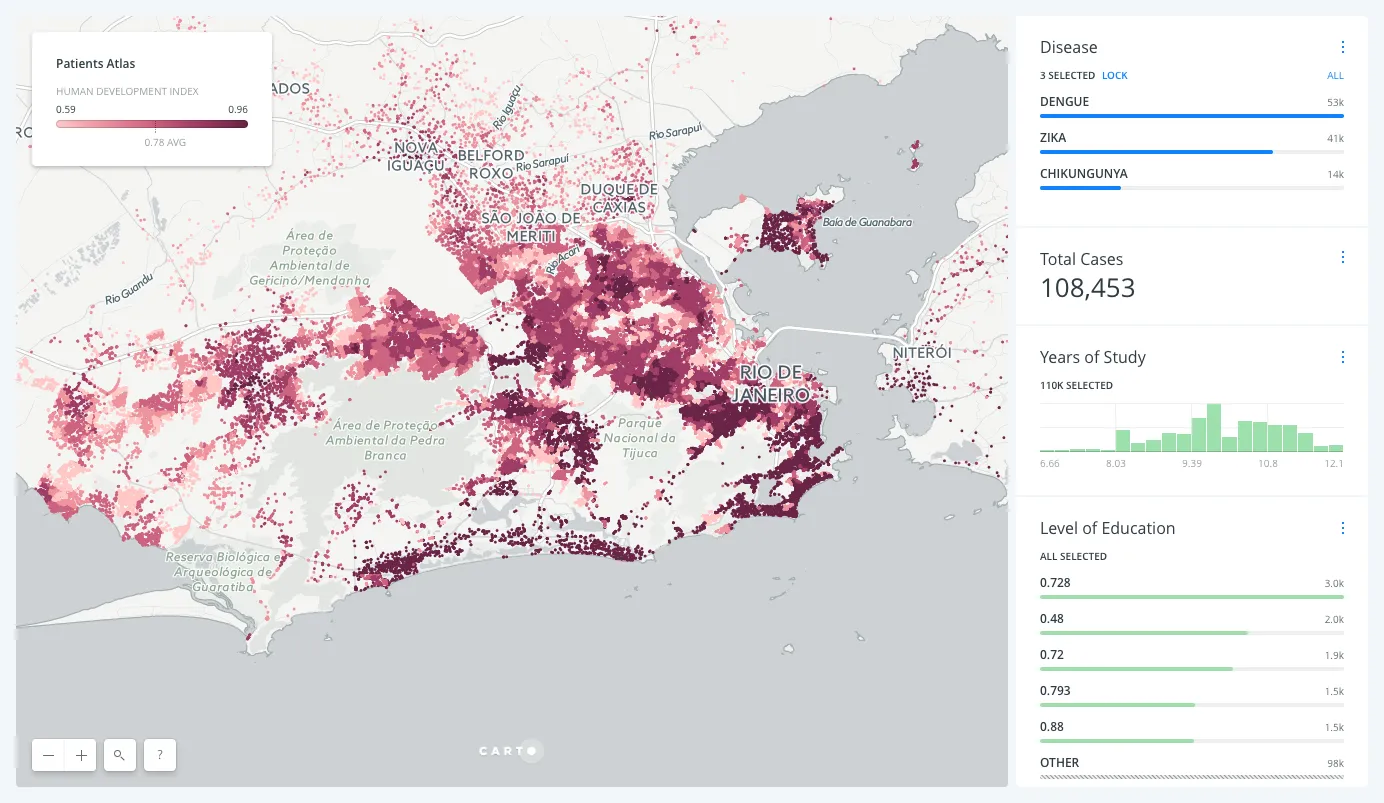
CARTO teams up with ZOE to analyze & predict the spatial patterns of COVID-19to develop a blueprint for understanding the spatial patterns of an epidemic.
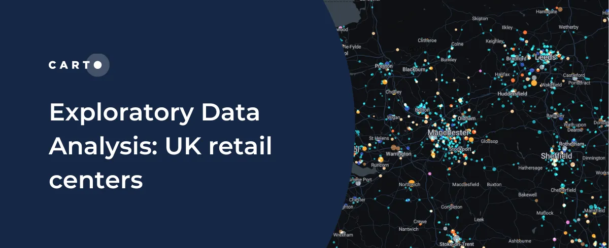
CARTO shares how you can use Exploratory Data Analysis to better understand your data and frame future analysis with CDRC’s latest dataset - UK Retail Centres
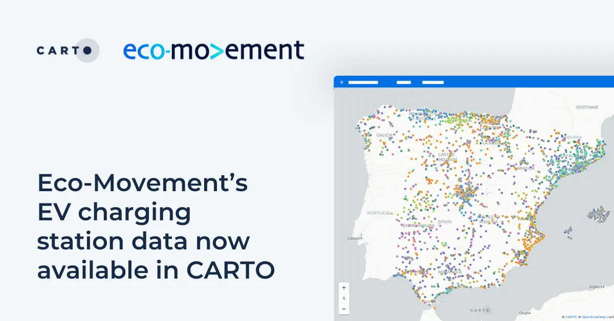
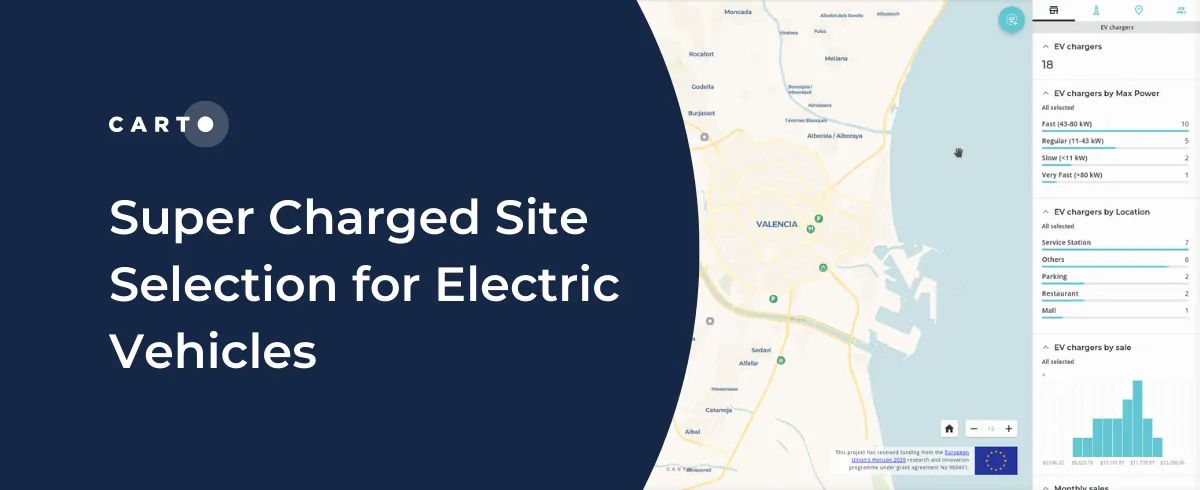
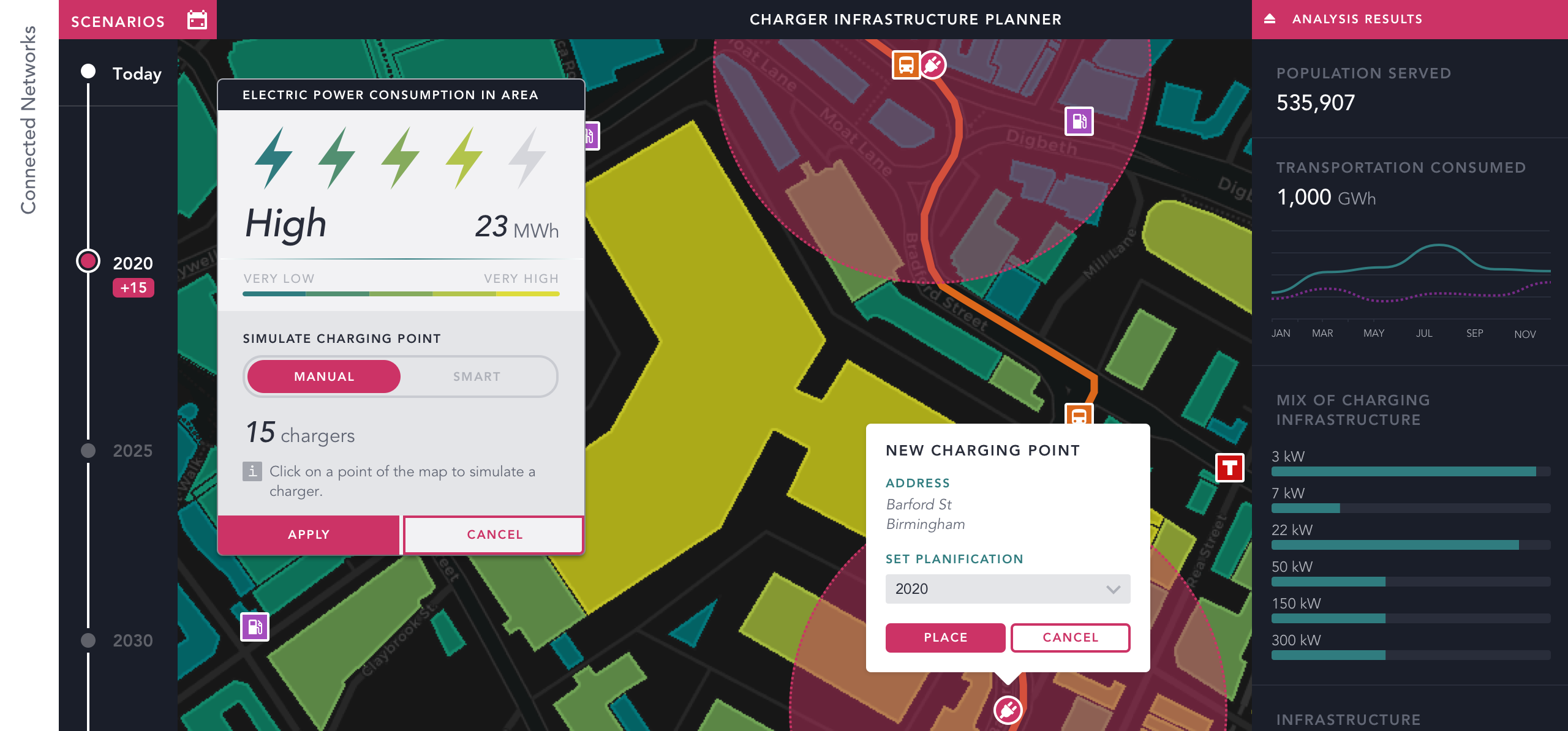
CARTO partners with CITD to understand how Location Intelligence can be used to drive stronger return on investment for Electric Vehicle charging stations.
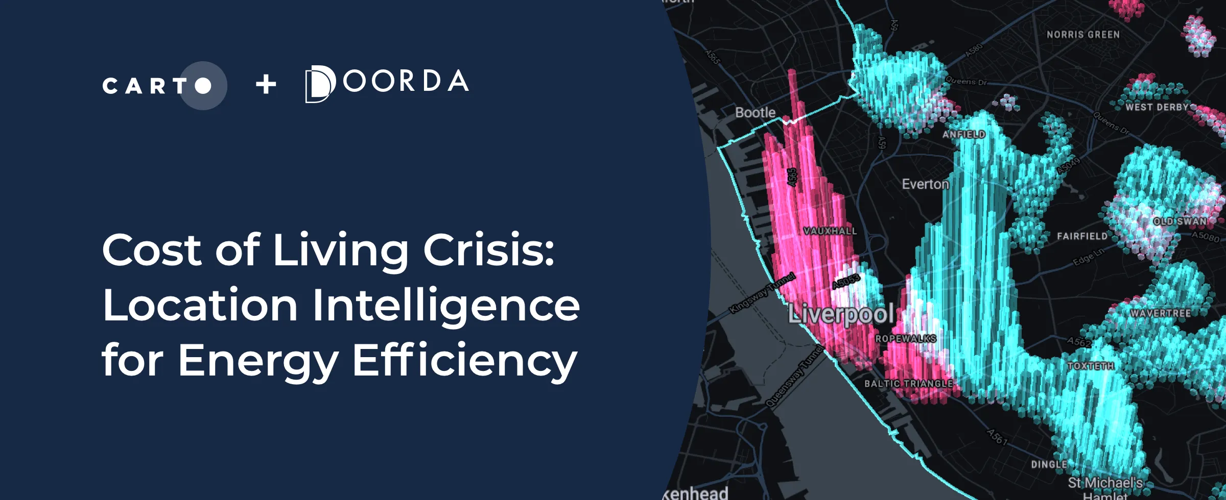
Improved availability & analytics of residential energy performance data will be a powerful tool to help during this crisis. Learn more & see it in action.
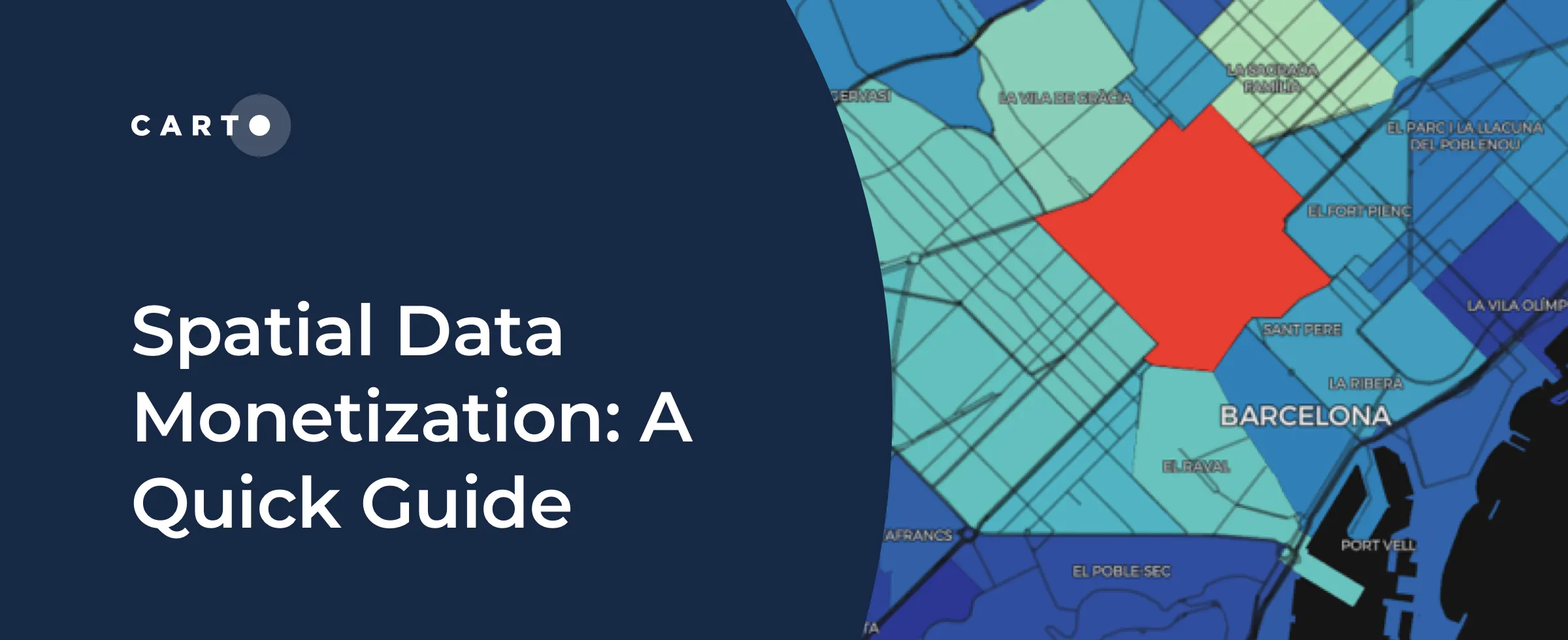
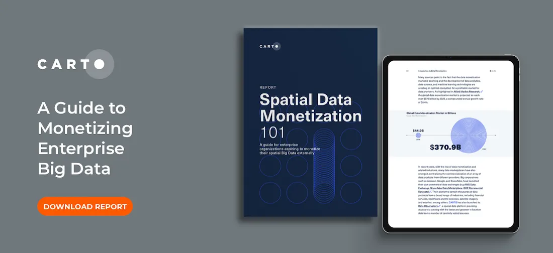
Wondering if you should offer data as a product? Read this spatial data monetization guide. It includes 3 tips for developing a data monetization strategy.
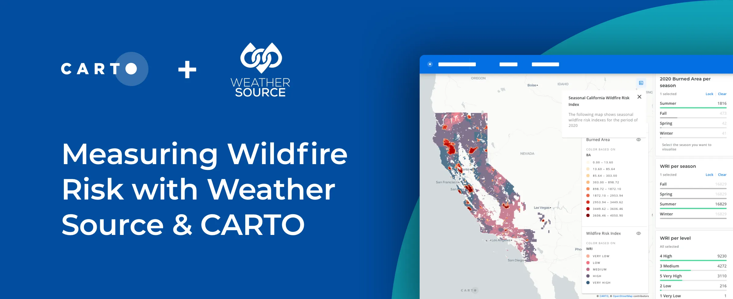
Mitigate wildfire risks with our guide on creating a Wildfire Risk Map. Explore spatial analysis using Weather Source & CARTO for informed decision-making.
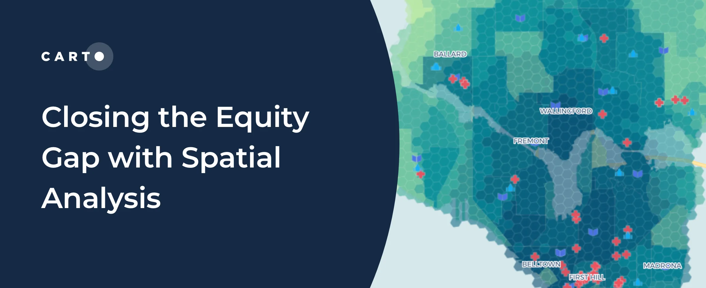
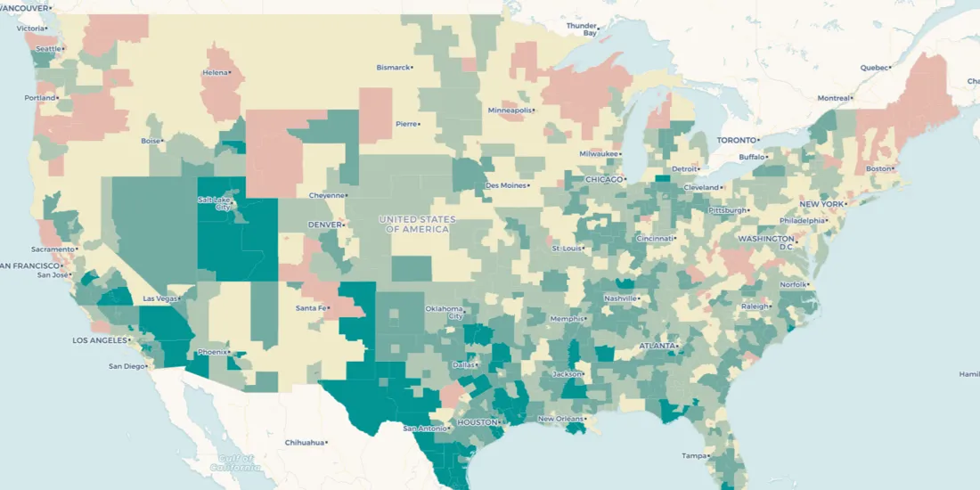
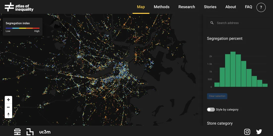
“See how spatial analysis can be used to determine & visualize where access to resources is equitable & inequitable so we can start closing the U.S. equity gap.”
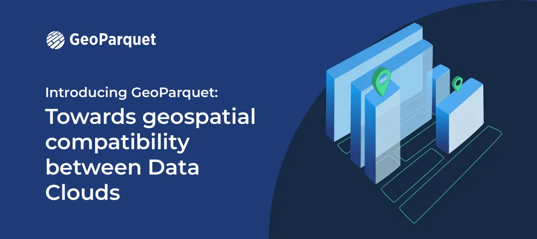
At CARTO, we're proud to release the first community proposal to standardize the storage of geospatial vector data in GeoParquet! Learn about our full goal.
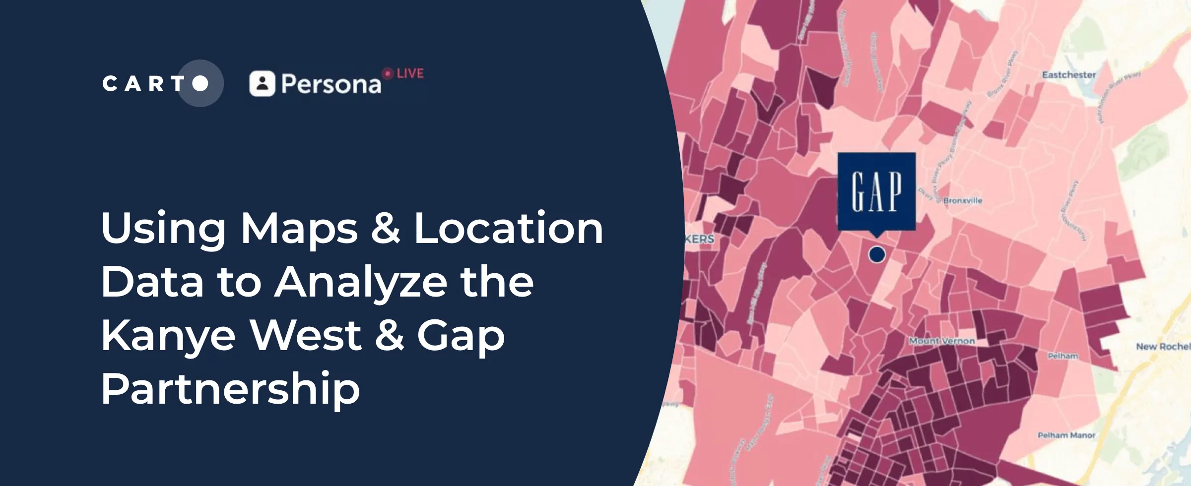
Kanye West's partnership with Gap generated a lot of buzz but how has it affected in store sales & visitation? Find out using maps & behavioral spatial data.
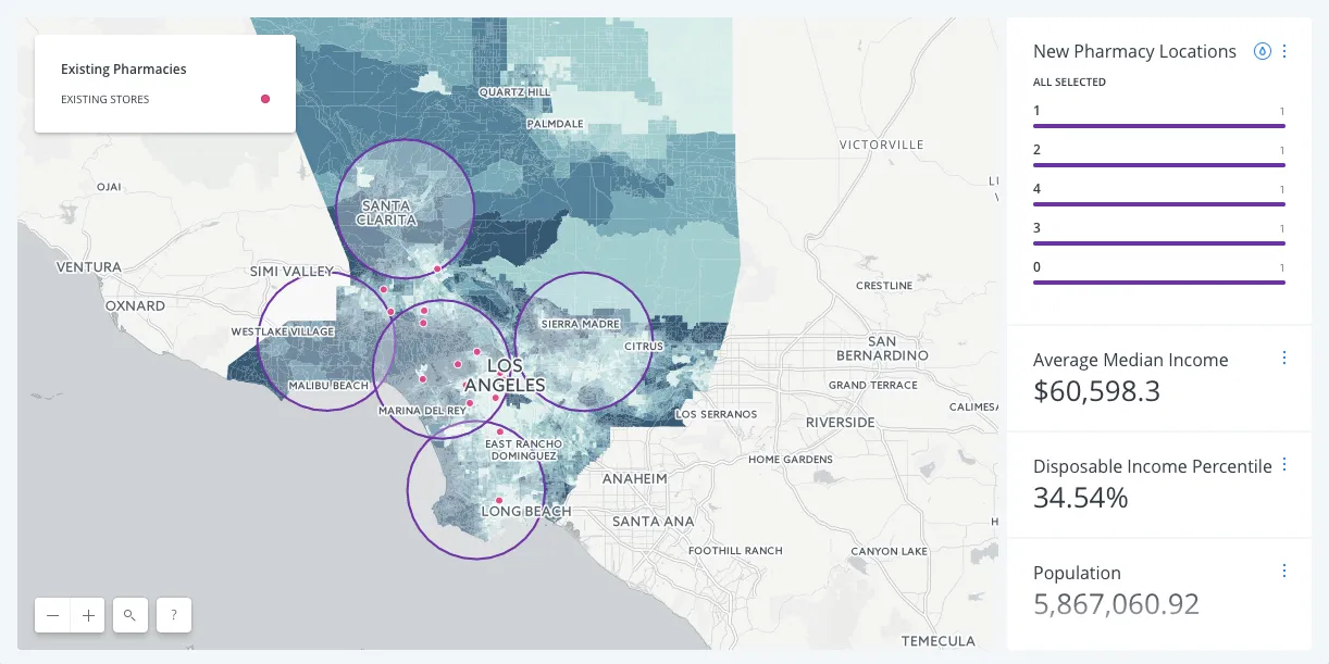
As the world’s population ages, discover how Assisted Living Facility owners & Private Equity can use CARTO for Site Selection to identify new optimal locations
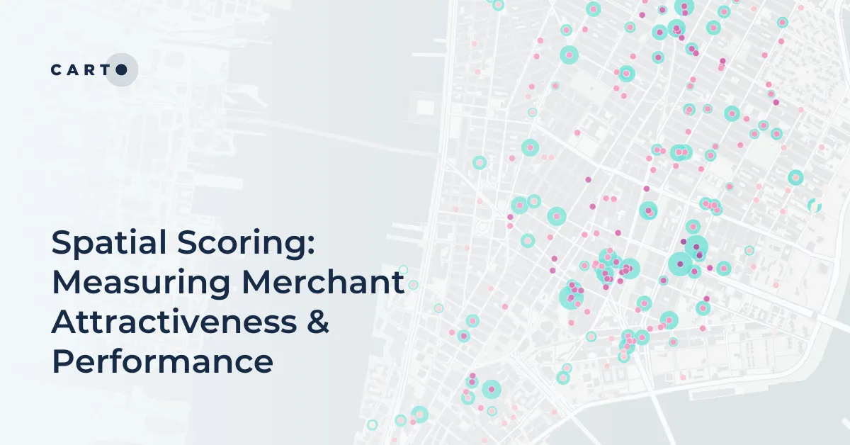
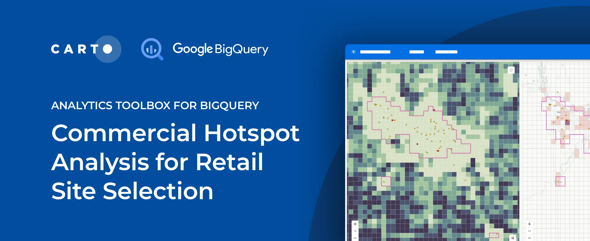
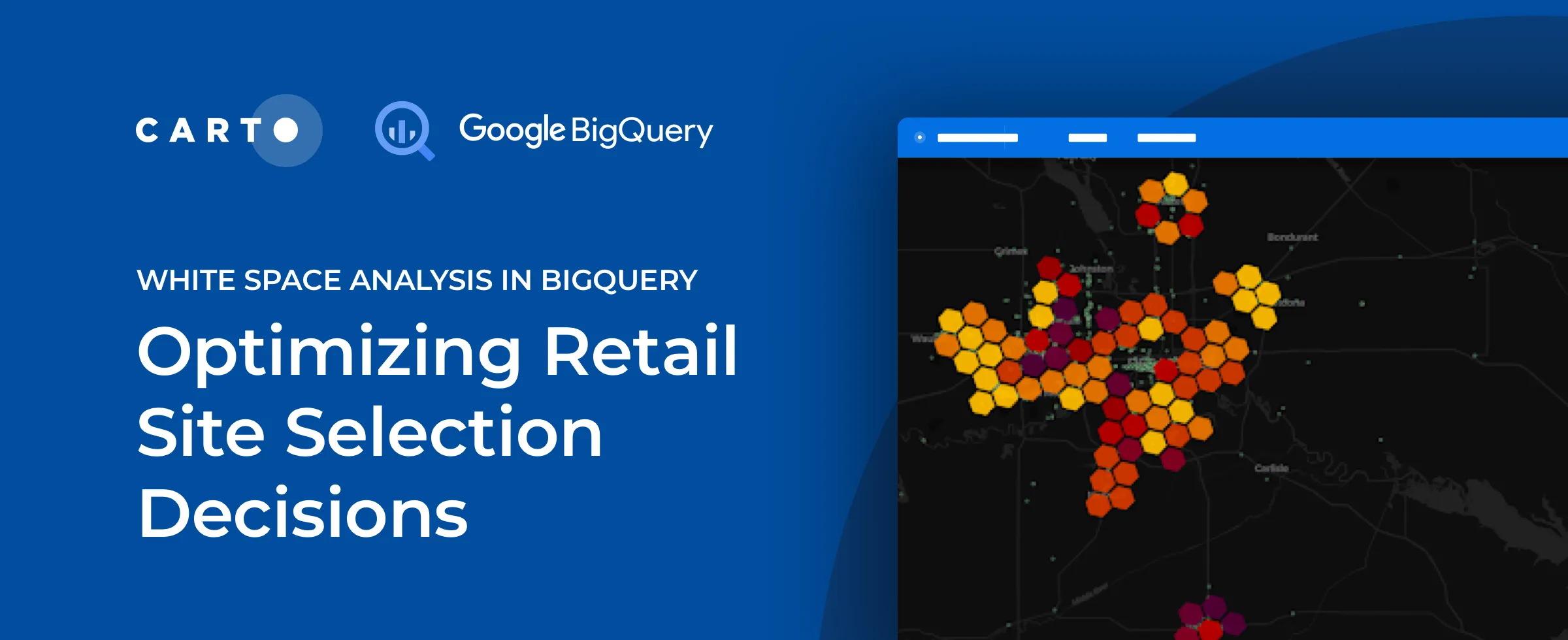
Discover how to use CARTO's Analytics Toolbox for Google BigQuery to train a spatial predictive model to predict annual store revenues across a territory
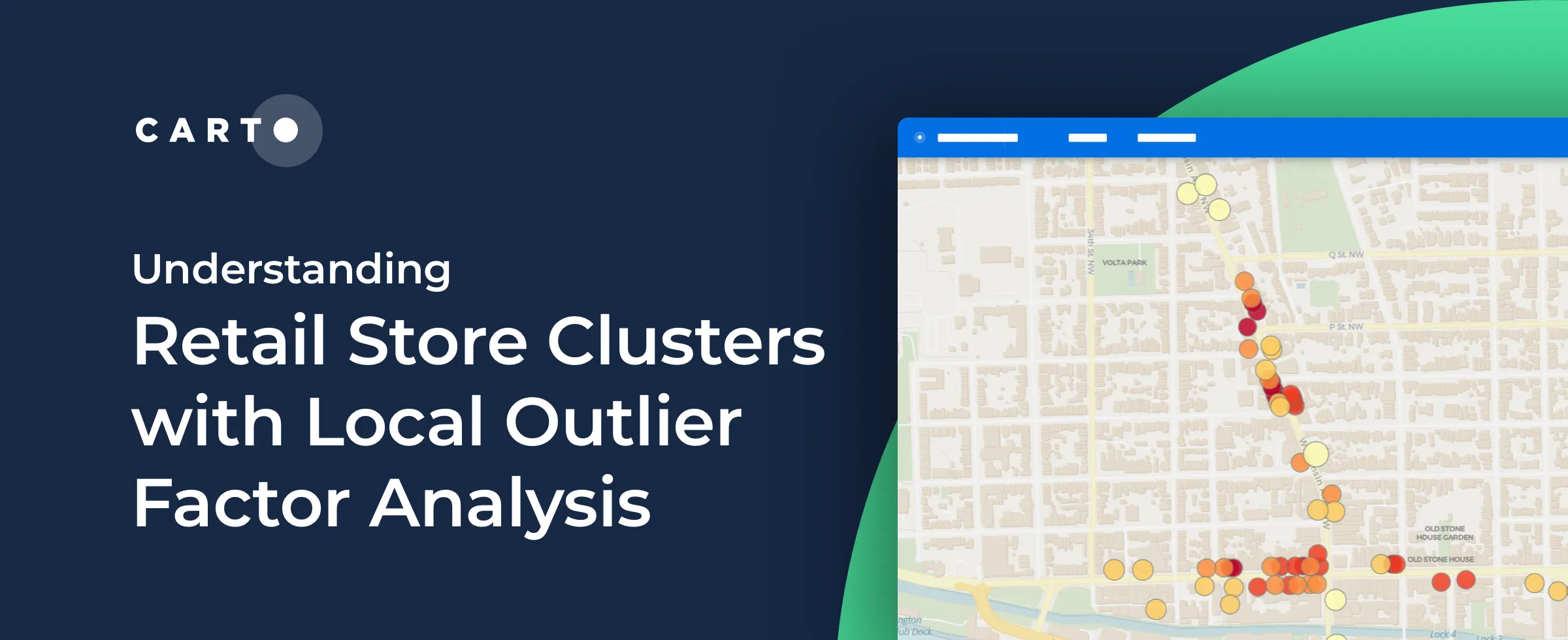
We are pleased to introduce 3 new functions for point data analysis in our Analytics Toolbox for Google Cloud BigQuery: K-nearest neighbors, Local Outlier Factor, & G-function
Discover how retailers can evaluate Black Friday & holiday sales performance using hotspot analysis, Safegraph foot traffic data, and the CARTO platform.
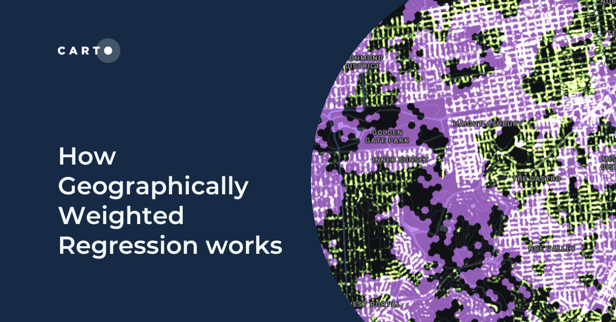
We are pleased to announce that the CARTO Analytics Toolbox for BigQuery now supports the Geographically Weighted Regression method–read about its usage.
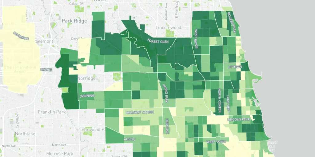
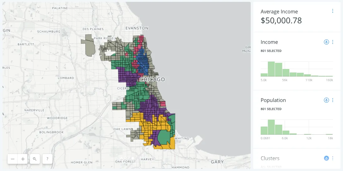
Learn how the University of Chicago built a tree equity solution to understand the impact that tree canopy cover has on social & health outcomes in the city of Chicago.
Earlier this year many petrol stations in some parts of the UK ran out of fuel. Discover what location data can tell us about the real story behind the long queues.
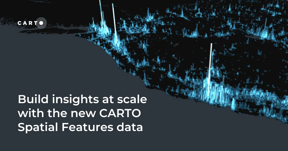
We are pleased to announce the release of a new version of CARTO Spatial Features, including new variables for urbanity level, elevation, & climatology
We are pleased to announce that we have been selected to participant in phase 2 of AI4Cities, a project to help cities accelerate their transition towards carbon neutrality
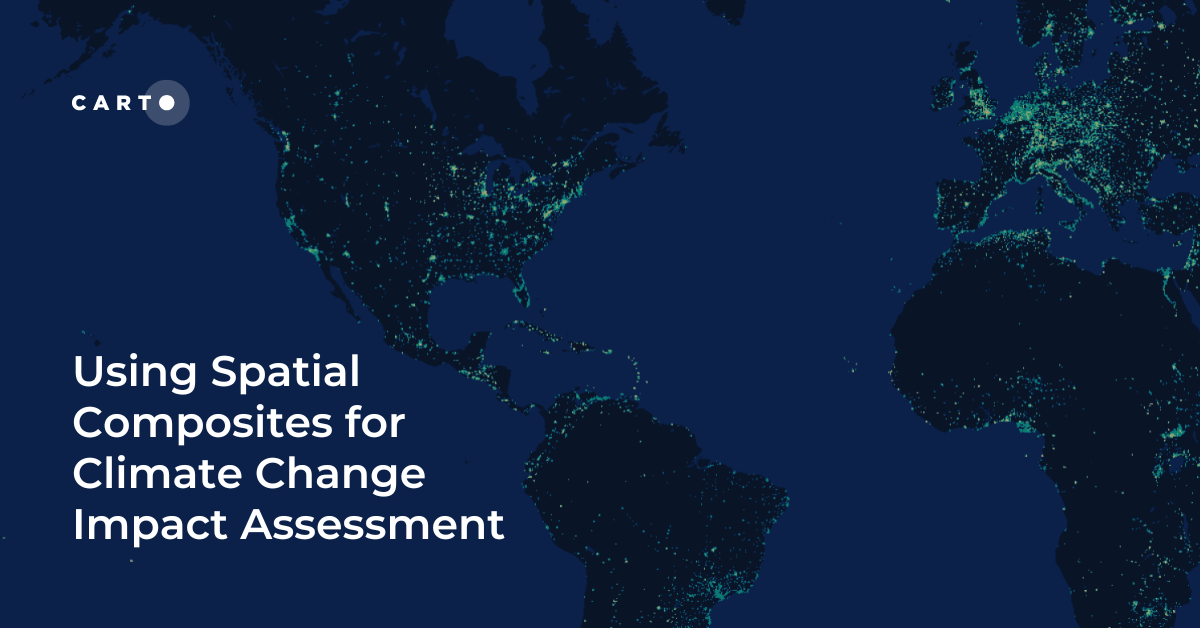
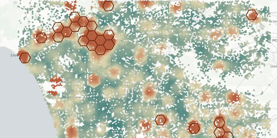
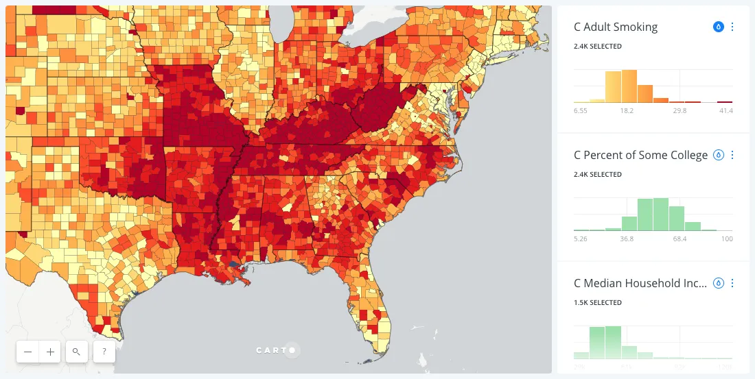
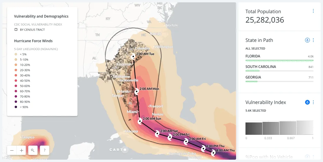
Climate change is contributing to extreme weather with increasing bursts of hurricanes, wildfires, & floods. See how maps can help plot, predict, & protect.
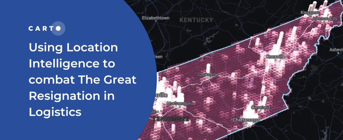
The disruption of global trade flows & a shortage of drivers has led to a global supply chain crisis. Read how Location Intelligence can be a road out of the crisis.
Wind energy is poised to be a significant contributor to national decarbonization goals, while there is enough wind available to power the nation, local siting challenges could have national implications. See how NREL is using location intelligence to better understand wind potential and it’s interaction with national clean energy targets.
18 months since CARTO made it’s platform free to public & private sector organizations fighting coronavirus, we look back at some of the hundreds of grants.
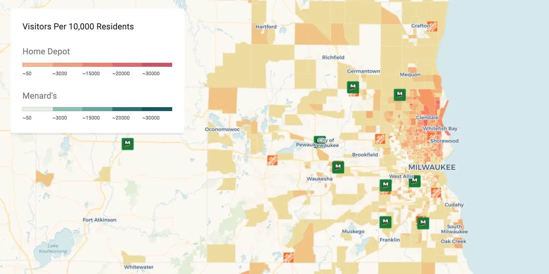
Discover how Point of Interest (POI) data can be used to uncover site selection strategies of leading brands in the US including McDonald's, Starbucks, & Subway
We are pleased to announce our partnership with CKDelta & the inclusion of their human mobility data within our Data Observatory. Learn more & see key use cases.
Discover our Scientific Committee's latest insights when they gathered recently to discuss human mobility data topics including representation, bias, & privacy.
We are pleased to announce our partnership with The Data Appeal Company, a leader in POI & visitor sentiment data, & their inclusion in our Data Observatory
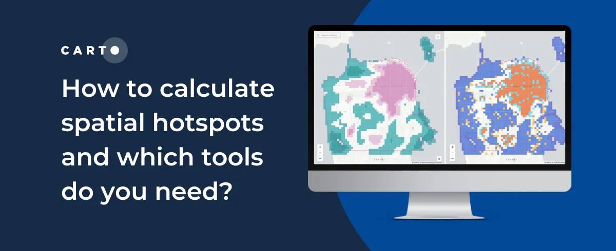
Index, or Z Scores, have often been used in geospatial analytics to identify hotspots & rank locations. Discover how to visualize them using Google BigQuery.
Learn about SPEED 2.0, a collection of spatial datasets wrapped into one app for the purpose of helping individuals identify environmental issues in New York City
Hand washing is key in the fight against COVID-19 but in Brazil water access can be an issue. Discover how Location Intelligence can be used to analyze the impact.
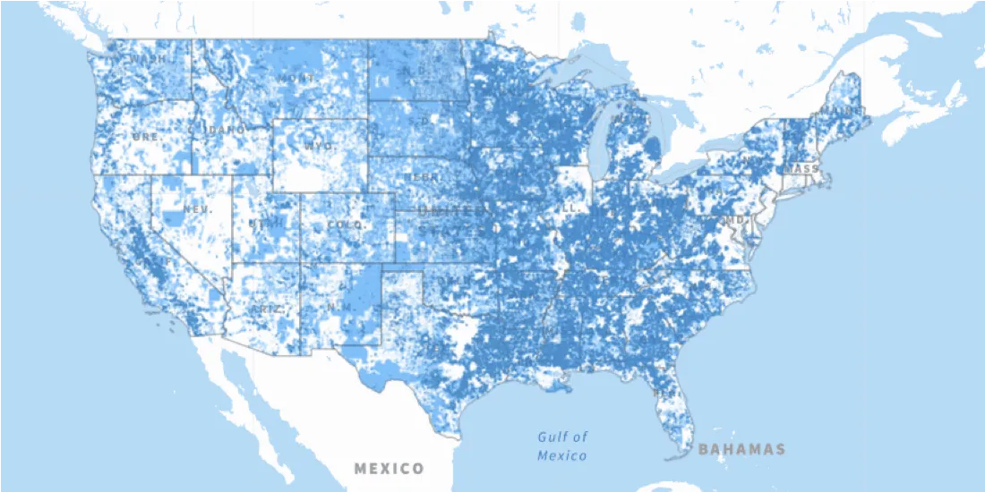
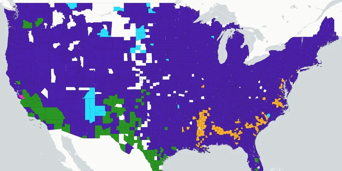
The Connect America Fund aims to close the digital divide between rural & urban America. Learn more about it's impact with a newly updated map from the USAC.
We are pleased to announce that we have been selected to participant in AI4Cities, a project to help cities accelerate their transition towards carbon neutrality
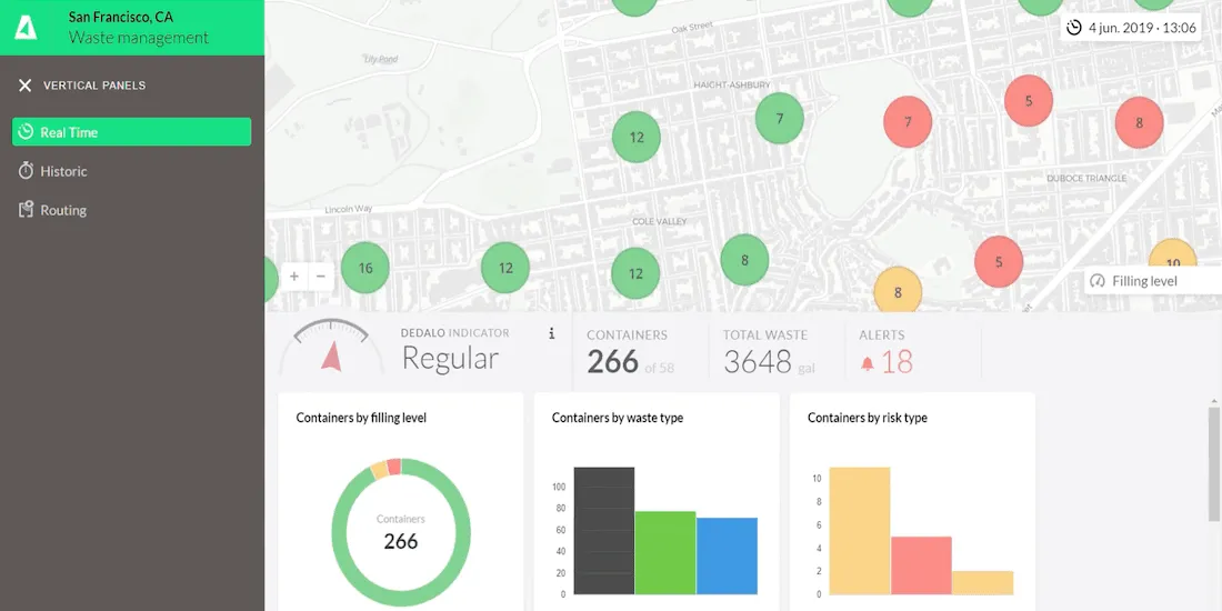
The pandemic has significantly affected waste management in our cities - read how Location Intelligence can be used to optimize collection & reduce costs.
How can Location Intelligence be used for Sustainability? Discover some examples including sustainability for agriculture, environment, mobility, cities, & more
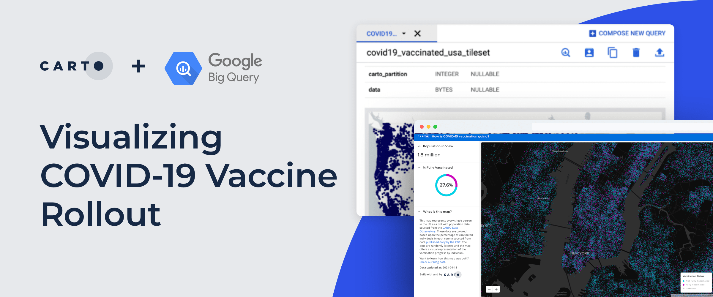
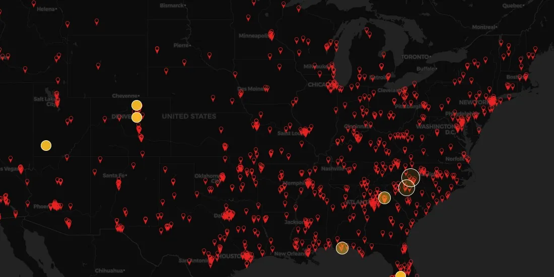
Recently we published a map to track the COVID-19 vaccination rollout in the US–learn how this Cloud Native Spatial App was developed using CARTO & Google Cloud
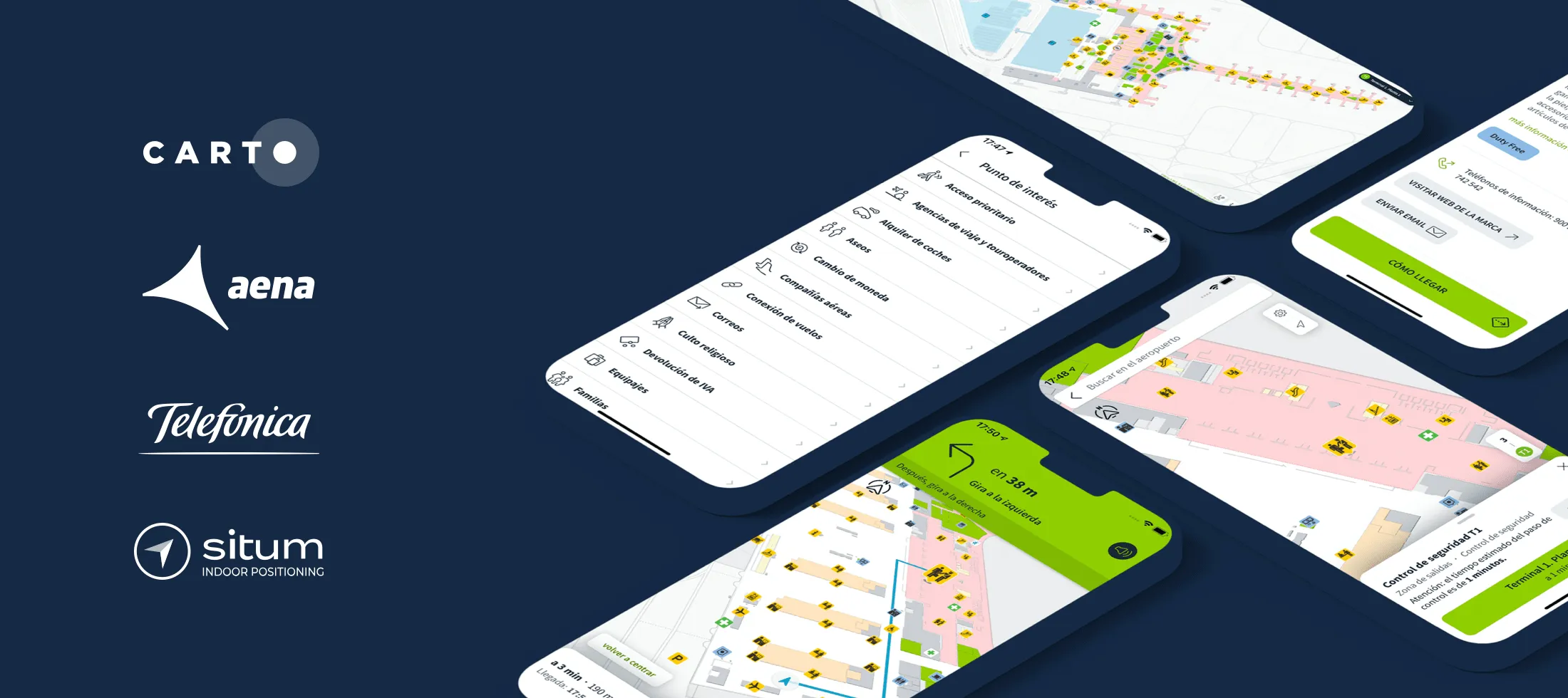
AenaMaps, a solution developed by CARTO, Telefónica, & Situm, leveraging indoor mapping to provide navigation within Aena's airports expands to Barcelona
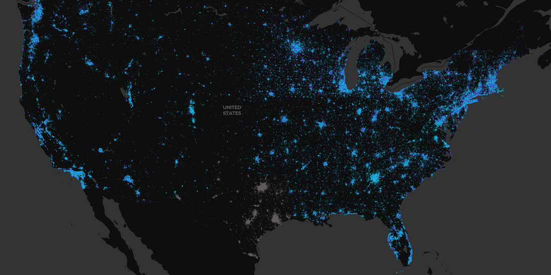
How is vaccination progressing in the US at an individual level? Find out using our interactive COVID vaccination tracker app visualizing every person in the US
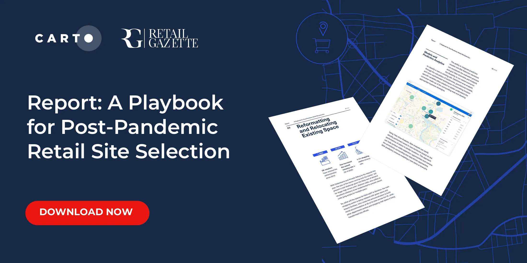
Download our new report on site selection strategies & how location data & advanced spatial analysis can help retailers adapt & thrive in a post pandemic world
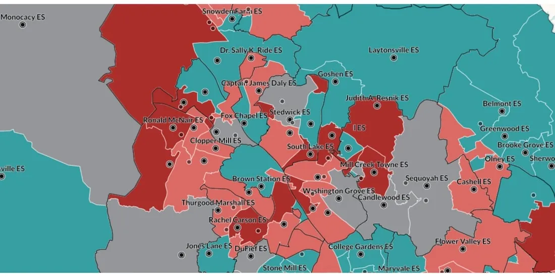
Read how WXY, an architecture, urban design, & planning firm, built an interactive school district dashboard for Montgomery county using the CARTO platform
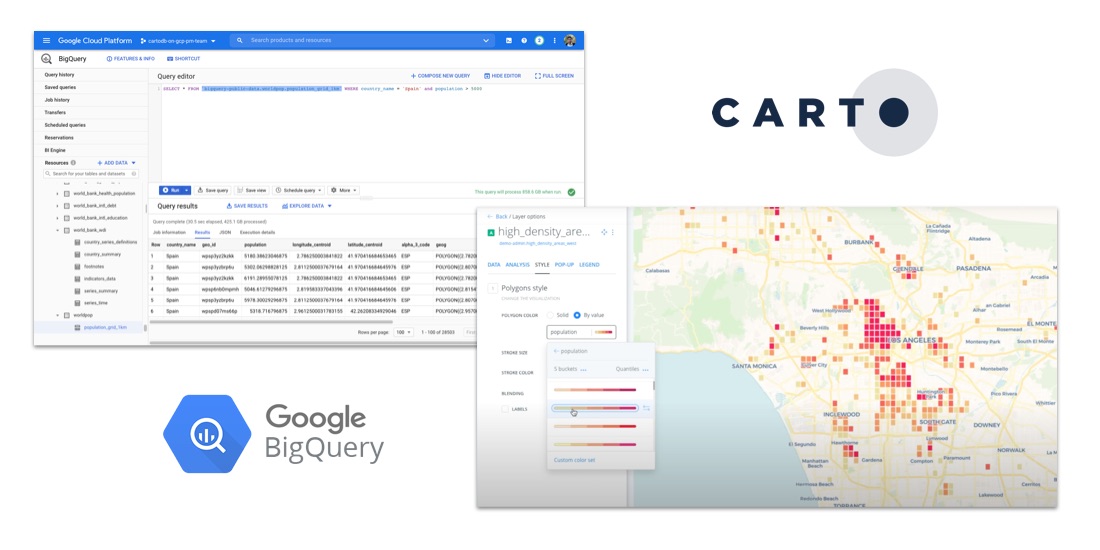
Discover how to scale your analytical workflow & access massive geospatial datasets with Google Cloud & CARTO & the general availability of BigQuery Tiler
As COVID vaccines become more widely available we look maps analyzing the rollout & supply chain optimization for an efficient & equitable immunization strategy
We are pleased to announce our partnership with Foursquare, leaders in location technology, & the inclusion of its POI & foot traffic data in our Data Observatory
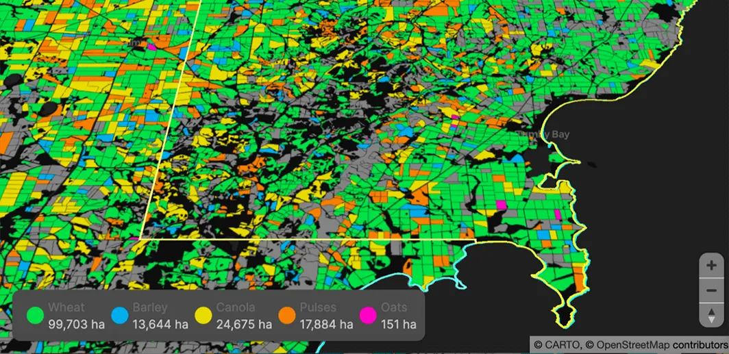
Read how our partner NGIS built a spatial web application, CroppingHub, to detect crop types & predict crop yield using cloud computing & machine learning
As many parts of the world enter into recession following the Coronavirus pandemic, read how Spatial Data Science can help identify areas with a greater risk
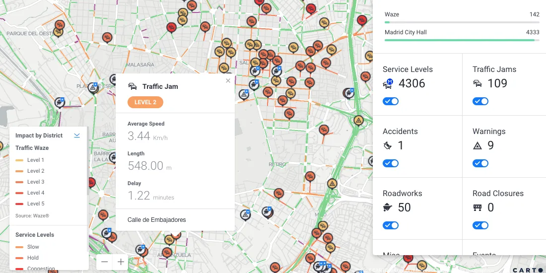
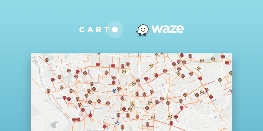
Learn how to import Waze for Cities traffic big data into CARTO using our Google BigQuery Connector for easy analysis & visualization in our step by step guide
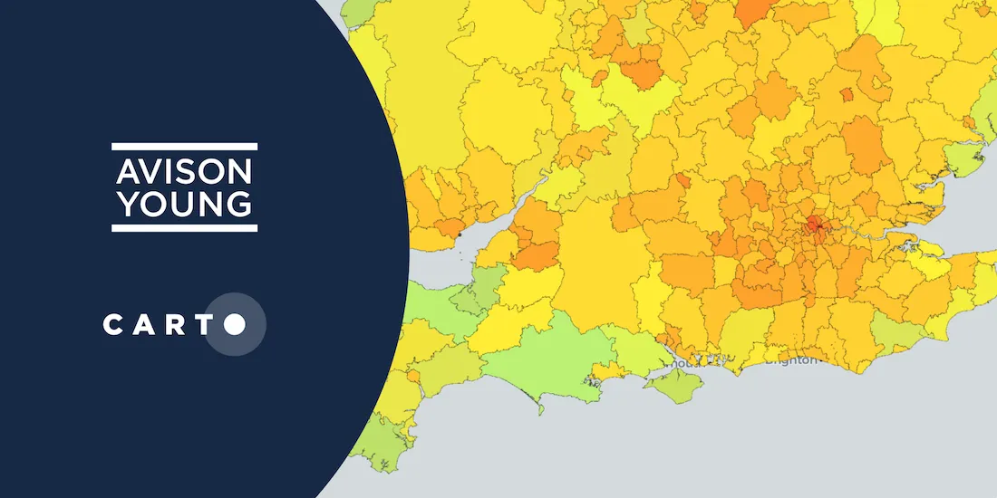
Explore Avison Young's UK Cities Recovery Index, monitoring commercial real estate rebound post-pandemic, analyzing diverse sectors, and predicting recovery trajectories.
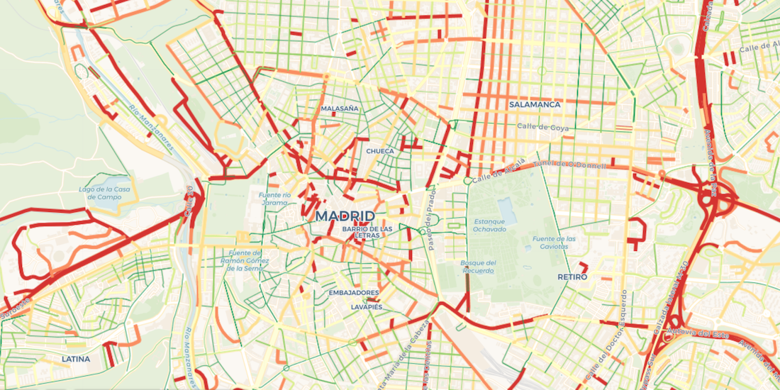
Road traffic injuries are a leading cause of death & have a big economic effect. Read how Spatial Data Science can identify dynamic hotspots & reduce accidents.
With COVID-19 vaccines requiring strict storage, ensuring an efficient cold chain transportation network using spatial will be key for effective distribution
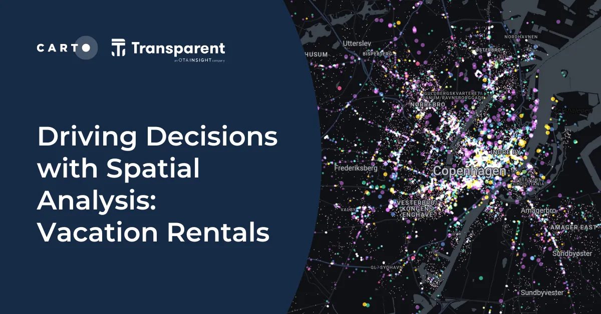
We are pleased to announce our partnership with Transparent, a leader in short-term rental intelligence, & the inclusion of their data in our Data Observatory
With COVID-19 causing dramatic shifts in consumer spending behavior, DIY & other retailers can leverage geospatial data to discover new revenue opportunities.
Modern Distribution Management, encompassing supply chain network design & logistics optimization, is going through a transformation. See why spatial is key.
Learn how to visualize geospatial Big Data hosted in Google BigQuery by creating a CARTO instance on the Google Cloud Platform & using our BigQuery Connector.
Download our data monetization guide on how to transform big data into a viable product. See how leading enterprise CDO / CTOs from Vodafone & Mastercard do it.
We are excited to announce a new release of CARTO's Data Observatory giving users the ability to explore, subscribe, & manage thousands of spatial datasets.
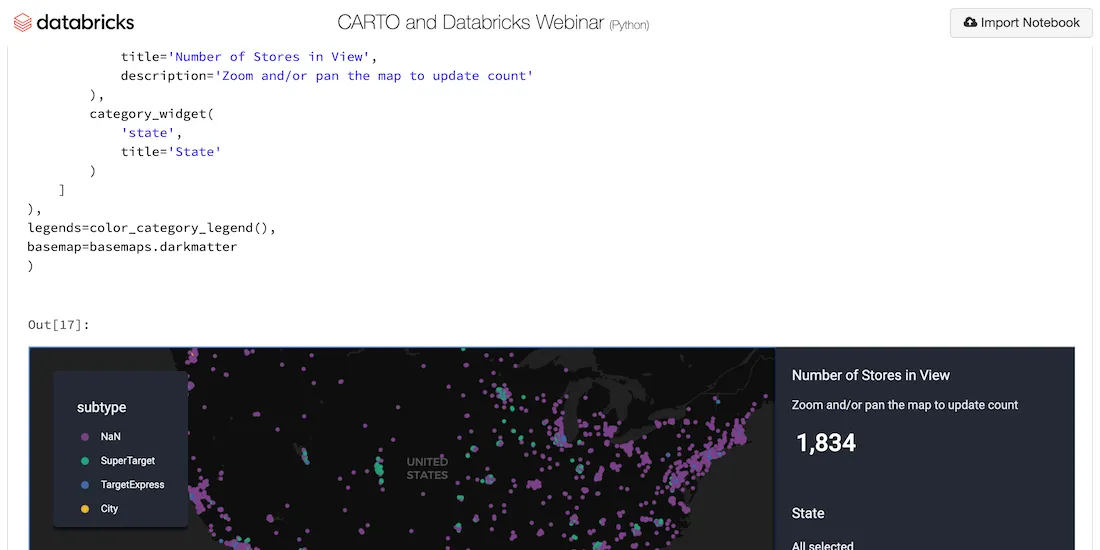
Explore examples of Databricks & CARTO together as part of a collaborative Data Science process including visualizing Big Data sets & creating ETL pipelines.
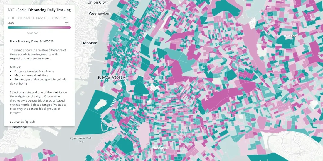
A detailed geospatial analysis of how changes & regional disparity in human mobility during the COVID-19 lockdown can be related to socioeconomic indicators.
Read a summary of the DeepFin (where Fintech meets Deeptech) Investor Masterclass we recently held with J.P.Morgan, a leading global financial services firm.
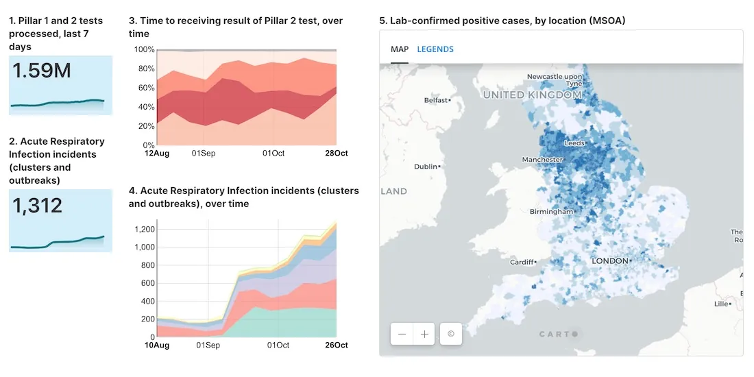
See how private & public sector organizations use Google Cloud Platform with CARTO to share insights & map visualizations relating to the coronavirus pandemic.
Within Retail Data Analytics we combine social media & credit card data to see how retailers can gain key market insights, optimize footprints, & boost sales.
Michael Bauer International's wide range of spatial data is available through CARTO's Data Observatory to provide socio demographic insights & digital boundaries.
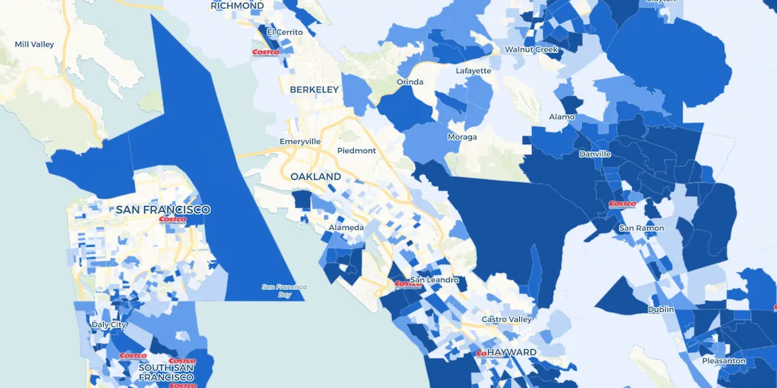
With many retailers consolidating stores & focusing on curbside pickup, comparative market analysis real estate can identify twin areas to maximize revenue.
One of our partners, makepath, describe how to use multiple open source spatial libraries for COVID-19 analysis focusing on the US meatpacking industry.
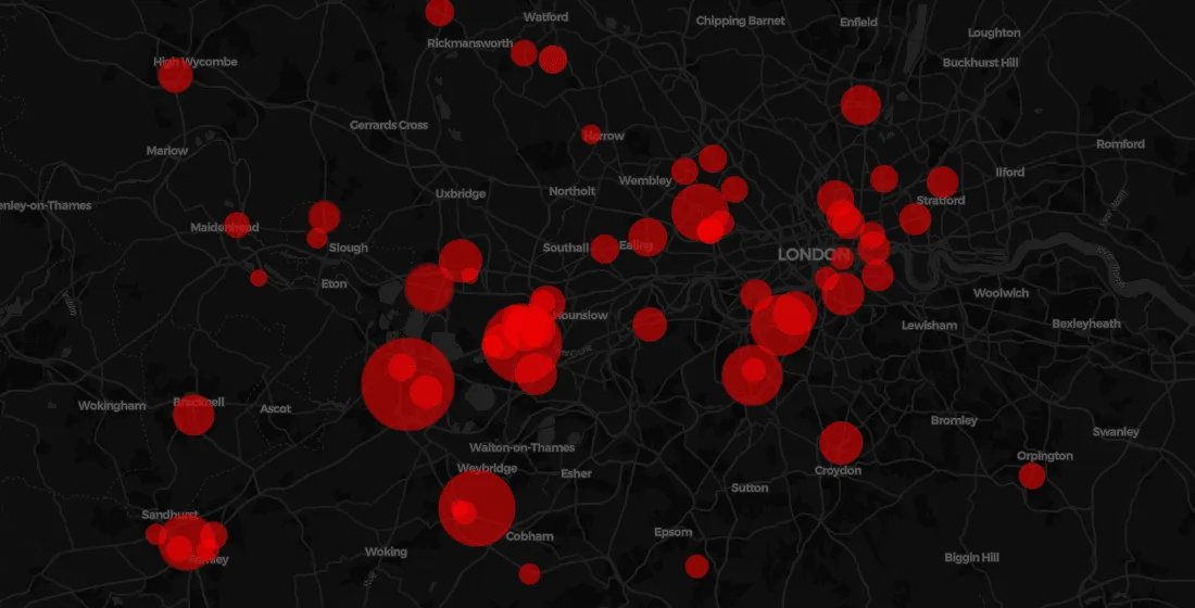
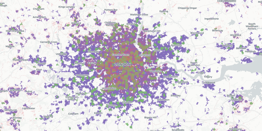
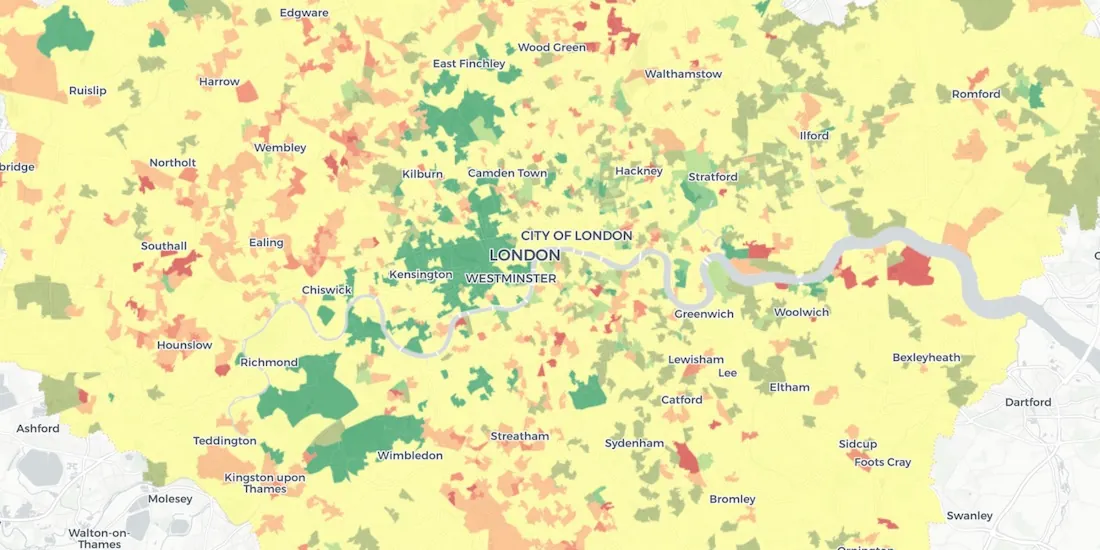
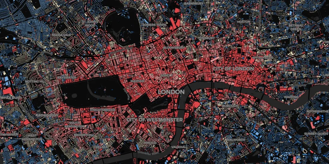
We explore Howsy's research on walk to work rental hotspots across London, with consumers looking to ditch mass transit as they look to change their new normal commute.
To enable safe social distancing cities are pedestrianizing urban areas & building infrastructure for greener transportation & micromobility. Discover how location data can help.
Location Data Streams from Apple, Unacast, Safegraph, & others now available for Spatial Analysis in our Data Observatory to aid in post COVID-19 recovery.
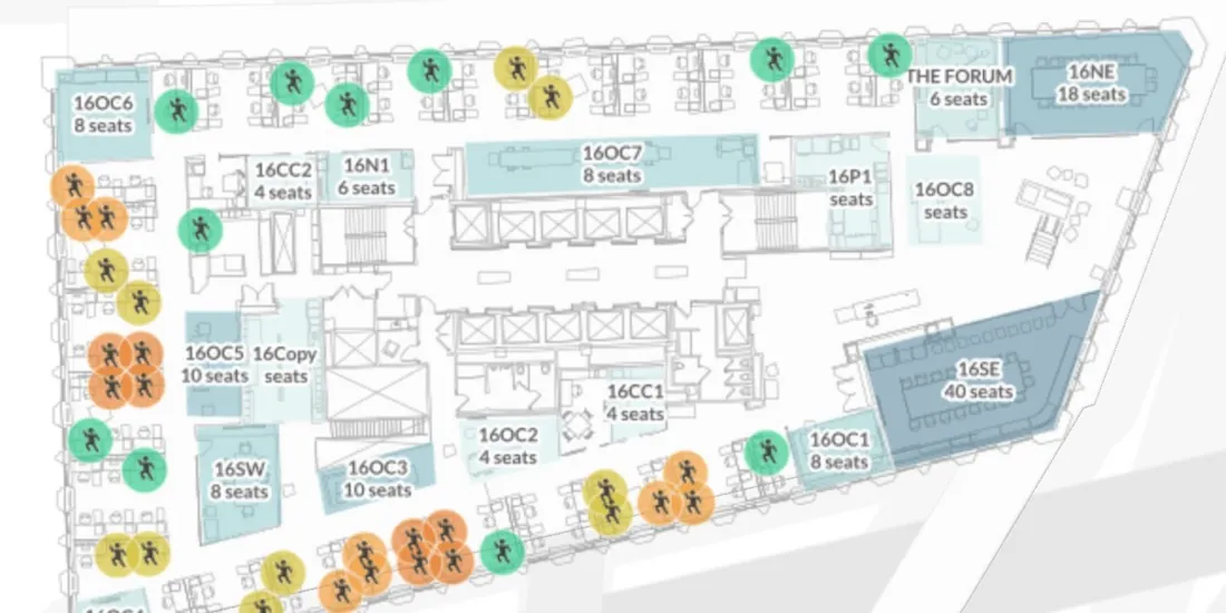
We explore how GIS Indoor Mapping Software can help organizations on their return to work, ensuring best practice in social distancing & contact tracing.
Geosocial Data is now available in CARTO through our partnership with Spatial.ai. See how location-based social media data can be used in spatial analysis.
Everyone has the same question: when will we return to normal? Spatial analysis has helped immensely to contain the spread, now how will it help us recover?
#StudentsAgainstCorona is a platform supported by our grants program enabling the pairing of volunteers with the elderly & vulnerable individuals who need support through the Coronavirus lockdown.
Trusted, business-ready data for the UK is now available in CARTO through our partnership with Doorda. These datasets will reduce data cleaning and prep time and allow you to get straight to analysis.
Leveraging Spatial Analysis techniques, researchers from the University of Chicago and the AHA worked to define and visualize the social determinants of health in America.
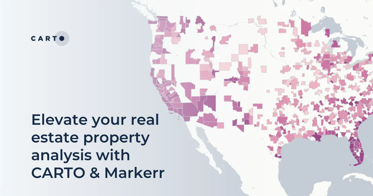
Real Estate Market Analysis needs to be data-driven, and given the spatial nature of Real Estate investment, you want the data that you are leaning on to be spatial data
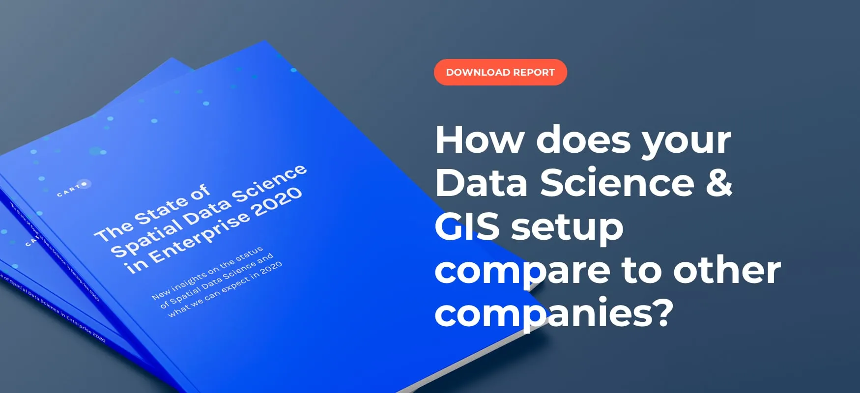
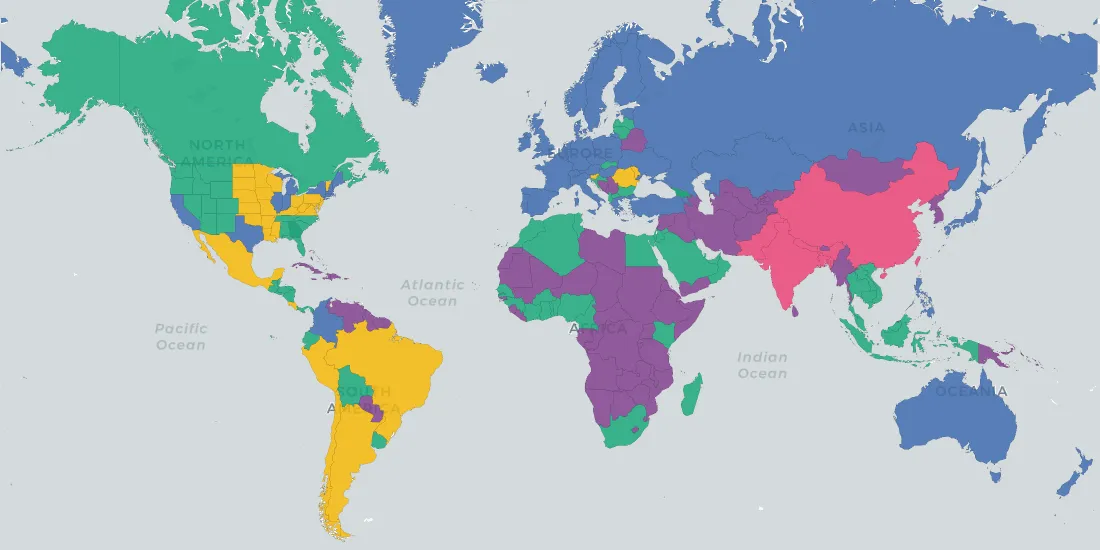
Discover key insights from our survey of how enterprise leaders from industries like Real Estate, Financial Services, Advertising and more are engaging with Spatial Data Science in 2020
From Autonomous Vehicles, to Digital Twin, to Human Augmentation, new technology is set to change the world and the Location Intelligence industry is no different.
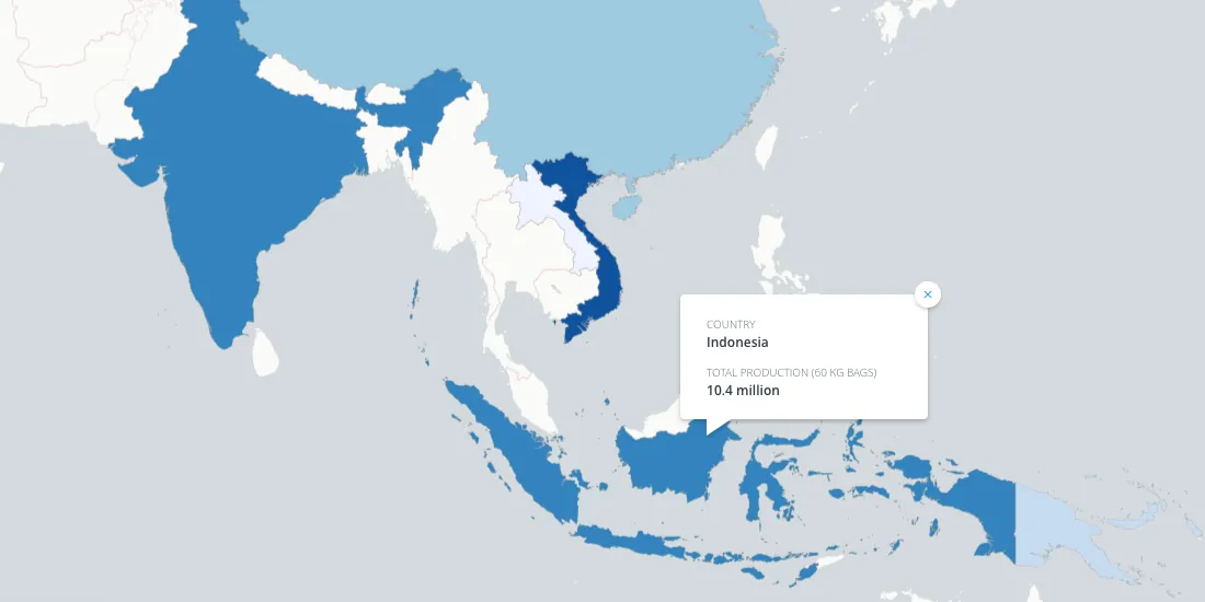
Enveritas leverages Location Intelligence to visualize global coffee production and poverty levels among farmers, as they work towards a more sustainable global coffee industry
In anticipation of COP25, we wanted to explore some of the ways that spatial data analysis can help to achieve the SDGs and invite you to several events to discover it yourself!
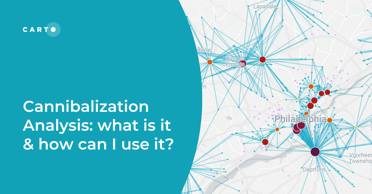
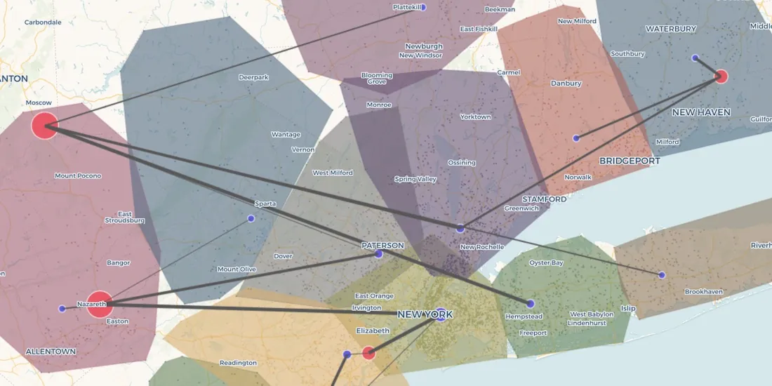
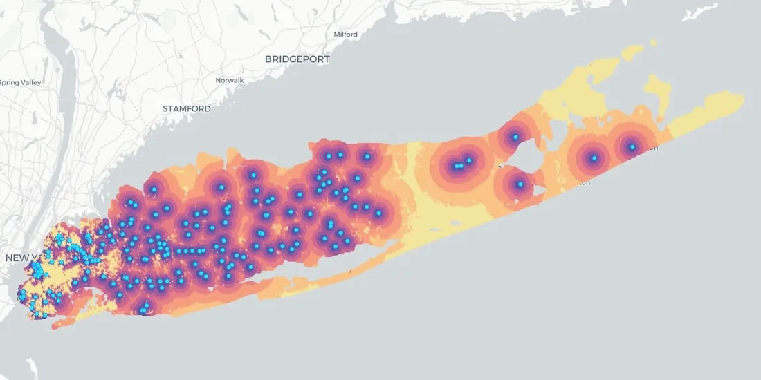
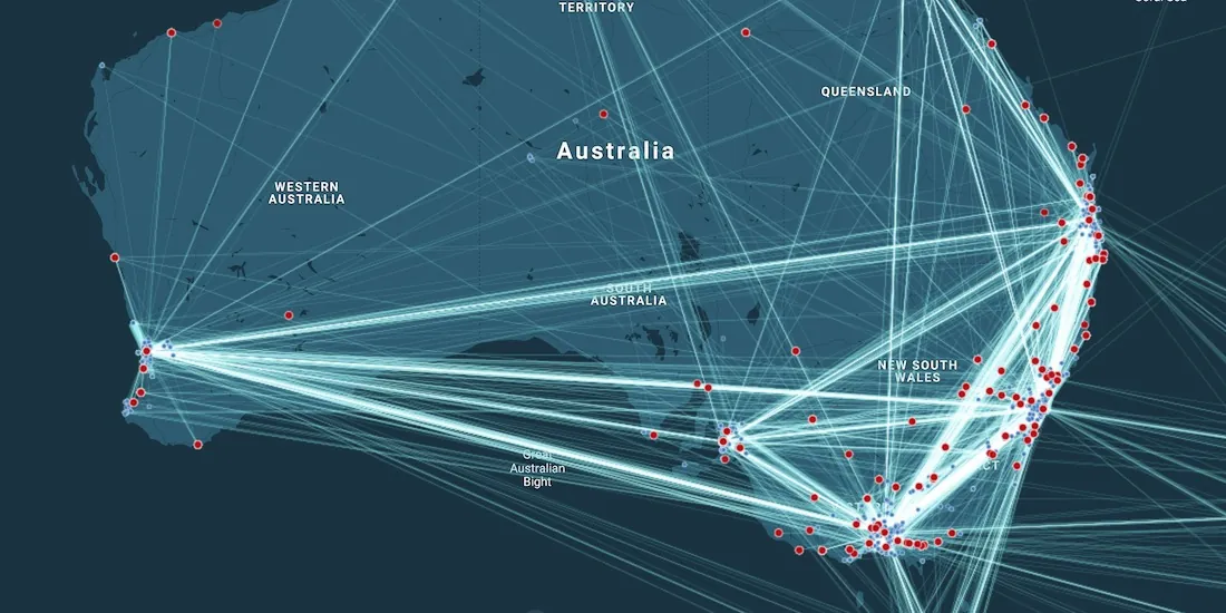
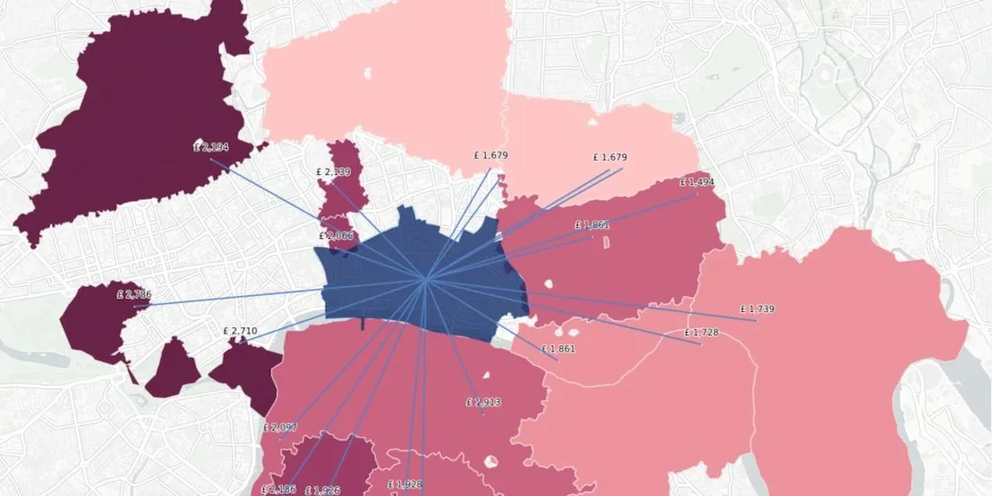
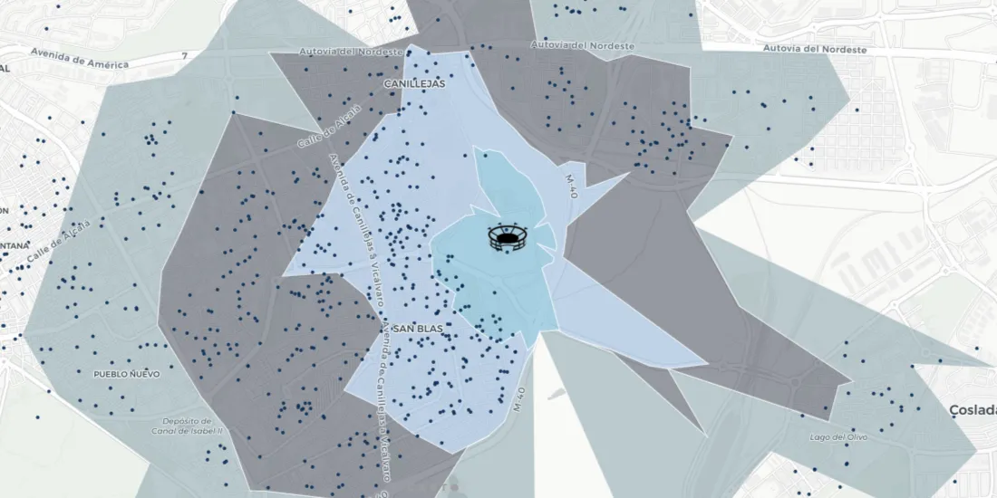
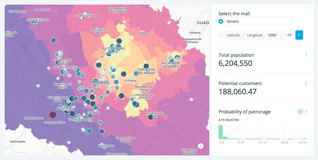
Traditional approaches like isochrones or buffers fail to capture where people visiting a specific location actually come from. Learn how to build better Catchment with Human Mobility Data.
Which types of funds invest in spatial analysis? How do they use location data in screening & portfolio management? We discuss the role of Data Science.
We’re introducing Data Observatory 2.0, the latest version of our spatial data repository that will make spatial data more accessible and faster to manipulate for Data Scientists and Analysts across the globe.
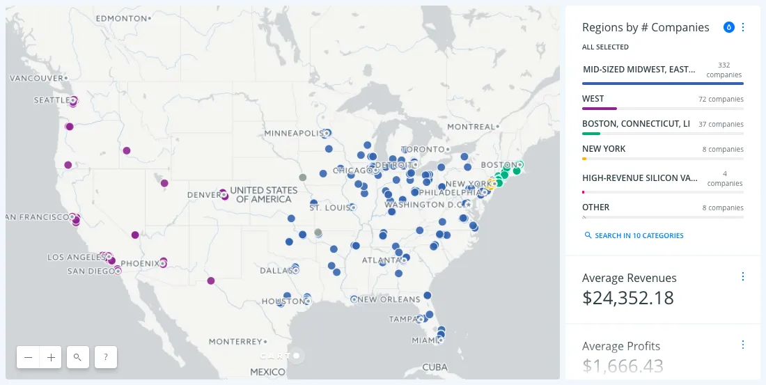
Predicting store revenues is critical, allowing retail leaders to stay agile, make informed decisions around current store operations, and plan the most effective new openings. The most accurate prediction models include the location component.
From meeting fluctuating customer demands and scheduling services, to proactively optimizing workflows to minimize risks in case of extreme events, weather-related data represents a huge asset
It started out as a joke-event on Facebook but 2 million registered event attendees later September 20th 2019 the scheduled date of 'Storm Area 51 They.
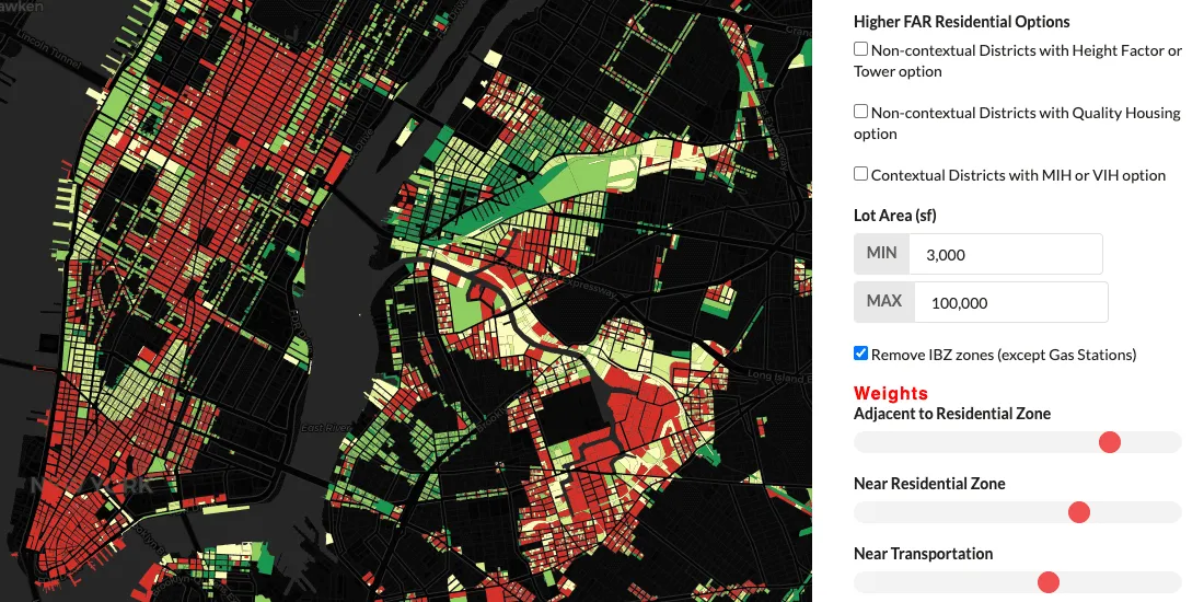
Uncover deeper insights beyond ZIP codes with geospatial analysis. Explore the limitations of ZIP codes and discover alternatives for spatial understanding.
News of a rising cannabis industry is nearly impossible to avoid these days as global perception and regulatory structures have changed dramatically over.
Sage Research Methods is the ultimate methods guide providing over 1000 high quality books reference works journal articles and instructional videos the.
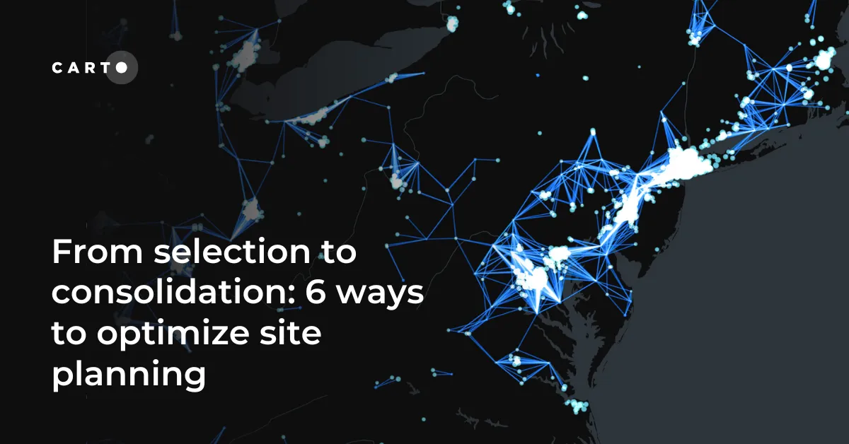
When it comes to Site Planning applications organizations have a strong desire to combine data from different sources not only to derive insights at a.
The proliferation of Location Intelligence solutions is a big part of Smart Cities growth. Cities uniquely benefit from a deeper understanding of 'where,' in areas from disaster relief and health services, to traffic optimization, and more.
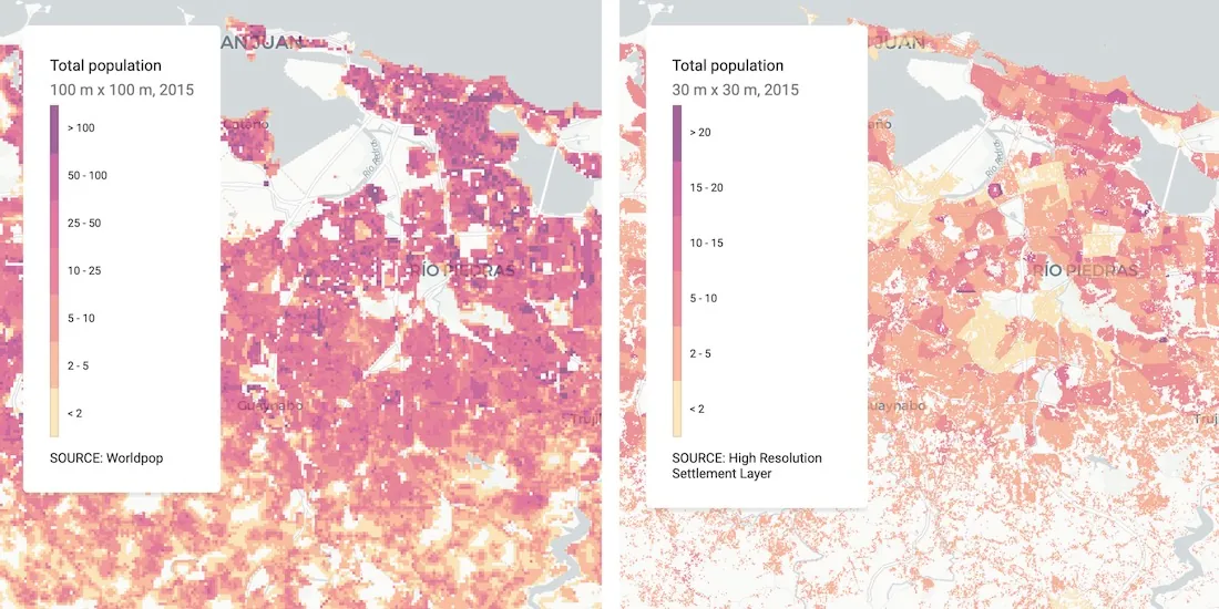
Uncover Census Oddities: Learn tips to navigate unexpected quirks in U.S. Census data, from shifting boundaries to population gaps. Avoid pitfalls now.
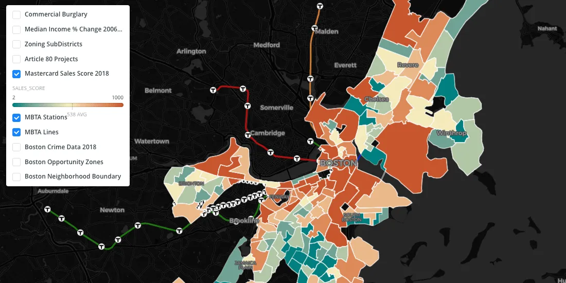
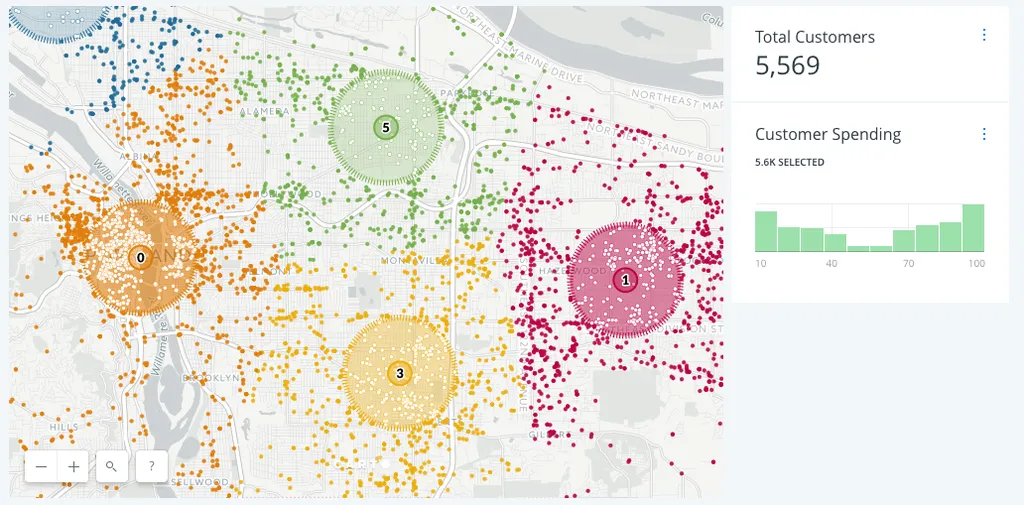
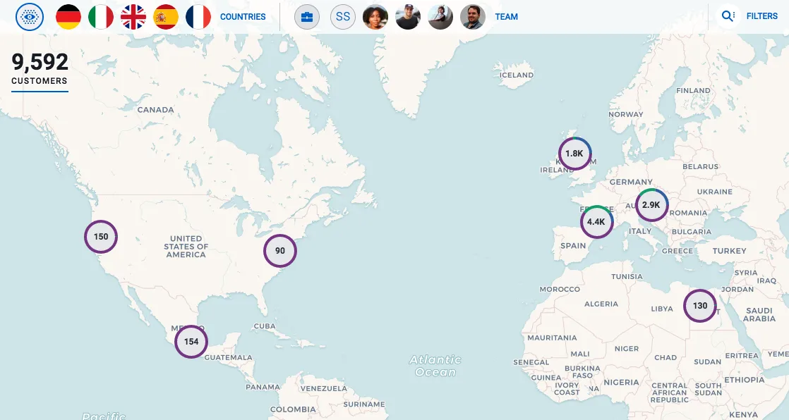
Discover effective customer segmentation strategies using location data. Learn how to target the right audience for sales & marketing success. Try for free.
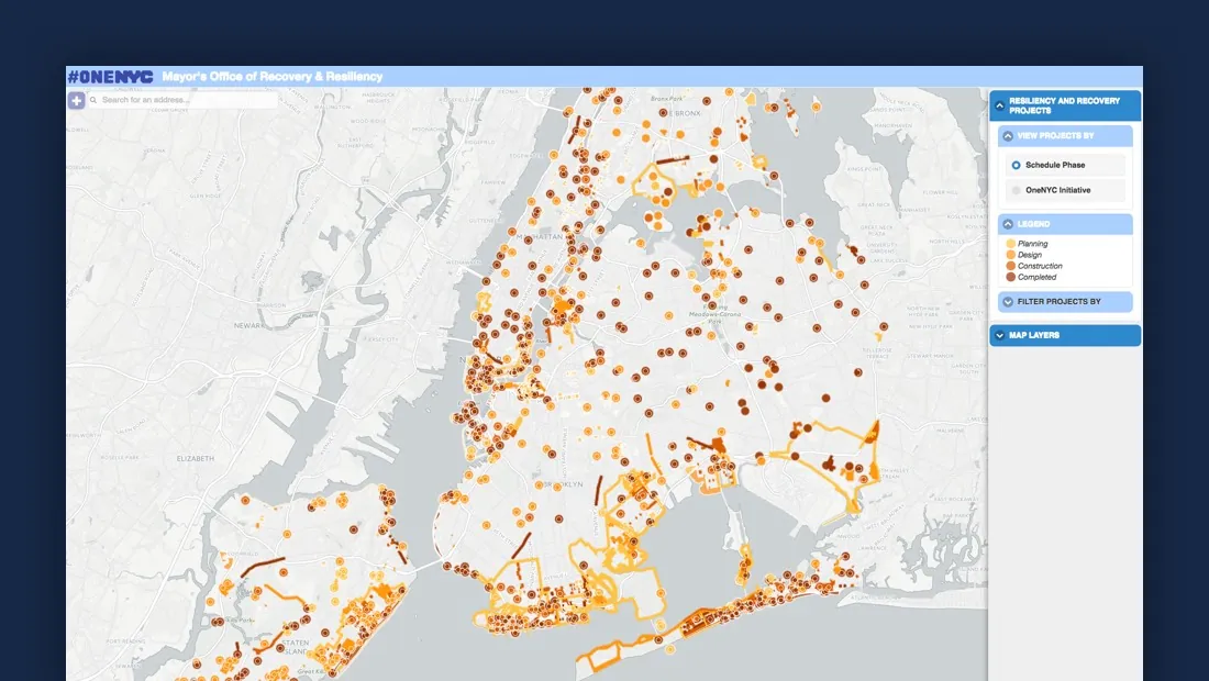
CARTO aids NYC's Mayor's Office in tackling climate change, visualizing risks, and preventing disasters like Hurricane Sandy. Explore OneNYC's efforts.
Analyzing data on important measures like electrical indicators can seem like a daunting task especially when that information needs to be timely and made.
Efficiently visualize massive datasets on maps with CartoDB's Data Overviews. Rapidly render tile features without compromising data integrity. Explore now!
You might have seen the blog post we produced a little while ago looking at the L train closure and the possible impact that might have on L commuters to.
Today is a famous day in NYC or more specifically in Manhattan it is one of two times a year that the sun aligns with the midtown street grid in what is.
Discover the integration of GeoJSON on PostGIS, enabling better import methods and direct usage for CartoDB. Read about the development consultancy by OpenGeo.
Learn how to execute bulk "nearest neighbor" queries using CartoDB for geographical analysis. Create maps depicting parcel distances from fire hydrants efficiently.
Implementing data-driven decision making can only show a return on investment for businesses if analysts ask the right questions with the right data. Here are the right questions to ask.
A growing and elite group of e-commerce companies have begun opening brick and mortar stores to extend their online brands. These 3 are leading the pack.
In our rapidly evolving online world, digital marketers constantly have to find new ways to make sure their campaigns are reaching the right people with the right message.
Enigma launched the first public sanctions tracker, a website that visualizes and contextualizes changes to the US sanctions program. See how they took thousands of data points and transformed them into insight.
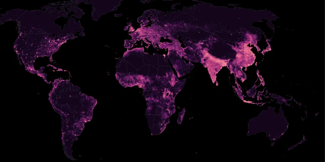
5.1 billion people own a cell phone. That ubiquitousness, coupled with innate connectivity, that makes mobile devices, and the data generated by them, the world's most powerful tool for understanding people.
From identifying new areas for potential investment to better understanding real estate investment risks, we look at some of the ways location data can support your investment strategy.
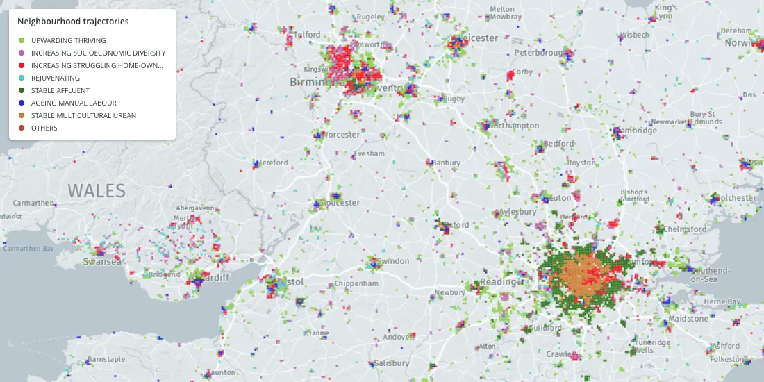
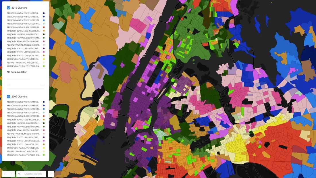
Citizen-led organizations use geospatial tech and location intelligence to analyze housing markets and demographic changes. Learn about NYC, SF, and Chicago.
Using Location Intelligence and data science techniques, retailers can offer premium services, like delivery windows, without breaking the bank to compete with ecommerce giants like Amazon.
As the subway enters a declared state of emergency, a new coalition is proposing changes based to the NYC bus system based on location data to help solve the city's transit woes.
Location Intelligence techniques and new data streams serve to improve omnichannel strategies, bolster brick-and-mortar retailers embracing change, and bring previously online-only sellers to establish storefronts of their own.
Businesses continue to search in vain for solutions to a wide range of logistics problems, but in this post we’ll highlight how spatial data science drives logistics optimization.
Successful ecommerce companies are opening brick and mortar showrooms and in this post we'll provide tips on taking advantage of this omnichannel trend with Location Intelligence
Using credit card data, one of the largest banks in Spain created an Urban Discovery tool that describes city dynamics and compares areas from different cities.
Cities, local governments, and entrepreneurs are working together, through hackathons and app challenges, to create successful businesses. We highlight 3 from Colorado's Go Code challenge.
Embracing Location Intelligence can help insurers to reduce their exposure to risk, while preparing and offering policyholders better service and more varied plans that meet their needs.
Retail mergers and acquisitions are driving revenue increases, and in this post learn why retail analysts rely on Location Intelligence when making consolidation decisions.
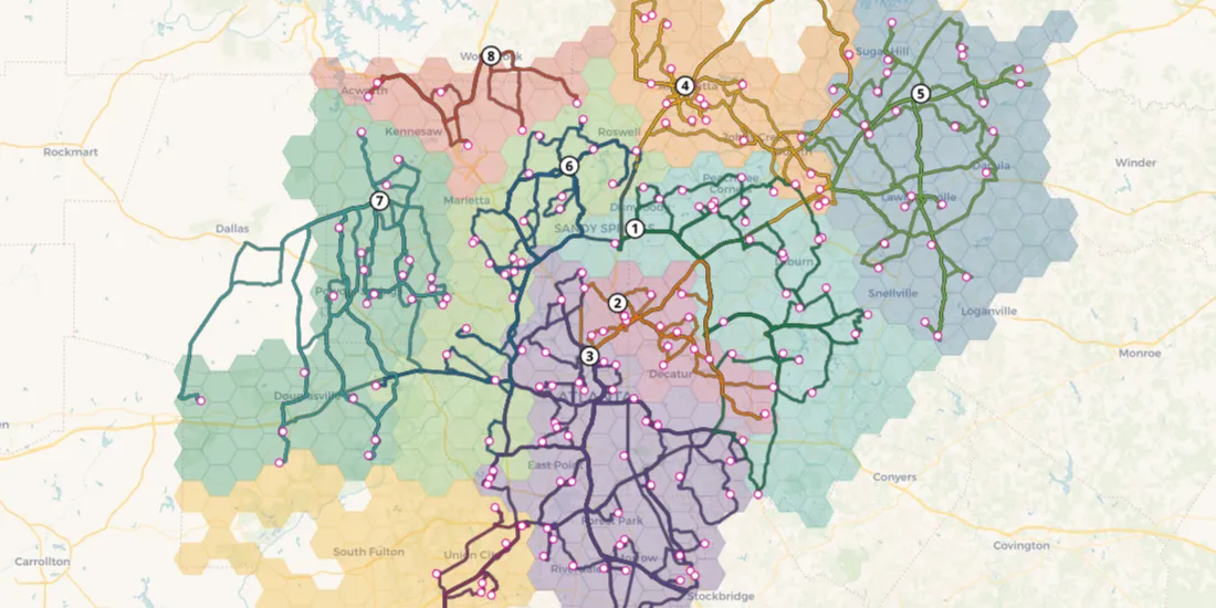
The most forward-thinking B2B sales and operations directors have started incorporating location intelligence into their sales territory management and defining sales territories differently from the rest.
CARTO SalesQuest is a location-based Sales Analytics solution that applies spatial analysis and location data streams to your company’s sales CRM data.
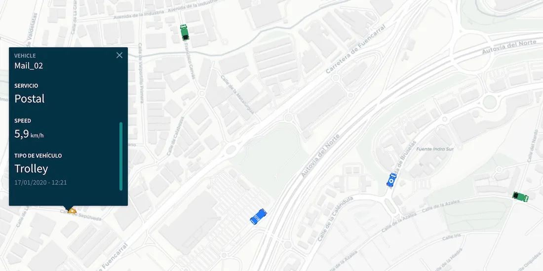
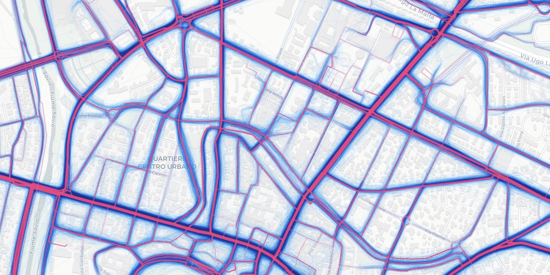
CARTO Traffico is a traffic management solution for civic engineers and urban planners that integrates crowdsourced GPS data with city specific mobility data sources to help cities adapt to citizens’ changing transportation behavior
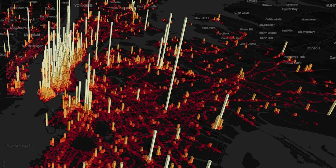
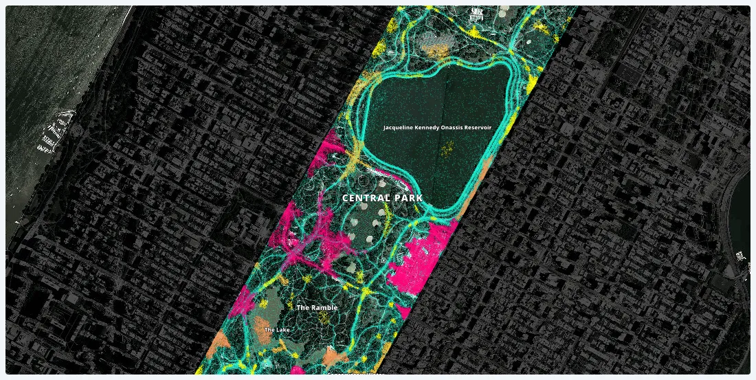
Working with one month of nation-wide GPS data, A Million Walks in the Park explores the use of public spaces, specifically public parks across New York City, to understand social interactions among New Yorkers.
GIS set the foundation for businesses to begin collecting and visualizing geographic information. But in order to stay competitive, businesses know they need to focus on the intelligence from their location data, not just on the geographic information itself.
Using the City Health Dashboard, city leaders are empowered by local data, and the tools to visualize and analyze that data to improve citizen health in 500 American cities
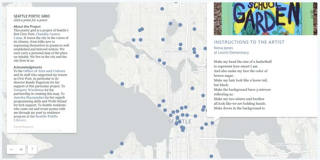
Learn how our Location Intelligence platform helped execute the vision of Seattle’s Civic Poet Claudia Luna Castro in our latest Map of the Month post.
The Anti-Eviction Mapping Project a collection of volunteers with a reputation for conducting deep analysis of eviction gentrification and housing rights.
Using Location Intelligence to show how modern site planning can shine a light on the impact of Amazon’s forthcoming HQ2 on local communities, the private sector, and Amazon itself
Discover why healthcare professionals are turning to location intelligence when deciding when, where, and in what form to open senior care centers to meet medical needs of rapidly increasing senior population.
While common methods like isochrones help businesses understand where their customers could come from, Catchments made with human mobility data help businesses see where there customers really are coming and going.
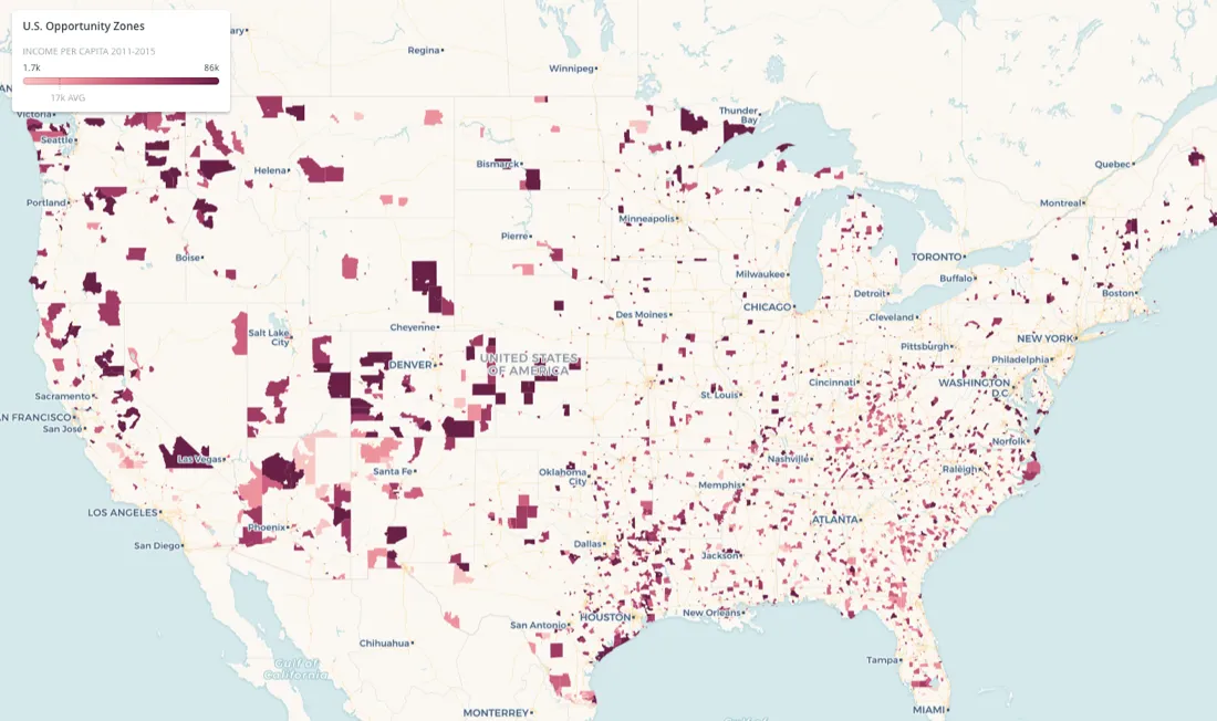
Real estate is still abuzz about the U.S. Treasury Department's creation of 8,700 Opportunity Zones, and in this post learn why Location Intelligence can provide the contextual insights needed for finding the right investments.
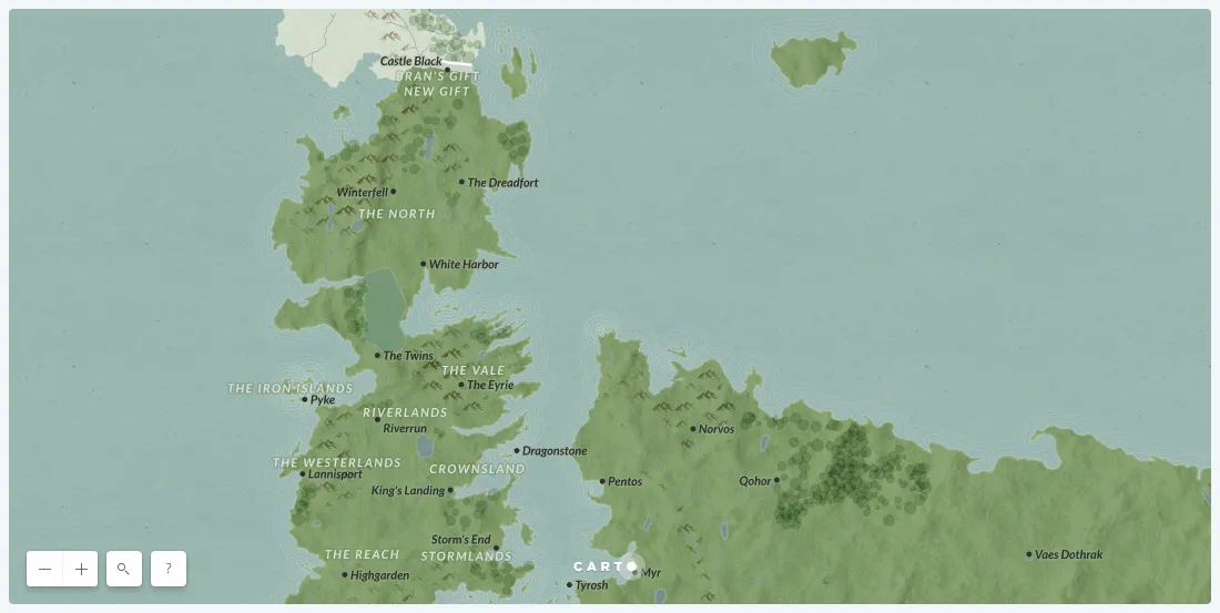
We built a custom basemap of the Game of Thrones world and we’re giving it away for free, with hopes that what you create will help someone unite the seven kingdoms.
For traffic engineers and analysts looking to tackle major challenges, such as reducing the number of car crashes in their city, new data streams and spatial data science are critical
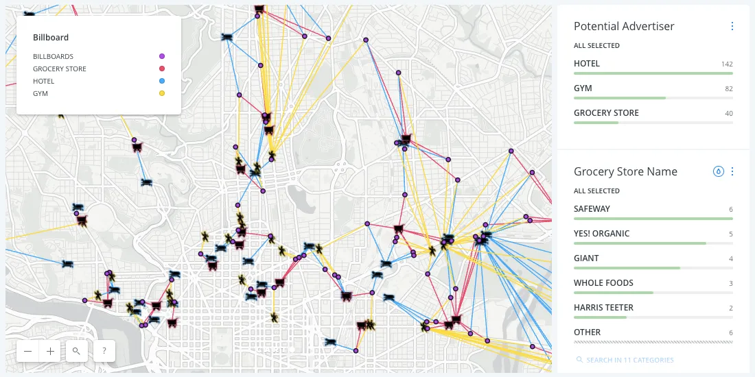
As the only traditional ad format still growing, Outdoor Advertising is going through some significant changes in 2017. Stay up to date with these major trends.
Learn how Count Love works with location data, spatial analysis, and digital mapping to record and study political protests in our latest Map of the Month feature.
We created this map in hopes that public officials and relief organizations can identify the most at-risk neighborhoods and deliver them life-saving resources before and after this disaster strikes.
Retailers are gaining more and more data about their customers, but making informed business decisions with that data has proven difficult and expensive.
We wanted to explore how we can use data to better understand and define communities of people, going beyond spatial borders like zip code and neighborhood boundaries.
A spatial interaction model is specifically used to map and model the interactivity between various factors in distinct locations. This makes it extremely useful to understanding any data you might have with more than one location component.
Bringing together different location data streams provides a modern alternative to traditional traffic impact studies. In this post we’ll present what value different types of location data add to mobility analysis.
The food industry has always driven technological innovation, and today's connected shopper is more demanding than ever. Learn how food production and delivery will need to rely on location intelligence to keep up.