CARTO FOR PUBLISHERS
Modernize Your Spatial Data Infrastructure for the AI Era
CARTO for Publishers helps governments, mapping agencies, research institutions, and data providers make authoritative geospatial data accessible to everyone — from analysts and developers to citizens, enterprises, and AI agents.
Built on open standards and aligned with the Portolan specification, CARTO enables you to publish, govern, commercialize, and scale your spatial data infrastructure without relying on traditional GIS server architectures. Create a sovereign, cost-effective, AI-ready publishing platform for open data, restricted datasets, cross-agency collaboration, and premium data products.

Agentic Access
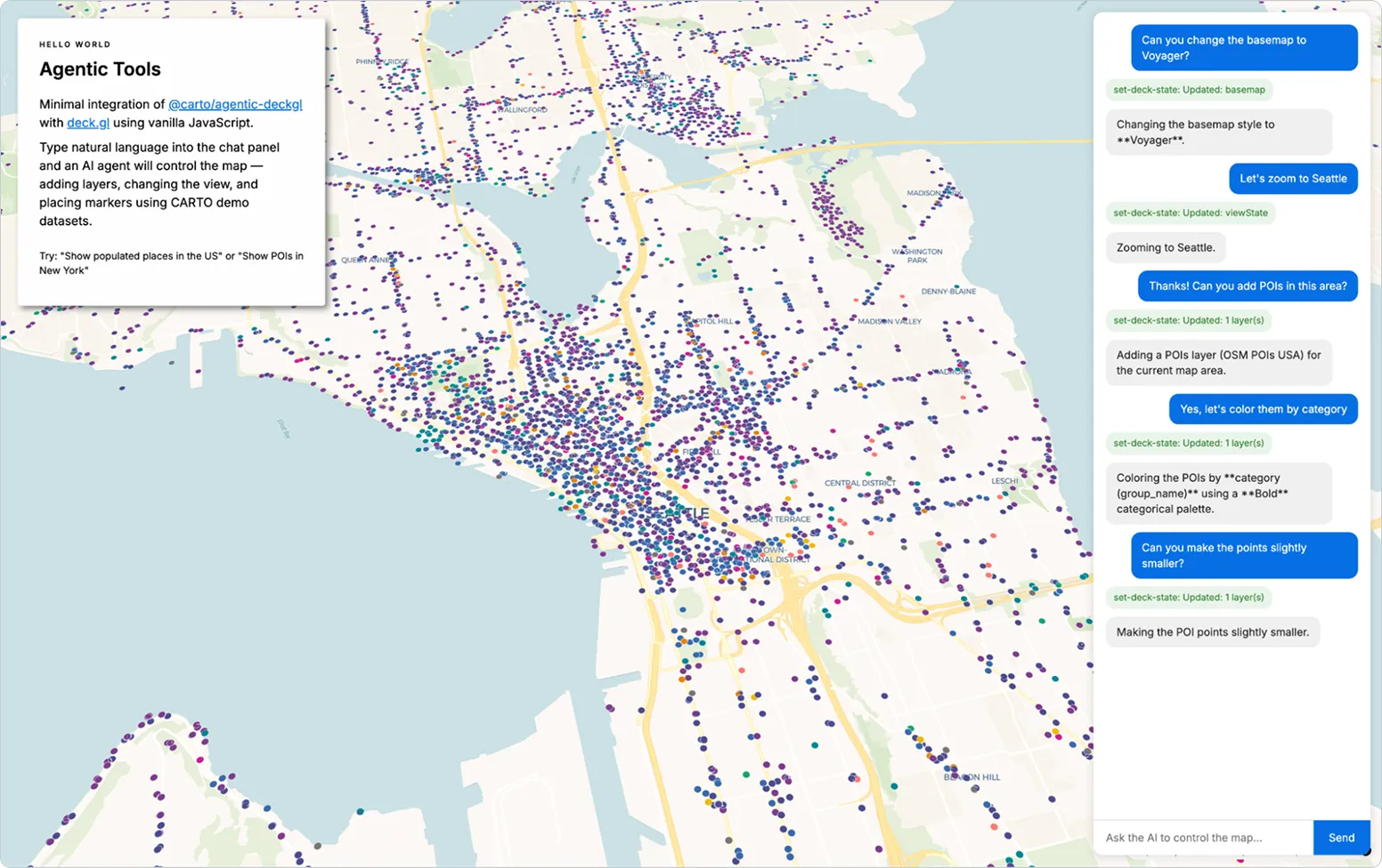
Let users ask questions and get answers directly from your authoritative data. Enable AI agents that discover, analyze, and explain trusted public data — without forcing users to understand GIS systems.

Scalable by Default
Publish from cloud-native storage instead of traditional GIS servers. Scale from a few users to millions of requests with predictable infrastructure costs and resilient service delivery.

Sovereign Stack
Run storage, compute, AI, and GIS capabilities on infrastructure you control: public cloud, sovereign cloud, local cloud, on-premises, or air-gapped environments.

Open Foundation
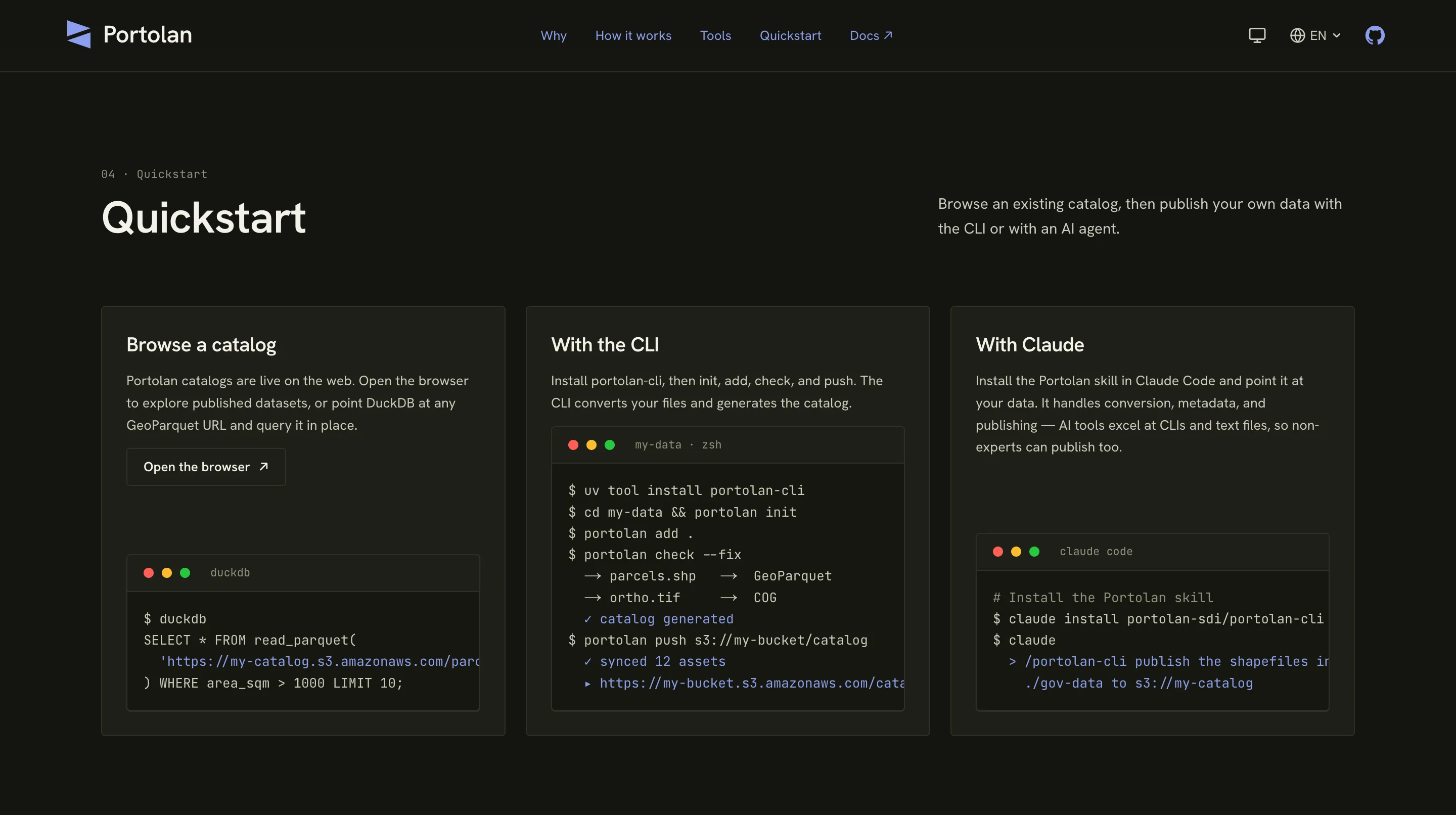
Publish using open standards and cloud-native formats such as GeoParquet, COG, PMTiles, OGC standards, Apache Iceberg, and the Portolan specification.
AGENTIC EXPERIENCES ON AUTHORITATIVE DATA
Make Authoritative Data Accessible to Everyone
Most public data portals still require users to search catalogs, download files, understand formats, open specialist tools, and interpret the results themselves. CARTO for Publishers changes that experience.
By publishing data through a Portolan-based infrastructure and connecting it to CARTO's AI and application capabilities, your users can interact with authoritative geospatial data through maps, applications, APIs, and agentic experiences.
A planner can ask where new housing is constrained by flood risk.
A citizen can understand what public data says about their neighborhood.
An analyst can combine your datasets with other trusted sources.
An AI agent can answer using your official data, not a random copy of it.
This is the real promise of modern spatial data infrastructure: not just publishing more data, but making authoritative data usable by everyone.
SCALABLE AND COST-EFFECTIVE BY ARCHITECTURE
Publish Once. Serve at Any Scale.
Traditional geospatial infrastructure depends on servers that render, transform, and serve data dynamically. That model becomes expensive and fragile when usage grows — especially in the AI era, where agents and applications may generate many more requests than human users.
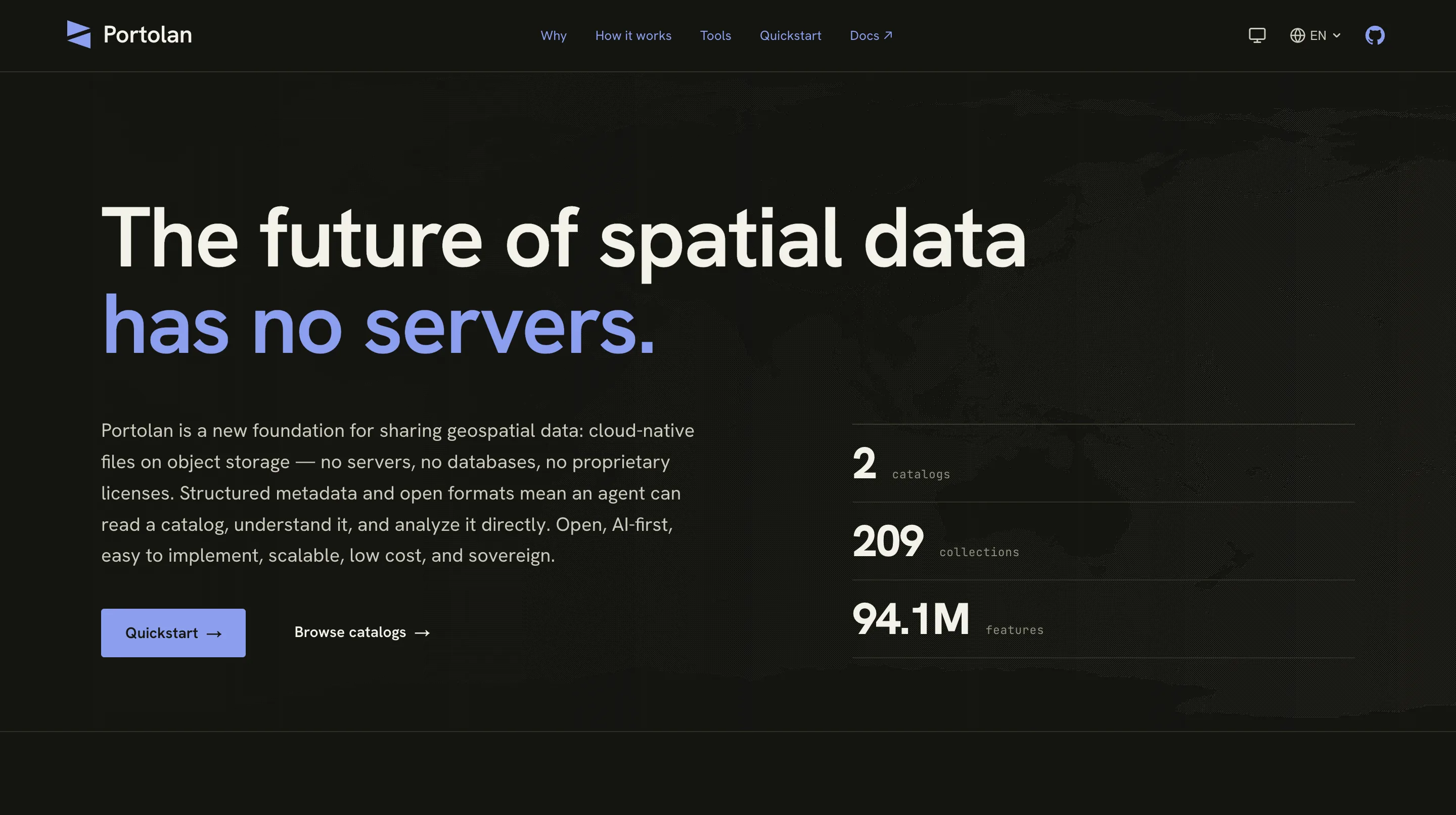
CARTO for Publishers uses a different architecture. Data is published as cloud-native files on modern storage, using open formats and metadata patterns. Consumers can access the data directly, through APIs, through applications, or through AI agents — without forcing every request through a specialized GIS server.
For public-sector publishers, this means stable service and cost control even when data becomes widely used by citizens, enterprises, applications, and AI systems.
This dramatically improves scalability and cost predictability:
- Fewer specialized servers to operate
- Lower infrastructure and maintenance costs
- Predictable pricing even as usage grows
- Resilient access for high-demand datasets
- Support for cloud, sovereign cloud, CDN, and zero-egress distribution models where available
SOVEREIGN BY ARCHITECTURE, NOT BY PROMISE
Keep Control of Your Data, Infrastructure, and AI
Sovereignty is not just a hosting claim. It is an architectural requirement. CARTO for Publishers is designed for institutions that need control over the full geospatial stack: storage, compute, metadata, AI, access control, analytics, and GIS capabilities.
Your data can live in your own object storage, your preferred cloud, a local cloud provider, a sovereign cloud, an on-premises environment, or a fully air-gapped deployment. AI experiences can be configured around the models, providers, and policies your organization approves.
No single vendor should have a kill switch over your national spatial data infrastructure.
BUILT ON THE OPEN PORTOLAN SPECIFICATION
Open Foundation. Enterprise Operation.
Portolan is an open specification for publishing geospatial data as cloud-native files on object storage. CARTO for Publishers builds on that foundation, helping institutions transform existing datasets, services, and catalogs into a modern spatial data infrastructure.
Your data remains in open formats, on infrastructure you control, following the Portolan specification. CARTO adds the enterprise capabilities needed to operate that infrastructure in production: governance, publishing workflows, access control, telemetry, commercialization, federation, and AI-ready consumption.
THE ENTERPRISE PLATFORM
CARTO for Publishers
Everything you need to operate Portolan-based infrastructure in production.
- Enterprise implementation and support
- Automated publishing workflows
- Private catalogs, permissions, and governance
- User management, telemetry, and subscriptions
- Dataset commercialization and entitlements
- Deployment, integration, and migration services
THE OPEN FOUNDATION · APACHE-2.0
Portolan
The open specification and community initiative — free, forkable, and yours to keep.
- Open specification for geospatial publishing
- Cloud-native data formats and metadata
- Open catalogs and discovery
- Interoperable data access
- Community-driven ecosystem
Your data stays in open formats, on storage you control — with or without CARTO.
FEDERATE ACROSS PUBLISHERS
Be Part of a Wider Spatial Data Ecosystem
Spatial questions rarely stop at one institution. A complete answer may require data from a mapping agency, a cadastral authority, an environmental agency, a city, a statistical office, a research institution, and private data providers.
CARTO for Publishers helps organizations participate in a federated Portolan ecosystem where users and AI agents can discover trusted datasets across multiple publishers while preserving provenance, governance, and access rules.
Your data becomes more valuable because it can be combined with other authoritative sources. Your institution remains the source of truth, while users get richer answers from a broader data ecosystem.
LEARN FROM USAGE AND IMPROVE THE DATA
Understand How People Use Your Data
Publishing should not be a one-way process. CARTO for Publishers gives institutions visibility into how datasets are discovered, accessed, combined, and used — creating a feedback loop between publishers and consumers.
You can understand which datasets are most valuable, which users and organizations depend on them, what questions people are asking, and where metadata or data quality can be improved. CARTO can also support workflows for suggested changes, user feedback, corrections, and improvement requests — helping publishers evolve their datasets based on real usage, not assumptions.
Better telemetry leads to better data products, better services, and stronger justification for continued investment in public data infrastructure.
GOVERN, SHARE, AND CONTROL ACCESS
One Infrastructure for Public, Restricted, and Private Data
Not every dataset is fully open. Some data is public. Some is restricted to government users. Some is shared with partners. Some is sensitive. Some requires registration. Some can only be used within defined limits.
CARTO for Publishers adds the governance layer institutions need to manage all these access models from one infrastructure — letting publishers increase access to data without losing control over who uses it, how much they use, and under what conditions.
- Public and private catalog listings
- User registration and identity management
- Dataset-level permissions
- Organization, group, and partner access
- Usage limits and quotas
- Audit trails and access reporting
- Approval workflows for restricted data
COMMERCIALIZE DATA PRODUCTS
Turn High-Value Datasets Into Sustainable Data Products
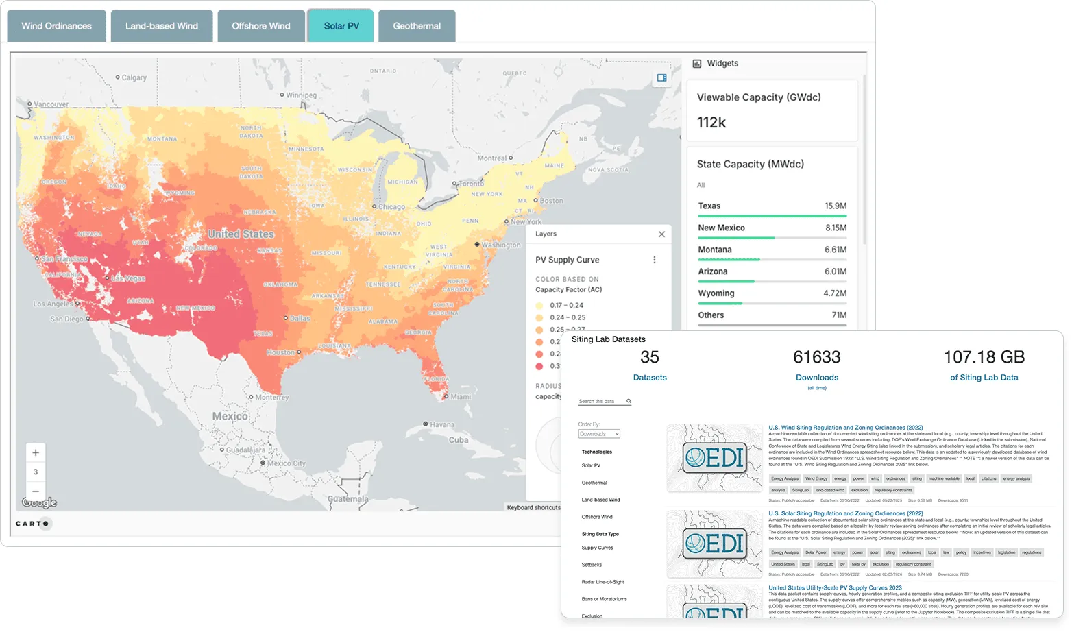
Some authoritative datasets have commercial value. They may support insurance, real estate, logistics, energy, infrastructure, climate risk, mobility, telecommunications, or financial services.
CARTO for Publishers helps institutions create premium data products around Portolan-based catalogs: subscriptions, pay-as-you-go access, usage-based pricing by bytes, calls, or datasets, license and entitlement management, private commercial listings, usage reporting, and integration with existing sales and billing processes.
This makes Portolan suitable not only for open data, but also for public-private partnerships and sustainable commercial data publishing.
FORWARD DEPLOYED ENGINEERING
Experts to Transform Your Existing Infrastructure
Modernizing spatial data infrastructure is not just a software installation. It requires understanding existing services, datasets, metadata, users, governance rules, and institutional constraints.
CARTO provides Forward Deployed Engineers and geospatial experts who work directly with your team to design, migrate, and operationalize your Portolan-based infrastructure.
The goal is not a generic platform demo. It is a practical path from your current infrastructure to a modern, AI-ready SDI.
We help you:
- Assess your current geoportal, SDI, and data services
- Prioritize the first datasets and use cases
- Convert legacy data into cloud-native formats
- Design metadata and publishing workflows
- Configure governance and access control
- Integrate with existing systems
- Launch the first production-ready experience
CUSTOM USER EXPERIENCES
Give Every User the Right Interface
A modern spatial data infrastructure should serve many types of users. Some need a public data portal. Some need internal government applications. Some need dashboards. Some need APIs. Some need AI agents inside existing workflows. Some need custom web applications designed around specific policy, planning, or operational questions.
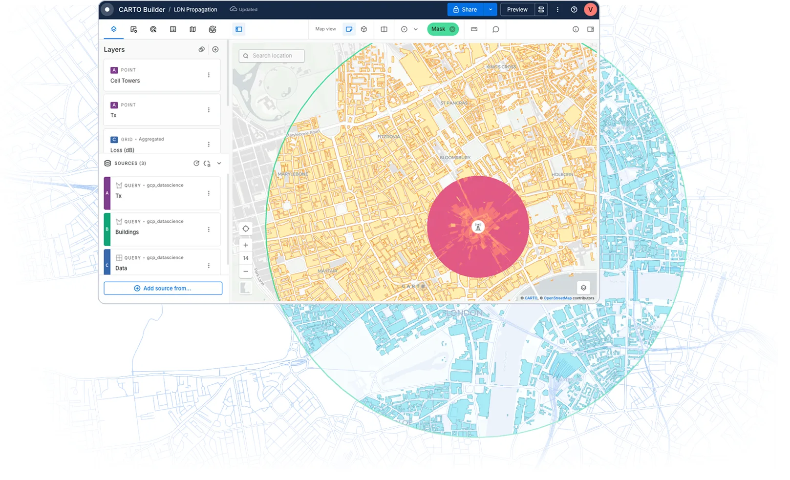
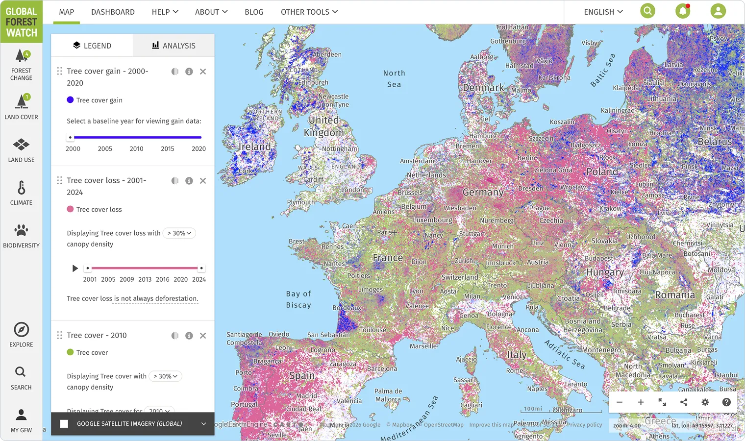
CARTO can help design and build custom user experiences on top of your Portolan-based infrastructure: public discovery portals, internal government data applications, map-based dashboards, developer and API experiences, AI assistants and agentic workflows, and embedded experiences for existing platforms.
Your data infrastructure becomes the foundation for multiple experiences, not a single portal.
STAY COMPATIBLE WITH THE EXISTING GIS WORLD
Modernize Without Breaking Existing Workflows
Institutions cannot migrate everything overnight. Many users still depend on existing GIS tools, metadata catalogs, OGC services, ISO XML records, ESRI workflows, and established procurement or compliance processes.
CARTO for Publishers helps expose modern Portolan-based infrastructure through the interfaces and formats your current users still need. That can include OGC APIs, legacy metadata, ISO XML, GIS-compatible services, ESRI catalog or server integrations, and other compatibility layers required during transition.
You can modernize the foundation while maintaining continuity for existing users.
FROM PUBLISHING TO AGENTIC GIS
Create the Foundation for the Next Generation of GIS
CARTO for Publishers is not a separate destination. It is the public-sector on-ramp to Agentic GIS. Once authoritative datasets are cloud-native, discoverable, governed, interoperable, and AI-ready, they can power a new generation of GIS workflows where users ask questions, agents select the right data, analysis runs automatically, and results are delivered through maps, dashboards, and applications.
Publishing is the first step.
Agentic GIS is the destination.
CARTO helps institutions move from legacy SDI to modern publishing infrastructure — and from there to AI-powered spatial analysis.

See Your Infrastructure in Portolan
Show us your current datasets, services, or geoportal, and we will show you how they could work as a Portolan-based spatial data infrastructure with CARTO for Publishers.
Frequently Asked Questions
Portolan is the open specification and community initiative. CARTO for Publishers is CARTO's commercial solution for organizations that want to implement and operate Portolan-based infrastructure at scale.
No. Portolan is not owned by CARTO. CARTO contributes to the ecosystem and provides a commercial implementation, support, and enterprise layer for institutions adopting the specification.
No. The foundation is open by design. Your datasets remain in open formats and follow the Portolan specification. CARTO adds operational capabilities on top.
Yes. CARTO for Publishers supports public catalogs, private listings, restricted access, partner data sharing, registered access, usage limits, and commercial subscription models.
Yes. CARTO for Publishers can provide telemetry, usage analytics, reporting, and feedback workflows so publishers understand how datasets are discovered, accessed, and used.
Yes. CARTO for Publishers supports subscriptions, premium listings, entitlement management, and usage-based models based on calls, bytes, datasets, or other metrics.
It can complement, modernize, or eventually replace parts of your existing infrastructure. Many organizations start by publishing selected datasets through Portolan while maintaining existing services for legacy users.
Yes. CARTO for Publishers can be deployed on infrastructure controlled by the publisher, including public cloud, sovereign cloud, local cloud, hybrid environments, on-premises, or air-gapped deployments.