Catastrophe Modeling
Predict the exposure of assets to catastrophes at scale. Analyze large volumes of climate, infrastructure and socio-economic data to build the most accurate CAT models.
.webp)


Catastrophe modeling with CARTO AI Agents

Pick yours to learn more
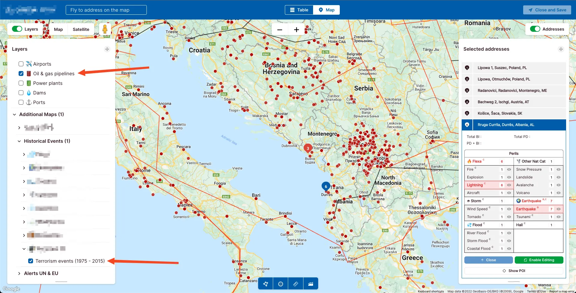
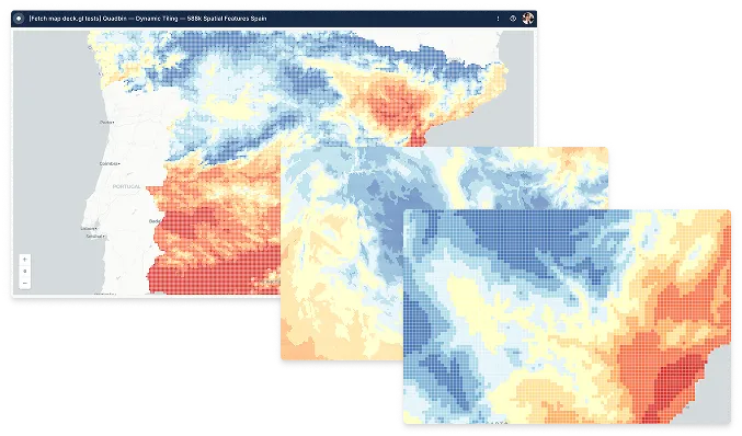
Fully cloud-native for hyper-local insights at scale
Traditional BI and GIS tools aren't designed for sophisticated spatial analysis at huge scales. A cloud-native approach provides unparalleled flexibility and scalability, allowing you to manage risks effectively, leveraging extensive spatial datasets without losing detail.
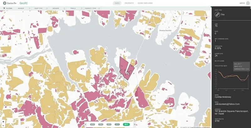
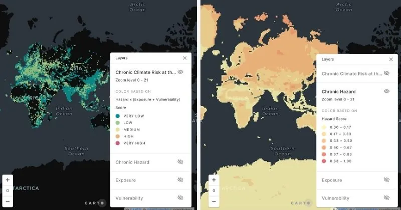
Know your risk using advanced spatial analytics
.webp)

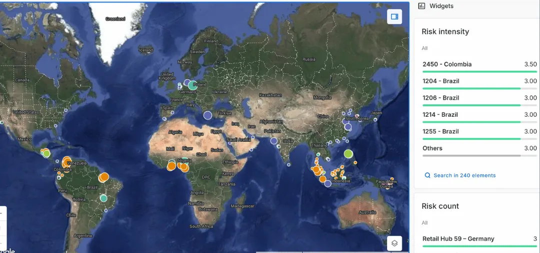
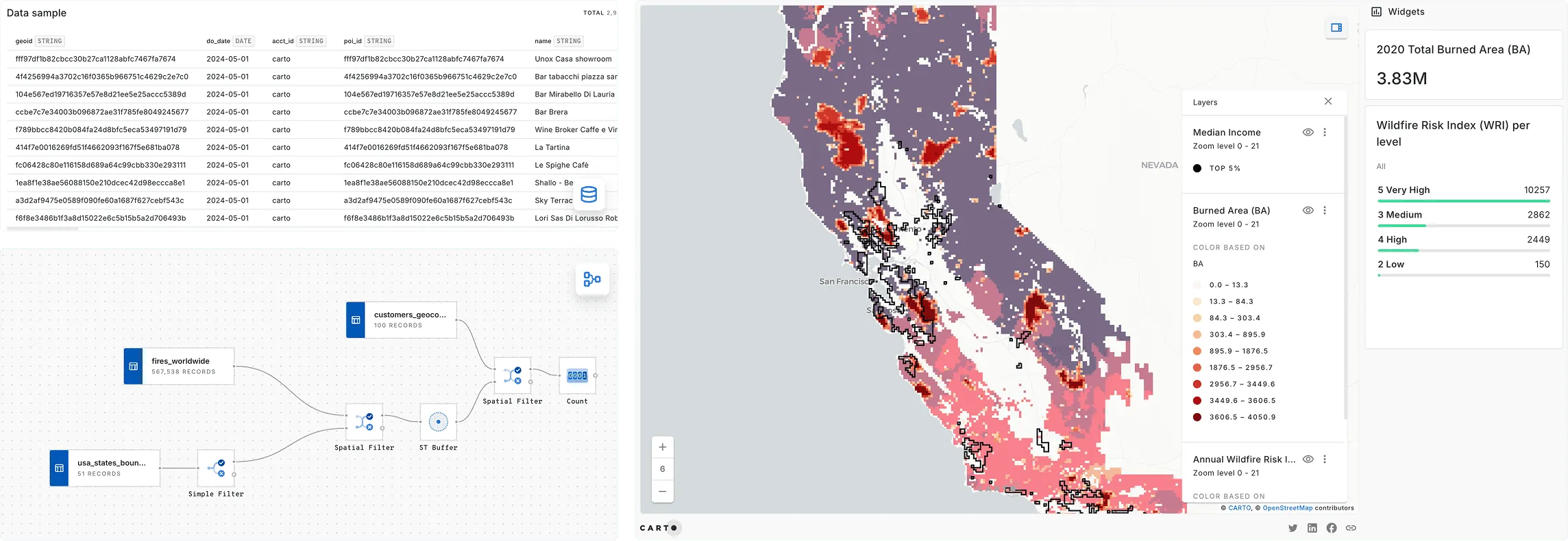
Visualize & share CAT model results faster
Slow analysis and data visualization processes can delay critical business decisions. Accelerate your analysis with powerful visualization tools, enabling you to share insights on insured losses and damage estimations quickly and effectively.
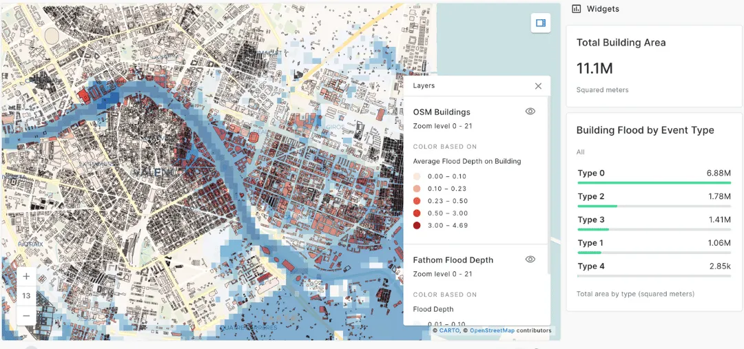
Enhance your models with better data
Outdated or poor-quality data can compromise your risk assessments. Enrich your models with diverse and granular data streams, ensuring you have accurate and detailed exposure data to improve your loss estimates.
.webp)