The first and only cloud-native GIS platform
Learn why GIS professionals are turning to CARTO for a scalable approach to spatial analysis


Scalability without limits
Seamlessly analyze and visualize billions of features, directly from your lakehouse.
Full stack integration
De-silo your GIS by placing it at the heart of your tech and data infrastructure.
Short learning curve
An intuitive platform that helps you and your end-users deliver insights fast.
GIS, but different
Cloud-native GIS vs desktop and open-source GIS
Three ways to run GIS, and why enterprise teams are moving spatial analysis into the cloud data warehouse.
The cloud-native GIS platform for teams of all sizes
Traditional desktop tools such as ArcGIS Pro
Self-managed tools such as QGIS and PostGIS
CARTO
Runs natively inside your cloud data warehouse. Your data never leaves it.
Desktop GIS
Runs on a local desktop machine. Data is copied and exported into the tool.
Open-source GIS
Runs on a desktop or servers you manage, with data loaded into a separate database.
CARTO
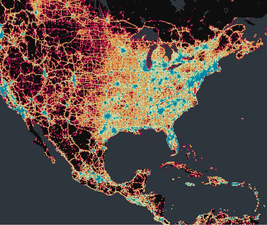
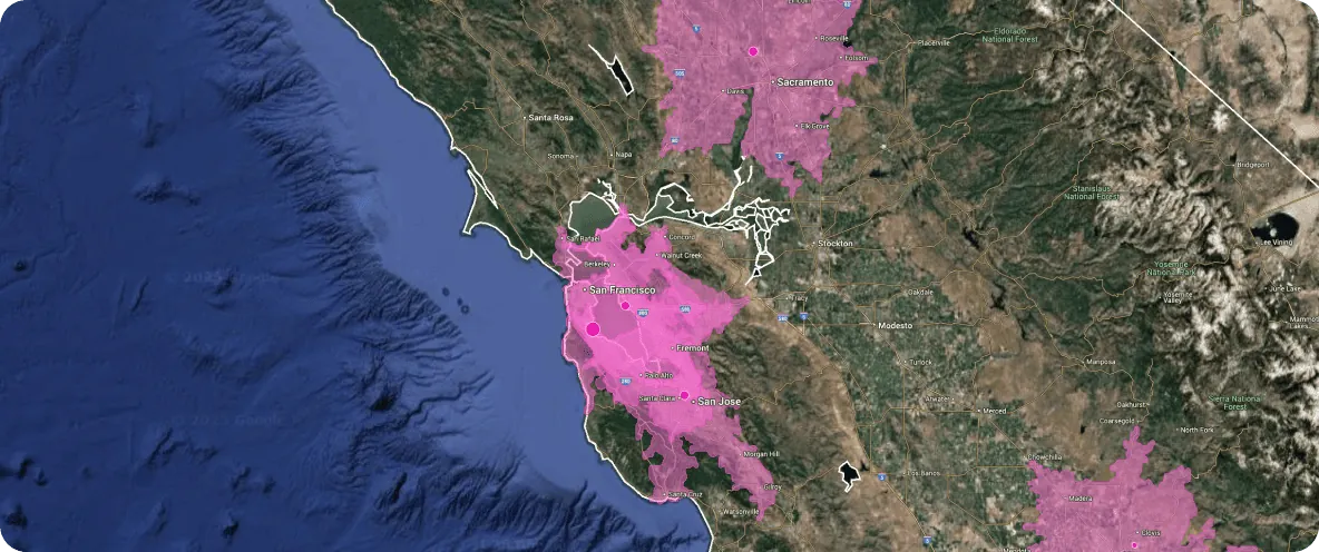
Billions of features on cloud data warehouse compute, visualized with dynamic tiling.
Desktop GIS
Limited by the desktop hardware it runs on.
Open-source GIS
Limited by the infrastructure you maintain.
CARTO
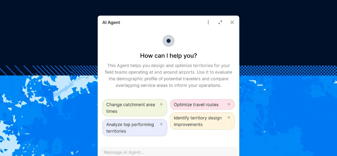
AI Agents and low-code Workflows for every user, plus an MCP Server and Agent Skills for external coding agents (Claude, ChatGPT, Copilot).
Desktop GIS
AI assistant in beta / limited availability; automation relies on proprietary scripting and formats.
Open-source GIS
Manual work or custom scripting.
CARTO
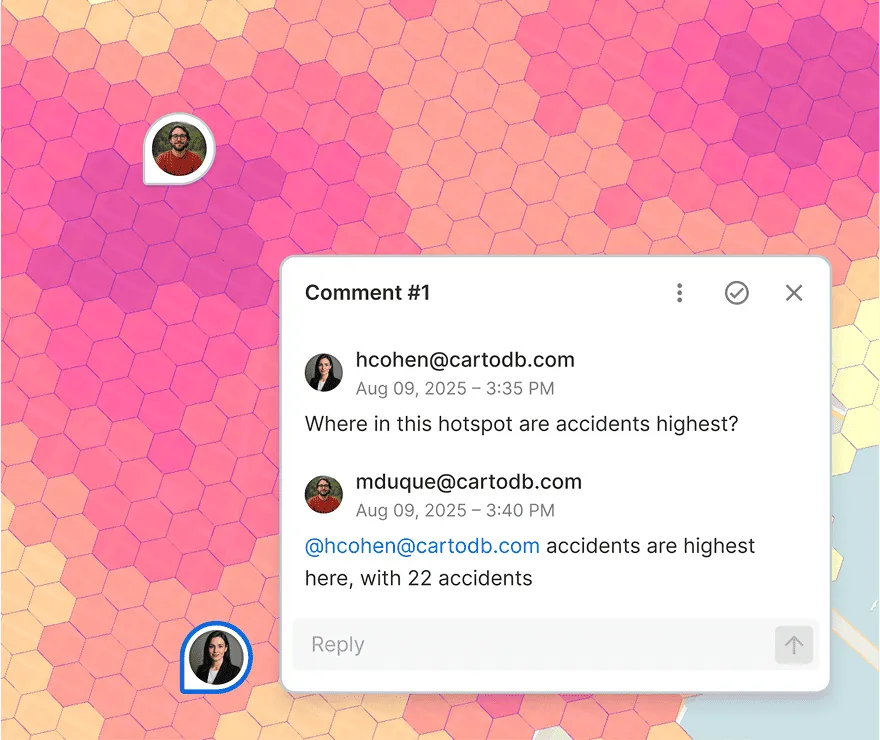
Browser-based, with live sharing and in-map commenting, like Google Docs for spatial data.
Desktop GIS
Per-seat installs on each machine.
Open-source GIS
Manual setup for each user.
CARTO
Clear, flexible plans for whole teams.
Desktop GIS
Per-user licensing that grows with every seat.
Open-source GIS
Free software, but you run the infrastructure.
CARTO
Inherits your cloud security and access controls.
Desktop GIS
Requires separate infrastructure to centralize.
Open-source GIS
You manage it yourself.
CARTO
Dedicated CSM, professional services, and SLAs, from a team shaping cloud-native and agentic GIS.
Desktop GIS
Vendor support through a large partner network.
Open-source GIS
No dedicated support or SLA, community-driven only.
Not sure where you stand with your Esri footprint?
Four questions. Two minutes. A personalized readiness signal and a clear next step tailored to your situation.
Take the migration assessment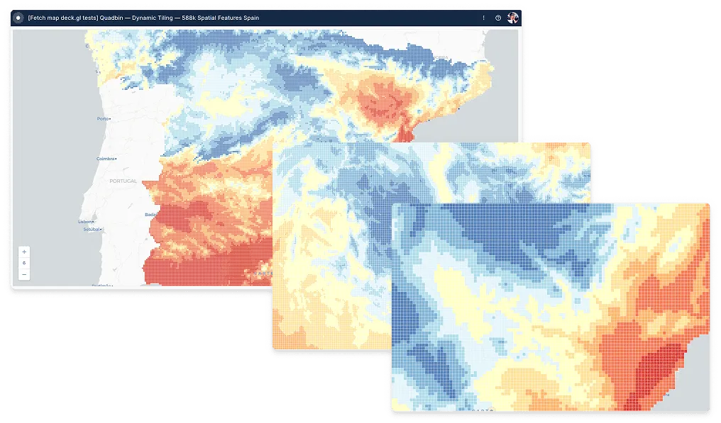
Everything your GIS team needs in one platform
From analysis and automation to visualization and integration, all running on your cloud data warehouse.
Work smarter, not harder
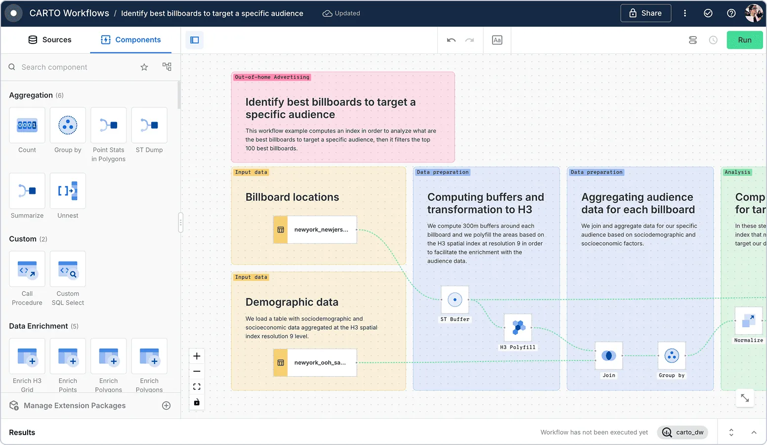
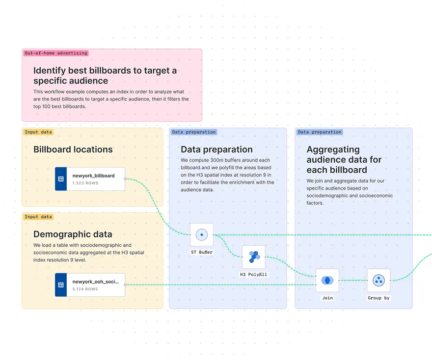
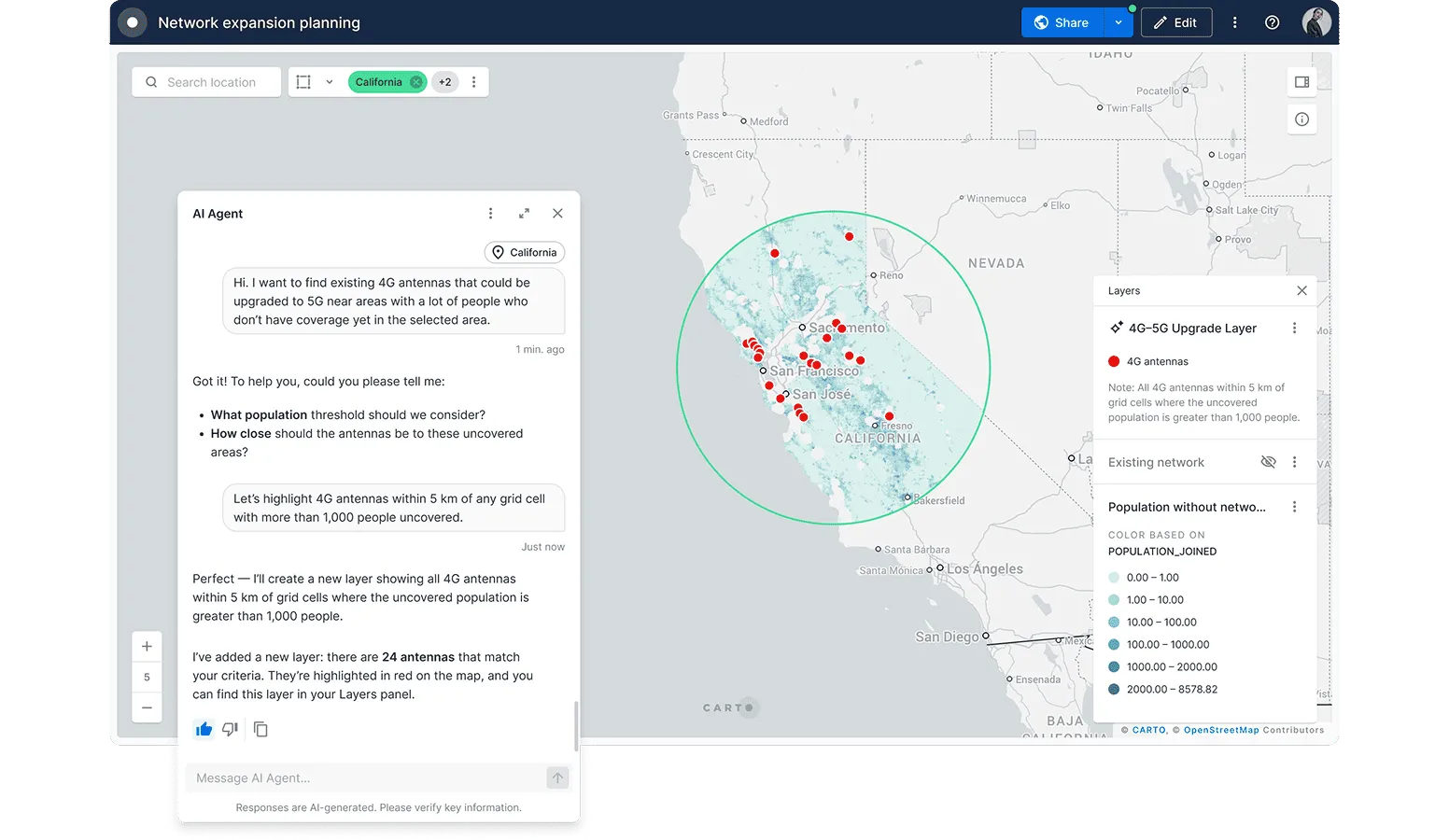
Automate repetitive GIS tasks like data preparation, geocoding, and map updates to free up time for high-value analysis. Focus on insights, not manual work.
.webp)
Scalable decision-making
Reduce ETL pain by running geospatial workflows in your lakehouse. Eliminate data silos and collaborate seamlessly across teams from inside your maps.

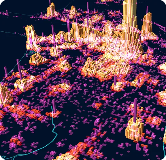
Stunning visualizations made easy
Create dynamic, interactive maps and visualizations with Builder’s intuitive interface. Share insights with stakeholders through easy-to-use, self-serve dashboards with built-in AI Agents.
.webp)


Integration across your organization
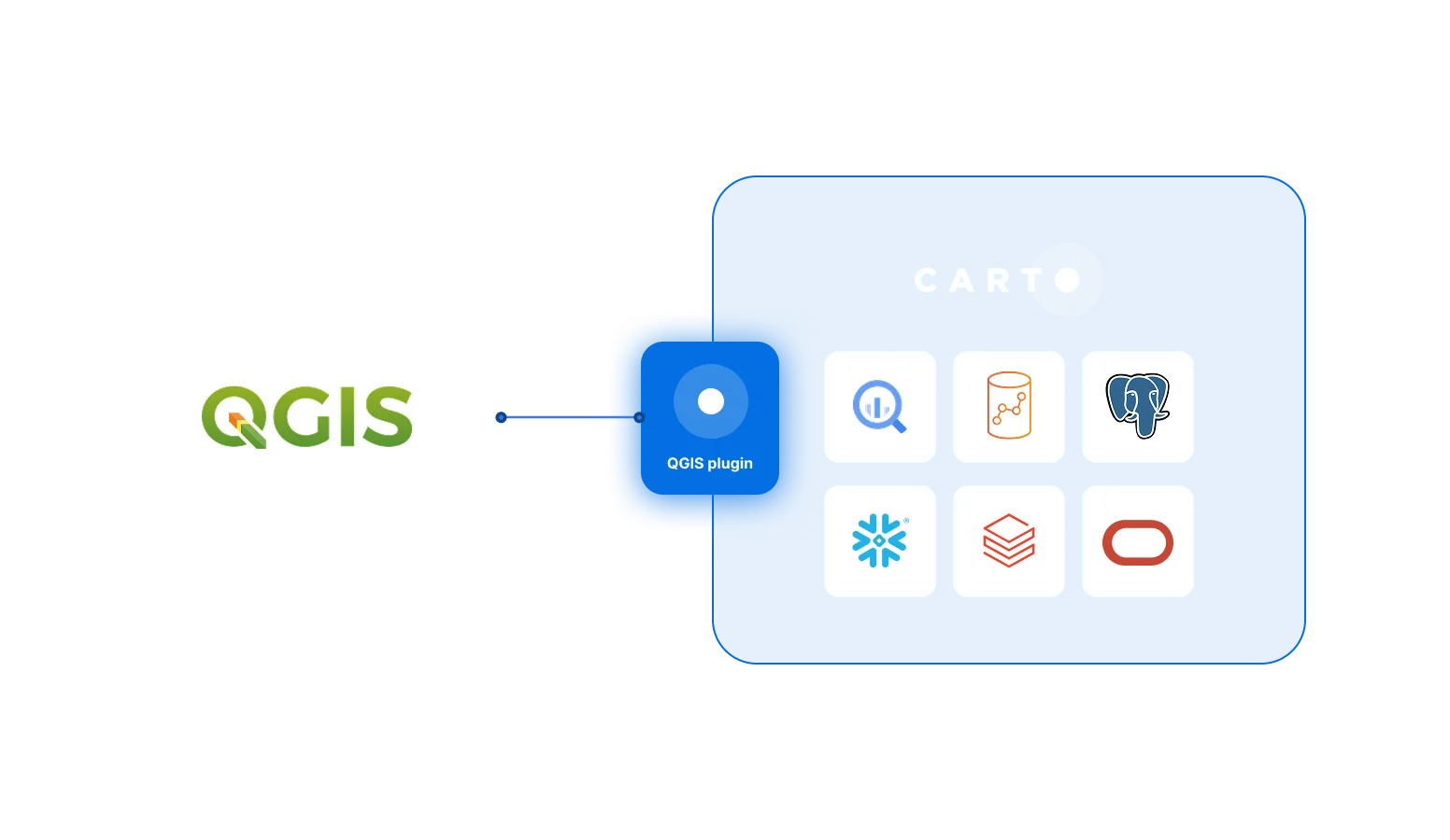
CARTO integrates seamlessly with your organization’s tech stack, including QGIS, BI platforms and other GIS & data tools. Ensure interoperability for a more connected, efficient workflow.
Agentic GIS built for the enterprise

Runs in your own cloud
CARTO runs entirely inside your lakehouse. Data is never synced, copied, or transferred out of it.

Your security and access
CARTO uses your existing single sign-on and the role-based access control from your data warehouse.

Flexible deployment
Run self-hosted in your own cloud, inside your VPC or behind your VPN, with proxy support.

Privacy and compliance
SOC 2 Type II certified and GDPR ready, so spatial analysis meets your compliance requirements.
Frequently asked questions
Yes. Integration is at the heart of the platform. Because CARTO is cloud-native, it fits into your wider tech stack with your cloud data warehouse as the foundation, and it works with tools including QGIS, BI platforms, and other GIS software. Learn more in our Documentation.
GIS professionals are usually productive in CARTO quickly because it builds on familiar concepts: a visual map-making interface, drag-and-drop Workflows, and Spatial SQL that mirrors the spatial functions used in PostGIS or ArcGIS. There is no desktop software to install, and the CARTO Academy offers full-code and low-code tutorials to get teams started.
Yes. CARTO is a leading Esri or ArcGIS alternative for organizations modernizing their GIS. It provides spatial analysis, cartography, and app development as a cloud-native platform that runs inside your data warehouse, with Spatial SQL, low-code Workflows, and AI Agents. Teams adopt it to grow beyond desktop limits and reduce licensing and infrastructure cost.
CARTO connects directly to your cloud data warehouse and runs spatial queries where the data already lives, across Google BigQuery, Snowflake, Databricks, Amazon Redshift, and Oracle, using each platform's native compute. There is no data extraction or separate spatial database to maintain.
With CARTO, your data never leaves your own cloud data warehouse, so it stays under your existing security, governance, and access controls. CARTO is SOC 2 compliant and supports GDPR requirements, single sign-on, and flexible deployment, including running fully within your cloud environment, which makes it suitable for regulated enterprise use.
In a fully cloud-native GIS, all computing is pushed down to your cloud data warehouse and your data never has to leave it. CARTO is unique among spatial analysis platforms in working this way, which gives you speed, scale, and security. Learn more about what this means for your spatial analysis here.
Yes. CARTO runs on cloud data warehouse compute and uses dynamic tiling, so it can analyze and visualize billions of points, lines, and polygons interactively and cost-effectively, on any modern device. Read how we build truly massive maps.
GIS (Geographic Information System) software is technology used to create, manage, analyze, and visualize location data on a map. It connects spatial data such as points, lines, and polygons to descriptive information so teams can answer where questions and make location-based decisions. Modern, cloud-native GIS software like CARTO runs this analysis directly inside a cloud data warehouse instead of on a desktop.