.webp)
Cities & Government
Governments are prolific generators & collectors of spatial data. Using data-driven solutions to improve quality of life for citizens at national, state & local level is fundamental.


Get inspired by our customers
CARTO has allowed us to tackle complex challenges relating to road accident analysis in London and much more. Working with their cloud-native platform has been a transformative experience, making it faster for us to visualize large-scale geospatial data and quickly deliver insights to different areas of our business, partners, and clients.

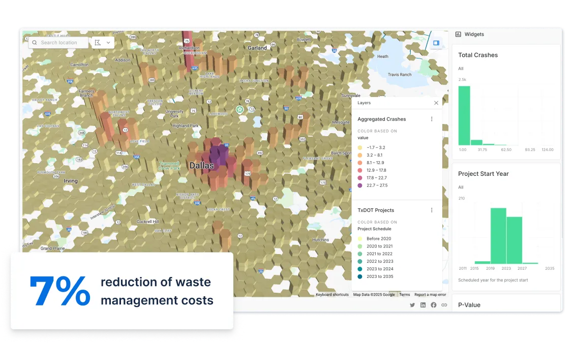
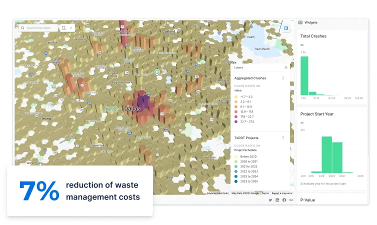
Smart Cities & IoT
With the Internet of Things (IoT) growing at 25% a year in cities, the number of sensors generating data for city decision makers is higher than it has ever been.
This provides a unique opportunity for local governments to reduce costs in areas such as waste management, street lighting, and public transport. If you’re making such significant investments in hardware, make sure you get the analytics right too.
Urban Planning
Being able to rapidly visualize and analyze projects can help urban planners to be more proactive and less reactive in the planning process.
Our solutions make it simple to collaborate on projects for internal agencies, consultancies and public stakeholders - increasing planning productivity and improving community engagement.
Open Data
The most innovative cities are making significant investments to ensure they accelerate their Open Data initiatives, making more datasets available to a wider audience and ecosystem.
By boosting collaboration and empowering decision-making, your city can start to solve some of its most pressing social and environmental challenges through spatial data.
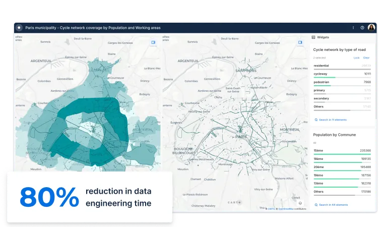
Mobility Planning
Optimizing public transport infrastructure, such as bikes, buses, trains, & metro services, is paramount in order to reduce traffic & improve road safety.
Analyzing commuter patterns through origin-destination matrices & spatial models allows cities to provide the right services to the people who need it most.