
How to use this data in CARTO?

Get started in a matter of minutes with a free trial account. Simply sign up here.

Discover datasets to enrich your analysis, by category, country or provider.

Bring new datasets into your analysis using our Data Observatory, augmenting the data you're already using in CARTO.

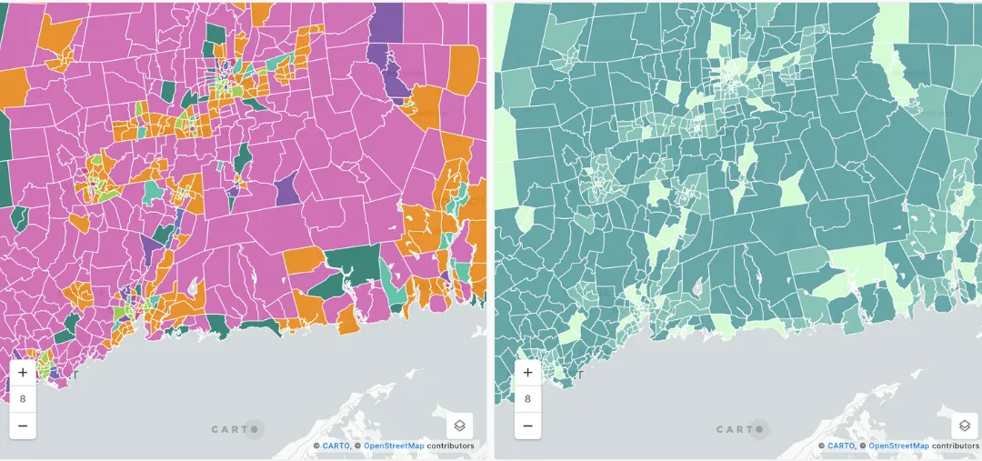
Example of Environmental Data Analysis
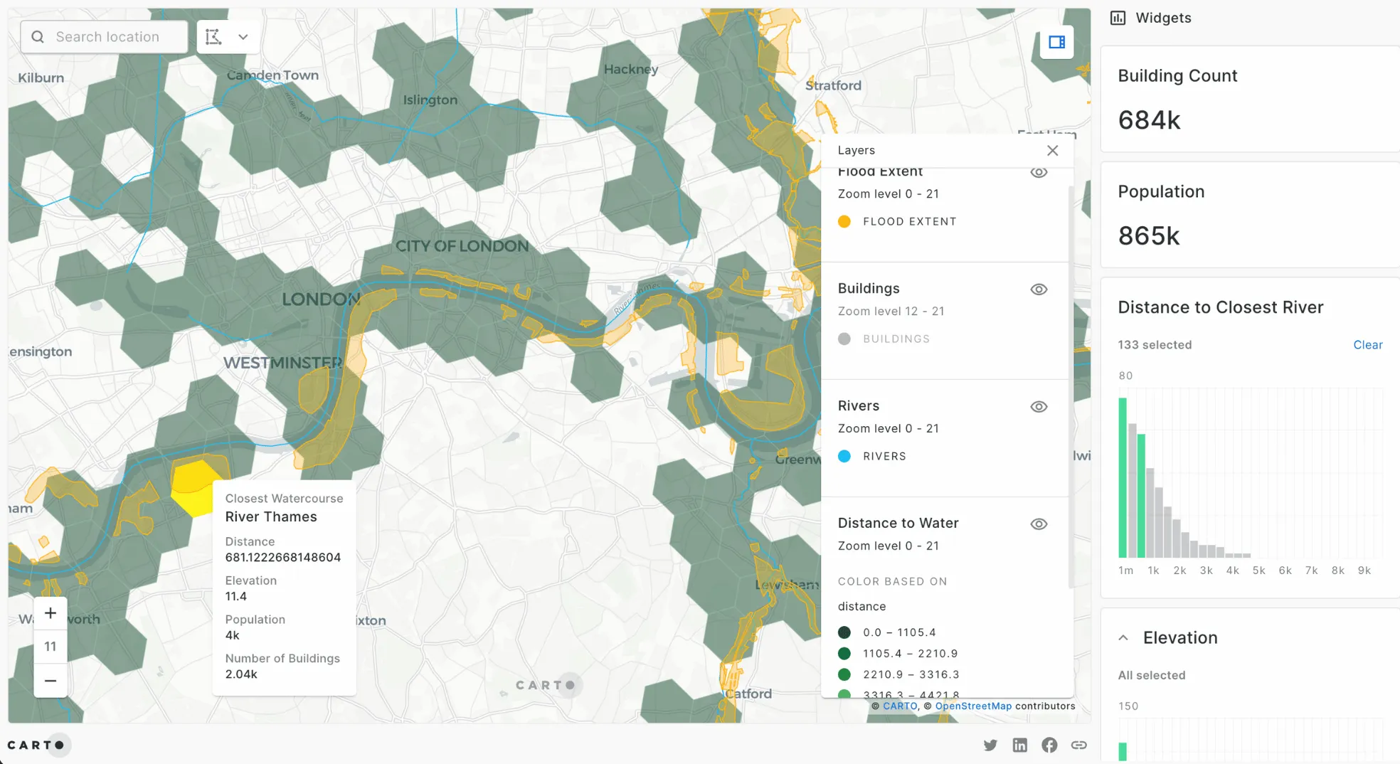
P&C Insurance
Catastrophe analysts in leading insurance and reinsurance firms use flood data in CARTO to understand risk exposure across their portfolios. Using H3 indexes and different environmental data sources, they can share insights on their Total Insured Value by location - dynamically understanding the impact of different climate scenarios.
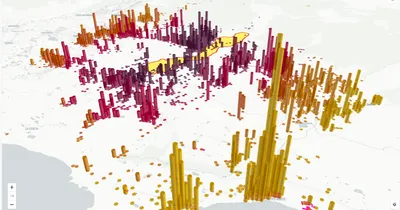
Example of Environmental Data Analysis
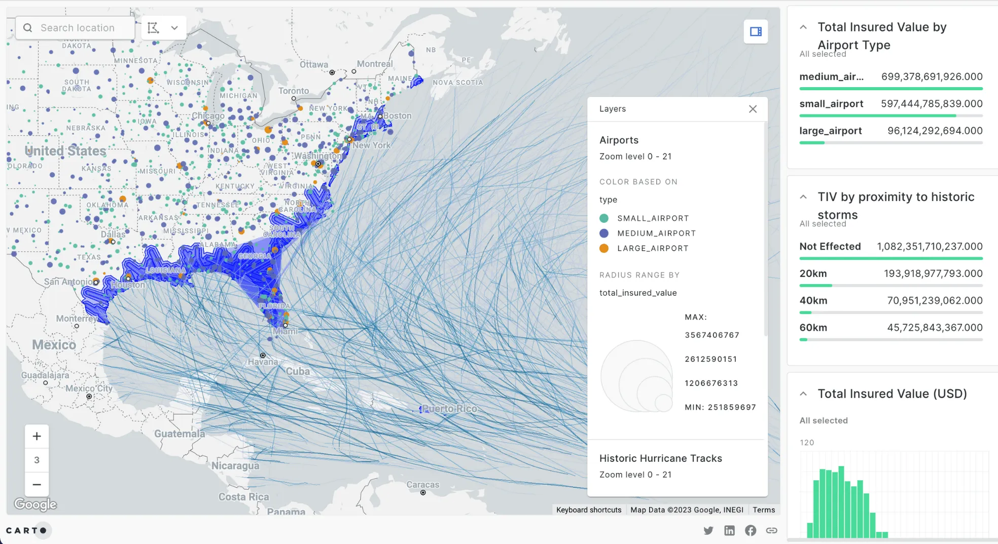
Aircraft Insurance
Specialized aircraft insurers use historic storm data, airport elevation data and POI data on airport locations along with customer data to predict risk and influence future pricing strategies - saving days of ETL work each month and reducing time to insight for stakeholders across the business.
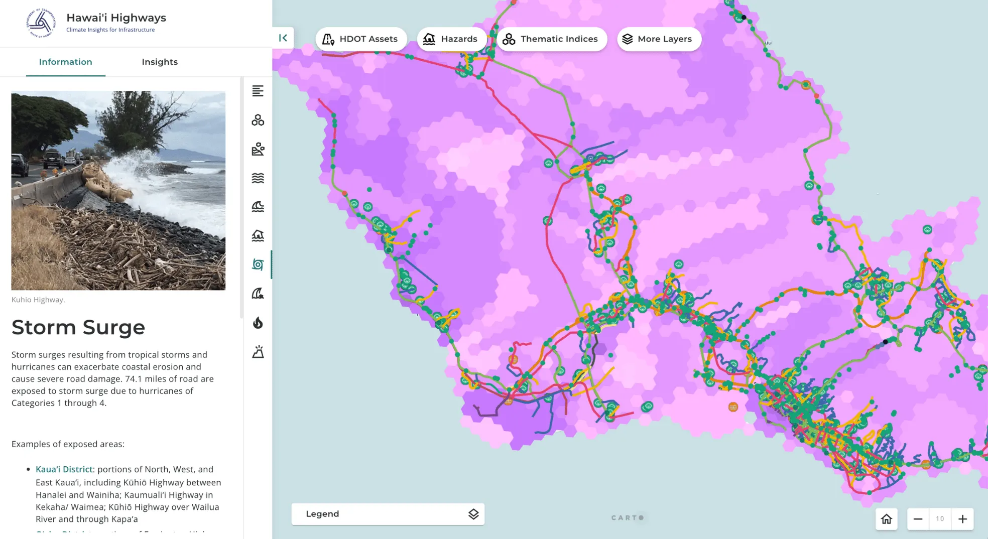
Example of Environmental Data Analysis
Transport Departments
The Hawaii Department of Transportation uses CARTO to bring together hundreds of datasets as part of their climate resilience strategy. Their transportation planners use our platform to dynamically analyze 50+ variables to set KPIs relating to climate and catastrophe risks to critical infrastructure assets, incorporating equity and environmental information to generate informed plans of action for addressing long-term climate risks and short-term disaster responsiveness.
DISCOVER OTHER SPATIAL DATA CATEGORIES

Property statistics, prices, and history to drive decisions and investment.
.svg)
The most recent census data including: age, income, household types, and more.
.svg)
Consumer Spending, Purchasing Power and Wealth indicators.

Data from routing apps and GPS to analyze traffic patterns and commuters.

Mobile device and GPS data provide insight into human movement patterns.

Location data for business establishments, restaurants, schools, attractions, …
.svg)
Climate and weather data, including exposure to weather-based hazards.
Browsing habits, app usage, feelings and experiences shared over social media platforms, ...

Digital boundaries for data aggregation and display on a map.