



CARTO SDI
Spatial data infrastructure, rebuilt for the AI age
Publish sovereign, AI-ready geospatial catalogs — governed, monetized, and open by design.

Publish anywhere
Cloud-native catalogs published to storage you control, read directly by any browser, GIS tool, SQL engine, or AI agent — with no server in between.

Open by design
Built on the open Portolan standard and open formats. No lock-in — every catalog keeps working in QGIS, DuckDB, or BigQuery without CARTO.

Govern & monetize
Access control, entitlements, and a full audit trail, plus usage analytics, licensing, and revenue reporting on every dataset.
Built on Portolan, not instead of it
CARTO SDI operates Portolan catalogs at enterprise scale. Your data stays as open files in storage you choose, and keeps working even without CARTO.


What CARTO SDI adds on top of Portolan
Portolan makes a catalog publishable. CARTO SDI makes it operable across two surfaces: a catalog explorer your users browse, and a control plane your team runs it from.

Interfaces for your users
A branded catalog browser, dashboards, and CARTO Builder maps on top of your published data, ready for your users.

Open to external AI agents
The same catalog is reachable from Claude, ChatGPT, or coding tools over MCP, so one question can join datasets live across organizations — no exports, no copies.

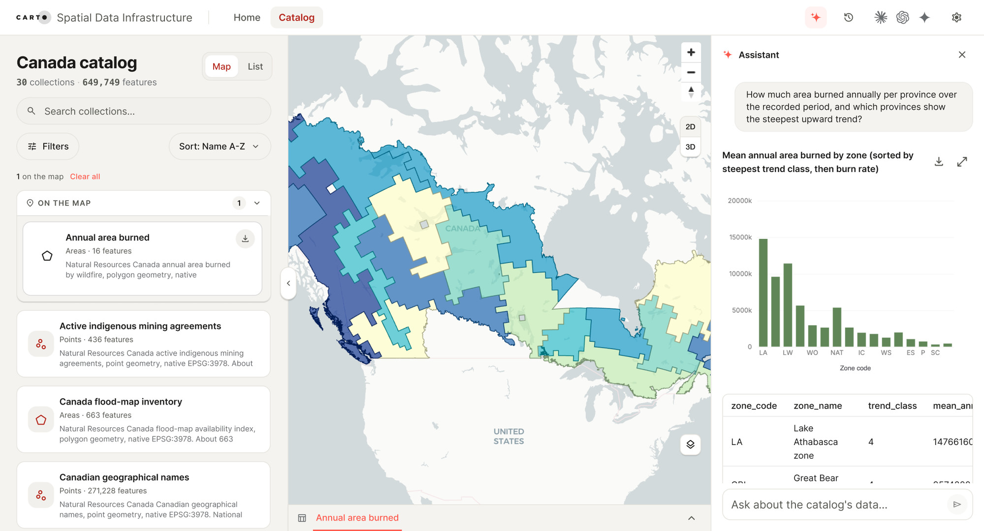
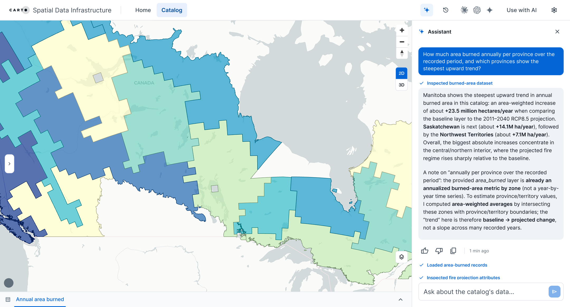
Ask the catalog anything
Ask in plain language inside the catalog. The assistant finds the datasets, queries them in place, and answers with a map, sources, and a re-runnable query.
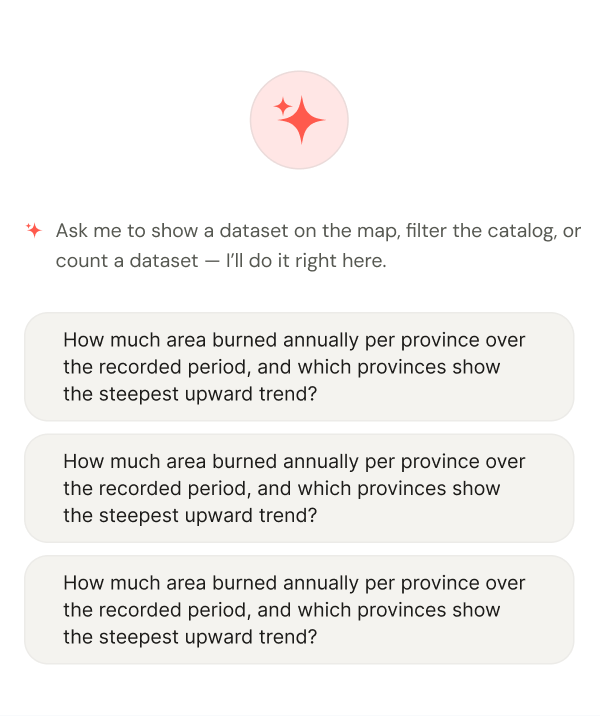

Self-registration
Users register themselves, accept licenses, and get credentials on their own, with no support ticket in the loop.

Public and private, one catalog
Public datasets are open to browse and download; licensed and internal ones sit behind a request — users see the whole catalog and ask for what they need.

The publisher control plane
One place to run your SDI as a product: private datasets and access control, governance and audit, monetization, usage analytics, writable datasets, and AI-assisted publishing.
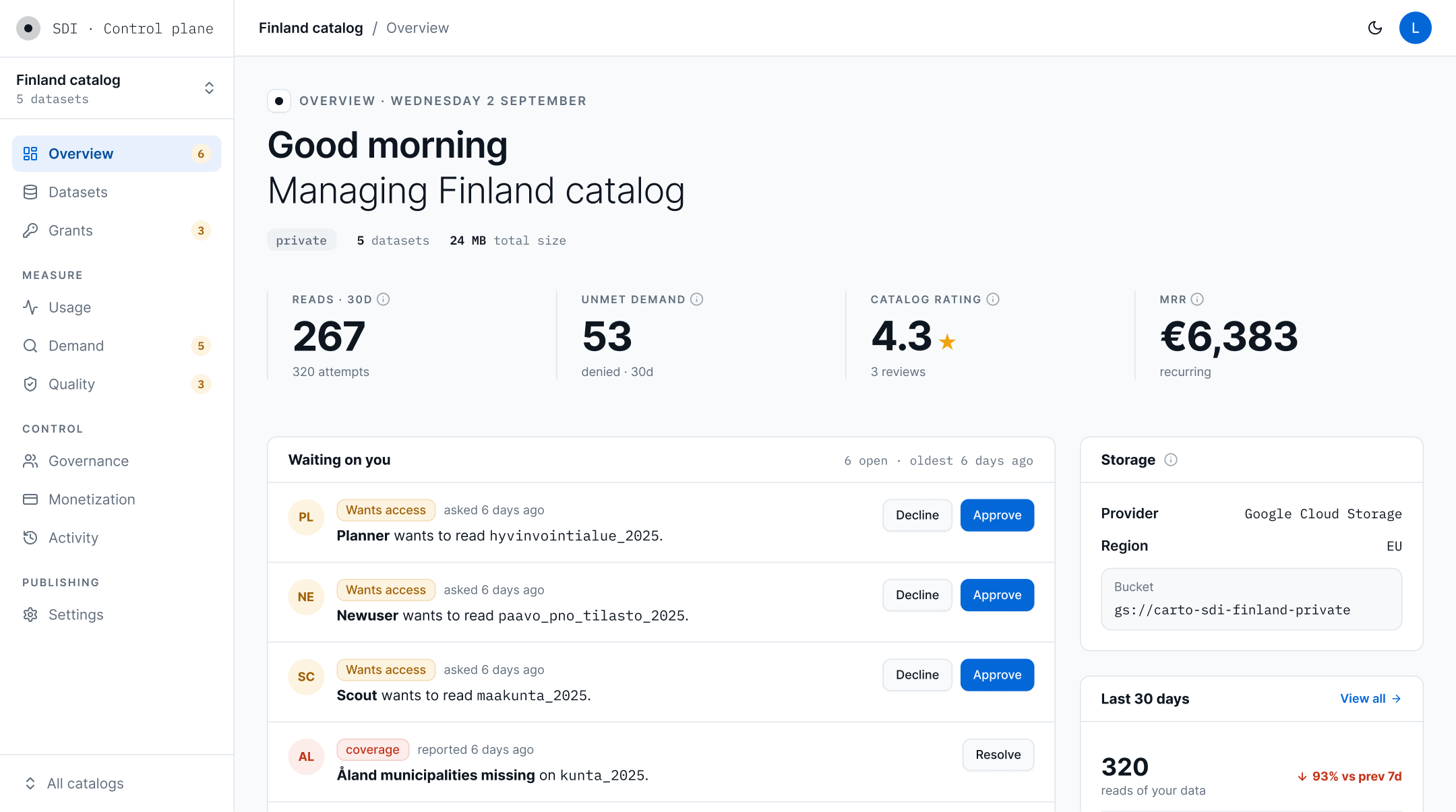

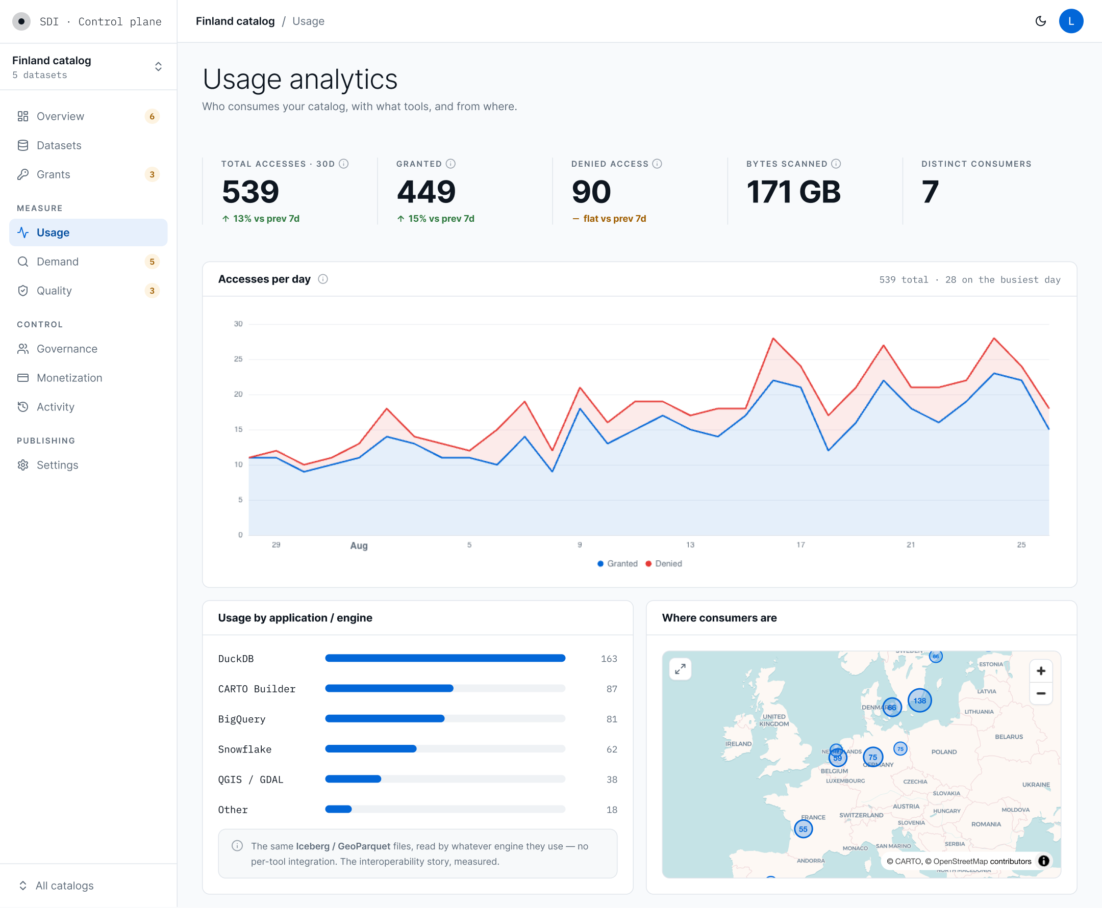
Usage analytics
Who consumes each dataset, with which tools, from where, and — for agent traffic — the intent behind the query.

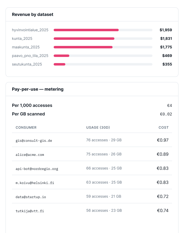
Monetization
Licensing, subscriptions, and pay-as-you-go on any dataset, with revenue reported per dataset and per customer.

Governance and audit
Approval flows, dataset versioning, and a complete audit trail across every catalog your team publishes and operates.

Private datasets and access control
You decide what stays open, licensed, or internal-only — roles, approval flows, and short-lived credentials govern every access request.
Legacy bridges
Serve WMS, WFS, and ISO 19139 metadata from the same catalog for the GIS clients that still rely on them today.

Open in QGIS and ArcGIS
QGIS, ArcGIS, and any OGC-compliant client connect straight to the catalog through open formats and standard APIs — no export, no copy, always the live data.

Writable datasets
Managed update flows on cloud-native tables, so a catalog takes corrections and new versions with no parallel pipeline.
AI-assisted publishing
The control plane drafts metadata, documentation, and map styles from the data itself; a publisher reviews and approves.
The full CARTO platform
Warehouse-native analytics, no-code Workflows, and AI Agents, connected to your catalog end to end so every team shares one source of truth.
Every screen answers a question publishers ask
The control plane is where your team runs the SDI day to day — six areas, each built around a question a traditional geoportal cannot answer:
- Usage — who uses our data?
- Demand — what should we publish next?
- Quality — is the data good?
- Monetization — what is it worth?
- Governance — who approved what?
- Settings — where does everything run?
From a list of datasets to an answer
A traditional geoportal hands you a download link and leaves the real work to specialists. CARTO SDI replaces it with an agent — on your site, under your brand, with models you approve — that finds datasets, queries them in place, and answers with sources, a map, and a re-runnable query.
Built for the organizations that publish authoritative data
They share one problem: authoritative data, many consumers, and a mandate to serve them well — while staying sovereign over where their data, compute, and AI run, usually with no extra budget. With no server in the request path, sovereignty and cost move in the same direction.
See your own data as an AI-ready catalog
A pilot starts small. We take a slice of your open data, publish it as a sovereign Portolan catalog, and put an agent on top that answers real questions about it. You bring the data and the first question that matters. You see the result in weeks, not quarters.