


Navigate global risk with MBI CONIAS Political Risk data
Monitor and forecast global political risks with MBI CONIAS data - spatial, predictive, and ready to support smarter decisions in volatile regions.
.jpg)


Automating your spatial workflows in Databricks with CARTO
Automate your geospatial workflows in Databricks with CARTO. Schedule, trigger, and integrate spatial data processes seamlessly using Databricks Workflows.


Space-time anomaly detection for smarter property risk assessment
Learn how to detect crime anomalies & assess property risk in near real-time using CARTO Workflows—low-code spatial analytics for scalable spatial data science
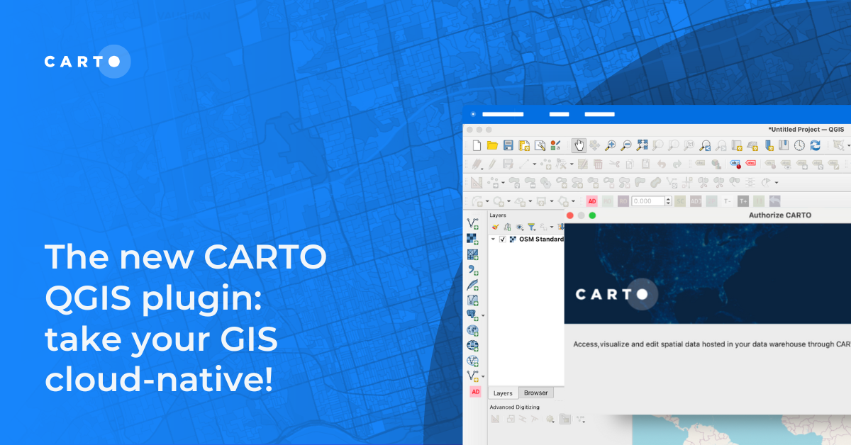

The new CARTO QGIS plugin: take your GIS cloud-native!
Modernize your GIS with QGIS & CARTO for scalable cloud-based analytics. Maximize efficiency, security, and collaboration.


BigQuery ML now in CARTO: supercharge your spatial analysis with AI
Supercharge your spatial analysis with AI! CARTO’s BigQuery ML Extension lets you build, train & deploy ML models seamlessly in Workflows.

Expand your analysis with the new CARTO Workflows Extensions
Expand & simplify your spatial analytics with AI-powered CARTO Workflows Extension Packages. Automate tasks, ensure consistency & enhance geospatial insights!


Drive smarter decisions with new BT mobility data in CARTO
Unlock mobility insights with BT Active Intelligence & CARTO! Drive smarter decisions with road-level data, OD matrices & seamless cloud integration.


What's New in CARTO - Q4 2024
Announcing the latest new features in the CARTO platform from Q4 2024! Explore the latest in visualisation, app development, analytics & security.

24 of the best maps, visualizations & analysis from 2024
Discover 24 of the best maps, visualizations, and analyses from 2024! Explore innovations in geospatial data, user-centric tools, & advanced spatial analytics.
.png)

Deploy CARTO inside Snowflake using Container Services
Discover the power of spatial analytics with CARTO inside Snowflake! Deploy seamlessly via Snowflake Marketplace for enhanced performance, security, and scalability.
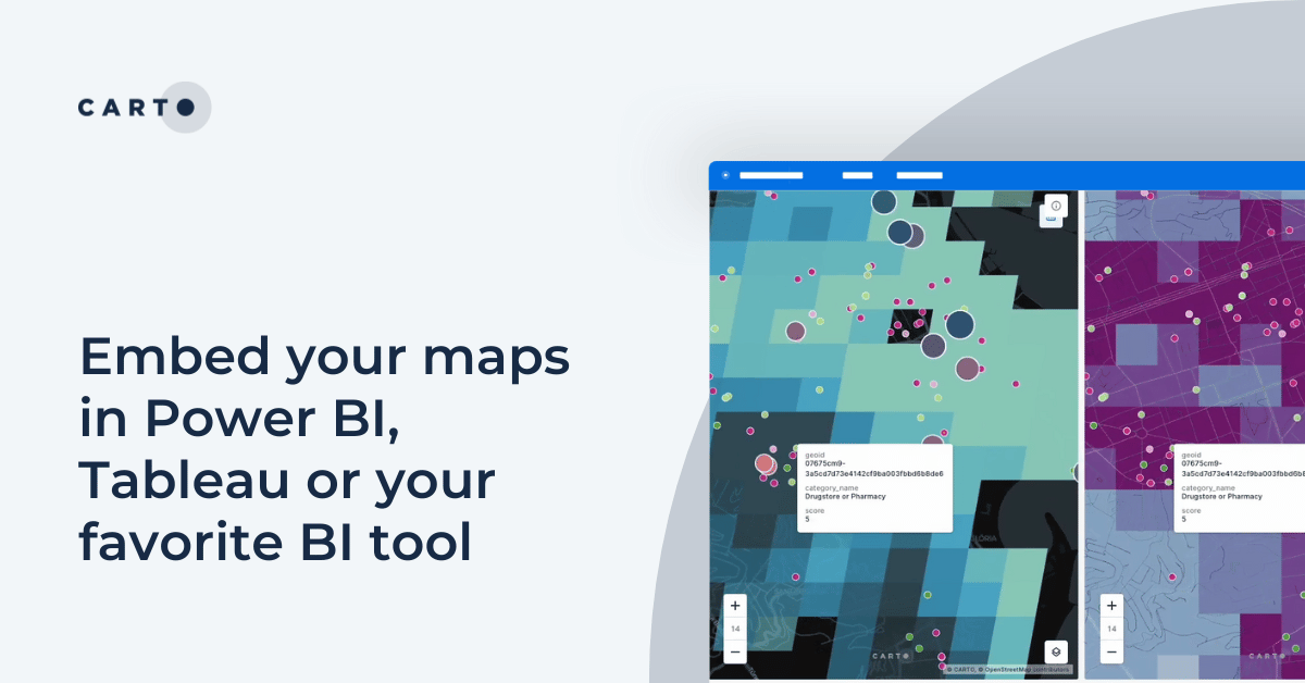
Embed your maps in Power BI, Tableau or your favorite BI tool
Learn how to embed CARTO maps in Power BI, Tableau, and other BI tools to enhance dashboards with interactive spatial data visualization and insights.


CARTO for Databricks: True Native Geospatial for the Lakehouse
Discover CARTO's integration with Databricks, empowering users with native geospatial analytics for enhanced Location Intelligence and streamlined workflows in the Lakehouse.
.png)

Recap of SDSC24 NYC & CARTO’s Vision for the Future
Latest innovations in geospatial analytics from CARTO, industry insights, and AI-driven spatial tools showcased at the Spatial Data Science Conference in NYC.

Academy
Navigate global risk with MBI CONIAS Political Risk data
Monitor and forecast global political risks with MBI CONIAS data - spatial, predictive, and ready to support smarter decisions in volatile regions.

Maps with a Mission: Environmental Impact with Spatial Analytics
Let’s dive into how organizations use CARTO to protect biodiversity, advance climate research, manage natural resources, and drive sustainable decision-making.
Google Cloud Next 2025: Key takeaways for geospatial
Discover key geospatial insights from Google Cloud Next 2025 - AI, low-code tools, Earth Engine, and more innovations shaping the future of location tech.
.jpg)
