CUSTOMER STORIES

Unlocking Consumer Insights at Scale with Cloud Native Spatial Analytics

"CARTO’s Location Intelligence platform lets us visualize massive sets of data hosted in Google BigQuery. Thanks to this cloud-native approach to spatial analytics, we have overcome challenges related to scalability and security, and can serve our customers even better."
Seamus Abshere
CTO & Co-founder of Faraday
"CARTO’s Location Intelligence platform lets us visualize massive sets of data hosted in Google BigQuery. Thanks to this cloud-native approach to spatial analytics, we have overcome challenges related to scalability and security, and can serve our customers even better."
Seamus Abshere
,
CTO & Co-founder of Faraday
The Client
Faraday
Faraday is the marketer’s choice for consumer prediction infrastructure that combines the right data with the right data science to deliver amazing digital experiences and highly effective 1-to-1 marketing experiences using responsible, no-code AI.
The Challenge
Making accurate predictions using large volumes of data
Predicting the future of ever-evolving industries is a difficult task. It requires a holistic approach to gathering, visualizing, and segmenting data from a variety of sources. Faraday’s challenge was to generate powerful insights through a seamless integration with Google BigQuery, whilst using a fully customizable solution for a variety of customer use cases.
Results
Limitless scalability and insight on demand
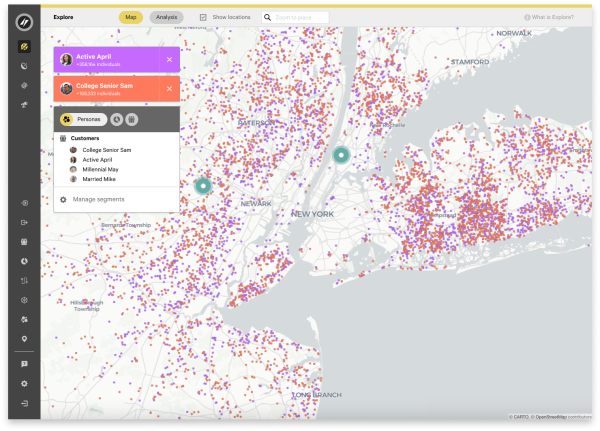
Cloud is revolutionizing the way spatial analysis is done. CARTO, as a cloud-native platform running directly on Google BigQuery, gives Faraday the security and scalability needed to take spatial data analytics to the next level. Faraday’s solution enables customers to segment massive volumes of clients and prospects into appropriate audiences based on detailed demographic or behavioral characteristics. In effect, Faraday’s customers can tailor their marketing campaigns and expansion plans based on unique data-driven insights.
Why CARTO?
A cloud-native approach that ensures scalability and security
As a cloud-native solution, CARTO provides Faraday with the near-limitless scalability and performance required to process, analyze and visualize very large datasets hosted in Google BigQuery. This, together with the ability to integrate and provide rapid, ready-made insights, made CARTO the ideal spatial analytics platform for Faraday.
+
.webp)
A cloud-native approach
CARTO is the Location Intelligence platform built to run natively within Google Cloud’s BigQuery lakehouse. This seamless integration breaks down GIS data silos, empowering you to transform spatial analysis into business-critical decisions directly inside your cloud environment.
CARTO’s platform eliminates slow and ungovernable ETL processes, and ensures enterprise-grade speed, scalability and security. Your geospatial teams gain native access to the full power of Google Cloud’s open, serverless architecture - including Apache Iceberg with BigLake, BigQuery ML, Vertex AI, and Google Maps APIs. In addition, CARTO offers rich geospatial visualizations, an advanced Analytics Toolbox, a low-code design and automation environment, and app development toolkits - all available through Google Cloud Marketplace.