CUSTOMER STORIES
Google BigQuery Visualization: Mapping Big Spatial Data
The Client
GDELT is the largest, most comprehensive, and highest resolution open database of human society ever created. Creating a platform that monitors the world’s news media from nearly every corner of every country in print, broadcast, and web formats, in over 100 languages, every moment of every day and that stretches back to January 1, 1979 through present day.
The Challenge
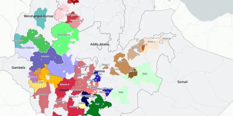
The Global Geographic Graph now spans more than 1.7 billion location mentions in worldwide English language news coverage back to 2017. GDELT wanted a way to map the geography of the global news narrative.
Results
Using CARTO’s BigQuery connector, The GDELT Project have been able to create interactive maps from their huge dataset, including a focus on news coverage in the context of COVID-19 at different points during the pandemic.
Why CARTO?
With CARTO you only need to enter a SQL query from BigQuery to connect your data & make it available on the platform—allowing you to easily visualize, perform spatial analyses, & build applications.
For more details on this customer story, read the full blog post.
+
.webp)
A cloud-native approach
CARTO is the Location Intelligence platform built to run natively within your Google Cloud’s BigQuery lakehouse. This seamless integration breaks down GIS data silos, empowering you to transform spatial analysis into business-critical decisions directly inside your cloud environment.
CARTO’s platform eliminates slow and ungovernable ETL processes, and ensures enterprise-grade speed, scalability and security. Your geospatial teams gain native access to the full power of Google Cloud’s open, serverless architecture - including Apache Iceberg with BigLake, BigQuery ML, Vertex AI, and Google Maps APIs. In addition, CARTO offers rich geospatial visualizations, an advanced Analytics Toolbox, a low-code design and automation environment, and app development toolkits - all available through Google Cloud Marketplace.