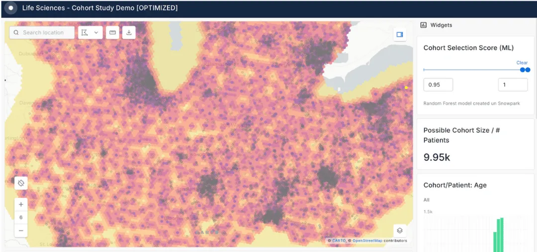
Healthcare Analytics
A patient’s location directly influences their health. Whether it’s disease prevention or clinic site selection, considering spatial in your healthcare analytics can have a drastic impact.


Healthcare Factor Analysis
Gaining spatial context on patients allows public & private healthcare systems to optimize resource allocation & provide superior services.
Spatial analysis allows your organization to identify which location-factors may be the root cause of certain health problems, allowing you to improve outreach, services & intervention with a more detailed picture of healthcare access.
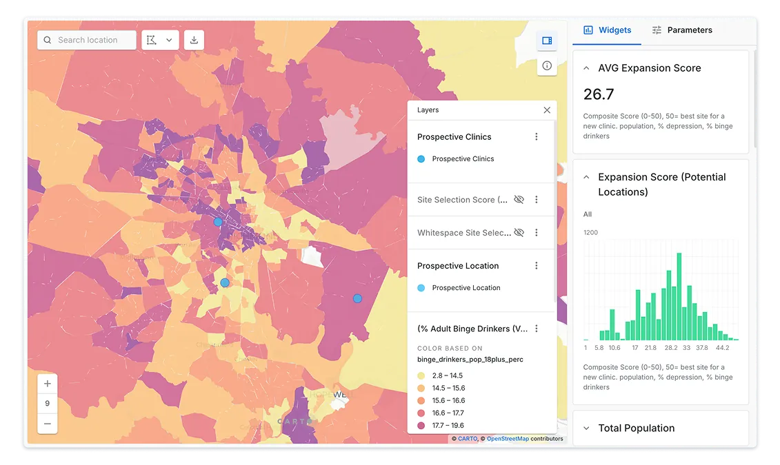
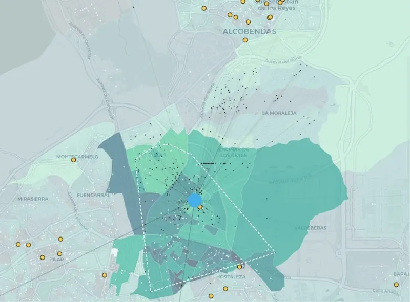
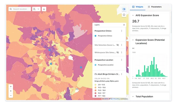
Medical Site Selection
Whether it’s hospitals, primary care, residential homes or dental clinics, selecting optimal locations to serve citizens & clients is fundamental to ensure quality service & profitability.
By using spatial analysis with new data streams to enrich Open Data & your existing CRM data, you will be able to monitor, consolidate & expand effectively - avoiding expensive site selection mistakes.
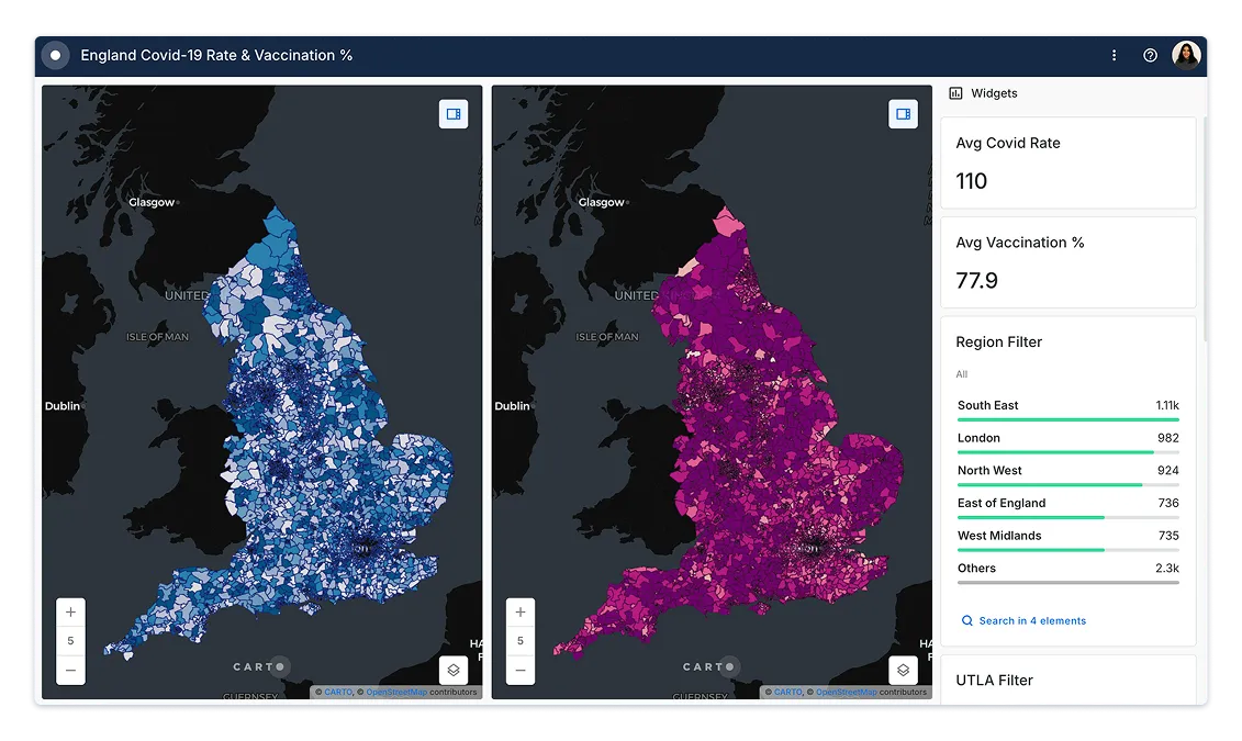
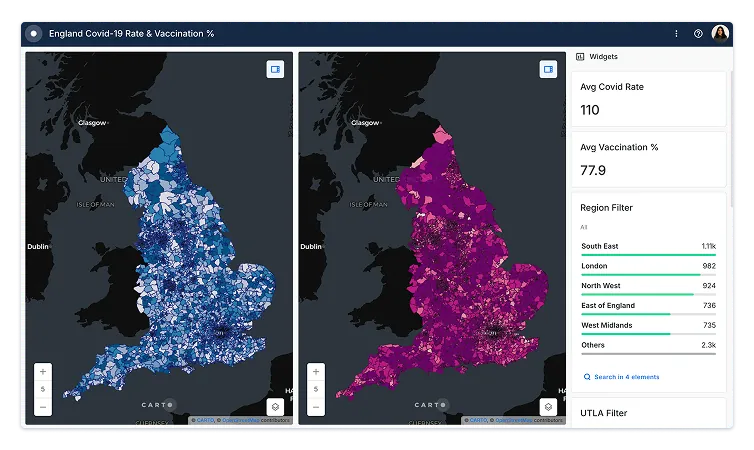
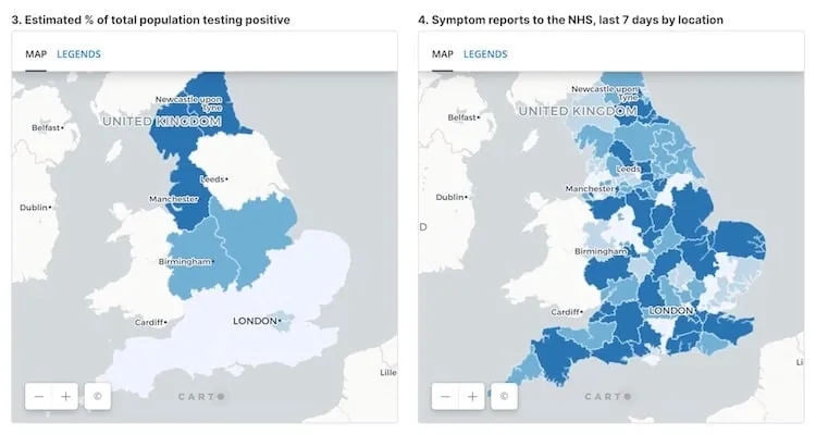
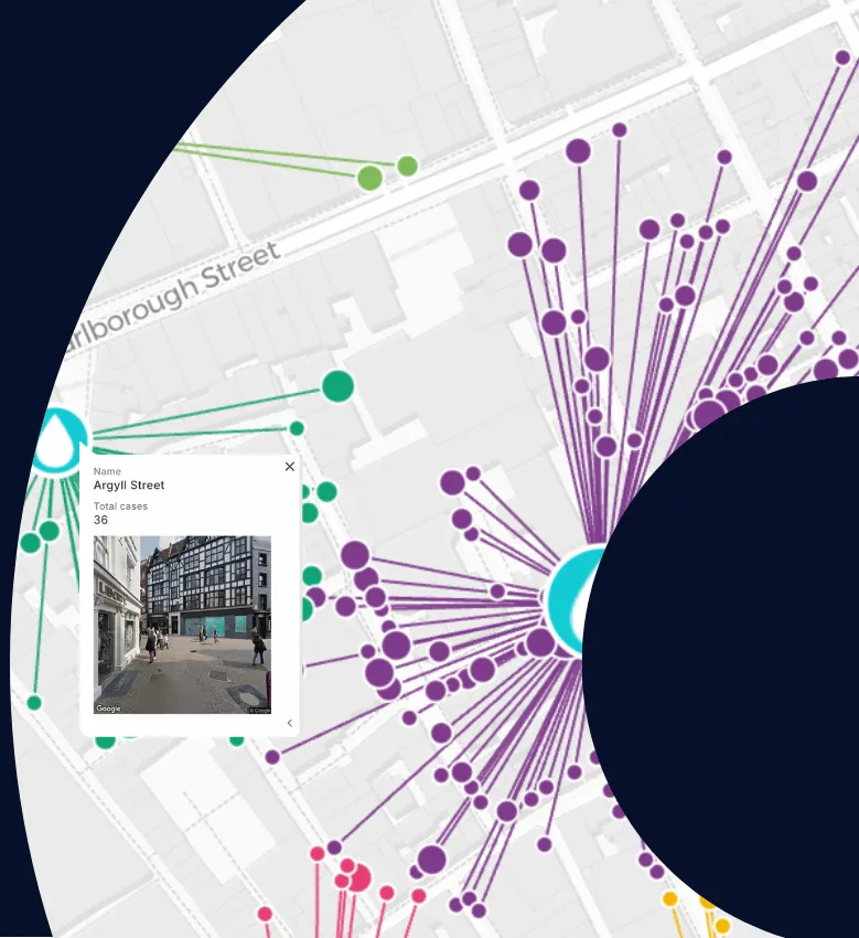
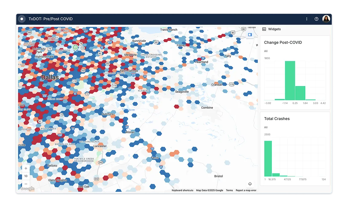
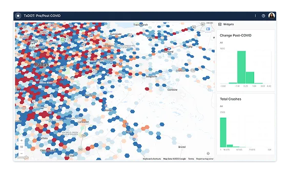
Disease Surveillance & Prediction
Using spatial data to model epidemics, pandemics & behavior in response to outbreaks is a key part of epidemiology.
By combining health data with other data streams such as human mobility, financial data & POIs, scientists & governments can inform policy more effectively using spatial modeling & visualization to drive decisions around social distancing, testing & emergency response.