.webp)
Territory Planning
Not considering location in your sales & service territory planning can cost millions in terms of lost productivity & operational inefficiencies. Balance, design & accelerate using Location Intelligence.
.svg)


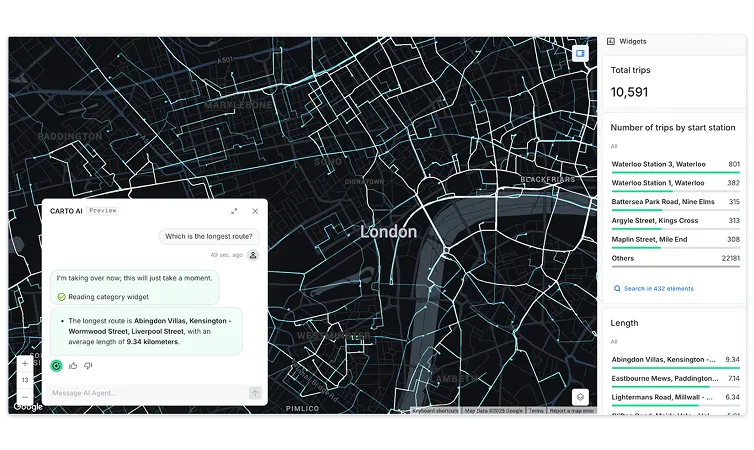
Territory Management
Too many field staff plan their days directly from complex CRM systems that don’t consider where customers are & how factors such as traffic & weather can affect their day. Using LI solutions, such sales leaders in industries (such as CPG & Pharma) can:
- Optimize field travel to ensure more visits per trip.
- Nurture & expand the highest potential accounts & identify gaps.
- Empower reps to spend more time selling.
.webp)
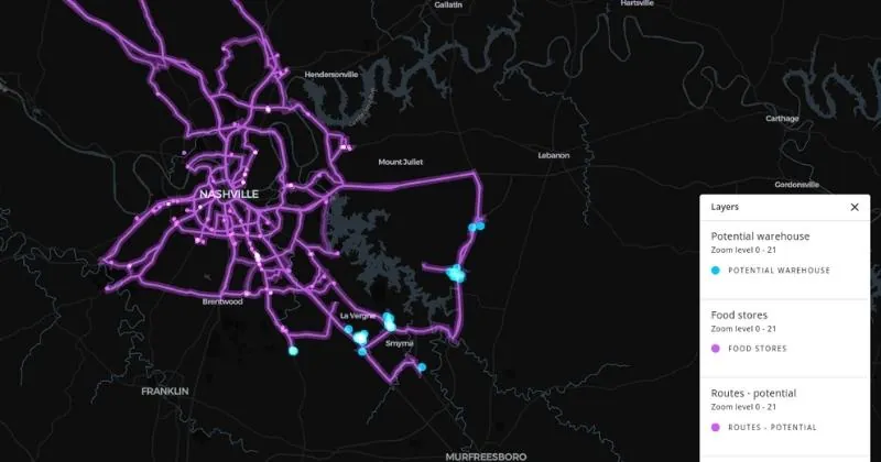
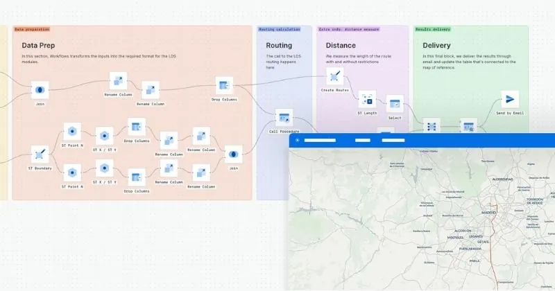
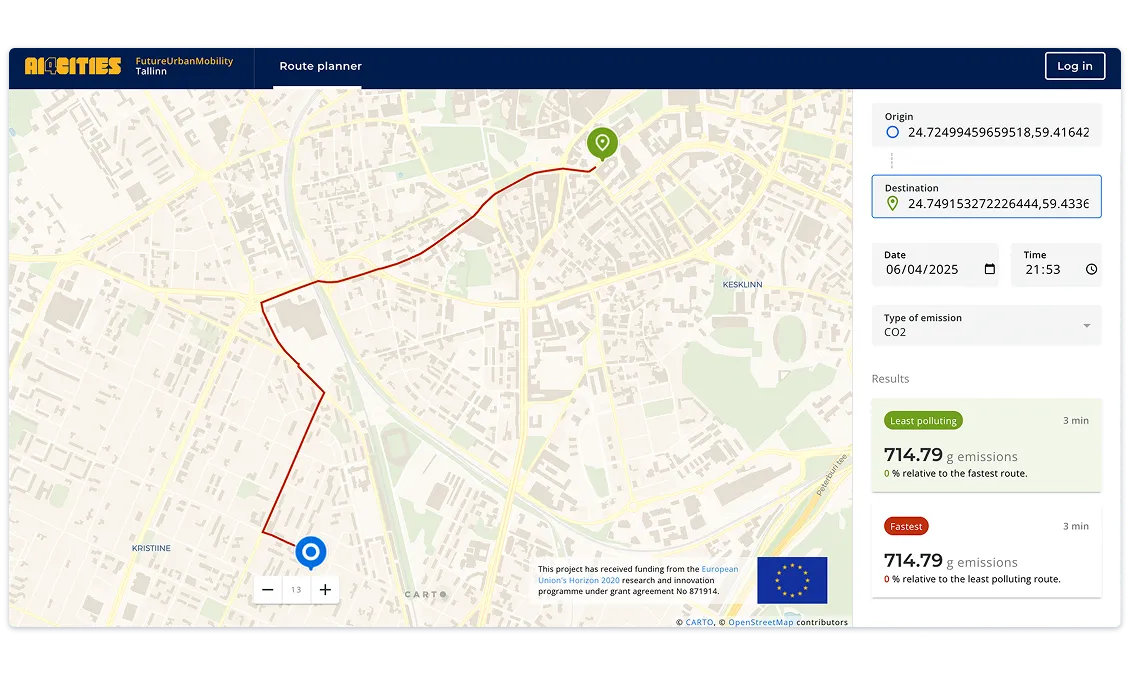
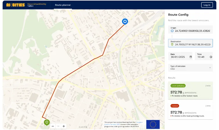
Route Planning
Whether it’s food delivery, haulage or ecommerce, route planning is critical in order to reduce costs & ensure higher levels of customer service. Market-leaders (like DPD, DHL & Securitas) use our platform for constraint-based route optimization, allowing them to:
- Ensure more deliveries or visits per journey.
- Reduce the number of failed visits or deliveries.
- Reduce fleet costs by reducing fuel consumption & vehicle maintenance
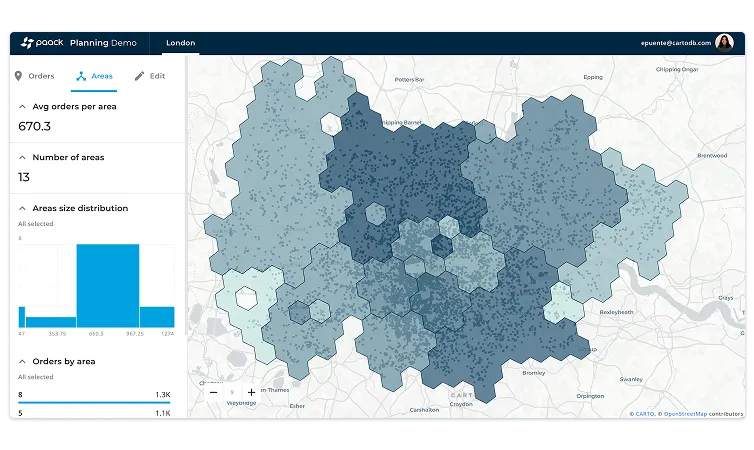
Territory Design
Revising & adapting sales & service territories can be an expensive & disruptive process for your field staff, which is why it’s so important to get it right with the first time.
Using Spatial Data Science to align your approach with your organization’s commercial needs is critical in order to run an efficient & profitable operation.
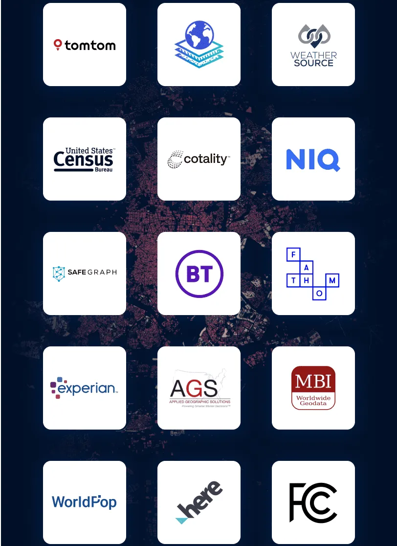
Over 12,000 geospatial datasets available
Take the pain away from selecting, collecting, and analyzing location to understand site performance with our Data Observatory, a one-stop shop for all things geospatial data.
Augment your sales data and broaden your analysis with a wide range of curated datasets on standardized spatial aggregations, such as foot traffic & credit card transactions.
Get inspired by our customers
The ability to scale our data is a big selling point, as well as the features in the Analytics Toolbox. I also love how easy it is to plot something using CARTO Workflows. As a team leader, I am looking forward to what we can create and achieve using CARTO.