Why is my geometry out of bounds?
Learn about digital map boundaries.
CARTO Builder gives you the ability to draw geometry on a map. You might encounter an error like this when drawing:
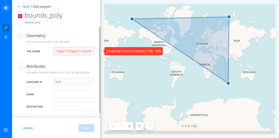
CARTO stores point, line and polygon coordinates in the_geom column, in EPSG:4326 projection. That error happens when the point or vertex you are drawing falls outside of the projected map’s boundaries.
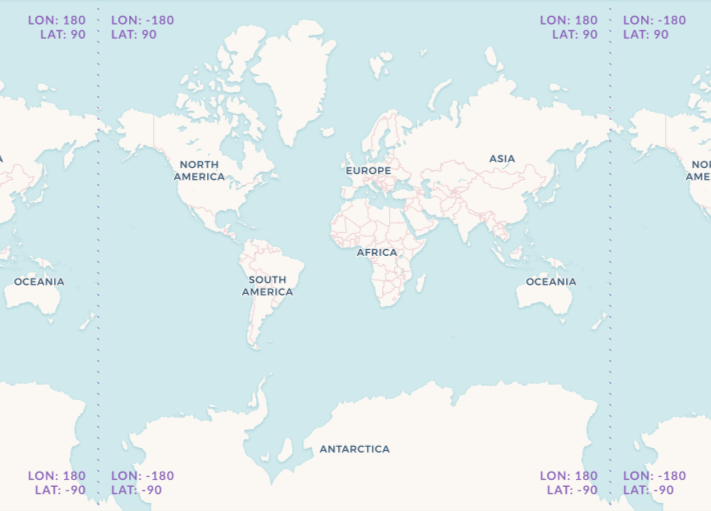
All features in a digital map fall within -180 and 180 decimal degrees of longitude, and within -90 and 90 latitude. When you zoom out far enough to see more than one set of continents, that means CARTO has automatically repeated the area within [180, 90],[-180, -90] bounds in order to fill the Map View.
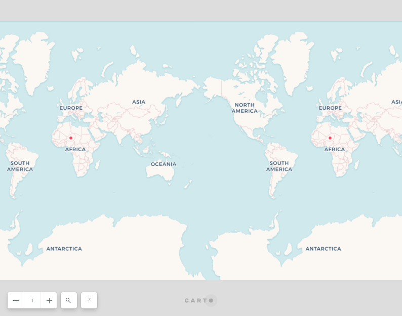
If you draw geometry within bounds and zoom out to level 1, you will see that your geometry is automatically repeated also.
For a general introduction to cartographic concepts visit this resources page in our Help Center.