Manage your subscriptions
Manage your public and premium dataset subscriptions
Learn how to manage your different subscription from the Data Observatory
Through the section “My Subscriptions” within the “Data” area in the user dashboard you can check all relevant details to manage and access the different datasets subscribed from the Data Observatory. From this central page you can check the status of each subscription (e.g. requested, active, expired, etc.), access each dataset’s metadata, and start working with your subscribed dataset.
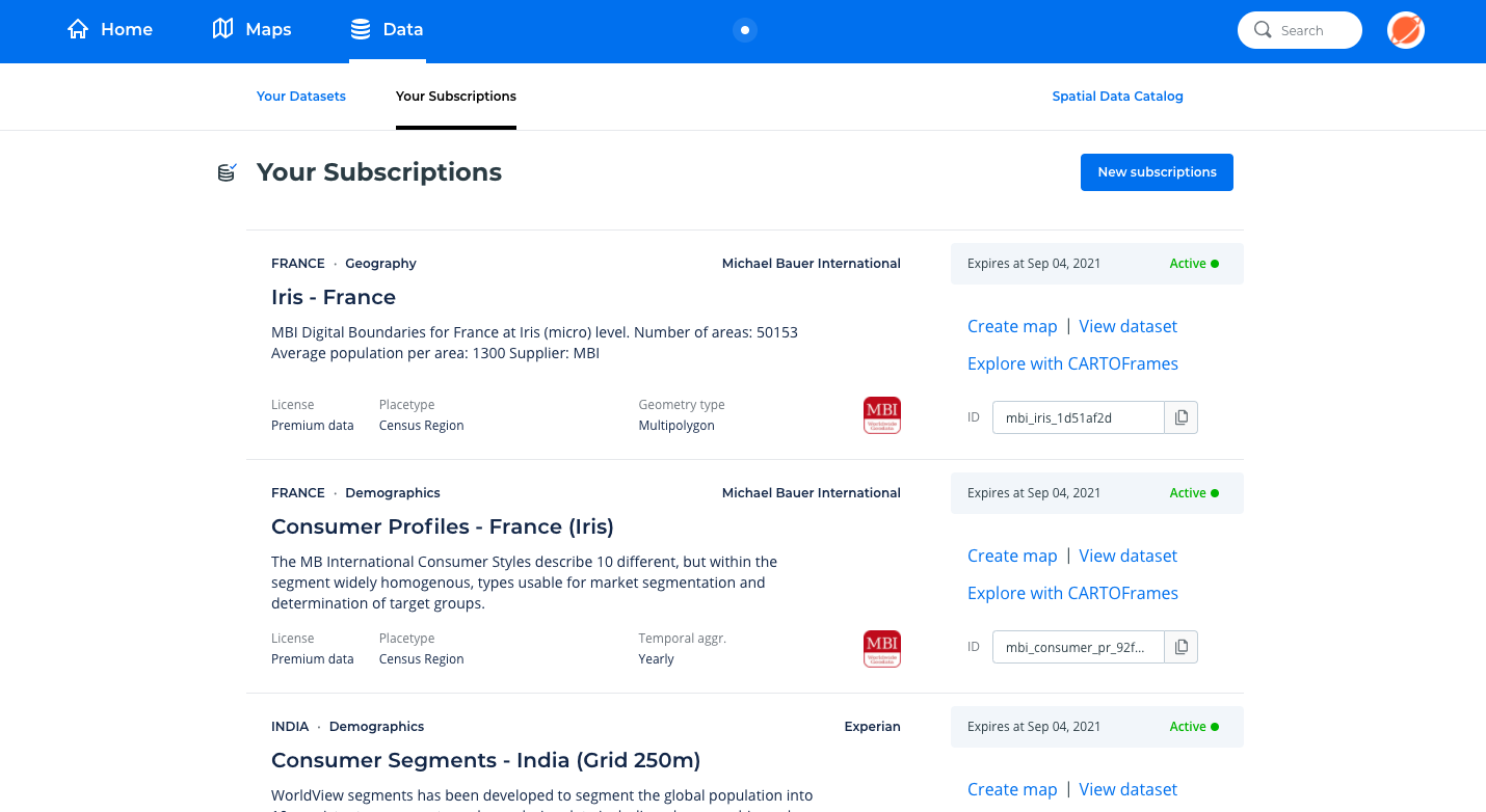
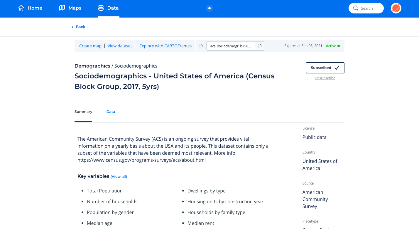
For those datasets supported by CARTO Builder, users can use this interface to directly access the data or create a new map through the options “View dataset” and “Create map” respectively.
Note
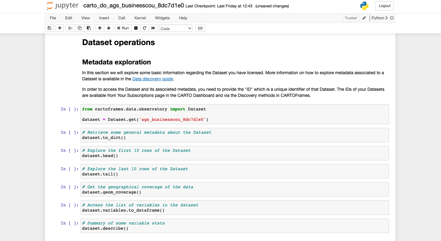
Not all datasets are available for use within CARTO Builder due to size and format reasons. In those cases, we recommend users to access those datasets with CARTOframes, to query them to reduce their coverage and/or scope (i.e. by filtering an area by a bounding box, selecting specific columns or filter by column values), and then to load the resulting geo-dataframe as a table to their CARTO account. To do that, please check our CARTOframes Data Management guide in the Developer Center. —
Users working in Python can either download a pre-built Python notebook illustrating how to access and explore the data with CARTOframes or use this web-based interface to retrieve the ID’s needed to call and access the data from their own notebooks.
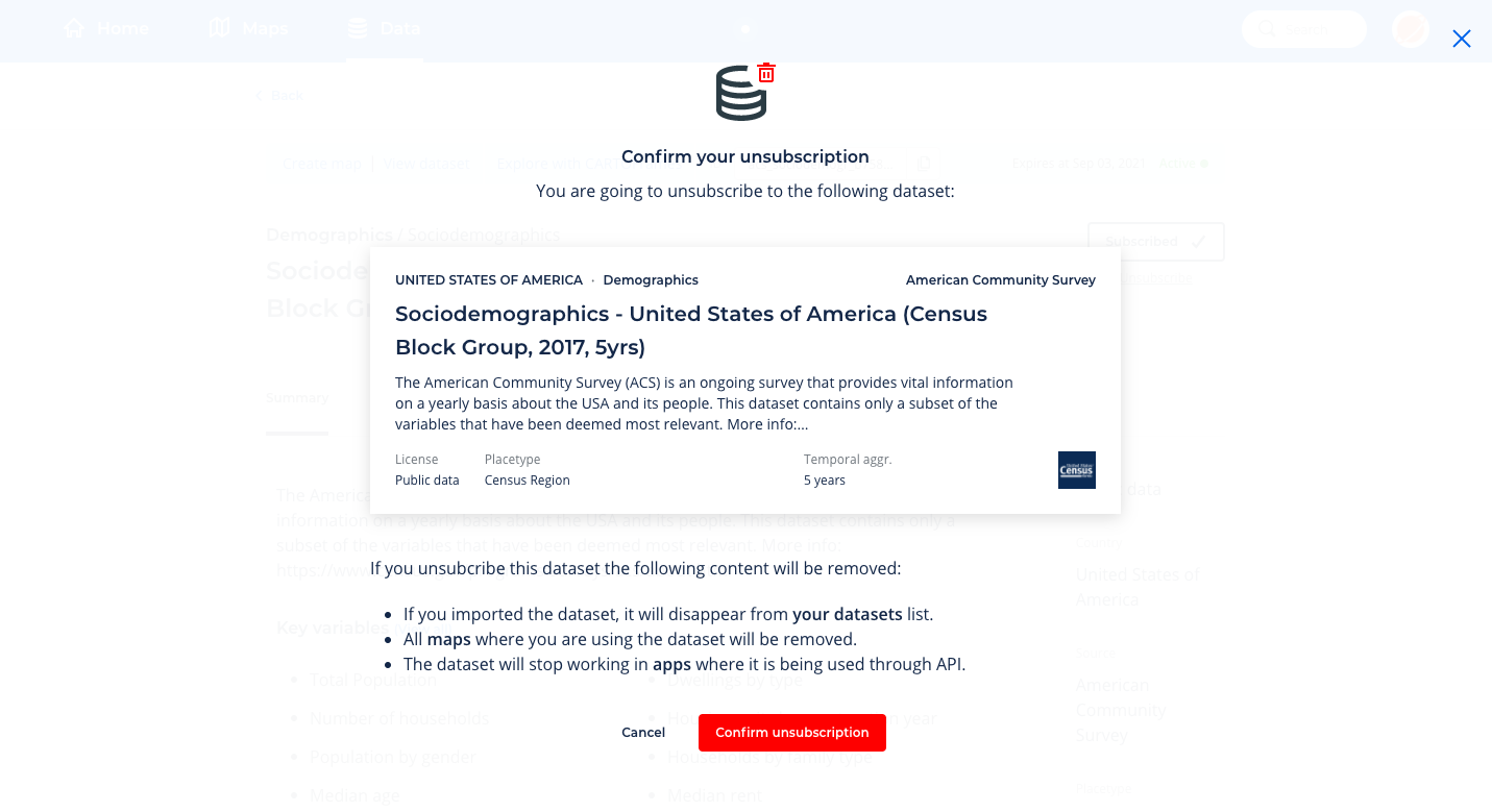
Users can unsubscribe from public subscriptions by accessing the dataset detailed page and clicking on “Unsubscribe”. Premium data subscriptions expire as per the terms defined in the acquired premium license.
Note
Additionally, for Python users, CARTOframes offers Data Enrichment methods for enriching both point-based and polygon-based data with variables from the datasets licensed via de Data Observatory. The results of the enrichment processes can then be uploaded back as CARTO tables if users want to work with that enriched data in Builder.