Spatial Data Catalog
Access and browse the Spatial Data Catalog
Learn how to browse our extensive catalog of spatial datasets
CARTO’s Spatial Data Catalog allows users to explore the specifications of thousands of spatial datasets available via the Data Observatory so to find the best data based on their requirements.
The Spatial Data Catalog is built on top a smart metadata system that has registered in an homogenous manner all characteristics defining a dataset (i.e. provider, coverage, schema, variable description, sample data, etc.), providing a unified experience to expore and understand the details of very different types of spatial data.
The Spatial Data Catalog is available from our public website and also from within the user dashboard once you log in to your account in the “Data” section. Additionally, for Python users the Spatial Data Catalog can also be explored from within a Python notebook environment with the Data Discovery methods available in CARTOframes.
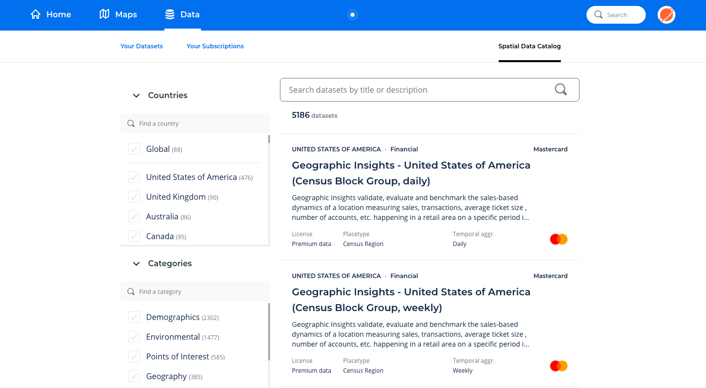
There are a set of high-level metadata attributes that allow the user to filter the different datasets when browsing the Spatial Data Catalog:
- Countries: the geographical coverage of the datasets
- Categories: the type of data product (e.g. demographic, human mobility, road traffic, environmental, etc.)
- Licenses: whether the dataset access is ruled by a public or premium license
- Sources: the premium data provider or public data source of the datasets
- Placetypes: the type of spatial aggregation used in the dataset (eg. admin region, postal codes, road segments, grids, etc.)
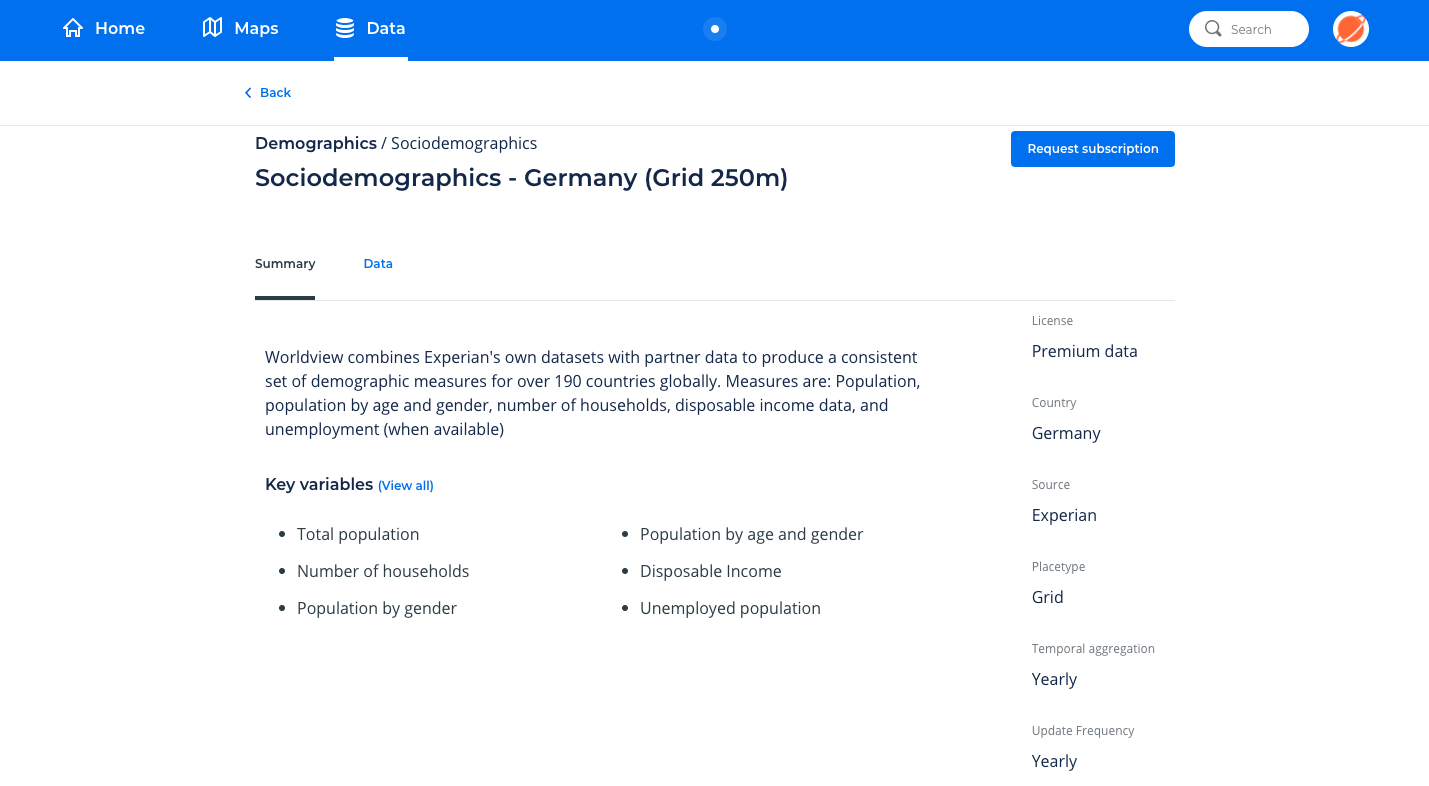
Then, once a dataset from the list is selected the following additional metadata attributes are available:
- Summary description of the dataset
- List of key variables
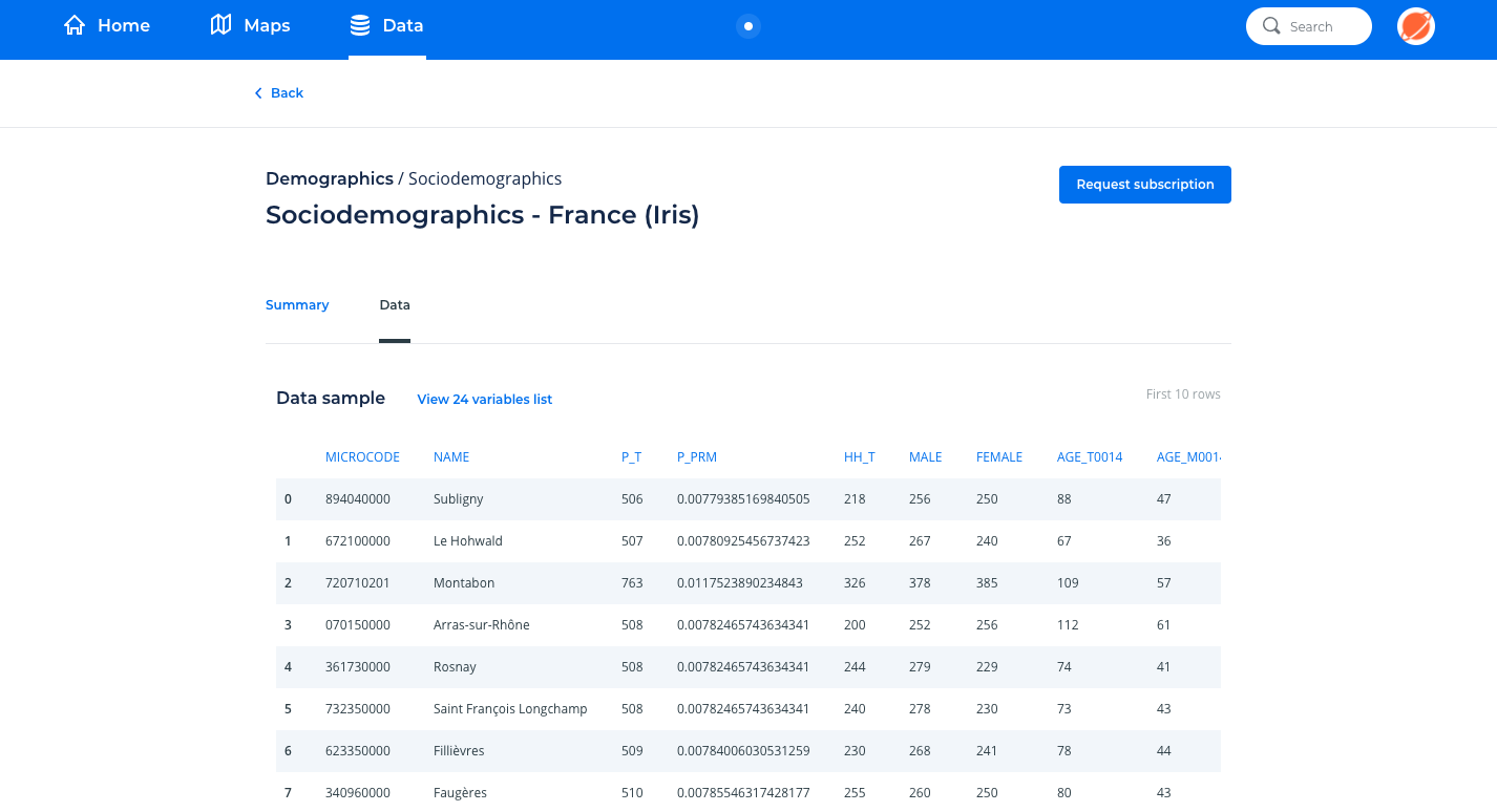
- Full detailed dataset schema with variable names and descriptions
- Sample table with 10 rows of data
- Temporal aggregation
- Update frequency
- Associated Geography, in case this product requires an additional Geography dataset for the digital boundaries (i.e. geometries). Note that some Geographies can also require their own premium license.