Geocoding is the process of converting street addresses, place names, or other location descriptions into geographic coordinates (latitude and longitude). Reverse geocoding is the opposite process: converting coordinates into human-readable addresses. Together, these processes are fundamental to connecting business data with spatial analysis.
What is Geocoding?
When you enter an address into a mapping application and see a pin on the map, geocoding is happening behind the scenes. The geocoder matches your input against a reference database of known addresses and returns the corresponding coordinates. Modern geocoding services can handle various input formats — from full structured addresses to partial or unstructured location text.
Geocoding is the critical first step in most Location Intelligence workflows because business data typically arrives with addresses (customer records, delivery locations, asset inventories) rather than coordinates. Without geocoding, this data cannot be placed on a map or used in spatial analysis.
How Geocoding Works
A geocoding service typically follows these steps:
- Parsing — Breaking the input into components (street number, street name, city, postal code, country)
- Normalization — Standardizing abbreviations, correcting misspellings, and handling variations (e.g., “St.” vs “Street”)
- Matching — Searching reference data to find the best match for the parsed address
- Interpolation — Estimating the precise position along a street segment when an exact match is not available
- Scoring — Returning a confidence score indicating the quality of the match
Types of Geocoding
- Forward geocoding — Address to coordinates. “1600 Pennsylvania Ave, Washington DC” becomes (38.8977, -77.0365)
- Reverse geocoding — Coordinates to address. (40.7484, -73.9857) becomes “350 5th Ave, New York, NY” (Empire State Building)
- Batch geocoding — Processing thousands or millions of addresses at once, common in enterprise workflows
- IP geocoding — Estimating a user’s location from their IP address (lower precision, city-level)
Use Cases
- Retail analytics — Geocoding customer addresses to analyze spatial demand patterns and trade areas
- Logistics — Converting delivery addresses to coordinates for route optimization
- Insurance — Geocoding property addresses to assess proximity to flood zones, fire stations, or fault lines
- Real estate — Placing property listings on maps for search and valuation analysis
- Public health — Mapping patient records to analyze disease spread and healthcare access
Geocoding in Cloud Data Warehouses
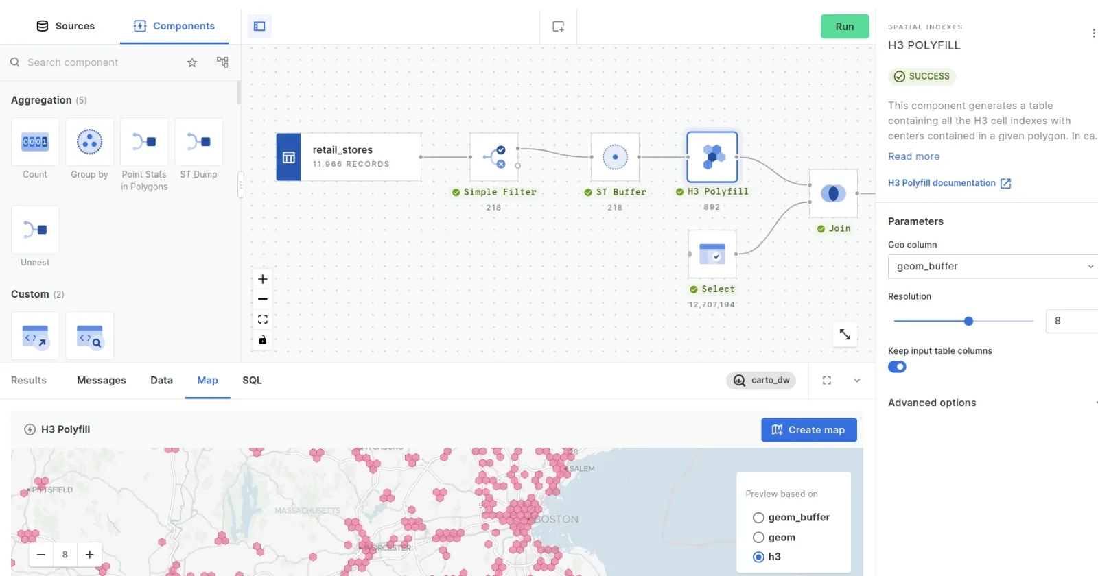
Cloud-native geocoding services allow organizations to geocode data directly inside their data warehouse without extracting it. CARTO provides geocoding functions through the Analytics Toolbox that run natively in BigQuery, Snowflake, and Databricks — processing millions of addresses while keeping data in the warehouse and maintaining security and governance policies.
Frequently Asked Questions
How accurate is geocoding?
Accuracy depends on the quality of the input address and the reference data. Well-formatted addresses in countries with good postal infrastructure typically achieve rooftop-level accuracy (within a few meters). Partial or rural addresses may only resolve to street or locality level.
What is the difference between geocoding and geolocating?
Geocoding converts a text address into coordinates. Geolocation determines a device’s current position using GPS, Wi-Fi, cell towers, or IP address. Geocoding works with addresses; geolocation works with devices.