Site Selection
Site selection, without the GIS queue
Site selection, planning, and consolidation analysis requests queue for the one team that knows the desktop GIS. With CARTO, any planner can get the answer they need, on live data in your own cloud.


What site selection teams run in CARTO
Choose, plan, and consolidate sites securely in your own cloud, whether you're opening stores, siting EV chargers, placing lockers, or reviewing branches.
Site scoring, on demand
When every new site planning request lands on an analyst's desk, the shortlist waits until they get to it.
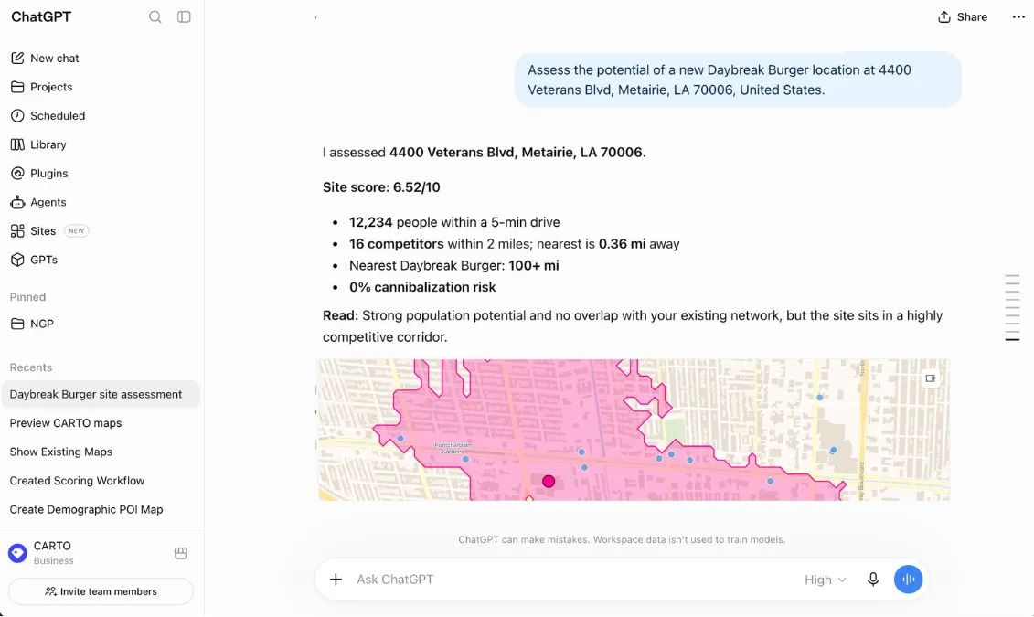
Your scoring model becomes a saved Workflow in CARTO, so anyone can score a new address on demand, competition, and access, whether they ask in a Builder map or an AI platform, and get the same answer your analysts would.

Find more places like your best
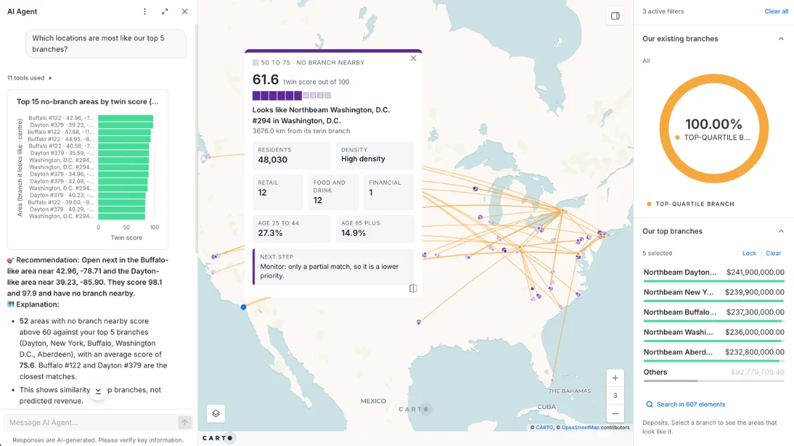
Your best sites are the clearest brief for the next one, but finding places like them by hand means guessing.
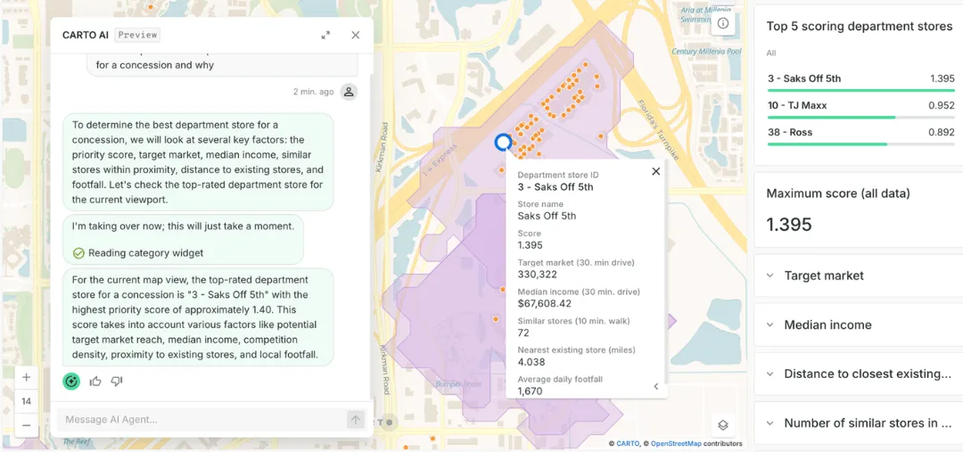
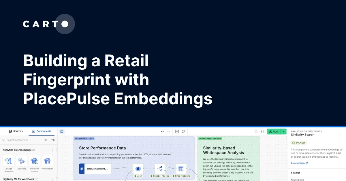
With CARTO, you can profile your top sites with your own performance data plus demographics, points of interest, and mobility from the Data Observatory, all inside your warehouse. Then ask an AI Agent which areas look most like your best five and get a ranked shortlist.
Forecast revenue before you sign
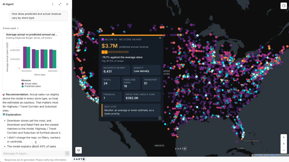
Most revenue forecasts are built once, so changing an assumption means rebuilding the model from scratch.
CARTO lets you build the forecast as a Workflow on live sales and market data, so when the market moves or you want to test a new scenario, you adjust a step and the numbers update.
Size trade areas across your whole network
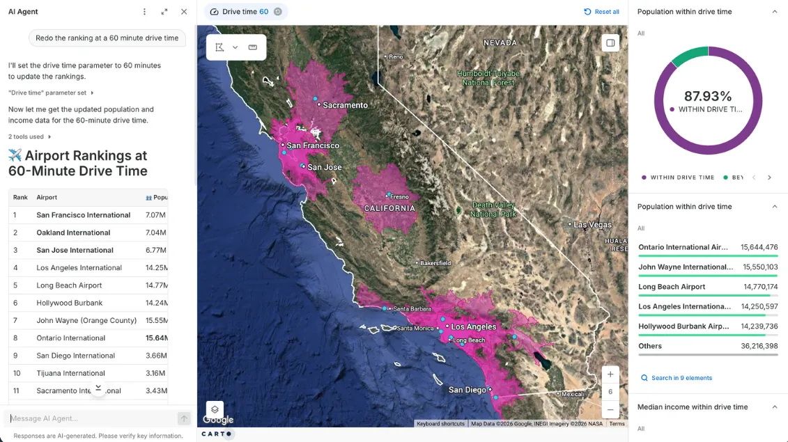
Building road networks and running drive times site by site is slow, so trade areas often trail behind the decisions they should inform.
Calculate drive- and walk-time trade areas for every site at once on pre-built road networks, inside your data warehouse, and enrich them with your own customer and sales data without moving it. Then ask an AI Agent which sites reach the most people.
Grow without stealing from yourself
A new site can take sales from the one down the road, and a closure can send customers to a competitor.
Cannibalization analysis runs as a low-code Workflow on the data already in your cloud warehouse, so planners can check every candidate's overlap with existing sites without writing code or waiting on a data scientist.
Close sites, keep the customers
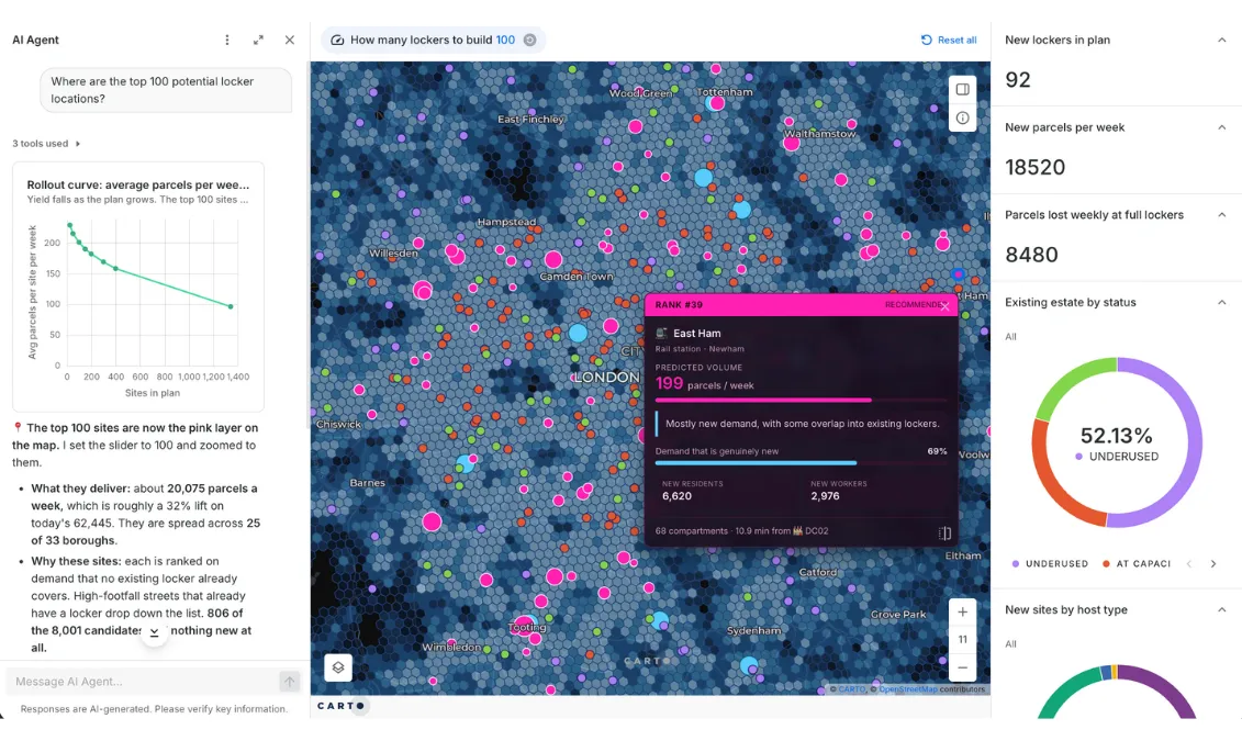
When a network shrinks, sites are often closed on their own sales figures, with no view of where their customers go next.
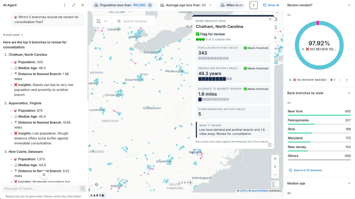
CARTO lets you test each closure as a scenario on your own customer data, see which nearby sites absorb the demand and how much goes to competitors, and share the before and after in a Builder map, so finance and operations decide from the same view. To know where to start, ask an AI Agent which sites to review first.
Built for any site planning problem
Retail
Where to open, and what each store takes from the next.
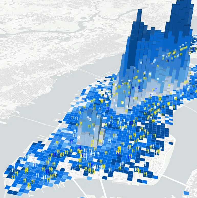
EV charging and energy
Where the next charger earns its keep.
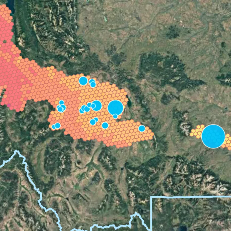
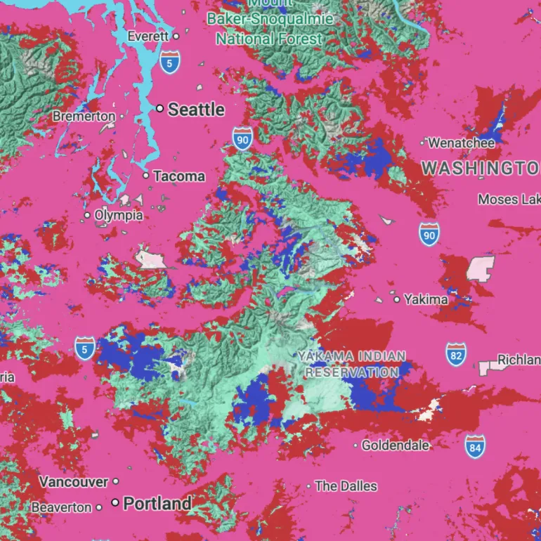
Telecoms
Where a new site adds coverage and customers.
Banking and insurance
Which branches and ATMs to keep, move, or close.
Logistics
Where lockers, depots, and dark stores should sit.
Real estate and investors
Which sites and tenants fit a screening brief.
The Site Selection app
Rank every site in one app
Site lists live in spreadsheets few people trust. The Site Selection app brings your stores, third-party data, and machine learning models into one interface, so planners can score, compare, and defend every site.
A better way to decide where to open, close, and relocate
Most teams stitch the answer together from exports, desktop tools, and data bought country by country. CARTO lets you run the analysis once, in one place, for everyone who needs it.
* Typical setups. Individual tools and teams vary.

Desktop GIS and workflow tools
Exported to the tool for each analysis
In-house builds and bought data
Copied into a separate store with its own pipeline
CARTO
Queried in place in your cloud warehouse, and behind your firewall if you need it
Desktop GIS and workflow tools
Each country buys and loads its own
In-house builds and bought data
The same, from different providers
CARTO
Comparable datasets across countries from the Data Observatory, so you compare markets on the same terms instead of aligning different sources
Desktop GIS and workflow tools
Averages and a spreadsheet
In-house builds and bought data
Custom models that rely on experts to update and maintain
CARTO
Twin areas, trade area analysis, revenue prediction, and your own custom models, in a saved Workflow
Desktop GIS and workflow tools
The GIS team who built it
In-house builds and bought data
Whoever built it
CARTO
Planners, real estate, and franchise teams, in plain language through an AI Agent your experts build and set guardrails for




Frequently asked questions
Yes. Your data scientists can bring their own model and run it as a step in a Workflow, next to CARTO's twin areas and revenue prediction, so the score stays yours and the data stays in your warehouse.
Your data needs to sit somewhere queryable. CARTO lets you run analysis directly inside BigQuery, Snowflake, Redshift, Databricks, or Oracle, so there are no copies to keep in sync, every site score uses your latest sales, and your warehouse's security and governance apply to every map, Workflow, and AI Agent.
CARTO lets your GIS team build AI Agents, apps, and Workflows, and set their guardrails, for your whole organization and beyond. Real estate, franchise, and field teams can then get site insights in plain language without GIS skills, built on the analysis your experts trust. Learn more about CARTO AI Agents.
CARTO is the whole spatial analysis platform: analysis, maps, apps, and agents that run on your warehouse. You can also subscribe to a wide range of location data, including points of interest, demographics, and mobility, from the CARTO Data Observatory, and access it directly in your cloud data warehouse.
Teams use it to decide where to open, build, close, or relocate sites, understand who each site serves, and plan delivery areas. In CARTO that means trade area analysis, twin areas, whitespace analysis, hotspot analysis, and revenue prediction, all running on your own cloud data. Read more about Location Intelligence.
Define the trade area of every candidate with drive-time analysis, enrich it with demand, competitor, and mobility data, then score the candidates against your best-performing sites using twin areas and composite scoring. CARTO lets you run that as one repeatable workflow, so you can compare scenarios when the market moves.
It measures how much a new site takes sales from nearby existing ones. CARTO lets you calculate trade area overlap with isolines and estimate sales transfer between sites, so you can compare a new opening or a closure on the sales you keep. See it in an expansion strategy.