


In our journey towards a fully self-serve model, we’ve been exploring ways to put mobility insights directly into the hands of our teams. The goal is to let people ask everyday, plain-language questions while ensuring the insights are consistent, transparent, and reproducible. CARTO’s approach, using AI Agents built on the Agentic GIS platform, makes this possible. It allows end users to ask natural-language questions about real-time population movement, traffic patterns, or demographics—and get instant, accurate answers. At the same time, the technical team can be confident that results are generated in the right, validated way. This removes bottlenecks, accelerates decision-making, and turns complex geospatial data into business value within seconds.
BT Group
Tim Rains, Lead Geospatial Data Scientist at BT Active Intelligence
In our journey towards a fully self-serve model, we’ve been exploring ways to put mobility insights directly into the hands of our teams. The goal is to let people ask everyday, plain-language questions while ensuring the insights are consistent, transparent, and reproducible. CARTO’s approach, using AI Agents built on the Agentic GIS platform, makes this possible. It allows end users to ask natural-language questions about real-time population movement, traffic patterns, or demographics—and get instant, accurate answers. At the same time, the technical team can be confident that results are generated in the right, validated way. This removes bottlenecks, accelerates decision-making, and turns complex geospatial data into business value within seconds.
BT Group
,
Tim Rains, Lead Geospatial Data Scientist at BT Active Intelligence
+
.webp)
A cloud-native approach
CARTO is the Location Intelligence platform built to run natively within your Google Cloud’s BigQuery lakehouse. This seamless integration breaks down GIS data silos, empowering you to transform spatial analysis into business-critical decisions directly inside your cloud environment.
CARTO’s platform eliminates slow and ungovernable ETL processes, and ensures enterprise-grade speed, scalability and security. Your geospatial teams gain native access to the full power of Google Cloud’s open, serverless architecture - including Apache Iceberg with BigLake, BigQuery ML, Gemini Enterprise Agent Platform (formerly Vertex AI), and Google Maps APIs. In addition, CARTO offers rich geospatial visualizations, an advanced Analytics Toolbox, a low-code design and automation environment, and app development toolkits - all available through Google Cloud Marketplace.

Transcription
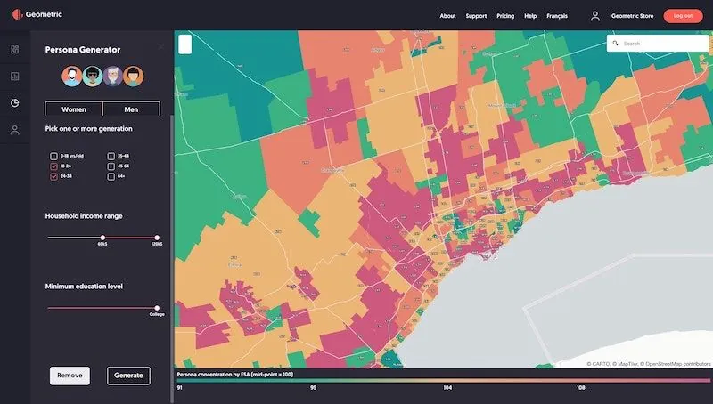
Turning massive mobility data into insights, for everyone
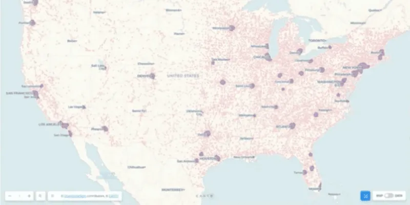
BT Active Intelligence harnesses aggregated, anonymized data from over 25 billion data points daily to turn complex mobility trends into actionable insights.
When working with vast amounts of real-time mobility data, getting critical insights to the teams who need them - when they need them - has been a major challenge. Intelligence has come from ad-hoc requests to data teams, creating frustrating bottlenecks and slowing down decision-making.
To solve this, BT partnered with CARTO to leverage Agentic GIS across their organization. With CARTO, BT’s teams can build AI Agents which transform their complex, real-time data into clear, natural-language insights that are accessible to everyone, from Insight Analysts to the Active Intelligence marketing team.
A user can now simply ask the AI Agent questions like, “How many people are present in this location right now?” or “What’s the age and gender split of visitors?” They can even get an instant summary of traffic patterns or a prediction of future footfall.
All of this is happening with the user’s data never leaving their governed Google Cloud environment, meaning they can be confident that everyone is making decisions based on the same accurate, centralized and protected information.
This capability goes beyond answering data exploration questions. CARTO’s AI Agents aid users across the whole decision-making process, for instance by helping to validate a marketing campaign plan by simulating future footfall - or by pivoting a sales strategy mid-execution based on real-time travel patterns.
The result is a solution that gives BT faster decisions by providing answers to any user in seconds, turning complex mobility data into instant business value and a competitive edge.