Environmental Management
Using GIS in the environmental management process is critical to contain the side effects of climate change, such as forest fires, flooding, air pollution or wastewater management.


Flood analysis
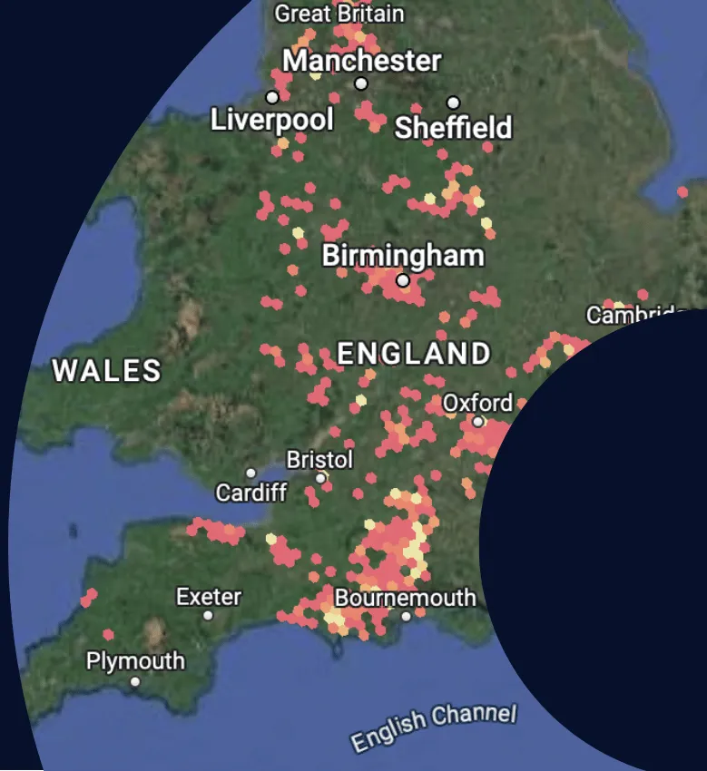
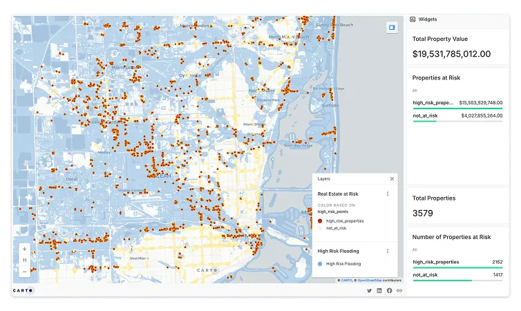
Floods are on the increase as an unfortunate side-effect of climate change. Assessing flood risk using the right GIS software & spatial data can help governments, environmental agencies & insurance companies to improve prevention, early warning mechanisms & mitigation efforts using predictive analytics.
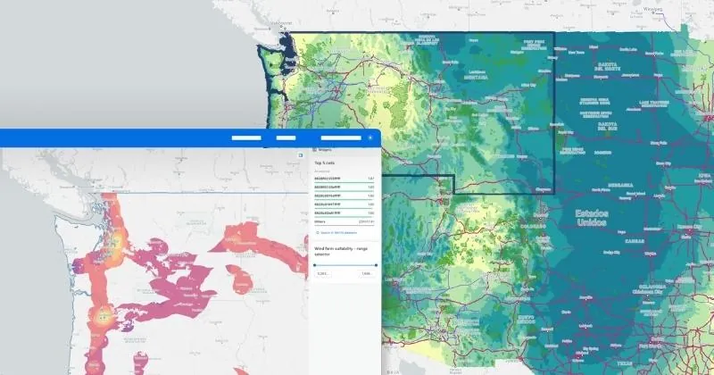
Whether it’s sophisticated Data Science workflows in Python, or cloud native web applications to share insights with decision-makers - our platform can help
Air pollution analysis
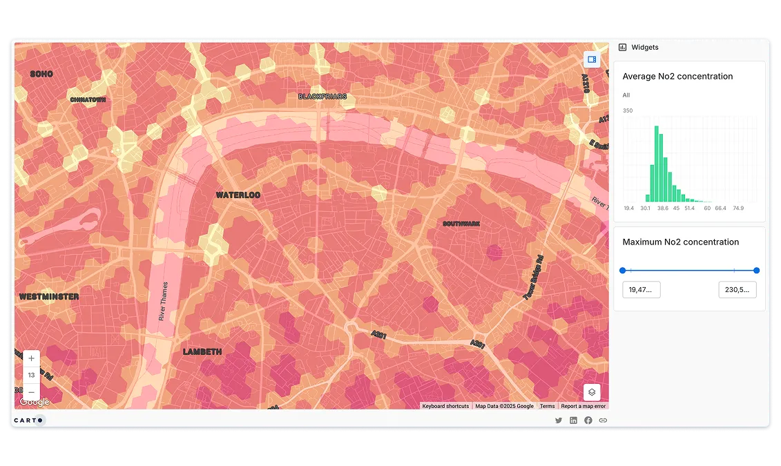
Sources of air contamination are often difficult to monitor. GIS systems can be used to track EPA regulated pollutant emissions by delineating the effects of ozone, smog, dust, and other harmful airborne pollutants on plant and human life.
Using spatial analysis, you can identify impacted areas, locate pollutant sources & predict change over time - allowing location data to inform policy relating to traffic, manufacturing & logistics.
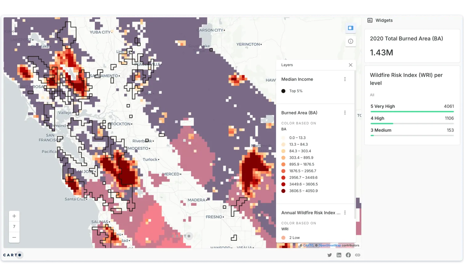
Forest fire analysis
Monitoring & analyzing forest fires in real-time is fundamental in order to reduce the social & economic impact of such natural disasters.
Using spatial data streams such as satellite imagery through our Data Observatory, you can visualize active fire perimeters & smoke density levels, providing vital information to rescue agencies, governments, citizens & other organizations.

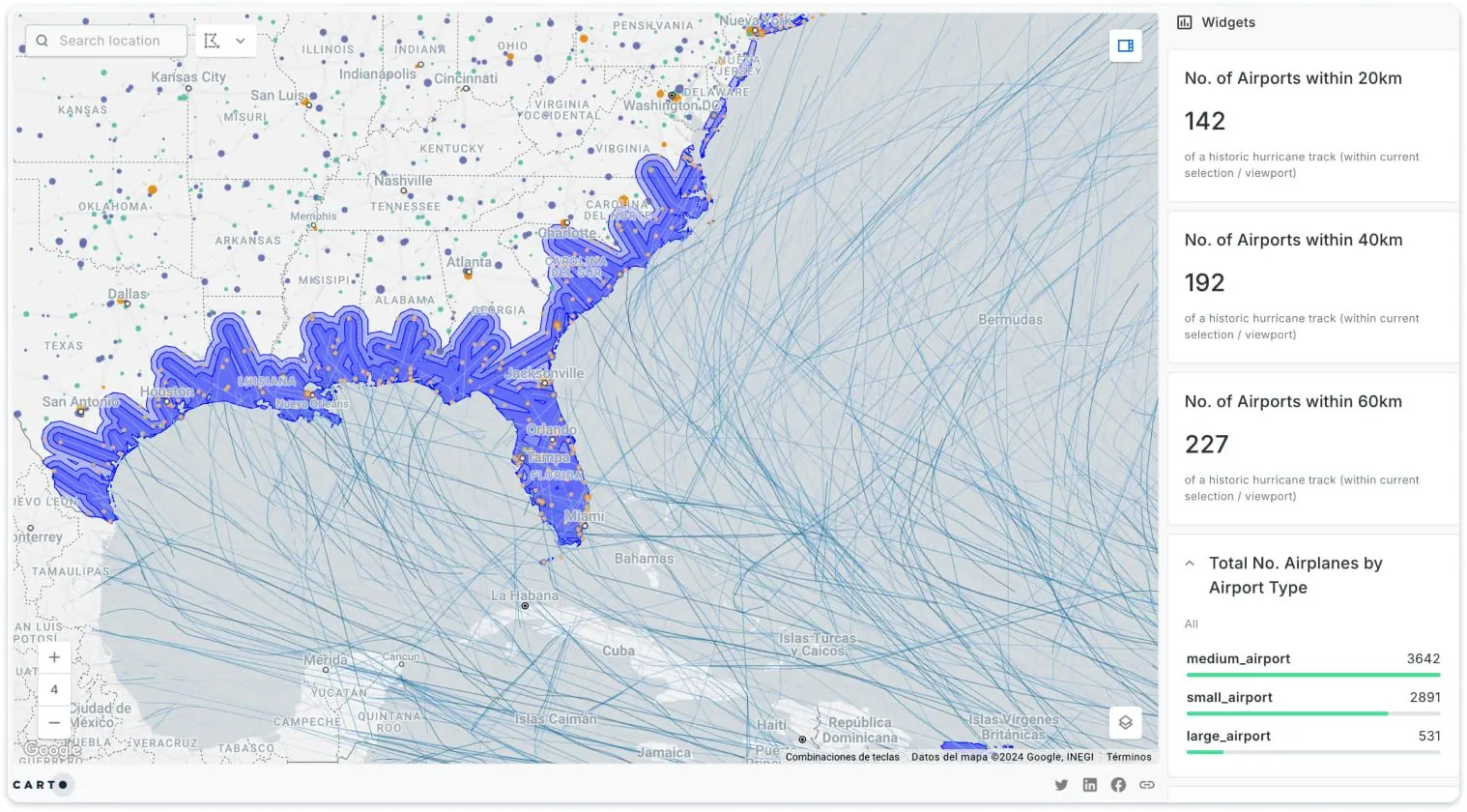
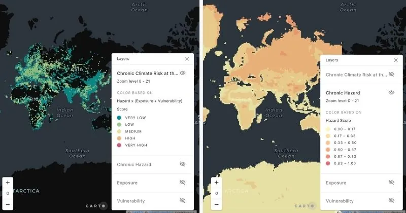
Climate Insights
Intensifying storms, floods and sea level rise not only impact the health and safety of millions of people worldwide, but also compromise key infrastructure elements.
Spatial data and analytics can help predict climate-related risks affecting the built environment, provide context and drive more informed infrastructure decisions across government departments.
Get inspired by our customers

CARTO's cloud-native approach and the ability to use H3 at scale was a big game changer for us. We can now compute data in real time without the need for heavy coding. Working with the CARTO platform has been extremely impactful as we can now easily visualize & analyse massive amounts of satellite data.