Insurance & Reinsurance
Outsmart tomorrow's risks
Reduce complexity and costs, with a streamlined, cloud-native approach for portfolio risk analysis, catastrophe modeling, and fraud detection—all while maintaining flexibility and scalability.


Boost business-analytics collaboration
Analyzing massive data volumes slows down decision-making. Harness cloud-native technology to perform seamless in-depth analysis at scale.

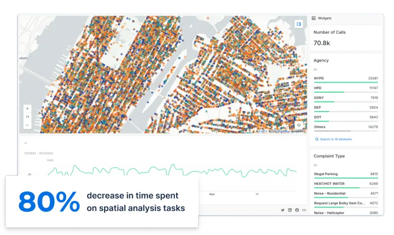
Use real-time insights
Without access to real-time data, organizations struggle to adapt to changing conditions. Stay agile with dynamic dashboards and interactive maps with real-time visibility into your analytics.

Deliver data-driven predictions
Identifying and mitigating risks is impossible without accurate data. Build predictive models to anticipate market changes and adjust pricing strategies effectively.

_logo%201.webp)


Insurance pricing with CARTO AI Agents

Get inspired by our customers

Migrating to CARTO’s cloud-native Location Intelligence platform was, without doubt, the right choice for us. The enhanced analytical capabilities of CARTO have opened up our business to new possibilities for more advanced spatial use cases. More than 700 active users of our tools can now work more efficiently to deliver faster and more accurate services themselves.


.webp)

Webinar
How to Use Spatial Data to Create a Wildfire Risk Index
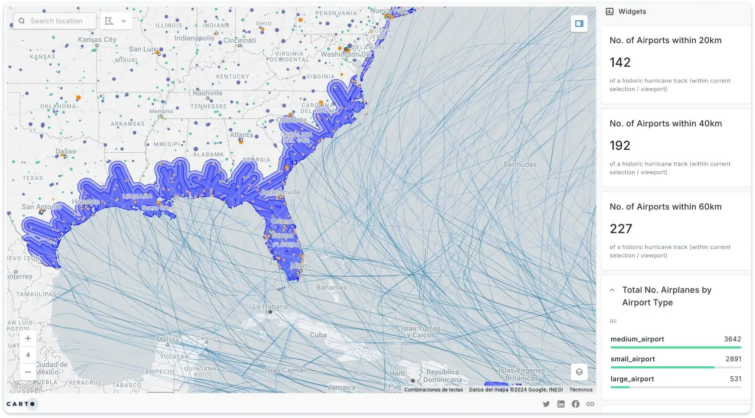
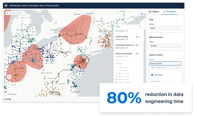
Catastrophe Modeling
Precision is key when estimating the economic impact of disasters, yet 82% of enterprises cite data quality issues as a key barrier. Harness hyper-local space-time data to accurately predict the impacts of extreme events, enabling informed decisions about insured assets and policy selection.


Exposure Management
Traditional methods for assessing risk exposure can be slow and cumbersome, with 63% of executives saying their analytics capabilities are too siloed to be insight-driven. Gain critical insights through fast and intuitive analyses of large volumes of location data, ensuring a unified perspective on exposure risks across all portfolios.


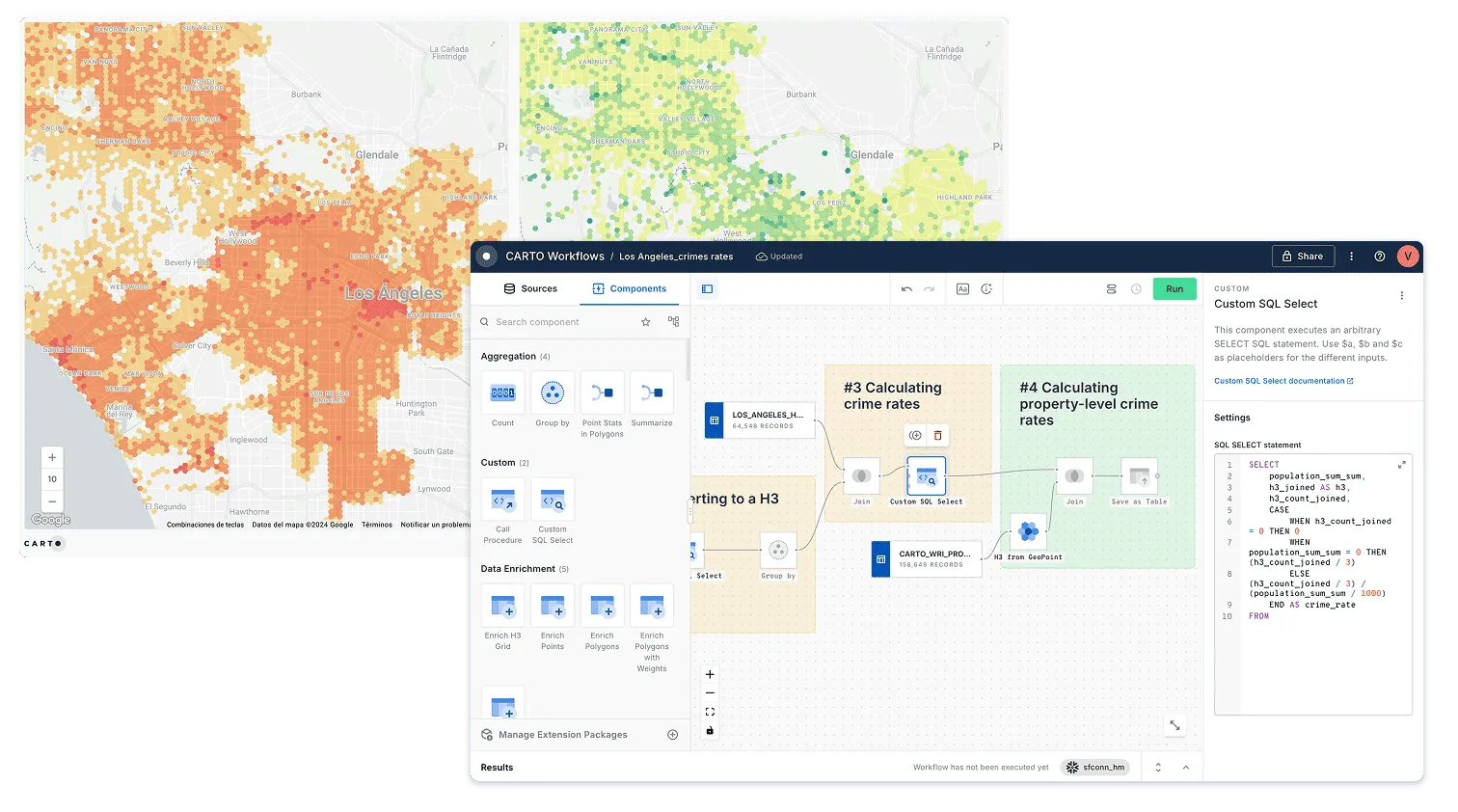
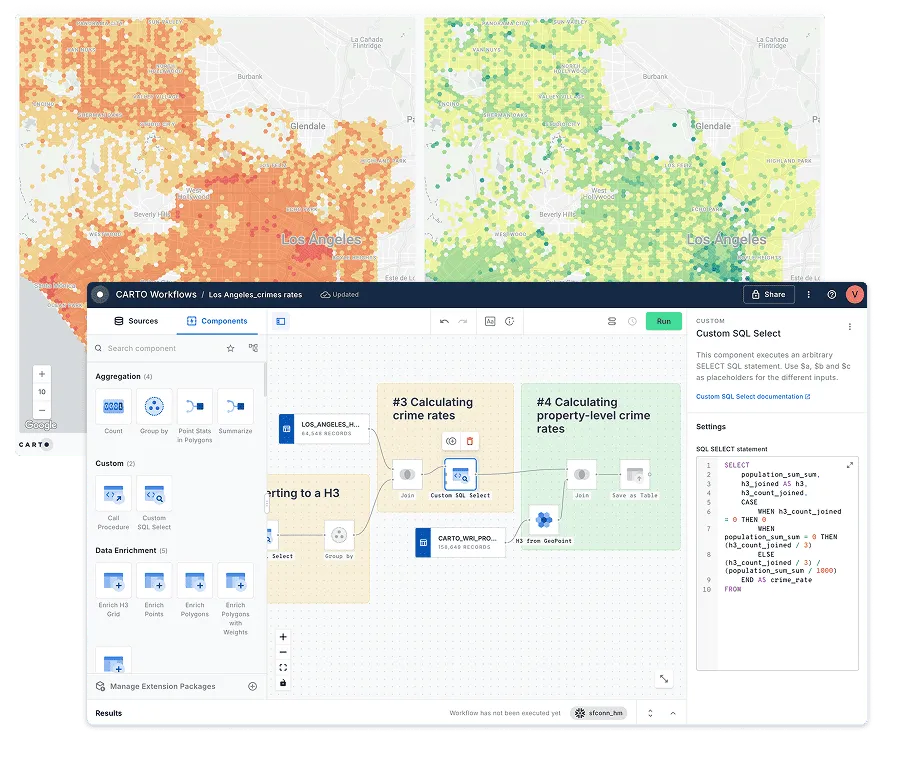
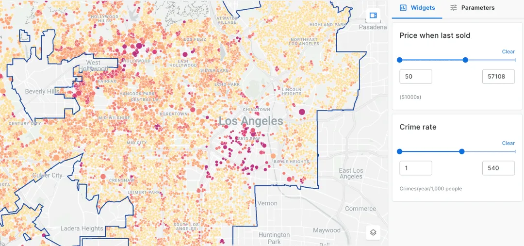
Risk-based Pricing Model Development
Accurately assessing risk factors can be a complex and time-consuming process, leading to suboptimal pricing strategies. Streamline the evaluation of key risk factors, such as climate events and urban crime rates, using intuitive analytical tools that enhance your pricing accuracy and responsiveness.