The go-to platform for Spatial Data Science
Only 1 in 3 Data Scientists have significant expertise working with location data. See why today's Spatial Data Scientist uses CARTO to speed up spatial analytics & visualization, natively in the cloud.
Try for freeSave time on "data admin"
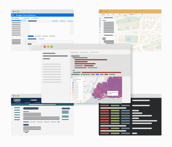
Sourcing, evaluating & cleaning spatial data to enrich Data Science models typically take up 80% of your time, leaving only 20% of your time to focus on the most important part of the job - analysis. CARTO’s Data Observatory brings together thousands of location data streams such as human mobility, weather & demographics. Discover the most suitable datasets for your model, subscribe to them, select the variables you need & enrich your data all from your Jupyter notebook.

Less time context-switching, more time modeling
With our Analytics Toolbox you can execute advanced spatial analytics within your cloud data warehouse, and integrate maps & analysis in your current notebook environment. Visualize datasets straight out of Python notebooks, use location data services to convert plain text to geometries (geocoding), create areas of influence within a specific distance or travel time (isolines) & more. Once your analysis is done, add some pre-defined widgets and share the results — empowering business teams to understand & act on the insights from your models.
.webp)
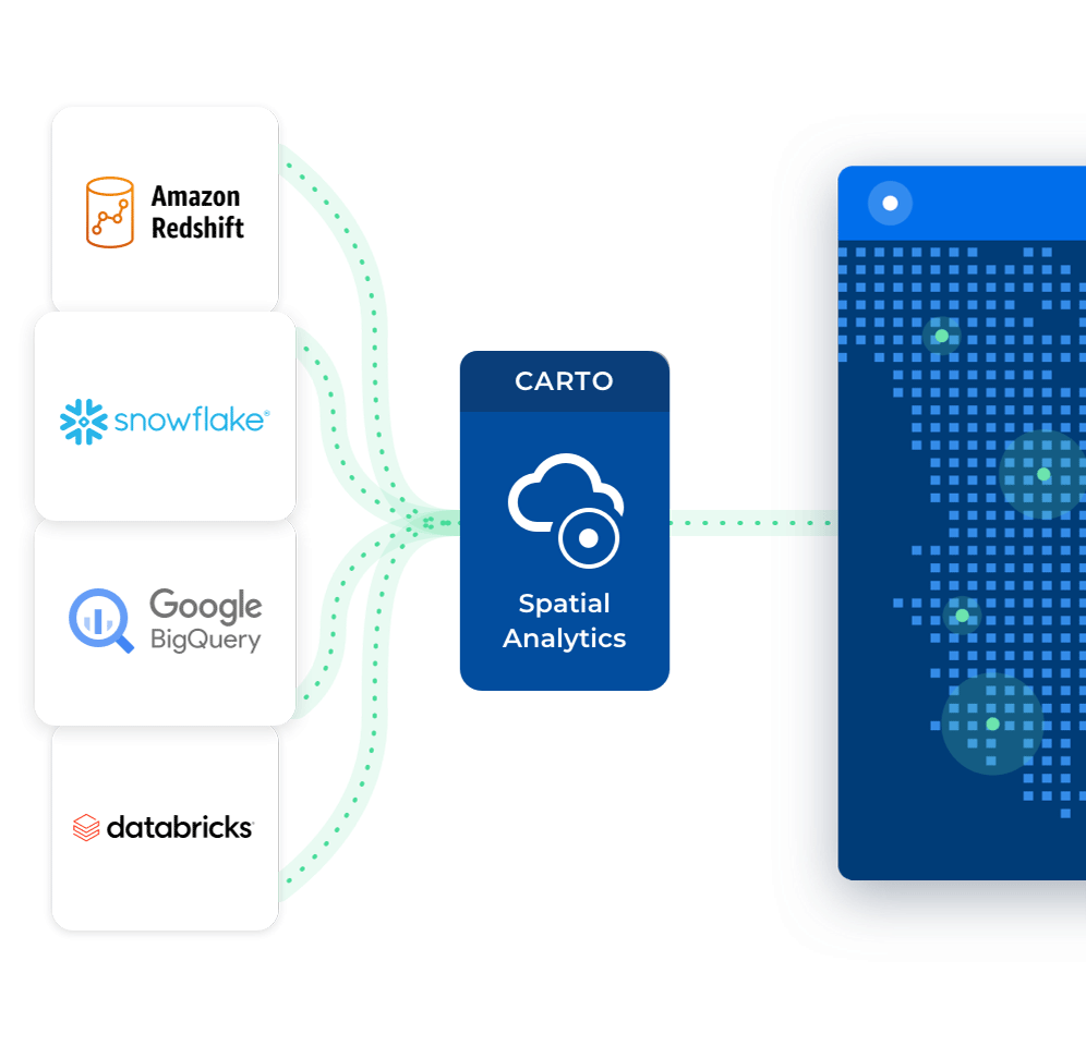
Seamless connectivity to your tools
Connect natively to the leading cloud data warehouses (such as Google BigQuery, Snowflake, Redshift & Databricks). Whether you’re looking for SaaS, private or public cloud or on-premise, our spatial analytics platform is ready to support location-based decisions on your terms.

EXAMPLE NOTEBOOKS
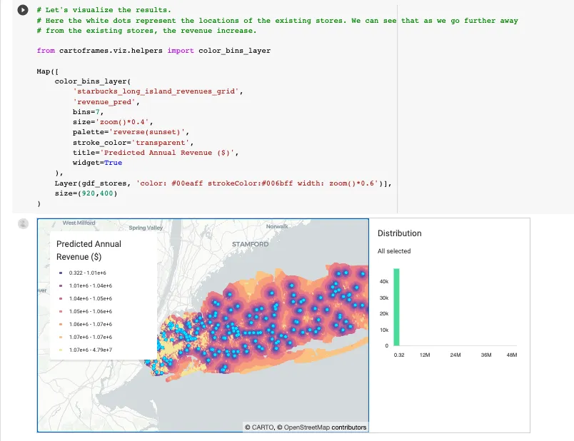
Revenue Prediction Model for Starbucks
This notebook (based on GeoPandas) shows how you can use CARTOframes & the Data Observatory to predict revenue for Starbucks locations to drive decisions around expansion & consolidation. In this example, we can see geocoding in action, the process of creating spatial lags using SQL, catchment area calculation with isochrones as well as enrichment with demographic & socioeconomic data sets. See a walkthrough here.
EXAMPLE NOTEBOOKS
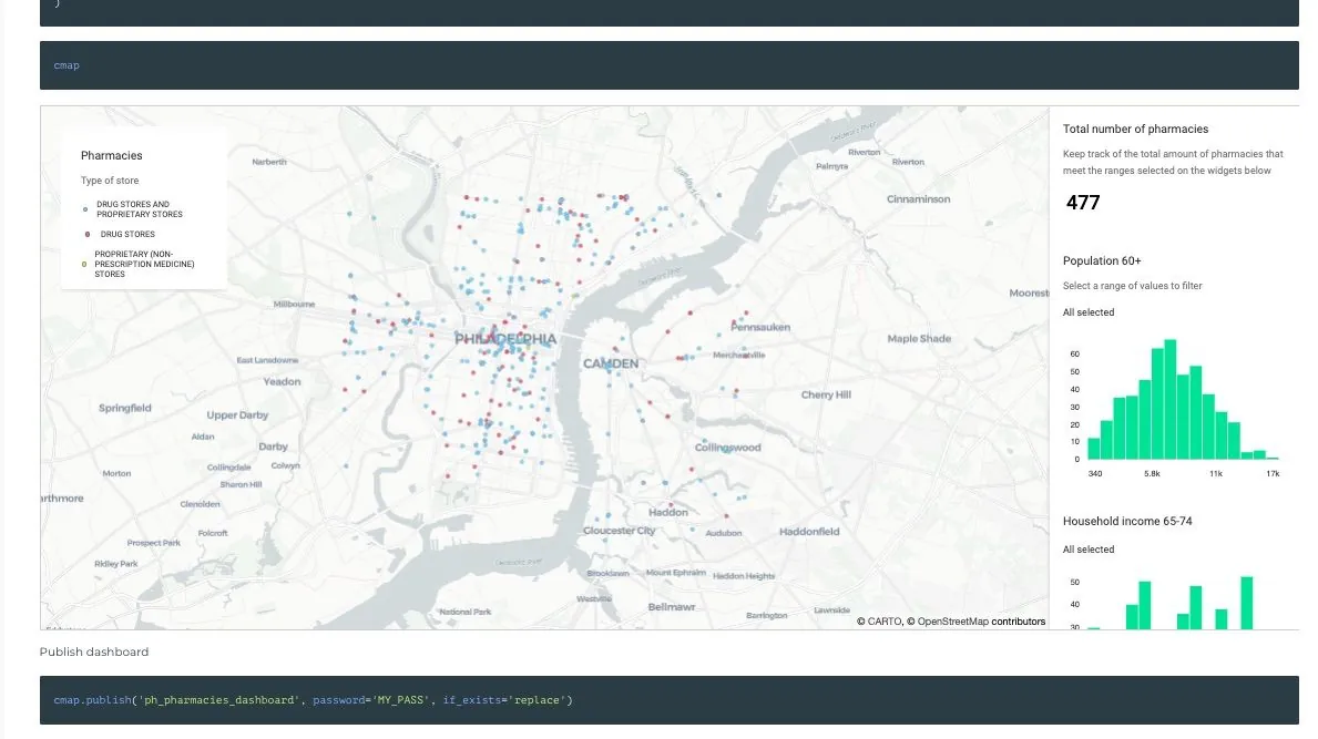
Building a Dashboard for a Marketing Plan
This notebook combines different data sources to identify patterns or understand behavior in a specific location. In this example, we can see how to import data from the Data Observatory, calculate catchment areas & enrich them with demographics, POI’s, and consumer spending data. Finally, with all the data gathered, it demonstrates how to build a dashboard with widgets such as filters.
EXAMPLE NOTEBOOKS
Combining Data to Understand Retail Performance
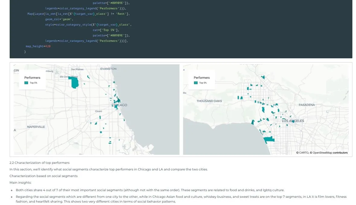
This notebook uses Spatial.ai geosocial data combined with Mastercard financial data to quantify how much of retail performance can be explained by geosocial behavior. In this example, you can see how to download datasets from the Data Observatory and combine them into a single dataframe, followed by how to analyze geosocial drivers such as identifying where top performers are, characterization of top performers & correlation analysis.