

Use cases


Mapping Segregation - MIT's Atlas of Inequality
Explore The Atlas of Inequality, a project revealing behavioral patterns and segregation impacts, led by MIT and Universidad Carlos III de Madrid.

Faster, Stronger Smart Cities with Location Intelligence
The proliferation of Location Intelligence solutions is a big part of Smart Cities growth. Cities uniquely benefit from a deeper understanding of 'where,' in areas from disaster relief and health services, to traffic optimization, and more.
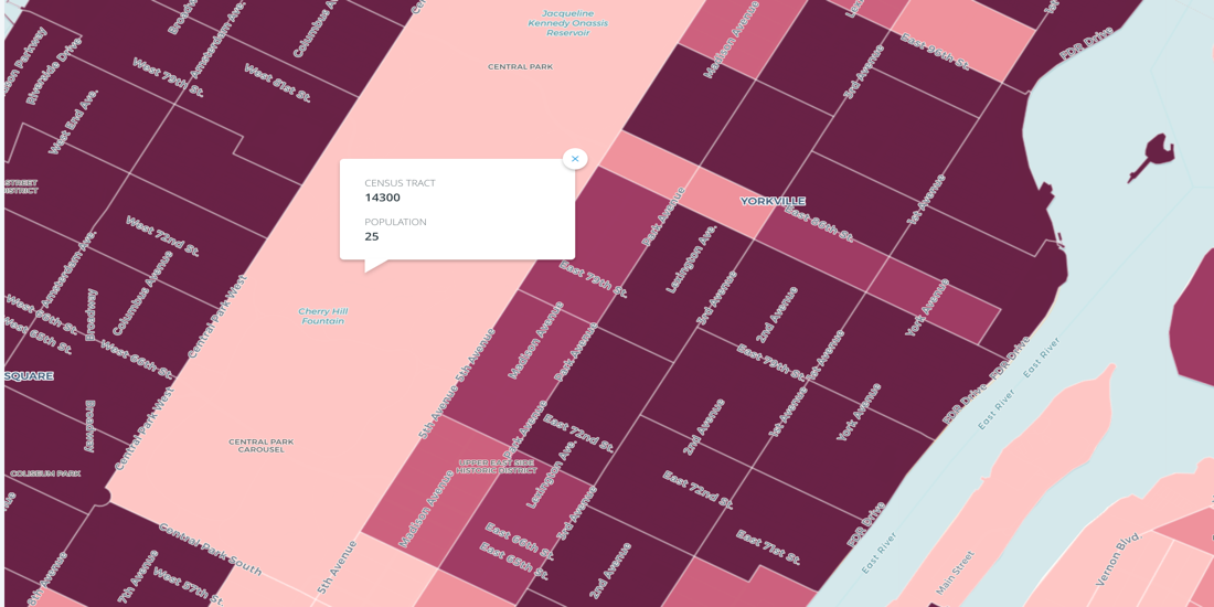

Census Oddities
Uncover Census Oddities: Learn tips to navigate unexpected quirks in U.S. Census data, from shifting boundaries to population gaps. Avoid pitfalls now.
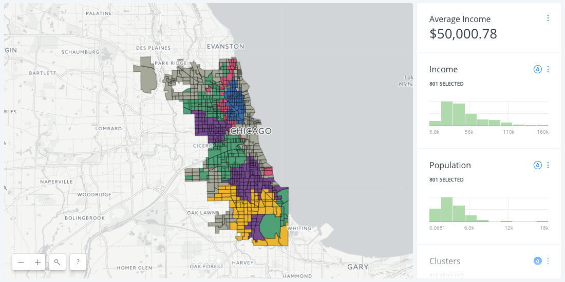
A New Approach to Customer Segmentation Using Location Data
Discover effective customer segmentation strategies using location data. Learn how to target the right audience for sales & marketing success. Try for free.
Spreading Location Intelligence all around the world
Thanks to our Partners for a year of growth in location intelligence! Join our network, explore projects, and anticipate more in 2017. Happy Data Mapping!


Spotify gets into the Groove with Musical Cities
Take a look how Spotify leverages CARTO to create the Musical Cities map, revealing distinctive music preferences across 1,000 cities worldwide.


Hurricane Season 2016: Locating Resiliency in Sandy's Aftermath
CARTO aids NYC's Mayor's Office in tackling climate change, visualizing risks, and preventing disasters like Hurricane Sandy. Explore OneNYC's efforts.

Academy


CARTO & Snowflake: Location Intelligence for Energy and Utilities
CARTO and Snowflake expanding cloud-native Location Intelligence for Energy and Utility organizations, unifying IoT data for resilient operations.
Nagarro & CARTO: Advancing Enterprise AI Transformation
CARTO and Nagarro partner to help enterprises move AI from pilots to production, embedding Location Intelligence into existing workflows and systems.


Unlock trade-area analysis at scale with H3 Isochrones
Scale travel-time analysis with H3-based isochrones in CARTO. Faster joins, overlap insights, and 96–99% time savings powered by TravelTime.